Future Directions for GIS in Samoa
Enhancing GIS practices in Samoa involves establishing a Samoa GIS User Group, improving spatial data management, developing a national spatial data infrastructure framework, and implementing GIS applications in various sectors like emergency response, public access, and natural resource management. Initiatives include setting standards for spatial data, adopting open-source technology, and hosting international GIS conferences in Samoa to boost the economy and raise GIS profile.

Download Presentation

Please find below an Image/Link to download the presentation.
The content on the website is provided AS IS for your information and personal use only. It may not be sold, licensed, or shared on other websites without obtaining consent from the author. Download presentation by click this link. If you encounter any issues during the download, it is possible that the publisher has removed the file from their server.
E N D
Presentation Transcript
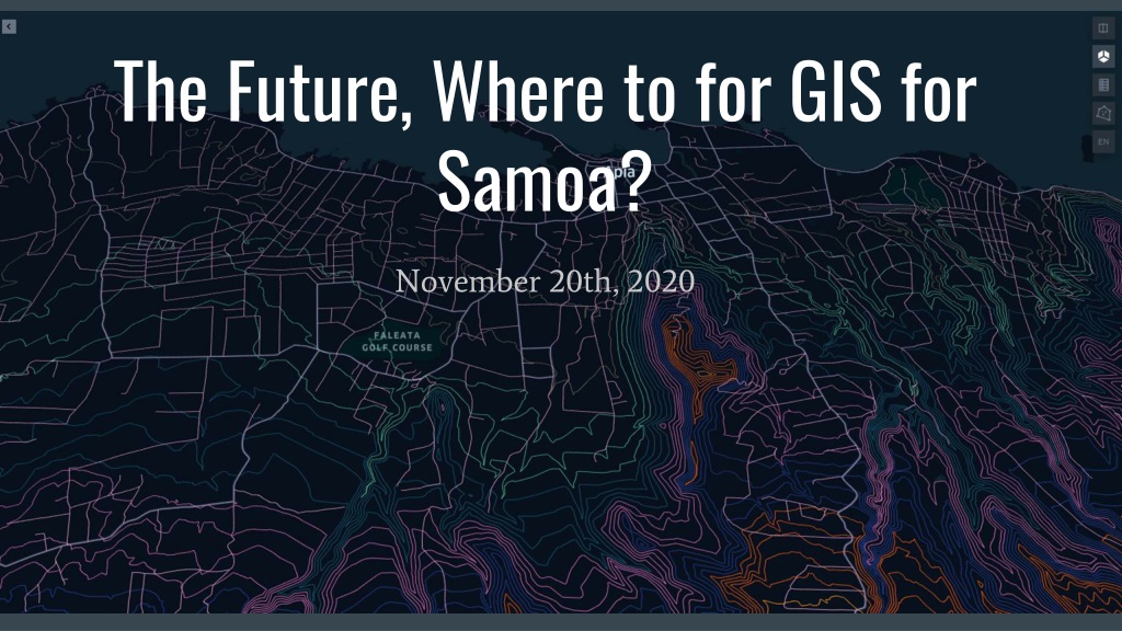
The Future, Where to for GIS for Samoa? November 20th, 2020
Improve Spatial Data Data Management Connect stakeholders/GIS practitioners to foster collaborative work through a Samoa GIS User Group Need to do a stocktake of existing Spatial data repositories to increase awareness of available Spatial data in Samoa Adoption a standards for Spatial data for example a coordinate system for Spatial data capture 1st Open Source approach to Spatial technology/standards not only for reducing cost but also for interoperability e.g OGC standard for sharing of Spatial data via internet
Develop a National Spatial Data Infrastructure Framework for GIS Policy, People,Tools to enhance Spatial Data Management Bible for GIS Practitioners in Samoa as well as any visiting GIS Specialist Foundation for new technology which relies on spatial infrastructures such as IOT, Drone Delivery and Driverless cars for future economy
Apply GIS Nationally/Sectors - Growth Areas Public Access to Samoa Street Addressing Emergency Response GIS Application (Fire,Police,Ambulance) NEOC GIS Application for Disaster Response/Relief Utility Asset Management Application Natural resource management Conservation, terrestrial and marine Management and monitoring of epidemics such as Measles and Covid Online shopping- connecting vendors with clients
Hosting International/Regional GIS Conference in Samoa Raise the profile of GIS while contributing to the economy Expose Samoa to cutting edge Spatial technology Business and training opportunities
Better Spatial Data/Intelligence for improve decision making Save time/money/resources Maximize use of Samoa s Natural and Man Made Resources Sustainable development
Recap Solid trend of utilization of GIS for significant projects for Samoa Almost every National, Regional and International project has a significant GIS component. Geospatial information is multidisciplinary and multidimensional, therefore multiple sectors have interest in accessing the same geospatial information. SIA Act requires the prioritization of GIS development An effective GIS User Group is dependent on the decision makers commitment to collaborate and implement the SIA Act. Organisation benefits are numerous but one of the significant benefits is the continuity of projects irrespective of HR dynamics. E.g staff turnover GIS can help bolster Samoa s Climate Change Resilience and Disaster Management logistics. CS Lewis once said, the task of modern educators is not to cut down jungles but to irrigate deserts. With Samoa s marginal pool of resources, GIS allows us to better plan, innovate and optimize