Understanding Spatial Analysis in GIS for Effective Decision-Making


UNIT 4: DATA ANALYSIS
GEO 382: GEOGRAPHICAL INFORMATION SYSTEMS
GEOLOGY AND GEOPHYSICS DEPARTMENT
KING SAUD UNIVERSITY


WHAT IS SPATIAL ANALYSIS
•
The true power of GIS lies in the ability to perform analysis.
•
Spatial analysis is a process in which you model problems
geographically, derive results by computer processing, and then explore
and examine those results.
•
Geographic information systems uses spatial analysis in order to
understand geographic questions.
•
This type of analysis has proven to be highly effective for evaluating the
geographic suitability of certain locations for specific purposes, estimating
and predicting outcomes, interpreting and understanding change, detecting
important patterns hidden in your information, and much more.

WHAT IS SPATIAL ANALYSIS
•
What types of relationships exist between geographic features, and how do
we express them?
•
Properties of spatial features and/or relationships between them:
size,
distribution, pattern, contiguity, neighborhood, shape, scale, orientation.
•
GIS analysis can be used to answer questions like:
Where’s the most
suitable place for a housing development?
•
A handful of seemingly unrelated factors: land cover, relative slope, distance
to existing roads and streams, and soil composition: can each be modeled as
layers, and then analyzed together
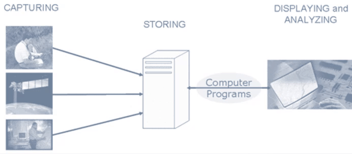
WHAT ROLE DOES GIS PLAY IN SPATIAL
ANALYSIS?
•
GIS is a tool with unique capabilities:
•
Can handle geographically-referenced data
•
Spatial/attribute data entry/update capabilities
•
Data conversion functions
•
Storage and organization of a variety of spatial and attribute data
•
Manipulation of spatial and attribute data (encompasses many different
operations)
•
Presentation/display capabilities
•
Spatial analysis tools (many tools may be used in combination)
ANALYSIS IN GIS
•
Traditionally, geographic information systems are considered to perform four
basic functions:
input/updating
,
data conversion
,
storage/organization
,
manipulation
,
spatial analysis
and
output (presentation/display).
Analysis
module usually contain four important functions:
a)
Selection is a rather simple operation, but it is important because all subsequent
work is based on the results of the selection process.
b)
Manipulation has to do with aggregation, buffering, overlaying and interpolation.
c)
Exploration is the first step in discovering any kind of pattern or cluster in a data
set. Explorative spatial data analysis (ESDA) uses the data in an inductive way to
get new insight about spatial patterns and relations - "we let the data speak for
themselves”.
d)
Confirmation can be seen as tools for estimation of process models, simulation and
forecasting,
ANALYSIS PROCEDURE
•
Before starting any analysis, one needs to assess the problem and establish an
objective.
•
The following steps outline the basic procedure for geographical analysis:
1. Establish the objectives and criteria for the analysis:
Define the
problem and then identify a sequence of operations to produce
meaningful results.
2. Prepare the data for spatial operations:
Prepare all map
coverages for the proposed data analysis. Add one or more
attributes to coverages in the database if necessary.
3. Perform the spatial operations:
Perform the spatial operations and combine the
coverages, e.g. creating buffering zones around features, manipulating spatial
features and performing polygon overlay.
4. Prepare the derived data for tabular analysis:
Make sure the feature attribute
table contains all the items needed to hold the new values to be created.
5. Perform the tabular analysis:
Calculation and query the relational database
using the model defined in step 1.
6. Evaluate and interpret the results:
Examine the results and determine whether
the answers are valid. Simple map displays and reports can help in this evaluation.
7. Refine the analysis if needed and repeat the analysis.
ANALYSIS PROCEDURE
GIS SPATIAL ANALYSIS
•
GIS data description
answers the question
"where?"
•
GIS data analysis
answers the question
"why is it there?“
.
•
GIS Analysis is the process of deriving information from one or more layers
of spatial data.
•
It can involve multiple steps and processes and it is perhaps the most important
capability of a GIS.
•
It allows discovering relationships between various spatial data that might not
have been apparent otherwise.
GIS SPATIAL ANALYSIS
•
Spatial Analysis in GIS involves
three types of operations
:
attribute
queries
(also known as aspatial queries),
spatial queries
, and
generation of new data sets from the original database
.
•
The scope of spatial analysis ranges from simple query about the spatial
phenomenon to complicated combinations of attribute queries, spatial
queries, and alterations of original data.
•
They characteristically include techniques such as
single layer (horizontal
operations)
and
multiple layer operations/vertical operations
(analytical procedures that operate on multiple data layers).
GIS SPATIAL ANALYSIS
•
These operations provide the most fundamental tools for the manipulation of the
data organized on separate layers and the examination of the relationship
among different features.
•
They can be classified according to functionality into:
overlay analysis (it
involves the logical connection and manipulation of spatial data on separate
layers);
•
Proximity analysis deals with operational procedures that are based on
distance measurement between features on different layers;
•
Spatial correlation analysis is useful for revealing the relation between
features of different types, spatial querying, point-in-polygon operation,
buffering, and intersection, dissolving, etc.
SPATIAL RELATIONSHIPS
•
The term spatial relationships is the use of knowledge about the physical location
of the objects, measure the distance between them and examine their attributes,
it is achieved through cartography (cartography is to view maps as a form of
visual communication: a special-purpose language for describing spatial
relationships.
•
The types of spatial objects are
points, lines, areas
(
for vector
),
raster cells
(
for
raster
); these object types are digital representations of phenomena and are
defined by their dimensionality.
•
An entity type is a type of phenomenon (e.g. building) and the same entity type may
be represented by different types of objects at different scales e.g. a city may be a
point at one scale, an area at another.
SPATIAL RELATIONSHIPS
•
A primary function of a GIS is to determine the spatial relationships
between features: Do they overlap? Is one contained by the other? Does
one cross the other.
TYPES OF SPATIAL ANALYSIS
•
Single layer operations
are GIS procedures which correspond to attribute queries, spatial
queries, and alternations of data that operate on a single data layer,.
•
Multiple-layer operations
are useful for manipulation of spatial data on multiple data layers.
•
Spatial modeling
involves the construction of explanatory and predictive models for statistical
testing
•
Point pattern analysis
deals with the examination and evaluation of spatial patterns and the
processes of point features.
•
Network analysis
, designed specifically for line features organized in connected networks,
typically applies to transportation problems and location analysis.
•
Surface analysis
deals with the spatial distribution of surface information in terms of a three-
dimensional structure
•
Grid analysis
involves the processing of spatial data in a spatial, regularly spaced form,
spatial overlay, Boundary analysis, Proximity analysis, and Buffer analysis.
TYPES OF SPATIAL ANALYSIS
•
The raster data model supports a wide variety of analysis methods including:
Neighborhood operations, Connectivity functions, Query, Classification and
Measurement functions
•
Analysis functions with vector-based GIS are not quite the same as with
raster GIS.
•
There are more operations deal with objects and measurements such as area
have to be calculated from coordinates of objects instead of counting cells as in
raster GIS.
•
In vector system most of the analyses like find are done by direct search in
the database.
•
Compared with raster GIS, some of the vector GIS operations are more
accurat
e (e.g. estimates of area based on polygons are more accurate than
counts of pixels; and estimates of perimeter of polygon are more accurate than
counting pixel boundaries on the edge of a zone), some are slower (e.g.
overlaying layers and finding buffers) and some are faster (e.g. finding path
through road network).
•
By using a traditional kind of 2-D co-ordinate system, with a ‘continuous’ number
system for the co-ordinate values, we can obtain a very high resolution very
efficiently.
•
The idea of a vector representation is that we represent objects in the real
world by points, lines and polygons in the GIS.
TYPES OF SPATIAL ANALYSIS
IDENTIFYING A
NUCLEAR
WASTE
DISPOSAL SITE
RASTER OVERLAYS:
(A) POINT-IN-POLYGON (USING ADD);
(B) LINE-IN-POLYGON (USING ADD);
(C) POLYGON-ON-POLYGON
(USING ADD);
(D) POLYGON-ON-POLYGON (BOOLEAN
ALTERNATIVES)
OVERLAY OPERATIONS IN GIS
(VECTOR DATA)
OVERLAY OPERAIONS IN GIS
(RASTER DATA)
OVERLAY OPERAIONS IN GIS
(RASTER DATA)
MAP OVERLAY IN GIS
Spatial analysis in GIS involves modeling geographic problems, processing data, and exploring results to understand spatial relationships, patterns, and suitability for various purposes. GIS tools offer unique capabilities for handling geographically referenced data, data entry, storage, manipulation, and presentation, enabling users to analyze and interpret spatial information effectively for decision-making.

Download Presentation

Please find below an Image/Link to download the presentation.
The content on the website is provided AS IS for your information and personal use only. It may not be sold, licensed, or shared on other websites without obtaining consent from the author. Download presentation by click this link. If you encounter any issues during the download, it is possible that the publisher has removed the file from their server.
E N D
Presentation Transcript
UNIT 4: DATA ANALYSIS GEO 382: GEOGRAPHICAL INFORMATION SYSTEMS GEOLOGY AND GEOPHYSICS DEPARTMENT KING SAUD UNIVERSITY
WHAT IS SPATIAL ANALYSIS The true power of GIS lies in the ability to perform analysis. Spatial analysis is a process in which you model problems geographically, derive results by computer processing, and then explore and examine those results. Geographic information systems uses spatial analysis in order to understand geographic questions. This type of analysis has proven to be highly effective for evaluating the geographic suitability of certain locations for specific purposes, estimating and predicting outcomes, interpreting and understanding change, detecting important patterns hidden in your information, and much more.
WHAT IS SPATIAL ANALYSIS What types of relationships exist between geographic features, and how do we express them? Properties of spatial features and/or relationships between them: size, distribution, pattern, contiguity, neighborhood, shape, scale, orientation. GIS analysis can be used to answer questions like: Where s the most suitable place for a housing development? A handful of seemingly unrelated factors: land cover, relative slope, distance to existing roads and streams, and soil composition: can each be modeled as layers, and then analyzed together
WHAT ROLE DOES GIS PLAY IN SPATIAL ANALYSIS? GIS is a tool with unique capabilities: Can handle geographically-referenced data Spatial/attribute data entry/update capabilities Data conversion functions Storage and organization of a variety of spatial and attribute data Manipulation of spatial and attribute data (encompasses many different operations) Presentation/display capabilities Spatial analysis tools (many tools may be used in combination)
ANALYSIS IN GIS Traditionally, geographic information systems are considered to perform four basic functions: input/updating, data conversion, storage/organization, manipulation, spatial analysis and output (presentation/display). Analysis module usually contain four important functions: a) Selection is a rather simple operation, but it is important because all subsequent work is based on the results of the selection process. b) Manipulation has to do with aggregation, buffering, overlaying and interpolation. c) Exploration is the first step in discovering any kind of pattern or cluster in a data set. Explorative spatial data analysis (ESDA) uses the data in an inductive way to get new insight about spatial patterns and relations - "we let the data speak for themselves . d) Confirmation can be seen as tools for estimation of process models, simulation and forecasting,
ANALYSIS PROCEDURE Before starting any analysis, one needs to assess the problem and establish an objective. The following steps outline the basic procedure for geographical analysis: 1. Establish the objectives and criteria for the analysis: Define the problem and then identify a sequence of operations to produce meaningful results. 2. Prepare the data for spatial operations: Prepare all map coverages for the proposed data analysis. Add one or more attributes to coverages in the database if necessary.
ANALYSIS PROCEDURE 3. Perform the spatial operations: Perform the spatial operations and combine the coverages, e.g. creating buffering zones around features, manipulating spatial features and performing polygon overlay. 4. Prepare the derived data for tabular analysis: Make sure the feature attribute table contains all the items needed to hold the new values to be created. 5. Perform the tabular analysis: Calculation and query the relational database using the model defined in step 1. 6. Evaluate and interpret the results: Examine the results and determine whether the answers are valid. Simple map displays and reports can help in this evaluation. 7. Refine the analysis if needed and repeat the analysis.
GIS SPATIAL ANALYSIS GIS data description answers the question "where?" GIS data analysis answers the question "why is it there? . GIS Analysis is the process of deriving information from one or more layers of spatial data. It can involve multiple steps and processes and it is perhaps the most important capability of a GIS. It allows discovering relationships between various spatial data that might not have been apparent otherwise.
GIS SPATIAL ANALYSIS Spatial Analysis in GIS involves three types of operations: attribute queries (also known as aspatial queries), spatial queries, and generation of new data sets from the original database. The scope of spatial analysis ranges from simple query about the spatial phenomenon to complicated combinations of attribute queries, spatial queries, and alterations of original data. They characteristically include techniques such as single layer (horizontal operations) and multiple layer operations/vertical operations (analytical procedures that operate on multiple data layers).
GIS SPATIAL ANALYSIS These operations provide the most fundamental tools for the manipulation of the data organized on separate layers and the examination of the relationship among different features. They can be classified according to functionality into: overlay analysis (it involves the logical connection and manipulation of spatial data on separate layers); Proximity analysis deals with operational procedures that are based on distance measurement between features on different layers; Spatial correlation analysis is useful for revealing the relation between features of different types, spatial querying, point-in-polygon operation, buffering, and intersection, dissolving, etc.
SPATIAL RELATIONSHIPS The term spatial relationships is the use of knowledge about the physical location of the objects, measure the distance between them and examine their attributes, it is achieved through cartography (cartography is to view maps as a form of visual communication: a special-purpose language for describing spatial relationships. The types of spatial objects are points, lines, areas (for vector), raster cells (for raster); these object types are digital representations of phenomena and are defined by their dimensionality. An entity type is a type of phenomenon (e.g. building) and the same entity type may be represented by different types of objects at different scales e.g. a city may be a point at one scale, an area at another.
SPATIAL RELATIONSHIPS A primary function of a GIS is to determine the spatial relationships between features: Do they overlap? Is one contained by the other? Does one cross the other.
TYPES OF SPATIAL ANALYSIS Single layer operations are GIS procedures which correspond to attribute queries, spatial queries, and alternations of data that operate on a single data layer,. Multiple-layer operations are useful for manipulation of spatial data on multiple data layers. Spatial modeling involves the construction of explanatory and predictive models for statistical testing Point pattern analysis deals with the examination and evaluation of spatial patterns and the processes of point features. Network analysis, designed specifically for line features organized in connected networks, typically applies to transportation problems and location analysis. Surface analysis deals with the spatial distribution of surface information in terms of a three- dimensional structure Grid analysis involves the processing of spatial data in a spatial, regularly spaced form, spatial overlay, Boundary analysis, Proximity analysis, and Buffer analysis.
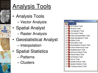
TYPES OF SPATIAL ANALYSIS The raster data model supports a wide variety of analysis methods including: Neighborhood operations, Connectivity functions, Query, Classification and Measurement functions Analysis functions with vector-based GIS are not quite the same as with raster GIS. There are more operations deal with objects and measurements such as area have to be calculated from coordinates of objects instead of counting cells as in raster GIS. In vector system most of the analyses like find are done by direct search in the database.
TYPES OF SPATIAL ANALYSIS Compared with raster GIS, some of the vector GIS operations are more accurate (e.g. estimates of area based on polygons are more accurate than counts of pixels; and estimates of perimeter of polygon are more accurate than counting pixel boundaries on the edge of a zone), some are slower (e.g. overlaying layers and finding buffers) and some are faster (e.g. finding path through road network). By using a traditional kind of 2-D co-ordinate system, with a continuous number system for the co-ordinate values, we can obtain a very high resolution very efficiently. The idea of a vector representation is that we represent objects in the real world by points, lines and polygons in the GIS.
IDENTIFYING A NUCLEAR WASTE DISPOSAL SITE
RASTER OVERLAYS: (A) POINT-IN-POLYGON (USING ADD); (B) LINE-IN-POLYGON (USING ADD); (C) POLYGON-ON-POLYGON (USING ADD); (D) POLYGON-ON-POLYGON (BOOLEAN ALTERNATIVES)
OVERLAY OPERATIONS IN GIS (VECTOR DATA)
OVERLAY OPERAIONS IN GIS (RASTER DATA)
OVERLAY OPERAIONS IN GIS (RASTER DATA)