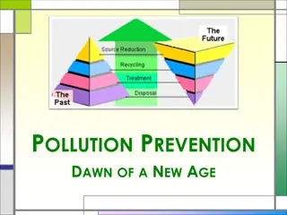
Oil Pollution GIS for the Wider Caribbean Region by RAC-REMPEITC
Utilizing GIS technology, RAC-REMPEITC focuses on preparedness and response to oil pollution in the Caribbean region. The initiative involves early warning systems, detection, decision-making, coordination, equipment location, remote sensing, modeling, and international support to protect the marine environment from oil spills. Through a series of meetings and workshops, technical support, and consultancy, RAC-REMPEITC engages with countries in the region to enhance their capacity in handling oil pollution incidents effectively.

Download Presentation

Please find below an Image/Link to download the presentation.
The content on the website is provided AS IS for your information and personal use only. It may not be sold, licensed, or shared on other websites without obtaining consent from the author. Download presentation by click this link. If you encounter any issues during the download, it is possible that the publisher has removed the file from their server.
E N D
Presentation Transcript
Oil Pollution GIS for the Wider Caribbean Region RAC-REMPEITC Caribe
RAC-REMPEITC Convention for the Protection and Development of the Marine Environment in the Wider Caribbean Region (Cartagena Convention) Regional Activity Centre of the Caribbean Environment Programme (UNEP-CAR/RCU) Regional Marine Pollution Emergency, Information and Training Centre Caribe
RAC-REMPEITC Antigua and Barbuda, Bahamas, Barbados, Belize, Colombia, Costa Rica, Cuba, Dominica, Dominican Republic, El Salvador, France, Grenada, Guatemala, Guyana, Haiti, Honduras, Jamaica, Mexico, Kingdom of the Netherlands, Nicaragua, Panama, St. Kitts and Nevis, Saint Lucia, St. Vincent and the Grenadines, Suriname, Trinidad and Tobago, United Kingdom, United States of America and Venezuela (23 of 52 U.N. Recognized Small Island Developing States) 2008-2018 312 Meetings/Workshops (Over 1,900 attendants) Technical support and consultancy
Caribbean Oil Pollution GIS - Preparedness Storage and visualization of: Shipping Traffic Heat map Datasets: Refineries, Oil Storage, Port facilities ESI shape files and PDFs GRS shape files and PDFs Equipment stockpiles and inventories Oil Spill Modelling Link to GNOME Training mode Risk assessment Potential sources of pollution Oil spill trajectory to identify areas affected Environmental Sensitivity Index (ESI) Maps Geographic Response Strategies (GRS) Equipment location Training and Exercise
Caribbean Oil Pollution GIS Early warning & Response Early warning Detection Response decision-making Response coordination Equipment location International support Common Operational Picture (COP) Remote sensing visualization and analysis Oil Spill Modelling Storage and visualization of datasets On-screen alert display of ongoing incidents Notification to neighboring countries using Carib-POLREP National and Regional oil spill contact list Requesting and offering assistance Live location of equipment and personnel
Caribbean Oil Pollution GIS - Considerations All participants are interested in a web-based GIS for oil pollution preparedness and response Oil spill track modelling created great interest (some users already utilize Gnome) Not all users have dedicated Information Management Officers to handle geospatial information during an oil pollution incident Not all users have a Common Operational Picture to coordinate the response Some users show reserves to openly share some oil pollution related datasets (e.g. past incidents, potential oil pollution sources )
Caribbean OP GIS Stage 1 Requirements Spatial Data Structure to host the datasets Development of Application Pre-processing satellite-AIS dataset to create heat map Obtain other regional datasets Promotion and training (end users) Functionalities Visualization of regional datasets without further interaction
Caribbean OP GIS Stage 2 Requirements Further development of Application Obtain datasets from national authorities Pre-processing and maintenance of dataset Functionalities Visualization/access to national datasets Pdf format (i.e. ESI maps, GRS) Datasets (i.e. ESI maps, GRS) Equipment inventories Visualization of remote sensing (i.e. satellite) Link to GNOME modelling Alert embedded in the system to release Caribbean-PolRep Different levels of access for users?
Caribbean OP GIS Stage 3 Requirements Satellite imagery Trained staff to analyze imagery Protocols to distribute information Modelling software? Oceanographic and meteorological forecast data? Functionalities Pollution detection through satellite imagery analysis Modelling embedded?
Caribbean OP GIS Stage 4 Functionalities wish list Create datasets for small scale operational use (i.e. development of ESI maps, development of GRS ) Upload information to the system from mobile App for on-field survey Common Operational Picture including equipment and staff deployment Satellite imagery to characterize coastline Oil spill track modelling of oil detected through satellite imagery
Caribbean Oil Pollution GIS What we have so far Shipping Traffic Heat map: Norway KYSTVERKET Satellite-AIS (AISSat- 1, AISSat-2, NorSat-1, and NorSat-2) ship tracking historical data in the region Outdated Datasets: Refineries, Oil Storage, Port facilities Access to some ESI shape files and PDFs Access to some GRS shape files and PDFs Access to some Equipment stockpiles and inventories Oil spill response contact points in the region Notification system Carib-POLREP
Caribbean Oil Pollution GIS - Questions Stage Functionalities To be defined Timeline Cost ? 1 Basic Visualization Regional scale One-time cost: In-kind support? Annual running cost ? 2 Visualization and interaction National/Regional scale ? One-time cost? Annual running cost? 3 Pollution detection Modelling? ? One-time cost? Annual running cost? ? 4 Operational scale functionalities ? ?
Caribbean Oil Pollution GIS Questions Level of modelling required Scale: Strategic vs Tactic Implications in the development of the application Preprocessing of the datasets (i.e. Satellite AIS to heatmap) Standardize equipment inventory Maintenance of datasets Levels of access
Caribbean Oil Pollution GIS Questions Funding options Project ownership Datasets ownership Software Remote sensing analysis: Selection of personnel to be trained Dependency of the project on 3 people Possibility of engaging universities in the region to provide long-term sustainability Use of the results (Routing monitoring, MARPOL violations, incident response)