GIS Data Management in Hydrologic Engineering Center (HEC) Software
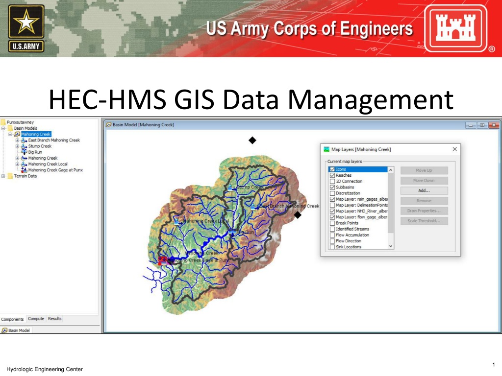

HEC-HMS GIS Data Management
Hydrologic Engineering Center
1
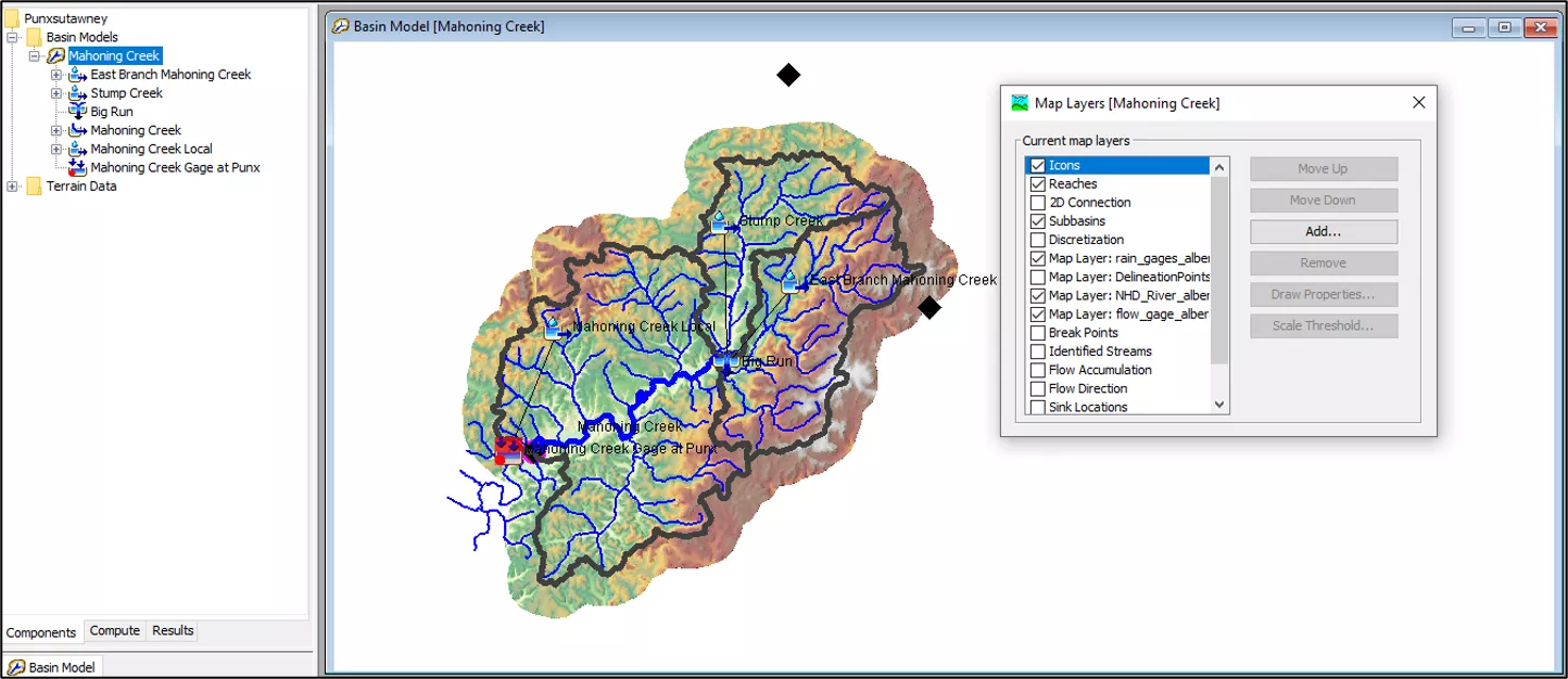
GIS Data Management
Hydrologic Engineering Center
2
•
Manually add background
shapefiles to the
maps
folder before adding them
to a basin model (makes the
files relative to the project)
•
HEC-HMS will save GIS files
created during automated
delineation to the
gis
folder
•
HEC-HMS will save terrain
files to the
terrain
folder
•
The *.sqlite file contains
information for
georeferenced elements,
including discretization
Typical HEC-HMS Project Directory
GIS Data Management
Hydrologic Engineering Center
3
The *.basin file contains
information about the
coordinate system, user
settings for delineation, and
background map files
GIS Data Management
Hydrologic Engineering Center
4
•
Information about the list of
background layers added to the basin
model map includes the location of the
file
•
Notice how pathnames for files located
within the project directory are saved
•
Using relative pathnames helps when
transferring the project from one
computer to another
GIS Data Management
Hydrologic Engineering Center
5
The
gis
directory is where
HEC-HMS saves files
created during the
delineation process
elevation.tif
– terrain
layer converted to basin
model’s projection
Other files are created
during the preprocessing
sinks and drainage,
identify streams, and
delineate elements steps
Efficiently manage GIS data in HEC software by organizing background shapefiles, saving files in relevant directories, and utilizing relative pathnames. Understand the contents of basin files, GIS directories, and the step-by-step process involved in the delineation of elements within a project.

Download Presentation

Please find below an Image/Link to download the presentation.
The content on the website is provided AS IS for your information and personal use only. It may not be sold, licensed, or shared on other websites without obtaining consent from the author. Download presentation by click this link. If you encounter any issues during the download, it is possible that the publisher has removed the file from their server.
E N D
Presentation Transcript
HEC-HMS GIS Data Management 1 Hydrologic Engineering Center
GIS Data Management Manually add background shapefiles to the maps folder before adding them to a basin model (makes the files relative to the project) Typical HEC-HMS Project Directory HEC-HMS will save GIS files created during automated delineation to the gis folder HEC-HMS will save terrain files to the terrain folder The *.sqlite file contains information for georeferenced elements, including discretization Hydrologic Engineering Center 2
GIS Data Management The *.basin file contains information about the coordinate system, user settings for delineation, and background map files Hydrologic Engineering Center 3
GIS Data Management Information about the list of background layers added to the basin model map includes the location of the file Notice how pathnames for files located within the project directory are saved Using relative pathnames helps when transferring the project from one computer to another Hydrologic Engineering Center 4
GIS Data Management The gis directory is where HEC-HMS saves files created during the delineation process elevation.tif terrain layer converted to basin model s projection Other files are created during the preprocessing sinks and drainage, identify streams, and delineate elements steps Hydrologic Engineering Center 5