Transforming Education with Technology: Connecting American Students to Broadband and GIS Resources
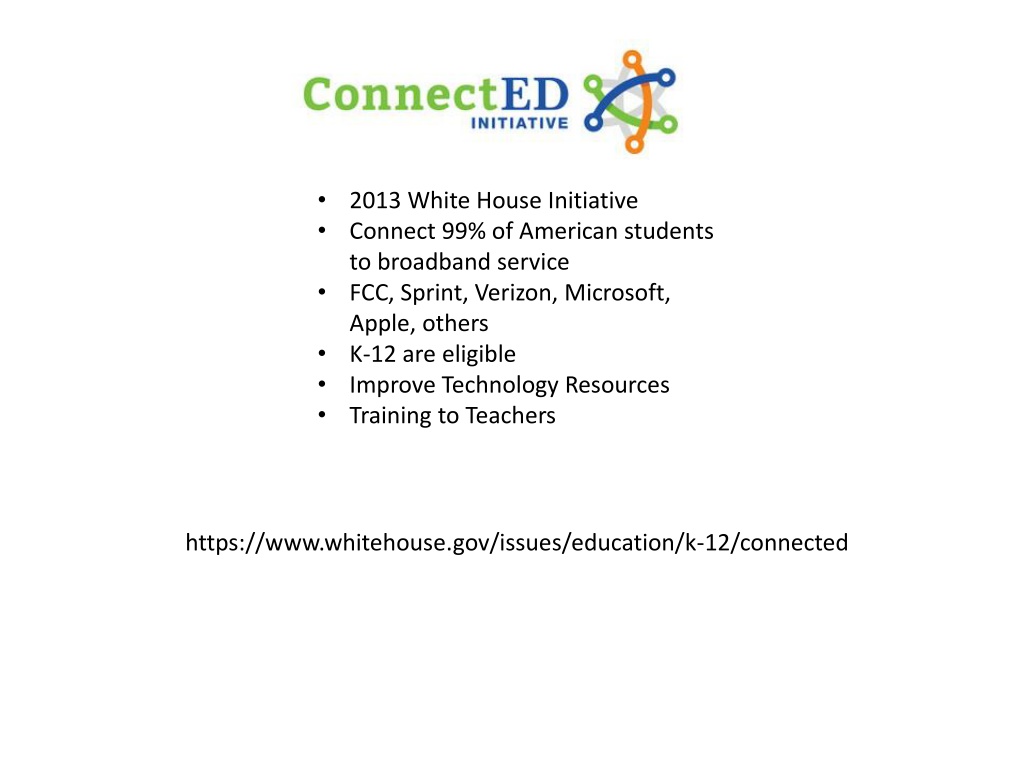
In 2013, the White House initiated a program to connect 99% of American students to broadband service, supported by companies like FCC, Sprint, Verizon, Microsoft, Apple, and others. Additionally, Esri is offering $1 billion worth of ArcGIS access for K-12 schools, enhancing students' mapping and data analysis abilities. GIS mentors in Fulton County are collaborating with schools to introduce GIS projects and support through ESRI. By leveraging technology and mentorship, this initiative aims to empower students with valuable skills for the future.

Download Presentation

Please find below an Image/Link to download the presentation.
The content on the website is provided AS IS for your information and personal use only. It may not be sold, licensed, or shared on other websites without obtaining consent from the author. Download presentation by click this link. If you encounter any issues during the download, it is possible that the publisher has removed the file from their server.
E N D
Presentation Transcript
2013 White House Initiative Connect 99% of American students to broadband service FCC, Sprint, Verizon, Microsoft, Apple, others K-12 are eligible Improve Technology Resources Training to Teachers https://www.whitehouse.gov/issues/education/k-12/connected
Esri will provide $1 billion worth of free access to ArcGIS Online Organization accounts to every K-12 school in America to allow students to map and analyze data Amazon Web Services agreed to provide the cloud infrastructure for the next three years Geographic Information System technology gives students powerful tools for understanding our planet, and teaches them to become problem solvers. It is a perfect complement to STEM courses and many other classroom activities, while preparing students for further education and expanding career opportunities in fields that can help better manage our world, build better lives for more people, and design a better future. - Jack Dangermond www.esri.com/connected
GIS Mentor Fulton County STEM Science, Technology, Engineering, Mathematics Contacted The Fulton County Board of Education STEM Coordinators In process of setting up schedule for meetings at multiple locations within the county Once a school decides to apply, a mentor is partnered with the school to help them understand potential projects and assist them with the startup Each School submits an application to ESRI on school letterhead After the school is operational, the mentor s role is to act as a consultant to answer questions about GIS Projects and AGOL The intent of the mentor is to get the school working with GIS and AGOL, so once the program is initiated, the mentor can move on to another school, grow the level of support for the current school or exit the mentorship Georgia URISA Actively Recruiting Mentors Contact: Education@gaurisa.org, President@gaurisa.org , IPP@gaurisa.org
GIS Mentor and ESRI AGOL Benefits Grow GIS knowledge, interest and applications throughout science Improve spatial thinking Professional development Connect, give back to and improve the communities where we live Help shape the future Fulton County Contacts Justyna.Grinholc@FultonCountyGA.gov Colin.Gowens@FultonCountyGA.gov Sharon.Smith@FultonCountyGA.gov