Radiosonde Technology and Upper Atmosphere Measurements in Meteorology
Upper atmosphere measurements above the surface are crucial for forecasting and research in meteorology. Radiosondes, carried by balloons, provide data on pressure, temperature, humidity, wind speed, and direction. These measurements are vital for analyses and research, especially in emergency situations. The altitude reached by the balloon when it bursts depends on various factors, and radiosonde technology plays a key role in providing accurate electrical outputs for data collection.
- Radiosonde Technology
- Upper Atmosphere Measurements
- Meteorology
- Balloon-carried Sensors
- Weather Forecasting

Download Presentation

Please find below an Image/Link to download the presentation.
The content on the website is provided AS IS for your information and personal use only. It may not be sold, licensed, or shared on other websites without obtaining consent from the author. Download presentation by click this link. If you encounter any issues during the download, it is possible that the publisher has removed the file from their server.
E N D
Presentation Transcript
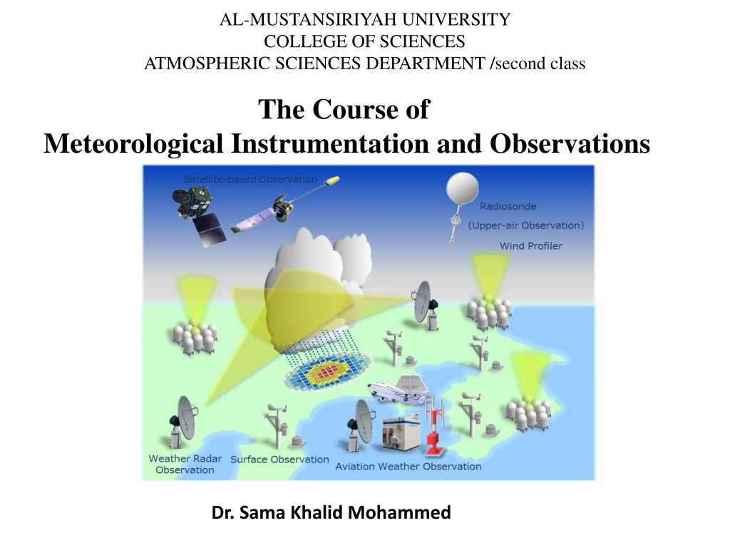
AL-MUSTANSIRIYAH UNIVERSITY COLLEGE OF SCIENCES ATMOSPHERIC SCIENCES DEPARTMENT /second class The Course of Meteorological Instrumentation and Observations Dr. Sama Khalid Mohammed
Welcome Students! LECTURE EIGHT
Upper atmosphere measurements Measurements made above the surface are important for forecasting analyses and for research applications because of the information they provide on the atmosphere s vertical structure. Data obtained within the atmosphere (i.e. in situ measurements) can be provided by sensors carried on aircraft or balloon platforms. Balloon-carried sensors are routinely used internationally to provide data for forecast initialization, launched at thousands of sites daily as well as more specialist surveys, for example to monitor stratospheric ozone. In some cases, such as emergency situations concerning the release of radioactivity or volcanic eruptions, balloon carried probes can provide the only source of safe in situ sampling throughout the troposphere. A balloon-carried measuring probe returning data by radio is known as a radiosonde.
Radiosonde Radiosondes instrument packages are carried by balloons to the upper troposphere or above, during which vertical profiles are obtained of pressure, temperature and humidity. In addition, changes in position during the ascent are used to derive the wind speed and direction. Measurements are telemetered to a ground station by a radio transmitter Sounding balloons A latex balloon of mass between about 200 g and 1000 g is inflated with the lighter than air gases of helium or hydrogen to allow free lift to be obtained. Of these gases, helium is becoming an increasingly scarce resource and expensive; hydrogen is less costly as a raw material, but, because it forms an explosive mixture with air, it requires special handling to prevent the possibility of ignition. The balloon eventually bursts from expansion, and the radiosonde package descends by parachute.
The altitude reached by the balloon when it bursts depends on the weight of its payload, the drag forces and the duration of the flight, as well as whether there are imperfections in the latex from which it is made. Because the shape of the balloon changes during its ascent, the drag force is not easily calculated and empirical relationships have to be used. The figure shows the typical variation in burst height with balloon mass. Larger balloons reach greater burst heights for the same payload: compared with the range of burst heights, there is much less variation in ascent speed with the balloon size. Variation of flight parameters with the unfilled mass of the carrying balloon, calculated for Helium as the lifting gas, with a payload of 365 g.
Radiosonde technology The sensors carried by a radiosonde have to provide an electrical output, such as a voltage, current or frequency. A key requirement for a radiosonde is its battery power supply, which must sustain the operation of the device as it becomes colder and more distant from the receiving station. As the radiosonde is carried aloft, sensors on the radiosonde measure profiles of pressure, temperature, and humidity. These sensors are linked to a battery powered, radio transmitter that sends the sensor measurements to a sensitive ground receiver that detect and process signals. By tracking the position of the radiosonde, information on wind speed and direction aloft is also obtained. The balloon, parachute and radiosonde, known collectively as a flight train, ascend at an approximate rate of 1000 feet per minute depending on weather conditions, amount of gas, and balloon size.
During the flight train's ascent, the radiosonde continuously transmits temperature, relative humidity, and pressure readings to the ground- based Radiosonde Tracking System which is housed in a fiberglass dome above the inflation shelter. NWS Upper Air Inflation Building at Alabaster, AL Wind speed and direction are determined for each minute of the flight, generally 90 minutes. They are determined from changes in the position and direction of the flight train as detected by the Radiosonde Tracking System. When winds are incorporated into the observation, it is termed a rawinsonde observation. Radiosondes may also encounter vigorous turbulent motion associated with rapid updrafts or jet streams. In addition, the full radiosonde package needs to be lightweight to minimize the amount of lifting gas required, as well as being disposable and inexpensive.
Significant changes in the meteorological parameters are entered into a minicomputer, which converts them into coded messages. These messages are relayed through various communications systems to all parts of the world. The National Center for Environmental Prediction (NCEP) prepares daily upper air charts and forecasts based on the rawinsonde observations. After the data has been used, it is archived at the National Climatic Data Center (NCDC), where it is available to anyone upon request. Requirements for modern radiosonde sensors are demanding, as they are expected to measure consistently and accurately across a wide range of conditions, typically include pressure from 1000 hPa to 20 hPa to 1 hPa, temperature from 40 C to 60 C to 0.5 C and relative humidity from 0 % to 100 % to 5%.
Worldwide, there are more than 900 upper-air observation stations using 15 major types of radiosondes. Most stations are located in the Northern Hemisphere and all observations are taken at the same times each day at 00:00 and 12:00 UTC, 365 days per year. Importance of Radiosonde Data to Local Weather Prediction Individual soundings help forecasters determine many local weather parameters including, atmospheric instability, freezing levels, wind shear, precipitabie water, and icing potential. The following are examples of local weather phenomena that are predicted with the aid of sounding data: Severe thunderstorms Tornadoes Microbursts Flash floods Ice storms Aircraft icing conditions and turbulence Cloud heights Maximum temperature
GPS Dropsondes Dropsonde is a weather reconnaissance device created by the National Center for Atmospheric Research (NCAR), designed to be dropped from an aircraft at altitude to accurately measure tropical storm conditions as the device falls to the ground. The dropsonde contains a GPS receiver, along with pressure, temperature, and humidity sensors to capture atmospheric profiles and thermodynamic data and winds.
Driftsondes It is a new type of observing system to track weather above hard-to-reach parts of the globe, as well as make soundings that will fill critical gaps in data coverage over oceanic and remote arctic and continental regions. These areas include: (1) relatively void of in-situ measurements from radiosondes and commercial aircraft, such as the remote Pacific and Atlantic oceans, (2) covered with extensive cloud shields so that satellite measurements are limited. The across the ocean driftsonde flights will provide high resolution atmospheric profiles made by GPS dropsondes that would be difficult or impossible to obtain by deployment of aircraft alone.
Remote Sensing in Meteorology Meteorologists need and use both in-situ and remote sensors. most countries, has an in-situ 'observing' network of stations for measuring surface and upper-air (different altitudes in the atmosphere) weather information. However, these stations only measure atmospheric conditions at specific locations/points and times. This network leaves gaps in weather information both spatially (in space) on the order of several kilometers to thousands of kilometers and temporally (in time) on the order of minutes to 12 hours. Remotely sensed data (satellite and radar) are vital to operational weather forecasters because they fill in the spatial and temporal gaps left by the observing network. Remote sensing provides meteorologists with detailed weather information that they could not obtain by just going outside and observing the sky themselves. These data complement and add to the surface and upper-air data to form a more complete and continuous picture of atmospheric conditions.
Weather radar Radar: RAdio Detection And Ranging Active remote sensing technique. Radars work electromagnetic pulses of energy (EM waves that fall into the microwave (1 mm < < 75 cm)). The energy is reflected and scattered off of particles in the atmosphere, including precipitation, clouds, airplanes, birds and insects. Some of the energy returns to the radar and is received by the antenna and receiver. The data are processed to determine information about the scatters in the atmosphere. by transmitting
What observations that a radar can give us? Precipitation measurements Wind measurements Negative (heading towards the radar) Positive (heading away from the radar) Turbulence and wind shear detection Severe storm nowcasting Hail detection Location of melting level in stratiform precipitation Mesocyclone detection Hurricane structure Three fundamental properties of the emitted beam: pulse repetition frequency (PRF), transmission time, beam width.
A radar usually emits a pulse for 0.000003 seconds then listen for 0.003 seconds (remember it goes through this transmit/receive cycle about 325 times every second!). So, 99.9% of the time, the radar is receiving, and 0.1% of the time, it s transmitting. Attenuation Particles will attenuate the energy in two ways: scattering and absorption, collectively known as attenuation Particles: raindrop, hail, snow, graupel, insects, .. Attenuation may cause a void in reflectivity directly behind a heavy thunderstorm
Satellite Data Satellite-borne sensors have the unique vantage of observing Earth and its atmosphere from orbit using remote sensing techniques. weather satellites sense the radiation to indicate the presence of clouds, water vapor, and surface features. Polar-orbiting Polar-orbiting satellites orbit longitudinally passing directly over the poles at an altitude of about 850 km. With each orbit, the satellite sees an area that is west of the previous pass. Because these satellites are in a low orbit and look directly down, the images they record show great detail about meteorological and non-meteorological features. While images record great detail, polar- orbiting satellites capture only a few images per location every day. These satellites provide excellent imagery of the polar regions though. the earth
Geostationary Orbiting Geostationary satellites revolve with the earth in a west-to-east direction directly over the equator at an altitude of 36,000 km. Since the satellite revolves at the same speed and in the same direction as the earth, it always has the same view of the earth's surface. These satellites are in a higher orbit than polar-orbiting satellites; therefore each image covers a much greater area. While geostationary satellites record less detail than POES, they capture many images of the same locations every day.