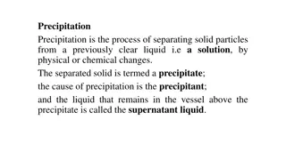
Understanding Precipitation in Meteorology

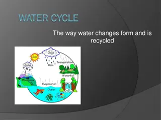
Precipitation in meteorology is the result of atmospheric water vapor condensing and falling to Earth, a vital element of hydrology. It can occur in liquid or solid forms through processes like evaporation, cooling, condensation, and droplet growth. Different geographic and climate conditions impact the formation of precipitation, leading to convective, orographic, and cyclonic precipitation types. Orographic precipitation, for example, involves moist air being forced upwards over terrain, leading to rain shadows and varied climates on windward and leeward sides.

Download Presentation

Please find below an Image/Link to download the presentation.
The content on the website is provided AS IS for your information and personal use only. It may not be sold, licensed, or shared on other websites without obtaining consent from the author. Download presentation by click this link. If you encounter any issues during the download, it is possible that the publisher has removed the file from their server.
E N D
Presentation Transcript
In meteorology, the term precipitation is any product of the condensation of atmospheric water vapour that under gravity. It includes all forms of water coming from the atmosphere to the earth. Precipitation is the one of the major element of hydrology after it falls on the ground because it is the source of water on the earth. Precipitation can fall in either liquid or solid phases, or transition between them at the freezing level. falls
The process of formation of precipitation works in four stages: Evaporation Process Cooling Process CondensationProcess Growth of dropletProcess
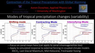
Itdepend on formation ofprecipitation,various geographic conditions and variousclimate conditions. Therearemainlythreetypesofprecipitation: 1. ConvectivePrecipitation 2. Orographic Precipitation 3. CyclonicPrecipitation
When evaporation happen, unsaturated air near theEarths surface is carried to higher levels. Pressure decrease with altitude and reduction of pressurecauses an expansion on the air and air absorbs more watermoisture. The moisture air moves up.Air cools and condenses with height due to lower temperature. That is referred to as dynamic cooling and condensed air is formed as clouds. (Cooling and Condensation Process) Condensation is not necessarily cause precipitation. Water droplets accumulate and larger droplets collide and combine with smaller droplets. That causes a further increase droplet size and when the water droplets heavy enough, fall as rain due to gravitational force. (Growth of Droplets Process)
This precipitation occurs when moist air is forced upwardsover rising terrain, such as a mountain. Heated air near the ground expands and absorbs watermoisture. The moisture air moves up. Then mass of air is pushed bywind are forced by a topographic barrier. Air rise to higher elevations and expansion, coolingand precipitation process take part with one by one. That process is referred as orographicprecipitation . Precipitation occurs on windward side ofbarrier. On the leeward side of barrier, the clouds are lighter without the weight of the water. Moisture is removed by barrier and air descent. Therefore, rain shadow can be observed on leewardside. Because of the orographic precipitations, a moisture climate can be observed at the windward side and a more arid climate canbe observed at leeward side due to lack of rainfall.
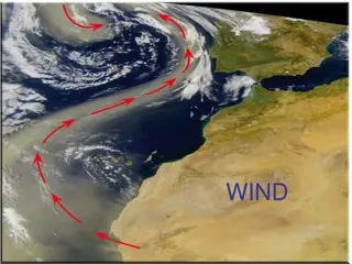
As the shape of the Earth is geoid. Therefore, sunlight comes to the Earth surfaces with different angle and causes an uneven heating on the Earth surface. Maximum heat from the sun is received by the regions close to equator and the air around that region gets warm. On the other hand apart from the regions close the equator, air gets cold. These warm and cold air flow and collide in some region with the effect of winds. In addition , during seasons the land can be heated more than the sea or vice versa that also causes the collide of the warm and cold air.
Warm Front and Cold Front (Frontal or non-frontal precipitation):- The uneven heating of the Earth s surface by the sun can result as high and low pressure regions. The boundary between air masses with different pressures is called asa front. If warm air moves over cold air, it is called a warmfront. . If cold air moves under warm air, it is called as a cold front. Precipitation along a warm front, warm air mass rise up on a slope over the colder air mass, because warm air has less density than thecold air. Warm air cools during rising up and it moisture gets condensed.That produces clouds and precipitation isobserved. Precipitation along a cold front, cold air mass wedges into thewarmer air mass. Warm air is lighter than cold air and therefore, warm air is liftedupward. Warm air cools during rising up and it moisture gets condensed. That produces clouds and precipitation is observed. Cold frontsmoves faster and produce high intensityrainfalls. As a result, a precipitation is caused by lifting of an air mass due tothe
Rainfall takes place in many different forms in the regions located in the middle latitudes. Typical characteristics of various forms of precipitation are explained below: Rain:- These are water droplets mostly size larger than 0.5 mm in diameter. Drizzle:- These are tiny water droplets of size between 0.1 to 0.5 mm which fall with such slow settling rates that they occasionally appear to float. Snow:- It is the type of precipitation which results from sublimation that is water vapors directly changes to ice. It falls as white or translucent ice crystals often agglomerated into snow flakes. The specific gravity of snow is often taken to be 0.1 1. 2. 3.
4. Hail:- These are the precipitations in the forms of lumps of ice. These hailstones are produced in convective clouds mostly cumulonimbus.(Very tall and large clouds i.e {5-13 km} in appearance) These may be conical, spherical, spheroidal or irregular in shape. The sizes of hailstones may be anything more than 5 mm. The specific gravity of hailstones is about 0.8 5. Snow Pallets:- These are sometimes called as soft hail too. These are more crisp and are of 2-5 mm of size. Due to their crispness upon hitting the hard ground, they oftenly breaks up.
6. Sleet:- When the rain drops fall through the layer of sub- freezing air near the earths surface, therain-drops gets frozen into ice stage. This is called as Sleet or Grains of ice. Drizzle Rain
Snow Hail Snow Pallets Sleet