Understanding Relational Database Design and Mapping Techniques
Explore the process of mapping Entity-Relationship (ER) and Enhanced Entity-Relationship (EER) models to relational databases. Learn about relational model concepts, mapping algorithms, and the goals and steps involved in the mapping process. Discover how to preserve information, maintain constraint
3 views • 42 slides
Insights on State of the Southern Ocean Observing System (SOOS) Portal Data Management
Delve into the recent discussions and updates from the Southern Ocean Observing System (SOOS) Portal Data Management Sub-Committee Meeting attended by Scott Ritz, Valerie Dixon, and Michael Morahan. Explore the challenges related to metadata documents, portal usage, and GCMD keyword status as highli
0 views • 13 slides
Adoption of Statistical Data Metadata Exchange (SDMX) in India and Its Way Forward
Data dissemination in India plays a crucial role in making statistics accessible and understandable to the public. The usage of SDMX for exchanging statistical data metadata aims to enhance comparability and interpretation, enabling collaboration with major data agencies. Challenges lie in extending
0 views • 9 slides
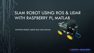
Mapping Robot using ROS, Lidar with Raspberry Pi & MATLAB
Turtle.bot is a popular product for home service robots, utilizing SLAM and navigation technologies. It features gyro, Kinect sensors, Lidar, and a laptop for mapping. The robot localizes and navigates using ROS in Raspberry Pi connected with MATLAB. ROS (Robot Operating System) is a set of software
0 views • 17 slides
National Labor Mapping Application User Roles and Access Overview
This detailed overview outlines the implementation plan, user roles, and access benefits of the National Labor Mapping Application. Users are assigned specific roles with established access through domain usernames, enhancing security measures. Different user roles such as VISN Coordinators, Site Te
0 views • 14 slides
Research Output Management in Higher Education: Metadata and FAIR Principles
Research in higher education focuses on metadata and FAIR principles for effective research output management. The content discusses the challenges related to metadata standardization and the importance of data findability, accessibility, interoperability, and reusability in scientific data manageme
0 views • 22 slides
Mapping Methodology for Establishing ESCO Relations
Learn how to set up teams, collect resources, compare classifications, and establish mapping relations for ESCO implementation projects. Get insights on using computer-assisted suggestions, updating mapping tables, and selecting mapping projects. Explore techniques for navigating classifications, br
1 views • 21 slides
Standardization Process for Metadata Components in Language Archives
The standardization process for metadata components within TC37/SC4 at the Language Archive Max Planck Institute involves analyzing existing metadata sets, seeking input from the CLARIN EU community, and determining the next steps for standardization. The process includes forming submission groups,
0 views • 23 slides
Comparison of Metadata Standards: FGDC, ISO, and NAP
Explore the differences and commonalities between the Federal Geographic Data Committee (FGDC), International Organization for Standardization (ISO), and North American Profile (NAP) metadata standards. Discover the evolution, mandatory elements, code lists, and focus areas in these standards to bet
0 views • 14 slides
Comprehensive Training and Education Resources for Metadata Standards
Explore a wealth of training resources including workshops, guidance documents, ISO workbooks, and online lessons related to metadata standards. Access tools, best practices, and guidance for transitioning to international metadata standards like ISO. Learn from presentations, modules, and other tra
0 views • 9 slides
Metadata Management System for Fusion Research Experiment Data
The metadata management system based on MongoDB for the EAST experiment addresses the challenges posed by the increasing size and complexity of experimental data. With a focus on resource organization and user accessibility, this system streamlines data management, enabling quick insights into the v
0 views • 15 slides
Exploring Texture Mapping in Computer Graphics
Delve into the world of texture mapping as a solution to the smoothness of polygons in computer graphics. Learn how to create textured scenes using techniques such as bump mapping and environmental mapping. Discover the process of representing textures, working with curved surfaces, and mapping onto
2 views • 24 slides
Supporting Researchers with Research Data Management (RDM) Costs by Jacques Flores
Helping researchers meet funder and institutional demands for data management plans, sharing data, metadata, security, privacy, and long-term preservation. Creating awareness about RDM costs beyond storage solutions, emphasizing metadata, informed consent, anonymization, and data preparation. Provid
1 views • 15 slides
Understanding Standard Metadata, Counters, and Meters in P4 Programmable Data Planes
Learn about the role of metadata in packet processing, the significance of intrinsic metadata, and how to utilize custom headers for monitoring switch queues in P4 programmable data planes. This tutorial explores the V1 Model standard metadata and provides hands-on experience in defining and using c
0 views • 21 slides
Innovative LiDAR Cave Mapper for Cavers
Develop a portable and cost-effective LiDAR cave mapper to assist freelance cavers in mapping caves efficiently. The project aims to create a device that is affordable, DIY-style, and open-source, making cave mapping more accessible and accurate. The team from FAMU-FSU College of Engineering strives
0 views • 22 slides
Atlantic Seabed Mapping Workshop Summary
Workshop held in Dublin Castle on Dec 2, 2014, discussed current and future plans for seabed mapping in the Atlantic. Key topics included navigational charting, initiatives by various organizations, challenges of disjointed mapping efforts, and proposed actions to address issues. Recommendations inc
1 views • 5 slides
Dealing with Metadata in the Spoken BNC2014: An Insightful Study
Delving into the metadata of the Spoken BNC2014, this study by Robbie Love at Lancaster University focuses on regional categorization, socio-economic status, and advancements towards dual compatibility with the BNC1994. With over 800 hours of recordings and nearly 700 unique speakers contributing to
0 views • 39 slides
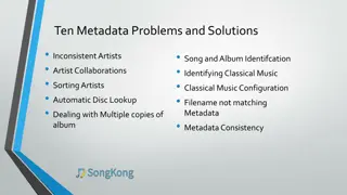
Metadata Challenges and Solutions in Music Management
Addressing ten metadata issues in music organization, such as inconsistent artist attributions and sorting discrepancies, with corresponding solutions including entity-based approaches and artist collaboration management. Strategies for improving metadata consistency and optimizing music data retrie
0 views • 30 slides
Improvement of Population and Vital Statistics Metadata in the Demographic Yearbook System
The Demographic Yearbook system focuses on enhancing population and vital statistics metadata to ensure accurate and concise reflection of population concepts across 230+ countries. It involves annual collection of official national population estimates, vital statistics, and UN international travel
0 views • 16 slides
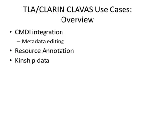
Integrating CMDI for Metadata Editing and Kinship Data Annotation
Explore the integration of CMDI for metadata editing in resources, including open/closed vocabularies, Arbil interface for vocabulary management, ELAN for resource annotation, and KinOath for kinship data. Discover how CMDI improves data annotation and vocabularies management in linguistic research.
0 views • 10 slides
Exploring Shelf Space Management Through Metadata Analysis
Delve into a novel approach of utilizing metadata such as number of pages, binding type, and year of publication to study shelf occupancy in libraries. The project focuses on addressing the challenge of accurately measuring shelf space taken up by library stock, proposing a data-driven model for bet
0 views • 13 slides
Mapping Project Overview and Attributes
This content provides detailed information about a mapping project involving the transition from S.S-53 to S-124, including complex and simple attributes, spatial references, and metadata. It covers aspects such as domain models, NAVWARN preamble, complex vs. simple attributes, and more. The content
0 views • 23 slides
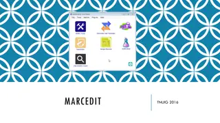
MarcEdit - Comprehensive Metadata Management Tool
MarcEdit is a versatile metadata management tool created by Terry Reese in 1999. Originally designed for MARC records, it has evolved to support various types of data. Key features include MARC editing tools, RDA helper, regular expressions support, task management, and more. Its robust functionalit
0 views • 16 slides
Understanding Metadata and RDF in Data Management
Explore the significance of metadata in data management, the use of RDF and triple stores in organizing data, different reasoning methods available, and the importance of metadata structures. Learn how schemas in RDF allow for easy integration of diverse data types without requiring database reorgan
0 views • 18 slides
Metadata Cleansing Using SPARQL Update Queries
Learn how to transform and cleanse RDF metadata using SPARQL Update queries to conform to the ADMS-AP for Joinup. This tutorial provides essential knowledge on converting metadata for interoperability solutions and the main queries involved. Discover how to ensure your metadata is compliant and read
0 views • 37 slides
Power Mapping: A Visual Tool for Advocates to Influence Change
Power mapping is a visual tool used by advocates to identify key individuals to target in order to effect change. It involves mapping the community around an issue or campaign, identifying decision-makers, adversaries, and influential stakeholders. By following important steps and asking relevant qu
0 views • 10 slides
Metadata Standards for Sample-Based Observations
Exploring the importance of metadata standards for sample-based observations, this comprehensive guide covers various aspects such as soil sampling, legacy repositories, policies, and best practices. Learn about the role of metadata in discovering, accessing, and preserving samples for long-term sha
0 views • 28 slides
GEBCO Technical Sub-Commission on Ocean Mapping (TSCOM) Overview
Technical Sub-Commission on Ocean Mapping (TSCOM) is a key component of the GEBCO program, established in 2006 to provide expertise in seafloor mapping and discuss emerging technologies. TSCOM serves as an authoritative source for bathymetric and hydrographic data and offers ongoing advice to associ
0 views • 12 slides
Virtual Network Mapping: A Graph Pattern Matching Approach
Virtual Network Mapping (VNM) involves deploying virtual network requests in data center networks in response to real-time demands. It facilitates the deployment of virtual networks on physical machines by mapping virtual nodes and links onto substrate nodes and paths, ensuring constraints are met.
0 views • 15 slides
Supervised Machine Learning for Data Management in Archives
In this study by Jennifer Stevenson, a supervised machine learning approach is proposed for arrangement and description in archives, specifically focusing on the DTRIAC collection which contains a vast amount of historical documents related to nuclear technology. The aim is to expedite the catalogin
1 views • 15 slides
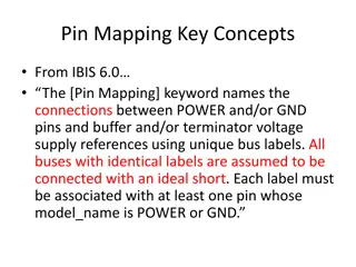
Understanding Pin Mapping and Interconnect in IBIS 6.0
Pin Mapping in IBIS 6.0 defines the connections between POWER/GND pins and buffer/terminator voltage supplies using unique bus labels. Interconnects between VDD pins and buffer supply terminals are crucial, with all pins associated with a named supply being shorted together. Draft 9 Interconnects an
0 views • 6 slides
Understanding Mercator Mapping: A Key Tool for Information System Management
Mercator is a web application designed for managing the mapping of an organization's information system, allowing for a comprehensive representation of its components and connections with the outside world. Mapping is crucial for controlling, protecting, and defending the information system, as well
0 views • 21 slides
Sustainable Development of C3S Data Rescue Portal
Develop and maintain the C3S Data Rescue Portal with a global registry for data rescue activities, focusing on registering metadata, providing searchable inventories, and supporting DARE activities. The project aims to update inventories, facilitate data uploads, and offer user support and technical
0 views • 20 slides
Interactive Mapping Assistant for Data Exchange and Reporting
The Interactive Mapping Assistant is a versatile tool used for configuring and managing structural metadata, creating connections to dissemination databases, defining data retrieval processes, managing mapping sets, and more. It supports various relational database management systems and provides es
0 views • 11 slides
Overview of Ceph Distributed File System
Ceph is a scalable, high-performance distributed file system designed for excellent performance, reliability, and scalability in very large systems. It employs innovative strategies like distributed dynamic metadata management, pseudo-random data distribution, and decoupling data and metadata tasks
0 views • 42 slides
Overview of Ceph: A Scalable Distributed File System
Ceph is a high-performance distributed file system known for its excellent performance, reliability, and scalability. It decouples metadata and data operations, leverages OSD intelligence for complexity distribution, and utilizes adaptive metadata cluster architecture. Ceph ensures the separation of
0 views • 23 slides
Enhancing Curriculum Development through Mapping for Schools
Curriculum mapping in schools involves using electronic tools to input, track, and analyze data related to curriculum, enabling stakeholders to meet standards, align content, collect real-time data on instruction, and reflect on practices for continuous improvement. Software programs like Rubicon At
1 views • 15 slides
Importance of Maps and GIS in Census Mapping: A Case Study from Nepal
Census mapping plays a crucial role in ensuring accurate population counts and territorial delineation. This case study from Nepal highlights the significance of Geographic Information Systems (GIS) in producing high-quality maps for census operations, data collection, analysis, and dissemination. T
0 views • 12 slides
Step-by-Step Guide to Mapping Metadata in an AMS
Learn how to efficiently map metadata into an AMS system by normalizing your spreadsheet, uploading it, importing it into the AMS, starting the mapping process, matching materials to PBCore, transforming mappings, and retrieving GUIDs for your files. Follow a detailed procedure to ensure accurate da
0 views • 8 slides
Evaluating Metadata Quality for Digital Preservation at Harvard Library
Explore the importance of metadata quality in digital preservation with insights from Harvard Library's experience managing their Digital Repository Service. Discover challenges faced with user-contributed metadata and the necessity for systematic validation and tracking to ensure accurate preservat
0 views • 17 slides
