European Maritime Single Window environment
Explore the European Maritime Single Window environment with key definitions, established platforms, and past regulations aiming to simplify and harmonize maritime reporting formalities in the EU. Understand port calls, declarants, reporting obligations, and the purpose behind this regulatory framew
5 views • 14 slides
BTH/OTH Radar and Maritime Surveillance Radar Overview
The article discusses BTH/OTH radar systems and maritime surveillance radars, exploring their functionalities, benefits, drawbacks, and real-world examples. It delves into the working principles of OTH radar, showcasing how it operates through the ionosphere. Additionally, it covers the concept of m
5 views • 12 slides
Professional Development and Maritime Education at US Naval Academy
The Division of Professional Development at the United States Naval Academy in Annapolis focuses on developing professional mariner skills to prepare Midshipmen for their roles as competent Naval officers. The program includes training in seamanship, navigation, summer sessions, fleet cruises, and a
2 views • 11 slides
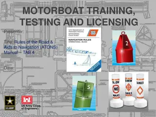
Motorboat Training, testing, and licensing: Rules of the Road & Aids to Navigation Manual
This presentation covers essential information on motorboat training, testing, and licensing, focusing on rules of the road and aids to navigation. It includes details on navigation rules, the importance of following them to prevent accidents, and where the rules apply. The content also explains who
0 views • 34 slides
Advancing Low Carbon Development in Sustainable Transport
Thierry Nervale, Deputy Director of the Transport SPC EDD Programme, highlights the importance of sustainable transport in achieving economic growth, social equity, and environmental preservation. The UN Conference on Sustainable Development underscores the central role of transportation in sustaina
5 views • 17 slides
Opportunities in Karnataka's Maritime Sector: Virtual Maritime India Summit 2021
Discover the marine investment opportunities in Karnataka highlighted at the Virtual Maritime India Summit 2021. With a well-developed industrial hinterland and picturesque coastal landscape, Karnataka offers multiple prospects in the maritime sector, including tourism development along its waterway
0 views • 10 slides
Development of Visit, Board, Search and Seizure (VBSS) Curricula for the Sulu Zone
The development of VBSS curricula for the Sulu Zone involves creating specialized training programs to enhance maritime security in the region. The aim is to adapt VBSS training to the unique requirements of the Sulu Zone, focusing on aspects such as maritime crime investigation and prosecution. VBS
0 views • 18 slides
Maritime and Geographical Overview of Equatorial Guinea
Equatorial Guinea, a country in central Africa, boasts a significant maritime presence and strategic geographical location in the Gulf of Guinea. With a population of over 1.2 million, it shares borders with Cameroon and Gabon while having maritime boundaries extending 320 nautical miles. The countr
0 views • 15 slides
Kiribati National Report on Marine Division Activities
This report sheds light on Kiribati's maritime organization, highlighting challenges faced due to economic vulnerabilities and reliance on foreign aid. It outlines the role of the Marine Division within the Ministry of Infrastructure, outlining its responsibilities as a maritime authority and regula
5 views • 17 slides
International Maritime Organization (IMO) and IMSAS: Ensuring Compliance with Maritime Standards
The International Maritime Organization (IMO) plays a crucial role in promoting maritime safety, protecting the marine environment, enhancing maritime security, and ensuring the human element in shipping. Through the Instrument Implementation Code (III Code) and the Voluntary IMO Member State Audit
0 views • 21 slides
Implementing In-App Navigation with Jetpack's Architecture Components
Discover how to easily implement in-app navigation using Jetpack's Navigation components. Learn to create a navigation graph, connect fragments, pass data, and set up your project efficiently. Check out essential steps like setting up dependencies, creating the navigation graph, and transitioning be
6 views • 16 slides
Maritime Investigation Report: Grounding of Bulk Carrier Munos
Investigation report by the UK Maritime Accident Investigation Branch on the grounding of the bulk carrier Munos off the East Coast of England in December 2015. The report includes details on the casualty, vessel parameters, onboard navigational systems, a timeline of events leading to the grounding
1 views • 18 slides
History of Transportation Innovations: Impact on Maritime Travel
Explore the evolution of maritime transportation through the ages, from oared galleys and sailing ships to the revolutionary steam-powered vessels. Learn about the advantages and disadvantages of different ship types, including their impact on trade, exploration, and warfare. Discover how innovation
2 views • 34 slides
Revolutionizing Indoor Navigation: Anyplace IIN Service by Demetris Zeinalipour
Demetris Zeinalipour's groundbreaking work focuses on revolutionizing indoor navigation with the Anyplace Internet-based Indoor Navigation (IIN) Service. With a strong emphasis on modern localization technologies and a wide range of indoor applications, this service aims to enhance user experiences
2 views • 50 slides
Progress Report on ADMM-Plus EWG on Maritime Security 2014-2017
Progress report on the activities and meetings of the ADMM-Plus EWG on Maritime Security from 2014 to 2017 co-chaired by Brunei Darussalam and New Zealand. The report includes workshops, meetings, exercises, and initiatives focused on enhancing maritime security in the region.
1 views • 19 slides
Teaching Physics at Maritime Academy: Insights from Dr. David P. Ciampa, Ph.D.
Dr. David P. Ciampa, Ph.D., shares his experience teaching physics at a Maritime Academy emphasizing on problem-solving techniques, motivation strategies, and challenges encountered. He discusses the unique aspects of teaching physics in a maritime setting and offers insights into student engagement
1 views • 12 slides
Coast Pilot Strategy for Enhanced Navigation Services
Recent observations and directives from Tom Loeper at the Office of Coast Survey, National Oceanic and Atmospheric Administration, highlight the need for developing new services to complement digital charts and electronic navigation. The focus is on providing navigation regulations, safety-related r
0 views • 14 slides
Speed Logs and Their Evolution in Maritime Navigation
Speed logs play a crucial role in measuring a vessel's speed and distance traveled through water. The evolution from primitive chip logs to modern RPM counters has significantly improved accuracy and efficiency in maritime navigation. Learn about the history, types, and working principles of speed l
0 views • 17 slides
Electronic Navigation Technologies
Electronic navigation technologies, such as satellite navigation, radio navigation, and radar navigation, utilize electricity-powered systems for precise positioning and tracking. Satellite navigation systems rely on signals from satellites for autonomous geo-spatial positioning, while radio navigat
0 views • 9 slides
TACAN: Tactical Air Navigation System Overview
TACAN, Tactical Air Navigation, is a precise navigation system used by military aircraft, providing distance and bearing information from ground stations. It offers more accuracy than VOR-DME systems, catering to both military and civil aviation needs. Through TACAN equipment, pilots can determine t
1 views • 15 slides
Constanta Maritime University - Empowering Maritime Education
Constanta Maritime University in Romania, established in 1972, is a prestigious public institution offering a diverse range of accredited study programs in maritime and engineering fields. With a focus on quality assurance and international recognition, the university remains a leading choice for st
2 views • 10 slides
Adriatic-Ionian Maritime Safety Development Project by Republic of Croatia Ministry
The Republic of Croatia Ministry of the Sea, Transport, and Infrastructure is leading the EUREKA project to enhance maritime safety in the Adriatic-Ionian region through harmonization of procedures and regulations. The project aims to address challenges in data exchange, surveillance systems, and tr
1 views • 14 slides
Implementation of Performance-Based Air Navigation Plan for SAM Region - Management of Navigation Service Personnel Competence
Seminar/workshop held in Lima, Peru in May 2011 focused on implementing the Performance-Based Air Navigation Plan for the SAM Region, emphasizing the management of navigation service personnel competence. The event highlighted the importance of training, awareness, infrastructure, budget, work envir
0 views • 6 slides
Maritime Emissions Reduction Strategies and Policy Instruments Overview
Assessment of the Expert Groups' reports on maritime emissions reduction strategies, emphasizing the need for multiple policy instruments targeting new ships, existing ships, and operational aspects. Discusses the negative side effects of flexible policies and the importance of imposing requirements
1 views • 23 slides
The Role of Time in Determining Longitude: A Historical Perspective
Exploring the pivotal role of time in the determination of longitude, this article delves into the historical background of John Harrison's invention of accurate timekeeping devices to solve the longitude problem, leading to a transformation in maritime navigation. By understanding the relationship
0 views • 16 slides
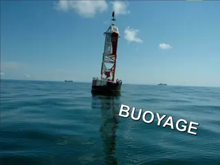
Buoyage Systems and Navigation Marks
Buoyage systems play a crucial role in maritime navigation, with IALA regions dividing the world into A and B regions. These systems use various marks such as lateral, safe water, isolated danger, special, and cardinal marks to indicate navigational pathways, hazards, and safe areas in the water. Ea
0 views • 13 slides
Modernization of Maritime Services for Enhanced Safety and Data Collection
The collection and dissemination of marine meteorological and oceanographic information using multiple Recognized Mobile Satellite Services (RMSS) is essential for improving global coverage and data sharing. The modernization of services, including Iridium SafetyCast and INMARSAT, enhances the Globa
0 views • 6 slides
Suriname Aton Academy - Providing Training for Aids to Navigation
The Suriname Aton Academy, established by the Maritime Authority of Suriname and accredited to deliver Aids to Navigation training, aims to enhance the knowledge and expertise of personnel responsible for navigation safety. Through its unique offerings and primary goals, the academy plays a crucial
0 views • 13 slides
Android Navigation: Menus, ActionBar/ToolBar, and Navigation Drawer
Explore the functionalities of ActionBar/ToolBar, menus, and navigation drawer in Android development. Learn about the transition from ActionBar to ToolBar, implementing multiple toolbars, and utilizing the Navigation Drawer layout for effective navigation in your app.
2 views • 53 slides
Maritime Safety Information Review Schedule 2024-2027 in Monaco
The document outlines the schedule for reviewing and finalizing various maritime safety information manuals and resolutions from 2024 to 2028 in Monaco. It includes amendments to Promulgation of Maritime Safety Information, Worldwide Navigational Warning Service, and more, leading up to submission a
0 views • 8 slides
Maritime Cloud: Supporting Seamless Information Transfer in E-Navigation
The Maritime Cloud is a technical framework designed to facilitate seamless data exchange in e-navigation, connecting maritime actors onboard and ashore. It addresses identified framework requirements and guiding principles for secure communication and efficient service provision in the maritime ind
0 views • 19 slides
Maritime Initiatives in St. Vincent and the Grenadines
The report outlines various maritime initiatives in St. Vincent and the Grenadines, including the Commonwealth Marine Economies Program, technical missions from IALA, goals for maritime spatial planning and development, and efforts towards ocean governance. Challenges and areas for improvement in ma
1 views • 5 slides
Deep-Draft Navigation Economic Analyses
This presentation discusses the requirements and procedures for conducting economic analyses in deep-draft navigation, particularly focusing on the National Economic Development (NED) criteria. It covers concepts, procedural steps, historical/existing conditions, sources of navigation and data, and
0 views • 12 slides
Nguyen Manh Duong: Maritime Safety Professional Achievements
Nguyen Manh Duong, a maritime safety professional from Vietnam, has a strong career background in aids to navigation management, inspection of nautical charts, and issuance of Notices to Mariners. His achievements include completing various training programs in technical aspects of maritime boundari
0 views • 8 slides
Economic Impact of Washington's Maritime Industry
Washington State's maritime industry, rooted in a rich history of timber production and trade hub location, encompasses core sectors like passenger water transportation, shipbuilding, fishing, and more. With an annual economic impact of $15.2B, the industry thrives through innovation, research, and
0 views • 9 slides
Delimitation of Maritime Boundaries by Negotiation or International Courts
Delimitation of maritime boundaries can be achieved through negotiation or by international courts or tribunals. Maritime boundary agreements have legal effects and obligations for the involved states. International bodies like the International Court of Justice and the International Tribunal for th
0 views • 5 slides
MARINN Maritime Innovation Cluster - Driving Skills Development in the Maritime Industry
MARINN Maritime Innovation Cluster, founded by GITONE Kvarner, is focused on developing skills in the maritime industry amidst a digital and green revolution. Through collaboration, education, and innovation, MARINN aims to enhance operations, promote sustainability, and empower professionals for th
0 views • 6 slides
Celebrate National Careers Week with Maritime Careers Ambassadors!
National Careers Week from 6th-12th March features a Maritime-focused day on 8th March. Ambassadors are invited to share their experiences in a case study template by including a photo, a quote on Maritime careers, their name, role, and UK region. The completed templates can be posted on social medi
0 views • 4 slides
Innovative Approach in Mathematical Education for Maritime Students
Explore the innovative approach in mathematical education for maritime students as presented during the MareMathics Teachers Training and Meeting in Tallinn. The sessions covered topics such as mathematical applications in thermodynamics, including partial derivatives, derivations, and integrals wit
0 views • 11 slides
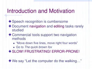
Enhancing Document Navigation Efficiency
Speech recognition in document navigation is often frustrating and error-prone, yet rarely studied. This image-packed presentation introduces innovative navigation proposals and evaluation metrics to improve task efficiency, offering insights from expert interviews and practical solutions for easier
0 views • 7 slides


