Electronic Navigation Technologies

 
ELECTRONIC
NAVIGATION
 
SRDJAN CAVIC
 
INTRODUCTION
 
E
l
e
c
t
r
o
n
i
c
 
n
a
v
i
g
a
t
i
o
n
 
a
r
e
 
f
o
r
m
s
 
o
f
 
n
a
v
i
g
a
t
i
o
n
 
t
h
a
t
 
s
h
i
p
s
,
 
l
a
n
d
 
v
e
h
i
c
l
e
s
,
 
a
n
d
 
p
e
o
p
l
e
 
c
a
n
 
u
s
e
,
 
w
h
i
c
h
 
r
e
l
y
o
n
 
t
e
c
h
n
o
l
o
g
y
 
p
o
w
e
r
e
d
 
b
y
 
e
l
e
c
t
r
i
c
i
t
y
.
Methods of electronic navigation include:
Satellite navigation
, satellite navigation systems
Radio navigation
, the application of radio frequencies to determining a position
Radar navigation
, the use of radar to determine position relative to known objects
 
SATELITE NAVIGATION
 
A
 
s
a
t
e
l
l
i
t
e
 
n
a
v
i
g
a
t
i
o
n
 
o
r
 
s
a
t
n
a
v
 
s
y
s
t
e
m
 
i
s
 
a
 
s
y
s
t
e
m
 
t
h
a
t
 
u
s
e
s
 
s
a
t
e
l
l
i
t
e
s
 
t
o
 
p
r
o
v
i
d
e
 
a
u
t
o
n
o
m
o
u
s
 
g
e
o
-
s
p
a
t
i
a
l
p
o
s
i
t
i
o
n
i
n
g
.
It allows small 
electronic
 receivers to determine their location (
longitude
latitude
, and 
altitude
/
elevation
) to
high precision (within a few centimeters to metres) using 
time signals 
transmitted along 
a line of
sight
 by 
radio
 from satellites.
 
SATELITE NAVIGATION
 
The system can be used for 
providing position
, navigation or for tracking the position of something fitted with a
receiver (satellite tracking).
The signals also allow the electronic receiver to calculate the current local time to high precision, which allows
time synchronisation.
T
h
e
s
e
 
u
s
e
s
 
a
r
e
 
c
o
l
l
e
c
t
i
v
e
l
y
 
k
n
o
w
n
 
a
s
 
P
o
s
i
t
i
o
n
i
n
g
,
 
N
a
v
i
g
a
t
i
o
n
 
a
n
d
 
T
i
m
i
n
g
 
(
P
N
T
)
.
Satnav systems operate 
independently
 of any telephonic or internet reception, though these technologies can
enhance the usefulness of the positioning information generated.
 
RADIO NAVIGATION
 
R
a
d
i
o
 
n
a
v
i
g
a
t
i
o
n
 
o
r
 
r
a
d
i
o
n
a
v
i
g
a
t
i
o
n
 
i
s
 
t
h
e
 
a
p
p
l
i
c
a
t
i
o
n
 
o
f
 
r
a
d
i
o
 
f
r
e
q
u
e
n
c
i
e
s
 
t
o
 
d
e
t
e
r
m
i
n
e
 
a
 
p
o
s
i
t
i
o
n
 
o
f
 
a
n
o
b
j
e
c
t
 
o
n
 
t
h
e
 
E
a
r
t
h
,
 
e
i
t
h
e
r
 
t
h
e
 
v
e
s
s
e
l
 
o
r
 
a
n
 
o
b
s
t
r
u
c
t
i
o
n
.
L
i
k
e
 
r
a
d
i
o
l
o
c
a
t
i
o
n
,
 
i
t
 
i
s
 
a
 
t
y
p
e
 
o
f
 
r
a
d
i
o
d
e
t
e
r
m
i
n
a
t
i
o
n
.
 
RADIO NAVIGATION
 
The basic principles are measurements from/to
 
electric 
beacons
, especially
Angular directions
, e.g. by bearing, radio phases or interferometry,
Distances
, e.g. 
ranging
 
by measurement of 
time of flight
 
between one transmitter and multiple receivers or
vice versa,
Distance differences
 
by measurement of
 
times of arrival 
of signals from one transmitter to multiple receivers
or vice versa
Partly also
 
velocity
, e.g. by means of radio 
Doppler Shift
.
 
RADAR NAVIGATION
 
A
n
 
E
l
e
c
t
r
o
n
i
c
 
C
h
a
r
t
 
D
i
s
p
l
a
y
 
a
n
d
 
I
n
f
o
r
m
a
t
i
o
n
 
S
y
s
t
e
m
 
(
E
C
D
I
S
)
 
i
s
 
a
 
g
e
o
g
r
a
p
h
i
c
 
i
n
f
o
r
m
a
t
i
o
n
 
s
y
s
t
e
m
 
u
s
e
d
 
f
o
r
n
a
u
t
i
c
a
l
 
n
a
v
i
g
a
t
i
o
n
 
t
h
a
t
 
c
o
m
p
l
i
e
s
 
w
i
t
h
 
I
n
t
e
r
n
a
t
i
o
n
a
l
 
M
a
r
i
t
i
m
e
 
O
r
g
a
n
i
s
a
t
i
o
n
 
(
I
M
O
)
 
r
e
g
u
l
a
t
i
o
n
s
 
a
s
 
a
n
 
a
l
t
e
r
n
a
t
i
v
e
t
o
 
p
a
p
e
r
 
n
a
u
t
i
c
a
l
 
c
h
a
r
t
s
.
 
I
M
O
 
r
e
f
e
r
s
 
t
o
 
s
i
m
i
l
a
r
 
s
y
s
t
e
m
s
 
n
o
t
 
m
e
e
t
i
n
g
 
t
h
e
 
r
e
g
u
l
a
t
i
o
n
s
 
a
s
 
E
l
e
c
t
r
o
n
i
c
 
C
h
a
r
t
S
y
s
t
e
m
s
 
(
E
C
S
s
)
.
A
n
 
E
C
D
I
S
 
s
y
s
t
e
m
 
d
i
s
p
l
a
y
s
 
t
h
e
 
i
n
f
o
r
m
a
t
i
o
n
 
f
r
o
m
 
E
l
e
c
t
r
o
n
i
c
 
N
a
v
i
g
a
t
i
o
n
a
l
 
C
h
a
r
t
s
 
(
E
N
C
)
 
a
n
d
 
i
n
t
e
g
r
a
t
e
s
p
o
s
i
t
i
o
n
 
i
n
f
o
r
m
a
t
i
o
n
 
f
r
o
m
 
p
o
s
i
t
i
o
n
,
 
h
e
a
d
i
n
g
 
a
n
d
 
s
p
e
e
d
 
t
h
r
o
u
g
h
 
w
a
t
e
r
 
r
e
f
e
r
e
n
c
e
 
s
y
s
t
e
m
s
 
a
n
d
 
o
p
t
i
o
n
a
l
l
y
 
o
t
h
e
r
n
a
v
i
g
a
t
i
o
n
a
l
 
s
e
n
s
o
r
s
.
 
O
t
h
e
r
 
s
e
n
s
o
r
s
 
w
h
i
c
h
 
c
o
u
l
d
 
i
n
t
e
r
f
a
c
e
 
w
i
t
h
 
a
n
 
E
C
D
I
S
 
a
r
e
 
r
a
d
a
r
,
 
N
a
v
t
e
x
,
 
 
A
u
t
o
m
a
t
i
c
I
d
e
n
t
i
f
i
c
a
t
i
o
n
 
S
y
s
t
e
m
s
 
(
A
I
S
)
,
 
a
n
d
 
d
e
p
t
h
 
s
o
u
n
d
e
r
s
.
In recent years concerns from the industry have been raised as to the system's security especially with
regards to 
cyber attacks 
and GPS spoofing 
attacks.
 
RADAR NAVIGATIONAL PERFORMANCE CHART
 
VOCABULARY
 
G
e
o
-
s
p
a
t
i
a
l
 
p
o
s
i
t
i
o
n
i
n
g
 
-
 
I
n
 
s
i
m
p
l
e
 
t
e
r
m
s
,
 
g
e
o
s
p
a
t
i
a
l
 
i
n
f
o
r
m
a
t
i
o
n
 
i
s
 
g
e
o
g
r
a
p
h
y
 
a
n
d
 
m
a
p
p
i
n
g
.
 
I
t
 
i
s
 
p
l
a
c
e
 
b
a
s
e
d
 
o
r
 
l
o
c
a
t
i
o
n
a
l
 
i
n
f
o
r
m
a
t
i
o
n
 
(
 
g
e
o
p
r
o
s
t
o
r
n
o
 
p
o
z
i
c
i
o
n
i
r
a
n
j
e
)
Longditude – geografska 
dužina
Latitude
 – geografska širina
Altitude – visina (u ovom slučaju nadmorska)
Beacon - 
a fire or light set up in a high or prominent position as a warning, signal, or celebration.
 (svetionik)
Interferometry- 
a family of techniques in which waves 
(
usually electromagnetic waves
)
 are superimposed, causing the phenomenon of interference, which is used to
extract information.
GPS spoofing - 
an attack in which a radio transmitter located near the target is used to interfere with a legitimate 
GPS
 signals
Clutter - 
cover or fill (something) with an untidy collection of things
, in this case interrupt radio waves
Doppler Shift - 
the change in 
frequency
 of a wave in relation to an observer who is moving relative to the wave source
Precipitation - 
rain, snow, sleet, or hail — any kind of weather condition where something's falling from the sky
 (nevrijeme)
Angular – having angles or sharp corners (ugaono/ugaona/ugaoni)
Icing - 
the formation of ice on an aircraft, ship, or other vehicle, or in an engine
 (leđenje, zaleđivanje)
Slide Note
Embed
Share

Electronic navigation technologies, such as satellite navigation, radio navigation, and radar navigation, utilize electricity-powered systems for precise positioning and tracking. Satellite navigation systems rely on signals from satellites for autonomous geo-spatial positioning, while radio navigation utilizes radio frequencies to determine object positions on Earth. Radar navigation involves the use of radar to calculate positions relative to known objects. These methods collectively form the basis of modern electronic navigation for ships, land vehicles, and individuals.

  • Electronic Navigation
  • Satellite Navigation
  • Radio Navigation
  • Radar Navigation
  • Technology

Uploaded on Sep 15, 2024 | 0 Views


Download Presentation

Please find below an Image/Link to download the presentation.

The content on the website is provided AS IS for your information and personal use only. It may not be sold, licensed, or shared on other websites without obtaining consent from the author. Download presentation by click this link. If you encounter any issues during the download, it is possible that the publisher has removed the file from their server.

E N D

Presentation Transcript


  1. ELECTRONIC NAVIGATION SRDJAN CAVIC

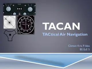
  2. INTRODUCTION Electronic navigation are forms of navigation that ships, land vehicles, and people can use, which rely on technology powered by electricity. Methods of electronic navigation include: Satellite navigation, satellite navigation systems Radio navigation, the application of radio frequencies to determining a position Radar navigation, the use of radar to determine position relative to known objects

  3. SATELITE NAVIGATION A satellite navigation or satnav system is a system that uses satellites to provide autonomous geo-spatial positioning. It allows small electronic receivers to determine their location (longitude, latitude, and altitude/elevation) to high precision (within a few centimeters to metres) using time signals transmitted along a line of sight by radio from satellites.

  4. SATELITE NAVIGATION The system can be used for providing position, navigation or for tracking the position of something fitted with a receiver (satellite tracking). The signals also allow the electronic receiver to calculate the current local time to high precision, which allows time synchronisation. These uses are collectively known as Positioning, Navigation and Timing (PNT). Satnav systems operate independently of any telephonic or internet reception, though these technologies can enhance the usefulness of the positioning information generated.

  5. RADIO NAVIGATION Radio navigation or radionavigation is the application of radio frequencies to determine a position of an object on the Earth, either the vessel or an obstruction. Like radiolocation, it is a type of radiodetermination.

  6. RADIO NAVIGATION The basic principles are measurements from/to electric beacons, especially Angular directions, e.g. by bearing, radio phases or interferometry, Distances, e.g. ranging by measurement of time of flight between one transmitter and multiple receivers or vice versa, Distance differences by measurement of times of arrival of signals from one transmitter to multiple receivers or vice versa Partly also velocity, e.g. by means of radio Doppler Shift.

  7. RADAR NAVIGATION An Electronic Chart Display and Information System (ECDIS) is a geographic information system used for nautical navigation that complies with International Maritime Organisation (IMO) regulations as an alternative to paper nautical charts. IMO refers to similar systems not meeting the regulations as Electronic Chart Systems (ECSs). An ECDIS system displays the information from Electronic Navigational Charts (ENC) and integrates position information from position, heading and speed through water reference systems and optionally other navigational sensors. Other sensors which could interface with an ECDIS are radar, Navtex, Automatic Identification Systems (AIS), and depth sounders. In recent years concerns from the industry have been raised as to the system's security especially with regards to cyber attacks and GPS spoofing attacks.

  8. RADAR NAVIGATIONAL PERFORMANCE CHART

  9. VOCABULARY Geo-spatial positioning - In simple terms, geospatial information is geography and mapping. It is place based or locational information ( geoprostorno pozicioniranje) Longditude geografska du ina Latitude geografska irina Altitude visina (u ovom slu aju nadmorska) Beacon - a fire or light set up in a high or prominent position as a warning, signal, or celebration. (svetionik) Interferometry- a family of techniques in which waves (usually electromagnetic waves) are superimposed, causing the phenomenon of interference, which is used to extract information. GPS spoofing - an attack in which a radio transmitter located near the target is used to interfere with a legitimate GPS signals Clutter - cover or fill (something) with an untidy collection of things, in this case interrupt radio waves Doppler Shift - the change in frequency of a wave in relation to an observer who is moving relative to the wave source Precipitation - rain, snow, sleet, or hail any kind of weather condition where something's falling from the sky (nevrijeme) Angular having angles or sharp corners (ugaono/ugaona/ugaoni) Icing - the formation of ice on an aircraft, ship, or other vehicle, or in an engine (le enje, zale ivanje)

Related


More Related Content

giItT1WQy@!-/#giItT1WQy@!-/#giItT1WQy@!-/#giItT1WQy@!-/#giItT1WQy@!-/#giItT1WQy@!-/#giItT1WQy@!-/#giItT1WQy@!-/#giItT1WQy@!-/#