The Role of Time in Determining Longitude: A Historical Perspective
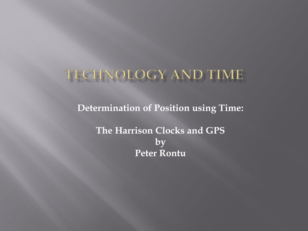


Determination of Position using Time:
The Harrison Clocks and GPS
by
Peter Rontu
Determination of Longitude using Time
In October 1707, a fleet of the British Navy were wrecked off the Scilly Isles through
not being able to determine their correct longitude position. Over two thousand men
were lost.
in July 1714, British Parliament passed the Longitude Act and set up a £20,000 prize
for the person who could invent a means of finding longitude to an accuracy of 30
miles after a six week voyage to the West Indies.
John Harrison ,a carpenter of limited education, developed a series of clocks that
kept very accurate time, built on the premise that a mechanical time device could
provide a relatively simple solution to the longitude problem.
To the chagrin of the English Establishment, this premise proved to be true. Due to
the unconventional methodology and the fact that Harrison was not formally
educated, a large controversy arose as to the awarding of the large prize. As a result,
Harrison was not awarded the complete prize until after his death in 1776.
The following offers a brief explanation of Harrison’s technique of determining
longitude using accurate measurements of time.
First, some background:
•
The Earth rotates (ie spins) in a West to East direction about its polar axis.
•
It completes one spin per day..ie it spins 360 degrees in 24 hours.
•
To an observer on earth, it appears that the sun is moving ie it rises in the East
and sets in the West.
•
Although the length of daylight hours changes over the year (ie longer days in the
summer, shorter days in winter), the rotation is still one day (24 hours).
•
When the sun is at its highest point in the sky, (ie at 12:00 or “noon”), it is exactly
South of your position.
•
If your position does not change to the East or West, the sun will return to that
same location in 24 hours.
The Earth, Sun and Time
•
Knowing then that the earth rotates 360 degrees in 24 hours, we can calculate that
the rotation per 1 hour is 1/24
th
of 360 degrees:
360 degrees rotation /24 hours = 15 degrees rotation/1 hour
and calculate then
= 1 degree rotation/ 1/15
th
of an hour
= 1 degree / 4 minutes
and further
= 0.25 degree rotation/ 1 minute
It was stipulated that the Longitude prize would be awarded to the method that could
provide an accuracy of 0.5 degrees,” as tested on a ship, sailing over the ocean, from
Great Britain to any such Port in the West Indies as those Commissioners choose...
without losing their Longitude beyond the limits before mentioned”.
•
From the calculations above, we can see this would require a timing accuracy of
better than 2 minutes over a period of perhaps 2 months.
Rate of Rotation/
It was stipulated that the Longitude prize would be awarded to the method that could
provide an accuracy of 0.5 degrees,” as tested on a ship, sailing over the ocean, from
Great Britain to any such Port in the West Indies as those Commissioners choose...
without losing their Longitude beyond the limits before mentioned”.
•
From the previous calculations , we can see this would require a timing accuracy of
better than 2 minutes over a period of perhaps 2 months.
So how do we relate time and rotation to where we are on earth?
•
To represent a location on earth we typically use coordinates of Latitude and
Longitude, which use degrees of arc as the unit of measure. Recall that:
•
A
Parallel of Latitude
is a line joining points of equal latitude.
•
A
Meridian of Longitude
is a line joining points of equal longitude
Rotation and Longitude
http://en.wikipedia.org/wiki/File:Latitude_and_Longitude_of_the_Earth.svg
•
Latitude is measured in degrees North and South of the Equator
•
Longitude is measured in degrees East and West of the Prime Meridian
•
The Prime Meridian (aka 0° Longitude) is located at Greenwich, England.
Latitude and Longitude
•
If you measure how high the sun is above the horizon (in degrees) at its highest
position (noon), you can calculate your Latitude North or South of the Equator.
•
To determine the difference in Longitude from your position to Greenwich, you
need to know the difference in time from your position to Greenwich.
•
To know what time it is in Greenwich, you must have an accurate clock that was
set to 12:00 precisely when the sun crossed the Prime Meridian in England.
Keeping Greenwich Time
•
Harrison’s clocks were precisely set to
Greenwich time when a voyage was begun.
•
Harrison went through several design
changes, ending up with pocket clocks
(models H4 and H5) that were accurate to
better than 5 seconds over several months.
•
These clocks cost almost as much as the
ships they sailed on!
•
You know that when the sun is at its highest (noon), it is directly South of you.
In other words, at 12:00 noon, the sun is on the same meridian of Longitude as
you are.
•
By carefully observing the sun and noting precisely when it is at its highest
point, you know it is 12:00 local time (“high noon”)
•
This was undertaken using a Sextant, which allows you to accurately sight the
height of the sun relative to the horizon.
A Sextant
Determination of Local time
Determination of Local time
•
Looking through the eyepiece on the sextant, while simultaneously keeping the
Horizon sighted at the “bottom” of the view, the navigator would watch as the
sun climbed toward its highest point.
•
At the precise moment that he would observe the sun beginning its decline, he
would yell out “mark”
•
At that moment , his assistant would observe the exact time on the Harrison
clock (set to Greenwich time).
•
By subtracting Greenwich time from Local time (12:00), they would know the
difference in hours (and minutes and seconds).
•
Multiplying the difference in hours by the rotation rate of 15 degrees/hour, they
would calculate the difference in longitude from Greenwich to better than 1/60
th
of a degree.
•
This equates to an accuracy of better than +- 1 mile, far better than the Contest
Committee’s requirement of +- 30 miles.
•
You are at an unknown location (X), which is at some point west of Greenwich.
•
At this moment (12:00 noon}, the sun is directly over (south of) Greenwich.
•
The Earth is rotating from West to East at a rate of 15 degrees/hour
Sample Calculation
West
East
•
Using a sextant at point X, you observe that when the sun is at its highest point
(and hence directly South of you), the time shown on your clock (set to Greenwich
time) indicates 14:30.
•
By subtraction, you calculate that noon is 2.5 hours later at your location than at
Greenwich. (14:30-12:00= 2:30, which equal 2.5 hours)
•
Based on the rotation of 15 degrees per hour, your longitude at X is then:
15 degrees/hour x 2.5 hours=
37.5 degrees West of Greenwich
Sample Calculation
West
East
•
Harrison’s clocks were an amazing technological success.
•
His self gained knowledge and abilities in woodworking and metallurgy were
remarkable.
•
His perseverance resulted in a revolution in navigation, which has aided sailors
and discoverers to safely navigate the world’s oceans for centuries.
•
An interesting modern twist to this tale is the use of time in modern navigation
methods, specifically in Global Positioning Systems (aka GPS).
•
Rather than taking measurements of time relative to the sun, GPS systems rely on
measurements of time relative to man made Satellites.
Time in Navigation: Then and Today
•
The GPS system is based on a network of at least 24 satellites that orbit the earth at
an altitude of 20,200km.
•
These satellites orbits are carefully controlled and monitored by 6 radar
tracking/communication systems located around the earth.
•
By monitoring the orbits of each satellite, accurate predictions (through complex
mathematical algorithms) are created that depict where (exactly) in space a
satellite will be at a particular (exact) time.
•
If your GPS receiver can measure the distance to at least 3 satellites at the same
time, it can calculate its position in Space at that time.
Time in Navigation: GPS
•
GPS receivers don’t actually measure the
distance
to the satellites: Instead, they
measure the length of
time
it took for the signal to travel from a satellite to its
antenna;
•
The GPS receiver has an internal clock that is precisely synchronized to the time
system used by the GPS Satellites (atomic “GPS time”)
•
The Signal being broadcast by a GPS satellite indicates exactly when that message
was transmitted.
•
By comparing (subtracting) the time that the message was transmitted to the time
that the message was received, the GPS receiver determines the “time of travel” of
the signal.
(ie Time of reception – time of transmission = time of travel)
Time in Navigation: GPS
Time in Navigation: GPS
•
The electromagnetic signal being
broadcast travels at the speed of light,
which is 299 792 458 m/
•
Using the formula “distance = speed x
time” , the distance to the satellite is
determined.
•
This measurement/calculation
procedure is repeated numerous times
per second, for each satellite in view.
•
Based on simultaneous measurements
to numerous satellites, GPS accuracy is
typically better than +- 10 metres.
•
Like the Harrison clocks, GPS has
created a revolution in navigation
through the use of time.
http://copter.ardupilot.com/wiki/
common-gps-how-it-works/
Conclusion
•
In the interest of brevity, the content s of this presentation offer only a
brief overview of the topics mentioned.
•
You are encouraged to investigate further to learn details of pronounced
interest on both the Harrison clocks and GPS, including:
•
Longitude: The True Story of a Lone Genius Who Solved the Greatest
Scientific Problem of His Time
, a best-selling book by Dava Sobel.
•
http://www.pocketgpsworld.com/howgpsworks.php
About the author:
•
Peter Rontu is an Instructor in the
Geomatics Dept. at the British Columbia
Institute of Technology in Burnaby, B.C.
Exploring the pivotal role of time in the determination of longitude, this article delves into the historical background of John Harrison's invention of accurate timekeeping devices to solve the longitude problem, leading to a transformation in maritime navigation. By understanding the relationship between time, rotation, and position on Earth, this narrative sheds light on the evolution of navigation techniques and the profound impact of accurate time measurement on maritime history.

Download Presentation

Please find below an Image/Link to download the presentation.
The content on the website is provided AS IS for your information and personal use only. It may not be sold, licensed, or shared on other websites without obtaining consent from the author. Download presentation by click this link. If you encounter any issues during the download, it is possible that the publisher has removed the file from their server.
E N D
Presentation Transcript
Determination of Position using Time: The Harrison Clocks and GPS by Peter Rontu
Determination of Longitude using Time In October 1707, a fleet of the British Navy were wrecked off the Scilly Isles through not being able to determine their correct longitude position. Over two thousand men were lost. in July 1714, British Parliament passed the Longitude Act and set up a 20,000 prize for the person who could invent a means of finding longitude to an accuracy of 30 miles after a six week voyage to the West Indies. John Harrison ,a carpenter of limited education, developed a series of clocks that kept very accurate time, built on the premise that a mechanical time device could provide a relatively simple solution to the longitude problem. To the chagrin of the English Establishment, this premise proved to be true. Due to the unconventional methodology and the fact that Harrison was not formally educated, a large controversy arose as to the awarding of the large prize. As a result, Harrison was not awarded the complete prize until after his death in 1776. The following offers a brief explanation of Harrison s technique of determining longitude using accurate measurements of time.
The Earth, Sun and Time First, some background: The Earth rotates (ie spins) in a West to East direction about its polar axis. It completes one spin per day..ie it spins 360 degrees in 24 hours. To an observer on earth, it appears that the sun is moving ie it rises in the East and sets in the West. Although the length of daylight hours changes over the year (ie longer days in the summer, shorter days in winter), the rotation is still one day (24 hours). When the sun is at its highest point in the sky, (ie at 12:00 or noon ), it is exactly South of your position. If your position does not change to the East or West, the sun will return to that same location in 24 hours.
Rate of Rotation/ Knowing then that the earth rotates 360 degrees in 24 hours, we can calculate that the rotation per 1 hour is 1/24th of 360 degrees: 360 degrees rotation /24 hours = 15 degrees rotation/1 hour = 0.25 degree rotation/ 1 minute and calculate then and further = 1 degree rotation/ 1/15th of an hour = 1 degree / 4 minutes It was stipulated that the Longitude prize would be awarded to the method that could provide an accuracy of 0.5 degrees, as tested on a ship, sailing over the ocean, from Great Britain to any such Port in the West Indies as those Commissioners choose... without losing their Longitude beyond the limits before mentioned . From the calculations above, we can see this would require a timing accuracy of better than 2 minutes over a period of perhaps 2 months.
Rotation and Longitude It was stipulated that the Longitude prize would be awarded to the method that could provide an accuracy of 0.5 degrees, as tested on a ship, sailing over the ocean, from Great Britain to any such Port in the West Indies as those Commissioners choose... without losing their Longitude beyond the limits before mentioned . From the previous calculations , we can see this would require a timing accuracy of better than 2 minutes over a period of perhaps 2 months. So how do we relate time and rotation to where we are on earth? To represent a location on earth we typically use coordinates of Latitude and Longitude, which use degrees of arc as the unit of measure. Recall that: A Parallel of Latitude is a line joining points of equal latitude. A Meridian of Longitude is a line joining points of equal longitude
Latitude and Longitude Latitude is measured in degrees North and South of the Equator Longitude is measured in degrees East and West of the Prime Meridian The Prime Meridian (aka 0 Longitude) is located at Greenwich, England. File:Latitude and Longitude of the Earth.svg http://en.wikipedia.org/wiki/File:Latitude_and_Longitude_of_the_Earth.svg
Keeping Greenwich Time If you measure how high the sun is above the horizon (in degrees) at its highest position (noon), you can calculate your Latitude North or South of the Equator. To determine the difference in Longitude from your position to Greenwich, you need to know the difference in time from your position to Greenwich. To know what time it is in Greenwich, you must have an accurate clock that was set to 12:00 precisely when the sun crossed the Prime Meridian in England. Harrison s clocks were precisely set to Greenwich time when a voyage was begun. Harrison went through several design changes, ending up with pocket clocks (models H4 and H5) that were accurate to better than 5 seconds over several months. These clocks cost almost as much as the ships they sailed on!
Determination of Local time You know that when the sun is at its highest (noon), it is directly South of you. In other words, at 12:00 noon, the sun is on the same meridian of Longitude as you are. By carefully observing the sun and noting precisely when it is at its highest point, you know it is 12:00 local time ( high noon ) This was undertaken using a Sextant, which allows you to accurately sight the height of the sun relative to the horizon. A Sextant
Determination of Local time Looking through the eyepiece on the sextant, while simultaneously keeping the Horizon sighted at the bottom of the view, the navigator would watch as the sun climbed toward its highest point. At the precise moment that he would observe the sun beginning its decline, he would yell out mark At that moment , his assistant would observe the exact time on the Harrison clock (set to Greenwich time). By subtracting Greenwich time from Local time (12:00), they would know the difference in hours (and minutes and seconds). Multiplying the difference in hours by the rotation rate of 15 degrees/hour, they would calculate the difference in longitude from Greenwich to better than 1/60th of a degree. This equates to an accuracy of better than +- 1 mile, far better than the Contest Committee s requirement of +- 30 miles.
Sample Calculation West East You are at an unknown location (X), which is at some point west of Greenwich. At this moment (12:00 noon}, the sun is directly over (south of) Greenwich. The Earth is rotating from West to East at a rate of 15 degrees/hour
Sample Calculation West East Using a sextant at point X, you observe that when the sun is at its highest point (and hence directly South of you), the time shown on your clock (set to Greenwich time) indicates 14:30. By subtraction, you calculate that noon is 2.5 hours later at your location than at Greenwich. (14:30-12:00= 2:30, which equal 2.5 hours) Based on the rotation of 15 degrees per hour, your longitude at X is then: 15 degrees/hour x 2.5 hours= 37.5 degrees West of Greenwich
Time in Navigation: Then and Today Harrison s clocks were an amazing technological success. His self gained knowledge and abilities in woodworking and metallurgy were remarkable. His perseverance resulted in a revolution in navigation, which has aided sailors and discoverers to safely navigate the world s oceans for centuries. An interesting modern twist to this tale is the use of time in modern navigation methods, specifically in Global Positioning Systems (aka GPS). Rather than taking measurements of time relative to the sun, GPS systems rely on measurements of time relative to man made Satellites.
Time in Navigation: GPS The GPS system is based on a network of at least 24 satellites that orbit the earth at an altitude of 20,200km. These satellites orbits are carefully controlled and monitored by 6 radar tracking/communication systems located around the earth. By monitoring the orbits of each satellite, accurate predictions (through complex mathematical algorithms) are created that depict where (exactly) in space a satellite will be at a particular (exact) time. If your GPS receiver can measure the distance to at least 3 satellites at the same time, it can calculate its position in Space at that time.
Time in Navigation: GPS GPS receivers don t actually measure the distance to the satellites: Instead, they measure the length of time it took for the signal to travel from a satellite to its antenna; The GPS receiver has an internal clock that is precisely synchronized to the time system used by the GPS Satellites (atomic GPS time ) The Signal being broadcast by a GPS satellite indicates exactly when that message was transmitted. By comparing (subtracting) the time that the message was transmitted to the time that the message was received, the GPS receiver determines the time of travel of the signal. (ie Time of reception time of transmission = time of travel)
Time in Navigation: GPS The electromagnetic signal being broadcast travels at the speed of light, which is 299 792 458 m/ Using the formula distance = speed x time , the distance to the satellite is determined. This measurement/calculation procedure is repeated numerous times per second, for each satellite in view. Based on simultaneous measurements to numerous satellites, GPS accuracy is typically better than +- 10 metres. http://copter.ardupilot.com/wiki/ common-gps-how-it-works/ Like the Harrison clocks, GPS has created a revolution in navigation through the use of time.
Conclusion In the interest of brevity, the content s of this presentation offer only a brief overview of the topics mentioned. You are encouraged to investigate further to learn details of pronounced interest on both the Harrison clocks and GPS, including: Longitude: The True Story of a Lone Genius Who Solved the Greatest Scientific Problem of His Time , a best-selling book by Dava Sobel. http://www.pocketgpsworld.com/howgpsworks.php About the author: Peter Rontu is an Instructor in the Geomatics Dept. at the British Columbia Institute of Technology in Burnaby, B.C.