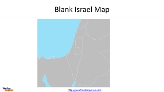
Blank Israel Map
Explore a detailed map of Israel and Palestine, highlighting countries, territories, capitals, and major cities. The map includes Lebanon, Syria, Egypt, Jordan, Iraq, Saudi Arabia, Mediterranean Sea, Red Sea, and more.
1 views • 4 slides
Overview of 2023 Higher Education Funding Projections
The report provides a detailed analysis of budget availability and cash flow projections for higher education institutions in 2023, focusing on applications, funding guidelines, systematic issues, and the readiness of new initiatives. It highlights budget allocations for universities and TVET colleg
4 views • 37 slides
Isometric Projections and Drawings
Isometric projections provide a way to represent objects in three dimensions on a two-dimensional surface, making it easier for non-technical individuals to grasp complex shapes. This article discusses the differences between orthographic and pictorial views, principles of projection, types of proje
6 views • 10 slides
Tracking Progress of Mitigation Commitments and Greenhouse Gas Emissions Projections
Explore the journey of tracking progress on mitigation commitments, projections of greenhouse gas emissions, and scenarios for future projections. Learn about the importance of developing projections, quality control, and reporting scenarios for various policy measures. Discover tools available for
0 views • 19 slides
Mastering Map Grid References for Accurate Location Identification
Learn how to find places on a map using grid references. Discover how to identify map symbols and determine accurate six-figure grid references. Follow step-by-step guidance to pinpoint locations with precision on maps. Enhance your mapping skills and boost your navigational expertise efficiently.
2 views • 18 slides
Regional Map Projections and Plotting Using WRF-ARW
Explore different map projections such as Lambert, Polar, Mercator, and Lat-lon in the context of WRF-ARW model. Learn about specifying grid spacing, map factors, and pole location adjustments. Discover how to create plots using Python with wrf-python for regional domains.
0 views • 13 slides
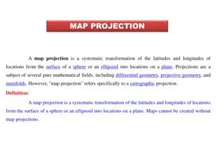
Map Projections: Types and Applications
Map projection is a systematic transformation of latitudes and longitudes from a curved surface to a flat plane. There are various classifications based on construction methods, tangent surface position, view point of light, and qualities like equal area and equi-distance. Zenithal Polar Equidistanc
0 views • 9 slides
Military Academy Map and Navigation Presentation
This presentation introduces basic map reading and navigation skills essential for Military Academy students. It covers various types of maps, map symbols, measuring distance, and understanding topographical features like physical and man-made elements. Navigation is highlighted as a critical skill
0 views • 18 slides
WaferMap Configuration Guide for Graph Builder
This guide provides detailed instructions on setting up WaferMap in Graph Builder, preparing map files, distributing and installing map files, creating wafer maps by cube/sub-chunk/chunk, using map shapes as background, and accessing a custom map creator tool.
0 views • 6 slides
Empowering Veterans Through the MAP Initiative
The Military Articulation Platform (MAP) aims to give veterans the credit they deserve by articulating college courses with ACE credit recommendations. This initiative allows veterans to receive up to one year of credit, enabling them to achieve their educational goals and access high-wage jobs. Thr
5 views • 35 slides
Camera Projection Techniques in 3D Rendering
Explore the process of projecting 3D scenes onto a 2D image through parallel and perspective projections. Learn about converting from 3D to 2D, types of projections, and the differences between parallel and perspective techniques. Discover how projections affect the display of objects in a 3D enviro
0 views • 40 slides
Essential Guide to Map Reading and Navigation Techniques
Discover the fundamentals of map reading and navigation developed by Dave Bere. Explore various types of maps used within SES, learn how to use different maps effectively, and understand the importance of map care and folding. From understanding marginal information to mastering compasses and bearin
0 views • 53 slides
Socio-Economic Projections for Kigali City: 2013 Master Plan Update
The IPAR Research Conference held on 19th June 2019 and presented by Brian Kiberu showcased the socio-economic projections for Kigali City from 2018 to 2050 as per the 2013 Kigali Master Plan update. The research covered population dynamics, labor market characteristics, GDP growth, economic activit
1 views • 37 slides
Climate Change Monitoring, Reporting, and Verification (MRV) Training Session Overview
This document outlines the purpose and reporting requirements for the development of a Climate Change Monitoring, Reporting, and Verification (MRV) system, focusing on projections and scenarios. It highlights the importance of collecting information for climate mitigation, assisting Serbia in meetin
0 views • 19 slides
Tourism Growth Projections and Performance Overview in India
The presentation showcases the past performance and future projections of the tourism sector in India, focusing on aspects such as GDP contribution, foreign exchange earnings, international and domestic tourist visits. It highlights the steady growth pre-pandemic, projections for 2024, 2030, and 204
0 views • 8 slides
Proposal for Dynamic Multi-AP Coordination in IEEE 802.11-23
This proposal focuses on enhancing the reliability of multi-AP coordination in IEEE 802.11-23 through the formation and management of MAP (Multi-AP) groups. It discusses the limitations of the current setup and suggests a dynamic approach where multiple APs can form MAP groups flexibly. The document
0 views • 11 slides
Climate Projections for Impact Assessment
The Climate Futures Framework provides insights into using climate projections for impact assessments, emphasizing the importance of tailoring projections to specific objectives. Typical climate projections involve central tendencies and uncertainty ranges, but assessing multiple variables jointly r
0 views • 24 slides
Occupational Forecasting and Industry Projections in Louisiana
Occupational Forecasting and Industry Projections in Louisiana are crucial for workforce planning and economic development. The process involves annual projections by industry and occupation, updated with new demand and wage data. The Occupational Forecasting Conference, overseen by key stakeholders
1 views • 14 slides
Chesapeake Bay Climate Change Load Projections for 2025
The document discusses climate change projections for the Chesapeake Bay in 2025, focusing on factors like sea level rise, temperature increase, and precipitation change. It outlines proposed policy decisions, addressing uncertainties in climate change impacts on water quality and the need to incorp
0 views • 22 slides
Alisal Union School District 2021-2022 Budget Workshop Overview
The Alisal Union School District held a budget workshop to review revenue projections, expenditure projections, enrollment and staffing projections, additional federal and state funding, and supplemental and concentration expenditures. The workshop highlighted revenue sources, including local contro
2 views • 26 slides
Basic Map Skills and Terms
Explore the essential map skills and terms such as map key/legend, compass rose, scale, latitude, longitude, Equator, Prime Meridian, hemispheres, and more to enhance your map reading and interpretation skills effectively.
0 views • 7 slides
Map Concepts: An Overview
Exploring essential map-related terms and concepts such as map projection, hemisphere, latitude, longitude, scale, equator, prime meridian, map symbol, and globe. Enhance your understanding of how maps represent Earth's surface and the key elements involved in cartography.
0 views • 14 slides
Short-Term Financial Projections Training Session
This training session focuses on enabling participants to create short-term profit/loss and cash flow projections, identify financing requirements, evaluate income and expenditure projections, calculate net profit, analyze cash flow, and evaluate key financial ratios.
0 views • 15 slides
Dynamic Microsimulation Projection Tool for Developing Countries
The DYNAMIS project, funded by the World Bank, aims to demonstrate the feasibility of dynamic microsimulation for population projections in developing countries. This portable platform offers highly disaggregated population projections and serves as a core component for simulating social development
0 views • 24 slides
Map Projections and Coordinate Systems in QGIS
Map projections are essential for representing the Earth's surface on a flat plane, with various distortions depending on the projection used. QGIS provides tools to work with different projections like UTM, Lambert Azimuthal Equal Area, and more. Mixing projections in QGIS can lead to errors in dat
0 views • 13 slides
Coordinate Systems, Map Projections, and GIS Applications
Explore the intricacies of Geographic Coordinate Systems, Projected Coordinate Systems, and different types of map projections as part of the Remote Sensing and GIS Application course taught by Lecturer Ruba Yousif Hussain in the third year. Dive into the properties of map projections like conforman
0 views • 13 slides
ETSU Fall 2014 Enrollment Projections Analysis
The ETSU Fall 2014 Enrollment Projections Analysis conducted by Mike Hoff, Director of Institutional Research, utilized a Markov chain model to estimate enrollment. The goal was to reach 15,500 enrollments, with data informing college-level improvement plans. Assumptions included stable recruitment
0 views • 43 slides
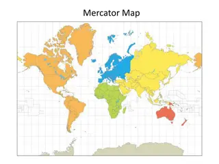
Different World Map Projections
Dive into the Mercator and Peters Projection maps, comparing their distinct features and discussing what sets them apart. Discover the nuances and implications of map projections in mapping our world.
0 views • 5 slides
Messy Situational Map Template with Suggestions for Use
This SA template provides a messy situational map template along with suggestions for use. The initial map should be done by hand on a large piece of paper to allow for quick adjustments and capturing thoughts. The template includes an abstract map and a customizable version for creating more readab
0 views • 4 slides
Various Strategy Maps and Their Components
This content discusses different types of strategy maps including the Balanced Scorecard, Classic Kaplan/Norton Strategy Map, Generic Example Strategy Map, and Basic Strategy Map Background. Each map highlights different perspectives such as financial, customer, internal, and learning & growth, alon
0 views • 22 slides
Projections Overview for Performance Analysis in Parallel Programming
Projections is a performance analysis and visualization tool used with Charm++. It allows for trace-based, post-mortem analysis with configurable levels of detail. Users can customize tracing options, instrument code, and add custom events to traces. The tool logs a variety of events, such as entry
0 views • 51 slides
Analysis of State Budget Trends by John Gilbert - Nov. 1, 2020
This comprehensive analysis by John Gilbert, a Budget and Revenue Analyst, delves into the multiyear trend of state budget outlook, general revenue fund trends, sources, growth, and projections. The analysis includes comparisons between revenue and expenditures, trend-based revenue projections, grow
1 views • 5 slides
Map Projections: Types and Techniques
Explore the world of map projections with a focus on classification based on construction methods and developable surfaces. Learn about perspective, non-perspective, and conventional projections, as well as cylindrical, conical, and zenithal projections. Delve into how different surfaces interact wi
0 views • 14 slides
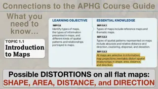
Map Projections in AP Human Geography
Explore the importance of map projections in AP Human Geography through visual aids from "The West Wing Season 2 Episode 16." Learn about the process of creating maps by tearing, stretching, and compressing, and its implications on depicting accurate representations of geographical features. Dive in
0 views • 7 slides
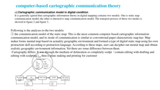
The Evolution of Cartographic Communication Theory in the Digital Age
Cartographic communication theory in digital mapping involves two models: the static map communication model and the interactive map communication model. The static map model follows traditional map-making methods adapted to digital tools, while the interactive map model leverages user feedback to r
0 views • 8 slides
Insights into General Use Projections for Climate Analysis
Explore the significance of General Use Projections in climate research, understanding their role in capturing future projections effectively. Learn about considerations for selecting these projections, key metrics to focus on, and guidelines for incorporating a diverse range of models. Discover pro
0 views • 21 slides
Sets, Maps, and Map Methods
Explore the concepts of sets, maps, and map methods in programming, focusing on efficient operations like adding, removing, and searching for values. Sets allow unique values with no duplicates, while maps hold key-value pairs like a dictionary. Map methods provide functions for manipulating mapping
0 views • 5 slides
Introduction to Spark in The Hadoop Stack
Introduction to Spark, a high-performance in-memory data analysis system layered on top of Hadoop to overcome the limitations of the Map-Reduce paradigm. It discusses the importance of Spark in addressing the expressive limitations of Hadoop's Map-Reduce, enabling algorithms that are not easily expr
0 views • 16 slides
Subnational Population Projections Workshop Highlights
The International Workshop on Subnational Population Projections discussed methods for preparing subnational projections using a bottom-up approach and integrating them into national projections. The session also covered the use of Spectrum software to generate subnational projections and steps invo
0 views • 35 slides
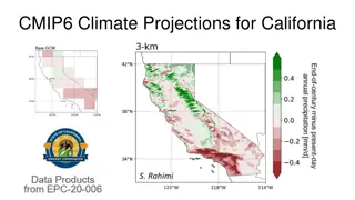
Climate Projections and Data Evaluation for California
Detailed information on CMIP6 climate projections for California, evaluation of global climate models, summaries of data on the C-DAWG website, large set of CMIP6 downscaled climate projection data, and improvements in the LOCA2-Hybrid approach. The LOCA2-Hybrid method offers higher resolution train
0 views • 15 slides
