Essential Guide to Map Reading and Navigation Techniques

 
Version: 1.2 - Jan 05
 
Developed by: Dave Bere
 
Map Reading
Map Reading
&
&
Navigation
Navigation
Version: 1.2 - Jan 05
Developed by: Dave Bere
Presentation  Overview
 
Types of maps used within SES
How to use various maps
Scale, Grid references, Ground shape, Gradient etc
Compasses & Bearings
Cross country navigation
Remote area preparedness 
– (supplement)
Version: 1.2 - Jan 05
Developed by: Dave Bere
Aim of Map Reading...
 
To navigate & recognise features on the
ground & map.
To picture the ground even though it
hasn’t been seen, and.
To understand and pass information
quickly.
Determine and plan a safe route.
Version: 1.2 - Jan 05
Developed by: Dave Bere
Definition of a Map…
 
Its a scaled representation of the earths
surface shown on a plane surface.
It shows natural and/or artificial features.
Used as a form of communication, used to
convey land features.
However, its only accurate at time of aerial
photo or field revision.
Version: 1.2 - Jan 05
Developed by: Dave Bere
Types of Maps...
 
Street directory
 
Topographic map
Topographic map
 
Thematic
Thematic
 
Scientific
Scientific
 
Mud Map
Mud Map
Version: 1.2 - Jan 05
Developed by: Dave Bere
Street Directory
 
Edition
Key map
Suburb index
 
Facility index
Street index
Map & reference
 
Version: 1.2 - Jan 05
 
Developed by: Dave Bere
 
Topographic Maps
Version: 1.2 - Jan 05
Developed by: Dave Bere
Map Care & Folding…
TIP
Don’t fully open maps in
 the wind or in
the vehicle.
 
Deterioration - dirt, grime, pens/markers &
unnecessary opening & folding.
Protecting the map - map case, clear
contact, plastic bag or map boards.
Map folding
1.
Fold in half (detail facing outward)
2.
Concertina into equal sections
3.
Fold in half (title showing)
Version: 1.2 - Jan 05
Developed by: Dave Bere
Marginal Information...
 
Printed around the
margin of the map to
aid in using the map.
E.g.. Title, scale, type,
legend of symbols,
edition & sheet
number, adjoining
maps, contour interval,
magnetic variation, grid
reference block,
Version: 1.2 - Jan 05
Developed by: Dave Bere
Conventional
Symbols…
 
Water features
Structures
Boundaries
 
Road & Rail
Road & Rail
Land features
Land features
Version: 1.2 - Jan 05
Developed by: Dave Bere
Mapping Datum
 
All mapping & coordinate systems are based on a datum
It’s a mathematical surface (overlay) that best fits the
shape of the earth.
 
AGD66 = Aust Geodetic Datum 1966 
– Aust region only
– Aust region only
AGD84 = Updated version of AGD66 
- USED ON 2
- USED ON 2
ND
ND
 EDITION TOPO MAPS
 EDITION TOPO MAPS
 
GDA94 = Geocentric Datum of Australia
 
 
- Adopted cause it best fits the earths surface as a whole
 
 
- USED ON 3
- USED ON 3
RD
RD
 EDITION TOPO MAPS
 EDITION TOPO MAPS
WGS84 = Used for Satellite based navigation
WGS84 & GDA94 for practical purposes are the same
   
TIP   
See map for datum
conversions
Version: 1.2 - Jan 05
Developed by: Dave Bere
Scale…
 
Scale is expressed in 3 methods.
1.
In words 
In words 
(One cm = One km)
(One cm = One km)
2.
Representative fraction. (RF)
1:25000   E.g 1cm = 25000cm or 250m.
TRICK - REMOVE LAST 2 ZEROS TO GET
ACTUAL SIZE ON GROUND IN METRES
 
1:10,000 to 1:100,000 are small scale
1:250,000 to 1:10 million are large scales
 
3.
Linear scale - scaled ruler.
TIP
As the second number increases, 
detail shown on the 
map decreases
Version: 1.2 - Jan 05
Developed by: Dave Bere
Measuring Distance…
 
Measuring straight line
distance (map)
Paper
Divider
Ruler


Measuring distance
Measuring distance
along a road/track (map)
Curved paper
Curved paper
Length of string
Length of string
Version: 1.2 - Jan 05
Developed by: Dave Bere
Map Coordinates
 
2 Types
Geographical coordinates given as latitude and longitude
Grid coordinates given as Eastings & Northings
 
Uses degrees, minutes, minutes
Each degrees & minutes is divided
into 60 graduations
into 60 graduations
Horizontal lines (Parallels of latitude)
(N or S of equator)
(N or S of equator)
Vertical lines (Meridians of longitude)
(E or W of Greenwich)
S31
S31
0
0
 51’ 0”  E115
 51’ 0”  E115
0
0
 54’ 3”
 54’ 3”
 
Latitude & Longitude
 
 
Note: All Australian Lat & Long coord’s are south & east
Version: 1.2 - Jan 05
Developed by: Dave Bere
Grid Coordinates
 
Used to accurately locate/position objects on a map.
Two sets of numbered parallel lines (vertical &
horizontal) intersecting at right angles to form squares
on a map.
Superimposed over the map to provide a reference
system.
Grid squares are generally 1km
2.
Grid lines are defined as ‘Eastings’ & ‘Northings.’
Version: 1.2 - Jan 05
Developed by: Dave Bere
99   00   01   02   03
        03
        02
        01
        00
        99
Cont’…
TIP
Across first, then up
Or
E before N
 
Eastings are the
vertical lines,
numbered left to
right.
 
Northings are the
Northings are the
horizontal lines
horizontal lines
numbered bottom
numbered bottom
to top.
to top.
 
Read ‘Eastings’ first,
then ‘Northings’.
then ‘Northings’.
Version: 1.2 - Jan 05
Developed by: Dave Bere
       11    12    13
03
02
01
00
4 Figure Area References…
 
The co-ordinates
represent the whole
square, not just the
single point.
 
E.G 1201 -
represents 1km
2
Find ‘12 easting’
first.
Find ‘01 northing’
second.
Version: 1.2 - Jan 05
Developed by: Dave Bere
A 6 figure reference is
1/100th the size of a
4 figure reference.
E.G 122016 - represents
100m
2
         12                   13
                 
1 2 3 4 5 6 7 8 9
 
02
           9
           8
           7
           6
           5
           4
           3
           2
           1
 01
6 & 8 Figure Grid References…
 
8 Figure Grid
8 Figure Grid
References
References
 
Romers
Romers
Version: 1.2 - Jan 05
Developed by: Dave Bere
GPS…
 
Global Positioning System
(satellite based navigation)
Features included:
Your position on the Earth’s
surface
Your current height - ASL
Your speed and direction of
travel
Lat/Long or UTM
Different world datums
WGS84
Developed by US Defence
system
Uses 24 satellites orbiting
the Earth twice a day
 
Signal doesn’t penetrate
buildings or thick scrub.
Uses triangulation principle
to pinpoint location.
Minimum of 4 satellites are
needed for an accurate 3D
position
Typical accuracy is within
30m - 95% of the time
Interfaces with your PC
and mapping software
Consult users guide for
operating instructions
Version: 1.2 - Jan 05
Developed by: Dave Bere
Universal Grid References…
 
Also known as UTM –
Universal transverse Mercator
A grid system is superimposed over the
world map.
Each square is uniquely identified. E.G
56h
Every square is further bisected by
another 100 squares. E.G 56hlh
So forth until the squares are bisected
into 100sq metres.
E.G
 
56hlh10
56hlh1201
56hlh122016
Version: 1.2 - Jan 05
Developed by: Dave Bere
Ground Shape…
 
Allows the user to
visualise the
surroundings
Ground shape is
referred to as relief.
Relief can be shown
as:
Hachures
Hill shading &
Contours


Version: 1.2 - Jan 05
 
Developed by: Dave Bere
 
Contours…
 
A contour is a line
that joins points of
equal elevation
Contour interval is
the vertical
distance between
contour lines
See legend for
contour interval
 
Version: 1.2 - Jan 05
 
Developed by: Dave Bere
 
Contour Patterns…
 
Contour lines close together
show steep slopes
Contour lines far apart show
gentle slopes
Contour lines evenly spaced
show uniform slope
If the spacing decreases when
going from high to low, the
slope is convex
If the spacing increases when
going from high to low, the
slope is concave
Version: 1.2 - Jan 05
Developed by: Dave Bere
Land Features…
 
Representation of height
Bench mark, trig station,
spot height
Physical features
Knoll
Saddle
Spur, ridge
Valley, gorge
Escarpment
Re-entrant
Crest
Plateau
Version: 1.2 - Jan 05
Developed by: Dave Bere
Gradient…
 
A method of expressing ground slope.
Gradient = 
Contour interval
 (height)
                
Horizontal Distance
 
 
1:10 = 1 unit up or down / 10 units across.
1:1 is a 45
1:1 is a 45
0
0
Simplify to smallest fraction = 
20
20
  =  
  =  
1
1
   =  1:6
   =  1:6


120       6
120       6
 
Version: 1.2 - Jan 05
 
Developed by: Dave Bere
 
Intervisibility
 – Line of sight
 
Used to
determine
the location
of radio
repeaters
(particularly
VHF) & fire
lookout
towers
 
 
Version: 1.2 - Jan 05
Developed by: Dave Bere
Map Enlarging
 
Map enlarging produces a portion of map
at a larger scale. (see learners guide)
Version: 1.2 - Jan 05
Developed by: Dave Bere
Compass…
 
Degree system - 
(360
0
 circle)
North = 0/360
0
South = 180
0
East   = 90
0
West  = 270
0
Cardinal points
32 in total,
only 16 are used.
 
Version: 1.2 - Jan 05
Developed by: Dave Bere
Bearings…
 
The p
The p
urpose of a
urpose of a
bearing is to give an
accurate indication of
direction from one
direction from one
point to another.
point to another.
Simply, a bearing is
an angle.
an angle.
It is the angle
It is the angle
measured clockwise
measured clockwise
from a fixed zero line,
generally north.
generally north.
 
Grid bearings
Used when bearings
are taken from or to
the map.
Magnetic bearings
Used in conjunction
with a compass. This
type of bearing is for
field operation.
Bearings are measured
using a protractor or
compass.
Version: 1.2 - Jan 05
Developed by: Dave Bere
Bearings - Cont’
        N
                   A
           
37
       0
               N
                   
75
       b
               0
                             N
                                        A
     X
                   
                               
31
                                           B
0a = 37                  0
0b = 75
AB = 31
 
if ‘A’ is specified
0c
 
= 304
                                       N
                          C
                                         304
                                        0
 
Version: 1.2 - Jan 05
 
Developed by: Dave Bere
 
North Points…
 
True north - TN
True north - TN
Earth spins on this axis
Magnetic north - MN
Magnetic north - MN
Compass needle points to magnetic north
Its a location in the far north of Canada
Grid north – GN
Grid north – GN
The vertical lines overlayed on a map point to grid north –
(eastings)
(eastings)
Not exactly true north.
Difference between TN & GN is called convergence
In map reading we only use GN & MN
Version: 1.2 - Jan 05
Developed by: Dave Bere
Magnetic Variation…
 
The difference between ‘grid north’ &
‘magnetic north’ is called magnetic variation.
The magnetic north pole is not fixed, it
moves continually
 
Easterly & westerly
Easterly & westerly
variation
variation
Check map for
Check map for
accuracy of
accuracy of
variation
variation
 
Version: 1.2 - Jan 05
 
Developed by: Dave Bere
 
Converting Bearings
 
Mag’ bearings must be converted to Grid bearings for
plotting.
Grid Bearings taken from map must be converted to
Mag’ for compass work
To convert bearings – simply add or subtract variation
GMS
 = Grid to Magnetic – Subtract 
(GrandMa Sux)
MGA
 = Magnetic to Grid – Add 
(My Green Apple)
Grid bearings are always larger than a magnetic
bearing with an easterly variation
Version: 1.2 - Jan 05
Developed by: Dave Bere
Back Bearings…
 
A back bearing is the
bearing immediately
opposite the current
bearing
Add 180
0
 if bearing is
smaller than 180
0
 
Subtract 180
Subtract 180
0
0
 if
 if
bearing is larger than
180
180
0
0
 
Reversing compass
Reversing compass
Version: 1.2 - Jan 05
Developed by: Dave Bere
Compasses…
 
Many types & shapes.
Prismatic, reflective & Silva
Consist of
Magnetised needle
A non ferrous or plastic box
A graduated 360
0
 circle and
Sometimes an aiming point
Version: 1.2 - Jan 05
Developed by: Dave Bere
Parts of a Compass…
 
Silva Compass
 
Prismatic Compass
Version: 1.2 - Jan 05
Developed by: Dave Bere
Taking a Grid Bearing…
 
Using a compass & map.
Place edge of compass
along intended bearing.
Direction arrow points the
way you want to travel
Turn housing so meridian
lines are parallel to easting
lines
Read grid bearing where
housing and index intersect
Note: This bearing must be
converted to mag’ bearing
if intended for field use.
TIP
Ignore the needle when
using compass as a
protractor
Version: 1.2 - Jan 05
Developed by: Dave Bere
Magnetic Bearings
 
Setting a Magnetic
Setting a Magnetic
bearing
bearing
Hold compass flat in
palm
palm
Set bearing on
Set bearing on
compass by rotating
compass by rotating
housing
housing
Turn yourself till 
Turn yourself till 
red
red
needle lines up with
north
north
Now walk in direction
of directional arrow
 
Taking a Magnetic
Taking a Magnetic
bearing
bearing
Hold compass with
Hold compass with
directional arrow
directional arrow
pointing at intended
object/direction
object/direction
Rotate housing till
Rotate housing till
north aligns with 
north aligns with 
red
red
arrow
arrow
Read bearing where
Read bearing where
index lines intersects
Version: 1.2 - Jan 05
Developed by: Dave Bere
TIP
The desk you’re sitting at 
has local magnetic attraction
Magnetic Bearings cont…
 
Compass Error
Compass Error
Individual compasses
Local magnetic attraction due to steel/iron ore
Transmission lines     = 80m
Car                          = 60m
Wire fence                = 10m
Pick, Axe or shovel     = 3m
 
Compass back bearings
Face the opposite direction,
turn compass around & walk
with directional arrow
pointing towards you.
Or use white needle as
directional indicator
 
Version: 1.2 - Jan 05
Developed by: Dave Bere
Cross-country Navigation
 
Improvised direction finding
By shadow stick & sun
By the stars
By using a watch & sun
Bushman's method – kangaroos
GPS
 
Factors influencing C-C navigation
Weather, terrain, vegetation, visibility
Team composition, fatigue
Access restrictions, boundaries, route choice
Version: 1.2 - Jan 05
Developed by: Dave Bere
Cross Country Navigation cont…
 
Predicted walking time
5km/hr easy going
3km/hr easy scrambling
1.5km/hr rough country,
snow, sand or thick bush
Add 1hr for every 500m up
or 1000m down
Every 5 hrs allow an 1hr for
fatigue.
 
Distance travelled -
pacing & time
pacing & time
Average step is 75cm
Approx’ 650-660 right steps
= 1km
= 1km
 
Judging distance - 
Judging distance - 
See
See
Learners Guide for object sizing P79
Unit of measure (Good up to
400m – Sports fields or
swimming pools)
swimming pools)
Appearance (Takes a lot of
practice – compare with
surroundings)
surroundings)
Bracketing (Greater than 200m,
Less than 600m)
Less than 600m)
Version: 1.2 - Jan 05
Developed by: Dave Bere
Planning…..
 
Route planning – Map study
Essential, you must have a good plan before setting off.
Have an alternate plan & route
Break route down into individual legs.
Each leg should terminate at recognisable objects or within an hour
Consider
Grain of country
Ridges
Rivers
Dense scrub
Access
Version: 1.2 - Jan 05
Developed by: Dave Bere
Map Orientation…
 
A simple way to read a map is
to orientate the map to its
surroundings.
Using land features
Lay the map on the ground.
Rotate map till features on
ground align with those on
map.
Using a compass (grid)
Determine & set mag’ variation
on compass
Align compass edge with ‘N-S’
meridian lines
Rotate map & compass till
compass needle is aligned
 
Using a compass (mag)
Draw mag’ variation lines on
map
Set compass to mag’ ‘N’
Align compass edge with
drawn lines
Rotate map & compass till
compass needle is aligned
All compass bearings can now
be taken directly from the map
Version: 1.2 - Jan 05
Developed by: Dave Bere
Lateral Drift
 
Is when you drift away from the given destination, but you
remain on the same bearing.
The compass alone, is not enough to eliminate  lateral drift.
Spot a feature (tree, knoll) on the set bearing, walk to that
feature, then reassess. Continue  until destination is
reached.
Version: 1.2 - Jan 05
Developed by: Dave Bere
Avoiding an Obstacle
 
Used to traverse around cliffs, knolls, swamps etc
Pacing at 90
0 
intervals
Leg 1 and 3 need to be of equal distance
Version: 1.2 - Jan 05
Developed by: Dave Bere
Checking…
 
Attack points
Used when navigating to
less identifiable features
Easier to find an attack
point than a specific
reference
A well defined location
Gets you close to your
given destination
E.G. Road junctions, man
made structures,
prominent knolls etc.
 
Aiming off
Aiming left or right of
given bearing or location
Used so you don’t
overshoot the mark
E.G. Creek junction - aim
for creek, then walk up or
downstream till you hit the
creek junction
 
Catching features
Catching features
Easily identified features.
Eg fences, creeks roads
Should prevent you from
walking too far
walking too far
 
Aspect of slope & Hand rails
 
Version: 1.2 - Jan 05
 
Developed by: Dave Bere
 
Position Fixing – Resection…
 
Used when you’re unable to
fix your position from the
ground to that on the map.
Find 2 or 3 prominent
features.
Take magnetic bearing of
features & convert to grid
bearing.
Change to back bearing &
plot all bearings on map.
Your position is where the
back bearings intersect.
Version: 1.2 - Jan 05
Developed by: Dave Bere
TIP
You’re never lost, just 
geographically
misplaced
 
Action If Lost!!!
 
Don’t 
Don’t 
PANIC
PANIC
,
,
 remain calm
 remain calm
Re-think route & confirm ground covered
Position fixing -resection
Identify a bearing (track junction) & head for safety
Unable to identify your position, set up camp & wait
for rescue
for rescue
Initiate any distress beacons
 
Version: 1.2 - Jan 05
 
Developed by: Dave Bere
 
Remote Area Section…


This section is not pitched at any level of expertise.
Everyone should be well prepared before entering the
bush.
bush.
6 P’s = prior preparation and planning prevents
poor performance.
poor performance.
Learn the area before departing
Have a navigational route planned
Group details
Group details
Route details
Route details
Intended camp locations
ETD and ETA
ETD and ETA
 
Version: 1.2 - Jan 05
 
Developed by: Dave Bere
 
Basic Requirements for Survival…
 
Water
Minimum 2ltr/day
Is there water in the area
Carrying capacity
Quality
Shelter
Tent or hutchie
Ground sheet
Improvisation
E.G. Caves, overhangs,
huts, sheds
 
Warmth
Dry clothes
Thermals
Matches/lighter
Strategies/procedures to
cope with the cold
Food
Enough food/nourishing
Hunting & gathering food
Rationing
Cooking/disease
 
Version: 1.2 - Jan 05
 
Developed by: Dave Bere
 
Navigational Tips - (
Generalised)
 
Sparse & scratchy vegetation along ridges & spurs
Thicker vegetation through gullies & valleys
South facing terrain is thicker vegetation
Slower moving through creek beds
Night navigation - use of lighting and the moon
Pack light, pack right
You’re only as fast as your slowest team member
Continue relating features from the ground to the map
Carry safety equipment & have knowledge of remote first aid
Know your limitations - be mentally & physically prepared
 
Version: 1.2 - Jan 05
 
Developed by: Dave Bere
 
Pack Checklist…
 
Clothing
Boots & socks
Underwear & thermal
Trousers/shorts
Shirts
Jumper/jacket
Headgear & gloves
Wet weather jacket &
pants
Gaiters
 
Personal equipment
Backpack
Sleeping bag
Sleeping mat
Toiletries
Toilet paper
Water bottle & water
Food & utensils
Insect repellent/sunscreen
Light source  batteries
Version: 1.2 - Jan 05
Developed by: Dave Bere
Pack Checklist…
 
Emergency equipment
Maps & map case
Watch
Compass
Whistle
Fire starters
Knife
Note book & pen
GPS
 
Group equipment
Tent or hutchie
Ground sheet
Stove & fuel
Water filter
Plastic shovel
Cordage
 
The End
The End
Slide Note
Embed
Share

Discover the fundamentals of map reading and navigation developed by Dave Bere. Explore various types of maps used within SES, learn how to use different maps effectively, and understand the importance of map care and folding. From understanding marginal information to mastering compasses and bearings, this comprehensive guide will help you navigate and recognize features on the ground and map accurately.

  • Map Reading
  • Navigation Techniques
  • Types of Maps
  • Marginal Information
  • Map Care

Uploaded on Sep 06, 2024 | 0 Views


Download Presentation

Please find below an Image/Link to download the presentation.

The content on the website is provided AS IS for your information and personal use only. It may not be sold, licensed, or shared on other websites without obtaining consent from the author. Download presentation by click this link. If you encounter any issues during the download, it is possible that the publisher has removed the file from their server.

E N D

Presentation Transcript


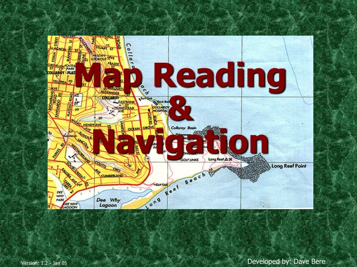
  1. Map Reading & Navigation Developed by: Dave Bere Version: 1.2 - Jan 05

  2. Presentation Overview Types of maps used within SES How to use various maps Scale, Grid references, Ground shape, Gradient etc Compasses & Bearings Cross country navigation Remote area preparedness (supplement) Developed by: Dave Bere Version: 1.2 - Jan 05

  3. Aim of Map Reading... To navigate & recognise features on the ground & map. To picture the ground even though it hasn t been seen, and. To understand and pass information quickly. Determine and plan a safe route. Developed by: Dave Bere Version: 1.2 - Jan 05

  4. Definition of a Map Its a scaled representation of the earths surface shown on a plane surface. It shows natural and/or artificial features. Used as a form of communication, used to convey land features. However, its only accurate at time of aerial photo or field revision. Developed by: Dave Bere Version: 1.2 - Jan 05

  5. Types of Maps... Street directory Topographic map Thematic Scientific Mud Map Developed by: Dave Bere Version: 1.2 - Jan 05

  6. Street Directory Edition Facility index Key map Street index Suburb index Map & reference Developed by: Dave Bere Version: 1.2 - Jan 05

  7. Topographic Maps Developed by: Dave Bere Version: 1.2 - Jan 05

  8. Map Care & Folding Deterioration - dirt, grime, pens/markers & unnecessary opening & folding. Protecting the map - map case, clear contact, plastic bag or map boards. Map folding 1. Fold in half (detail facing outward) 2. Concertina into equal sections 3. Fold in half (title showing) TIP Don t fully open maps in the wind or in the vehicle. Developed by: Dave Bere Version: 1.2 - Jan 05

  9. Marginal Information... Printed around the margin of the map to aid in using the map. E.g.. Title, scale, type, legend of symbols, edition & sheet number, adjoining maps, contour interval, magnetic variation, grid reference block, Developed by: Dave Bere Version: 1.2 - Jan 05

  10. Conventional Symbols Water features Structures Boundaries Road & Rail Land features Developed by: Dave Bere Version: 1.2 - Jan 05

  11. Mapping Datum All mapping & coordinate systems are based on a datum It s a mathematical surface (overlay) that best fits the shape of the earth. AGD66 = Aust Geodetic Datum 1966 Aust region only AGD84 = Updated version of AGD66 - USED ON 2ND EDITION TOPO MAPS GDA94 = Geocentric Datum of Australia TIP See map for datum conversions - Adopted cause it best fits the earths surface as a whole - USED ON 3RD EDITION TOPO MAPS WGS84 = Used for Satellite based navigation WGS84 & GDA94 for practical purposes are the same Developed by: Dave Bere Version: 1.2 - Jan 05

  12. Scale Scale is expressed in 3 methods. 1. In words (One cm = One km) 2. Representative fraction. (RF) 1:25000 E.g 1cm = 25000cm or 250m. TRICK - REMOVE LAST 2 ZEROS TO GET ACTUAL SIZE ON GROUND IN METRES 1:10,000 to 1:100,000 are small scale 1:250,000 to 1:10 million are large scales TIP 3. Linear scale - scaled ruler. As the second number increases, detail shown on the map decreases Developed by: Dave Bere Version: 1.2 - Jan 05

  13. Measuring Distance Measuring straight line distance (map) Paper Divider Ruler Measuring distance along a road/track (map) Curved paper Length of string Developed by: Dave Bere Version: 1.2 - Jan 05

  14. Map Coordinates 2 Types Geographical coordinates given as latitude and longitude Grid coordinates given as Eastings & Northings Latitude & Longitude Uses degrees, minutes, minutes Each degrees & minutes is divided into 60 graduations Horizontal lines (Parallels of latitude) (N or S of equator) Vertical lines (Meridians of longitude) (E or W of Greenwich) 051 0 E115 054 3 S31 Note: All Australian Lat & Long coord s are south & east Developed by: Dave Bere Version: 1.2 - Jan 05

  15. Grid Coordinates Used to accurately locate/position objects on a map. Two sets of numbered parallel lines (vertical & horizontal) intersecting at right angles to form squares on a map. Superimposed over the map to provide a reference system. 2. Grid squares are generally 1km Grid lines are defined as Eastings & Northings. Developed by: Dave Bere Version: 1.2 - Jan 05

  16. Cont TIP Across first, then up Or E before N Eastings are the vertical lines, numbered left to right. 99 00 01 02 03 03 Northings are the horizontal lines numbered bottom to top. 02 01 00 Read Eastings first, then Northings . 99 Developed by: Dave Bere Version: 1.2 - Jan 05

  17. 4 Figure Area References The co-ordinates represent the whole square, not just the single point. 11 12 13 03 E.G 1201 - represents 1km 2 02 01 Find 12 easting first. 00 Find 01 northing second. Developed by: Dave Bere Version: 1.2 - Jan 05

  18. 6 & 8 Figure Grid References A 6 figure reference is 1/100th the size of a 4 figure reference. 12 13 1 2 3 4 5 6 7 8 9 02 9 8 7 6 5 4 3 2 1 01 E.G 122016 - represents 100m 2 8 Figure Grid References Romers Developed by: Dave Bere Version: 1.2 - Jan 05

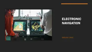
  19. GPS Global Positioning System (satellite based navigation) Features included: Your position on the Earth s surface Your current height - ASL Your speed and direction of travel Lat/Long or UTM Different world datums WGS84 Signal doesn t penetrate buildings or thick scrub. Uses triangulation principle to pinpoint location. Minimum of 4 satellites are needed for an accurate 3D position Typical accuracy is within 30m - 95% of the time Developed by US Defence system Interfaces with your PC and mapping software Uses 24 satellites orbiting the Earth twice a day Consult users guide for operating instructions Developed by: Dave Bere Version: 1.2 - Jan 05

  20. Universal Grid References Also known as UTM Universal transverse Mercator A grid system is superimposed over the world map. Each square is uniquely identified. E.G 56h Every square is further bisected by another 100 squares. E.G 56hlh So forth until the squares are bisected into 100sq metres. E.G 56hlh10 56hlh1201 56hlh122016 Developed by: Dave Bere Version: 1.2 - Jan 05

  21. Ground Shape Allows the user to visualise the surroundings Ground shape is referred to as relief. Relief can be shown as: Hachures Hill shading & Contours Developed by: Dave Bere Version: 1.2 - Jan 05

  22. Contours A contour is a line that joins points of equal elevation Contour interval is the vertical distance between contour lines See legend for contour interval Developed by: Dave Bere Version: 1.2 - Jan 05

  23. Contour Patterns Contour lines close together show steep slopes Contour lines far apart show gentle slopes Contour lines evenly spaced show uniform slope If the spacing decreases when going from high to low, the slope is convex If the spacing increases when going from high to low, the slope is concave Developed by: Dave Bere Version: 1.2 - Jan 05

  24. Land Features Representation of height Bench mark, trig station, spot height Physical features Knoll Saddle Spur, ridge Valley, gorge Escarpment Re-entrant Crest Plateau Developed by: Dave Bere Version: 1.2 - Jan 05

  25. Gradient A method of expressing ground slope. Gradient = Contour interval (height) Horizontal Distance 1:10 = 1 unit up or down / 10 units across. 1:1 is a 45 Simplify to smallest fraction = 20 = 1 = 1:6 0 120 6 Developed by: Dave Bere Version: 1.2 - Jan 05

  26. Intervisibility Line of sight Used to determine the location of radio repeaters (particularly VHF) & fire lookout towers Developed by: Dave Bere Version: 1.2 - Jan 05

  27. Map Enlarging Map enlarging produces a portion of map at a larger scale. (see learners guide) Developed by: Dave Bere Version: 1.2 - Jan 05

  28. Compass Degree system - (3600 circle) North = 0/3600 South = 1800 East = 900 West = 2700 Cardinal points 32 in total, only 16 are used. Developed by: Dave Bere Version: 1.2 - Jan 05

  29. Bearings The purpose of a bearing is to give an accurate indication of direction from one point to another. Grid bearings Used when bearings are taken from or to the map. Magnetic bearings Used in conjunction with a compass. This type of bearing is for field operation. Simply, a bearing is an angle. It is the angle measured clockwise from a fixed zero line, generally north. Bearings are measured using a protractor or compass. Developed by: Dave Bere Version: 1.2 - Jan 05

  30. Bearings - Cont N N A X A 31 B 0a = 37 0 0b = 75 AB = 31if A is specified 0c= 304 N 37 0 N C 304 0 75 b 0 Developed by: Dave Bere Version: 1.2 - Jan 05

  31. North Points True north - TN Earth spins on this axis Magnetic north - MN Compass needle points to magnetic north Its a location in the far north of Canada Grid north GN The vertical lines overlayed on a map point to grid north (eastings) Not exactly true north. Difference between TN & GN is called convergence In map reading we only use GN & MN Developed by: Dave Bere Version: 1.2 - Jan 05

  32. Magnetic Variation The difference between grid north & magnetic north is called magnetic variation. The magnetic north pole is not fixed, it moves continually Easterly & westerly variation Check map for accuracy of variation Developed by: Dave Bere Version: 1.2 - Jan 05

  33. Converting Bearings Mag bearings must be converted to Grid bearings for plotting. Grid Bearings taken from map must be converted to Mag for compass work To convert bearings simply add or subtract variation GMS = Grid to Magnetic Subtract (GrandMa Sux) MGA = Magnetic to Grid Add (My Green Apple) Grid bearings are always larger than a magnetic bearing with an easterly variation Developed by: Dave Bere Version: 1.2 - Jan 05

  34. Back Bearings A back bearing is the bearing immediately opposite the current bearing 0 if bearing is Add 180 smaller than 180 0 0 if Subtract 180 bearing is larger than 180 0 Reversing compass Developed by: Dave Bere Version: 1.2 - Jan 05

  35. Compasses Many types & shapes. Prismatic, reflective & Silva Consist of Magnetised needle A non ferrous or plastic box A graduated 360 Sometimes an aiming point 0 circle and Developed by: Dave Bere Version: 1.2 - Jan 05

  36. Parts of a Compass Silva Compass Prismatic Compass Developed by: Dave Bere Version: 1.2 - Jan 05

  37. Taking a Grid Bearing Using a compass & map. Place edge of compass along intended bearing. Direction arrow points the way you want to travel Turn housing so meridian lines are parallel to easting lines Read grid bearing where housing and index intersect TIP Note: This bearing must be converted to mag bearing if intended for field use. Ignore the needle when using compass as a protractor Developed by: Dave Bere Version: 1.2 - Jan 05

  38. Magnetic Bearings Setting a Magnetic bearing Hold compass flat in palm Set bearing on compass by rotating housing Turn yourself till red needle lines up with north Now walk in direction of directional arrow Taking a Magnetic bearing Hold compass with directional arrow pointing at intended object/direction Rotate housing till north aligns with red arrow Read bearing where index lines intersects Developed by: Dave Bere Version: 1.2 - Jan 05

  39. Magnetic Bearings cont Compass back bearings Face the opposite direction, turn compass around & walk with directional arrow pointing towards you. Or use white needle as directional indicator Compass Error Individual compasses Local magnetic attraction due to steel/iron ore Transmission lines = 80m Car = 60m Wire fence = 10m Pick, Axe or shovel = 3m TIP The desk you re sitting at has local magnetic attraction Developed by: Dave Bere Version: 1.2 - Jan 05

  40. Cross-country Navigation Factors influencing C-C navigation Weather, terrain, vegetation, visibility Team composition, fatigue Access restrictions, boundaries, route choice Improvised direction finding By shadow stick & sun By the stars By using a watch & sun Bushman's method kangaroos GPS Developed by: Dave Bere Version: 1.2 - Jan 05

  41. Cross Country Navigation cont Distance travelled - pacing & time Average step is 75cm Approx 650-660 right steps = 1km Predicted walking time 5km/hr easy going 3km/hr easy scrambling 1.5km/hr rough country, snow, sand or thick bush Add 1hr for every 500m up or 1000m down Every 5 hrs allow an 1hr for fatigue. Judging distance - See Learners Guide for object sizing P79 Unit of measure (Good up to 400m Sports fields or swimming pools) Appearance (Takes a lot of practice compare with surroundings) Bracketing (Greater than 200m, Less than 600m) Developed by: Dave Bere Version: 1.2 - Jan 05

  42. Planning.. Route planning Map study Essential, you must have a good plan before setting off. Have an alternate plan & route Break route down into individual legs. Each leg should terminate at recognisable objects or within an hour Consider Grain of country Ridges Rivers Dense scrub Access Developed by: Dave Bere Version: 1.2 - Jan 05

  43. Map Orientation A simple way to read a map is to orientate the map to its surroundings. Using land features Lay the map on the ground. Rotate map till features on ground align with those on map. Using a compass (mag) Draw mag variation lines on map Set compass to mag N Align compass edge with drawn lines Rotate map & compass till compass needle is aligned All compass bearings can now be taken directly from the map Using a compass (grid) Determine & set mag variation on compass Align compass edge with N-S meridian lines Rotate map & compass till compass needle is aligned Developed by: Dave Bere Version: 1.2 - Jan 05

  44. Lateral Drift Is when you drift away from the given destination, but you remain on the same bearing. The compass alone, is not enough to eliminate lateral drift. Spot a feature (tree, knoll) on the set bearing, walk to that feature, then reassess. Continue until destination is reached. Developed by: Dave Bere Version: 1.2 - Jan 05

  45. Avoiding an Obstacle Used to traverse around cliffs, knolls, swamps etc 0 intervals Pacing at 90 Leg 1 and 3 need to be of equal distance Developed by: Dave Bere Version: 1.2 - Jan 05

  46. Checking Catching features Easily identified features. Eg fences, creeks roads Should prevent you from walking too far Attack points Used when navigating to less identifiable features Easier to find an attack point than a specific reference A well defined location Gets you close to your given destination E.G. Road junctions, man made structures, prominent knolls etc. Aiming off Aiming left or right of given bearing or location Used so you don t overshoot the mark E.G. Creek junction - aim for creek, then walk up or downstream till you hit the creek junction Aspect of slope & Hand rails Developed by: Dave Bere Version: 1.2 - Jan 05

  47. Position Fixing Resection Used when you re unable to fix your position from the ground to that on the map. Find 2 or 3 prominent features. Take magnetic bearing of features & convert to grid bearing. Change to back bearing & plot all bearings on map. Your position is where the back bearings intersect. Developed by: Dave Bere Version: 1.2 - Jan 05

  48. Action If Lost!!! Don t PANIC, remain calm Re-think route & confirm ground covered Position fixing -resection Identify a bearing (track junction) & head for safety Unable to identify your position, set up camp & wait for rescue Initiate any distress beacons TIP You re never lost, just geographically misplaced Developed by: Dave Bere Version: 1.2 - Jan 05

  49. Remote Area Section This section is not pitched at any level of expertise. Everyone should be well prepared before entering the bush. 6 P s = prior preparation and planning prevents poor performance. Learn the area before departing Have a navigational route planned Group details Route details Intended camp locations ETD and ETA Developed by: Dave Bere Version: 1.2 - Jan 05

  50. Basic Requirements for Survival Water Minimum 2ltr/day Is there water in the area Carrying capacity Quality Warmth Dry clothes Thermals Matches/lighter Strategies/procedures to cope with the cold Shelter Tent or hutchie Ground sheet Improvisation E.G. Caves, overhangs, huts, sheds Food Enough food/nourishing Hunting & gathering food Rationing Cooking/disease Developed by: Dave Bere Version: 1.2 - Jan 05

Related


More Related Content

giItT1WQy@!-/#giItT1WQy@!-/#giItT1WQy@!-/#giItT1WQy@!-/#giItT1WQy@!-/#giItT1WQy@!-/#