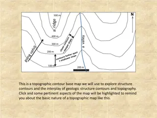
Map Concepts: An Overview
Exploring essential map-related terms and concepts such as map projection, hemisphere, latitude, longitude, scale, equator, prime meridian, map symbol, and globe. Enhance your understanding of how maps represent Earth's surface and the key elements involved in cartography.

Uploaded on Sep 19, 2024 | 3 Views
Download Presentation

Please find below an Image/Link to download the presentation.
The content on the website is provided AS IS for your information and personal use only. It may not be sold, licensed, or shared on other websites without obtaining consent from the author.If you encounter any issues during the download, it is possible that the publisher has removed the file from their server.
You are allowed to download the files provided on this website for personal or commercial use, subject to the condition that they are used lawfully. All files are the property of their respective owners.
The content on the website is provided AS IS for your information and personal use only. It may not be sold, licensed, or shared on other websites without obtaining consent from the author.
E N D
Presentation Transcript
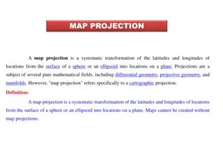
A framework of lines that helps to transfer points on Earth s surface onto a flat map. map projection
One half of the sphere that makes up Earth s surface. hemisphere
A list of symbols used on a map and their meanings. key
A sphere that represents Earths entire surface. globe
The distance in degrees north or south of the equator. latitude
A unit used to measure distances around a circle. degree
The distance in degrees east or west of the prime meridian. longitude
Used to relate distance on a map or globe to distance on Earth s surface. scale
A flat model of all or part of Earths surface as seen from above. map
The line that makes a half circle form the North Pole to the South Pole and that passes through Greenwich, England. prime meridian
An imaginary line that circles Earth halfway between the North and South poles. equator
On a map, a picture used by mapmakers to stand for features on Earth s surface. symbol
GOOD LUCK!!! STUDY! STUDY! STUDY!