Enhancing Safety in Navigation Through Improved Data Quality Visualization
The IHO Data Quality Working Group focuses on classifying and depicting the quality of digital hydrographic information to ensure safe navigation. The group addresses the need for clear warnings on ECDIS displays regarding poor-quality survey data. Despite progress in developing visualization methods for bathymetric data, current symbology faces disadvantages like screen clutter and lack of direct visible relation between symbol size and quality areas. Continued efforts aim to refine the visualization methodology for improving bathymetric data quality assessment.

Download Presentation

Please find below an Image/Link to download the presentation.
The content on the website is provided AS IS for your information and personal use only. It may not be sold, licensed, or shared on other websites without obtaining consent from the author. Download presentation by click this link. If you encounter any issues during the download, it is possible that the publisher has removed the file from their server.
E N D
Presentation Transcript
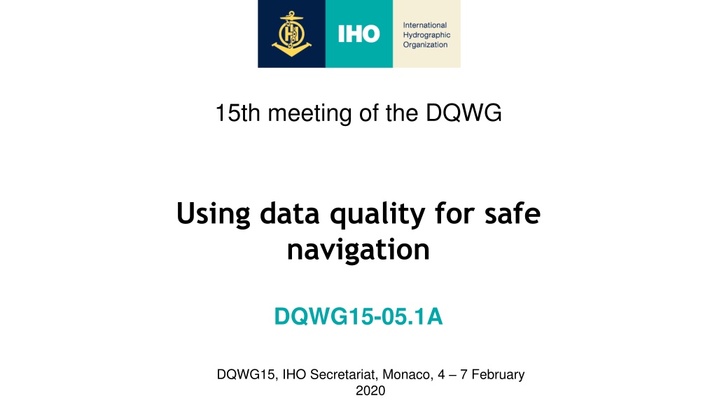
15th meeting of the DQWG Using data quality for safe navigation DQWG15-05.1A DQWG15, IHO Secretariat, Monaco, 4 7 February 2020
INTRODUCTION The primary objective of the IHO Data Quality Working Group is to develop appropriate methods of classifying and depicting the quality of digital hydrographic information (www.iho.int) Data Quality Working Group existence: Data Quality Working Group was re-activated at 18th CHRIS meeting (2006) CHRIS-19 Committee agreed to add presentation of data quality to the DQWG work plan and the ToR to be amended accordingly (2007) HSSC-9 agreed on the continuity of the activities of the DQWG and approved the new ToRs (2017) DQWG-15, IHO Secretariat, Monaco, 4 - 7 February 2020
WHAT PROBLEM NEEDS TO BE RESOLVED? UK MAIB Report No 18/2007, published 9 August 2007: Report of the investigation of the grounding of the jack-up barge Octopus towed by the tug Harald, Stronsay Firth, Orkney Islands, 8 September 2006 . Damage value: approximate UK 1M. Executive summary: To consider a recommendation of the UK s Marine Accident Investigation Branch (MAIB) arising from its investigation into the grounding of the jack-up barge Octopus. Specifically, to investigate ways of ensuring that ECDIS displays provide a clear warning or indication to the mariner whenever the survey data used to produce the electronic chart in use is of poor quality. HSSC tasked the DQWG to develop a method to visualize the quality of bathymetric data. (2007-present). DQWG-15, IHO Secretariat, Monaco, 4 - 7 February 2020
CURRENT METHOD TO INFORM THE MARINER A1 means 5m horizontal accuracy, full seafloor coverage A2 means 20m horizontal accuracy, full seafloor coverage B means 50m horizontal accuracy, lines of soundings C means low accuracy or incomplete chart D means unreliable chart U means chart with quality not assessed DQWG-15, IHO Secretariat, Monaco, 4 - 7 February 2020
DISADVANTAGES OF CURRENT SYMBOLOGY Screen clutter, mariners (almost always) turn the symbology off. There is no direct visible relation between the size of the symbol and the area it is valid for. There may be a small area in-between the symbols with a different quality value. There are two types of symbols, a triangle and rounded rectangle, there are six different quality values. The number of * inside the symbols are not easy to differentiate. The size of the symbol is relatively large (in mm). The value at the pivot point of the symbol is taken and displayed, underlying quality next to the pivot point may have a different value. DQWG-15, IHO Secretariat, Monaco, 4 - 7 February 2020
PROGRESS SINCE HSSC9 (NOV 2017) Decision HSSC9/35: HSSC endorsed the proposal made by the DQWG to further develop the conditional visualization methodology of quality of bathymetric data in liaison with NCWG, NIPWG, ENCWG, S-101PT. DQWG13 meeting (Jan 2018): members shared their national methodologies How to allocate CATZOC values. (member states: BR, FI, FR, IT, JP, NL, NO, UK, US). DQWG14-08C: paper for consideration by Data Quality Working Group: Proposal for a new method to display quality information. (Feb 2019). DQWG agreed and presented this method at HSSC11 (May 2019). HSSC agreed to continue this development, in liaison with S-100WG, NCWG, NIPWG, ENCWG, S-101PT, training centres, academia, expert contributors (task HSSC11/50). DQWG-15, IHO Secretariat, Monaco, 4 - 7 February 2020
HOW TO ALLOCATE CATZOC VALUES? The quality of a survey is validated against S-44 standard. A survey is be done from a moving platform: ship, drone, plane, helicopter, satellite. A survey is be done with a remote sensing device: single/multibeam echosounder, laser, satellite sensor, other... Quality of a charted survey may decrease over time (e.g. moving seabed area). DQWG has collected national methodologies from survey to CATZOC. See DQWG meeting 13 webpage, papers DQWG13-06B. See Quality of Bathymetric Data Decision Tree (as designed for S-101). DQWG-15, IHO Secretariat, Monaco, 4 - 7 February 2020
TASK HSSC11/50 HSSC11 tasked DQWG to continue the development of the conditional visualization methodology of quality of bathymetric data (May 2019). Quality of Bathymetric Data (in S-101) = M_QUAL/CATZOC (in S-57). S-57 ENC cells were provided by several DQWG members for testing. Test data was made available to S-100WG Vice-Chair. First results were discussed at S-100 Test Strategy Meeting (Sept 2019). Portrayal is still the biggest issue. This presentation is a proof of concept using existing software. For testing/symbology reason only, S-57 object RESARE is used. Implementation to be decided by HSSC. DQWG-15, IHO Secretariat, Monaco, 4 - 7 February 2020
THE PRINCIPLE TO VISUALIZE THE QUALITY Conditional visualization is based on the principle that isolated features hazardous to navigation need to be highlighted on need-to-have basis. The horizontal and vertical accuracy of these isolated features is taken into account. If no horizontal accuracy (HORACC) of a single feature is available, it will assume to have the accuracy associated with the quality indicator of the area. Same for vertical accuracy (VERACC). The area quality indicator - Category Zone of Confidence (CATZOC) - has been in use for more than 20 years. CATZOC is mandatory in existing S-57 ENCs. DQWG-15, IHO Secretariat, Monaco, 4 - 7 February 2020
THE CONDITIONS New methodology should: Be intuitive to the Mariner. Not create confusion or distraction to the Mariner. Only be shown when the Mariner needs it for decision making. Make use of existing symbology in ECDIS. Be easy to supply the underlying data by the Hydrographic Office. Be easy to understand by the Hydrographic Office. Be supportive to facilitate autonomous shipping. Also work if no portrayal at all is needed. DQWG-15, IHO Secretariat, Monaco, 4 - 7 February 2020
THE METHODOLOGY (VERTICALLY) Applies to: - obstructions - under water rocks - wrecks - soundings Draft Grounding Risk Safety Depth Safety alert Nearest Safety Contour Safe Passage (A1) (A2 and B) (C) (D) (U) DQWG-15, IHO Secretariat, Monaco, 4 - 7 February 2020
THE METHODOLOGY (HORIZONTALLY) Circle showing the area of the possible position of the isolated feature - CATZOC A2 = - CATZOC B = - CATZOC C and D = 500 meter 20 meter 50 meter (A2) (B) (C and D) DQWG-15, IHO Secretariat, Monaco, 4 - 7 February 2020
OPERATIONAL TEST Testcase using ENC data from Denmark. Greenland area (60-30N, 46-30W). Intended Usage = 4. Polar region. Source data: old paper charts, recent Satellite Imagery. Difficult to confirm or disprove historic data without sufficient recent surveys. Cell contains areas of CATZOC = D, B and A2. Cell contains 116 UWTROCs (107 unknown depth). DQWG-15, IHO Secretariat, Monaco, 4 - 7 February 2020
HOW TO ESTABLISH THE CORRECT FEATURES? Filter the areas of a specific CATZOC value (e.g. D). Select all UWTROC point objects inside the CATZOC D areas. Copy these to a scratch layer. Create Restricted Areas (SAA in S-101) around each single UWTROC. Draw a circle until the edge of the CATZOC D area OR until the circle is 500m wide. Assign attributes: Category of restricted area = Offshore safety zone (not in S-101). Restriction = Area to be avoided (not in S-101). DQWG-15, IHO Secretariat, Monaco, 4 - 7 February 2020
CURRENT MARINERS VIEW DQWG-15, IHO Secretariat, Monaco, 4 - 7 February 2020
S-101 ENC WITH ADDITIONAL SAFETY ALERT AREAS DQWG-15, IHO Secretariat, Monaco, 4 - 7 February 2020
VESSEL PASSING TOO CLOSE TO UNDERWATER ROCK DQWG-15, IHO Secretariat, Monaco, 4 - 7 February 2020
VERTICAL EXAMPLE SOUNDING AT 10.6M Current ECDIS display with Sounding depth value = 10.6m M_QUAL/CATZOC = B DQWG-15, IHO Secretariat, Monaco, 4 - 7 February 2020
VERTICAL WARNING FOR INDIVIDUAL SOUNDINGS Least possible depth = 9.4 m (10.6 1.0 0.02*10,6) Safety alert area to avoid grounding DQWG-15, IHO Secretariat, Monaco, 4 - 7 February 2020
SUCCESSFULLY LOADED INTO ECDIS Pick Report Shows the UWTROC Shows the RESARE DQWG-15, IHO Secretariat, Monaco, 4 - 7 February 2020
ECDIS SAFETY ALERT FEATURES @ 1.5 NM DQWG-15, IHO Secretariat, Monaco, 4 - 7 February 2020
CONSIDERATIONS FOR S-101 In S-101 the feature Safety Alert Area (SAA) is suggested. Safety Alert Areas are optional, the HO decides if they wish to visualize the quality of the underlying bathymetric data and isolated dangers. Attribute depth value is needed to check against the safety depth of the Mariner. Mariner enters a Safety Depth and minimal XTD into ECDIS. When dangerous isolated objects (including their accuracy) are within the ships boundaries of Safety Depth and minimal XTD, alerts are triggered. ECDIS issues an alarm to attend the Mariner of the risk ahead. More autonomous vessel may deviate to avoid the risk. DQWG-15, IHO Secretariat, Monaco, 4 - 7 February 2020
MAN-MACHINE INTERFACE Mariner is at all times in charge of the vessel. Mariner requires to be in charge of the information presented to him for decision making. Mariner requires an ON/OFF switch to manually activate and de-activate the Safety Alert Area features (voyage planning). Mariner can be supported in decision making by automatically activating the Safety Alert Area features when vessel comes too close to isolated hazardous objects dangerous to navigation (voyage monitoring). System is automatically de-activated when risk is no longer present. Mariner has the ability to de-activate the Safety Alert Area Features. DQWG-15, IHO Secretariat, Monaco, 4 - 7 February 2020
BENEFITS The HO decides which Areas need to be created to alert the Mariner In S-57: Portrayal of object RESARE is already implemented into S-57 and S-52. Usage of RESARE already triggers an alarm in ECDIS to the Mariner. S-52 Ed 4.0: 10.5.10 Detection of Areas, for which Special Conditions Exist. In S-101: A similar mechanism can be created for Safety Alert Area s. Add Tidal information => Under Keel Clearance / risk avoidance system. long term tidal prediction + accuracy. short term tidal prediction + accuracy. current tidal observation + accuracy. tidal forecast + accuracy. DQWG-15, IHO Secretariat, Monaco, 4 - 7 February 2020
REQUIREMENTS S-101 model needs an update: Safety Alert Area features. ECDIS needs a user input: show Safety Alert Area (ON/OFF). ECDIS needs new Conditional Symbology Procedure (activate SAA). If no SAA s are available in an ENC, the Mariner should receive a Warning Message. Include tidal information and its accuracy to improve safety. S-101 DCEG, paragraph 24.5 Spatial Quality needs update -> POSACC should become HORACC, VERACC remains. DQWG-15, IHO Secretariat, Monaco, 4 - 7 February 2020
QUESTIONS FROM NCWG5 MEETING 1. Safety Alert Areas are optional, what if they are not included in an ENC? 2. What about existing features with a high level of confidence of the position? 3. What if we don t have the accuracy values of previous (historic) data? 4. What about areas with rocky coastlines? Screen clutter may lead to switching off by the Mariner? 5. Finnish example showed there is almost nowhere to maneuver in an area with many under water rocks. How about that? DQWG-15, IHO Secretariat, Monaco, 4 - 7 February 2020
ANSWER 1 Q: Safety Alert Areas are optional, what if they are not included in an ENC? A: ECDIS should provide a warning message that no Safety Alert Areas are available. Mariner should take appropriate caution (as he should do today using CATZOC symbology). DQWG-15, IHO Secretariat, Monaco, 4 - 7 February 2020
ANSWER 2 Q: What about existing features with a high level of confidence of the position? A: High level of confidence positions do not require Safety Alert Areas. Current symbols are larger that the area of its true position. DQWG-15, IHO Secretariat, Monaco, 4 - 7 February 2020
ANSWER 3 Q: What if we don t have the accuracy values of previous (historic) data? A: How to allocate CATZOC -> assessments are continuously made by HO s. New data model and visualization does not change that principle. DQWG-15, IHO Secretariat, Monaco, 4 - 7 February 2020
ANSWER 4 Q: What about areas with rocky coastlines? Screen clutter may lead to switching off by the Mariner? A: Adjacent isolated objects should be surrounded by a single polygon, a safety alert area. This will avoid screen clutter. DQWG-15, IHO Secretariat, Monaco, 4 - 7 February 2020
ANSWER 5 Q: Finnish example showed there is almost nowhere to maneuver in an area with many under water rocks. How about that? A: Does the current CATZOC value justify the inaccuracy of the under water rock positions? If not, assign appropriate (smaller) values of HORACC -> circles will be smaller. DQWG-15, IHO Secretariat, Monaco, 4 - 7 February 2020
PAPER EXAMPLE OF ASSESSMENT AND INFORMATION Paper NCWG4-06.6A (Nov 2018) DQWG-15, IHO Secretariat, Monaco, 4 - 7 February 2020
WAY FORWARD Concept proven for Greenland situation, other Test Data to be tested. Concept to be shared with other HSSC WGs/PTs. Serious testing: showcase along US East coast (New York - Miami). Test results to be discussed at next DQWG meeting (Feb 2020). If approved, paper to be delivered at HSSC12 (May 2020). DQWG-15, IHO Secretariat, Monaco, 4 - 7 February 2020
END Feedback on this concept is welcome. IHO Data Quality Working Group Send email to: R.Broekman.01@mindef.nl DQWG-15, IHO Secretariat, Monaco, 4 - 7 February 2020


")


")
")