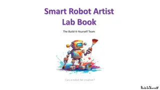
Exploring Creativity in Robotics: Can a Robot Be an Artist?
Delve into the world of robotics and creativity as we ponder the question: can a robot truly exhibit creativity? Join us on a journey to teach a robot to draw creatively, exploring the intersection of technology and artistry. Discover research principles of famous art designs and innovative projects
2 views • 15 slides
Understanding Relational Database Design and Mapping Techniques
Explore the process of mapping Entity-Relationship (ER) and Enhanced Entity-Relationship (EER) models to relational databases. Learn about relational model concepts, mapping algorithms, and the goals and steps involved in the mapping process. Discover how to preserve information, maintain constraint
1 views • 42 slides
Understanding SLAM Techniques for Robot Localization and Mapping
SLAM (Simultaneous Localization and Mapping) is a concept crucial for robots to construct and update maps while tracking their own locations. It is likened to a chicken and egg problem, where building a map and localizing the robot occur concurrently. Hardware, landmarks, and steps involved in SLAM
0 views • 29 slides
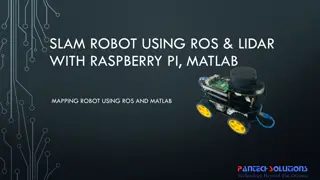
Mapping Robot using ROS, Lidar with Raspberry Pi & MATLAB
Turtle.bot is a popular product for home service robots, utilizing SLAM and navigation technologies. It features gyro, Kinect sensors, Lidar, and a laptop for mapping. The robot localizes and navigates using ROS in Raspberry Pi connected with MATLAB. ROS (Robot Operating System) is a set of software
0 views • 17 slides
National Labor Mapping Application User Roles and Access Overview
This detailed overview outlines the implementation plan, user roles, and access benefits of the National Labor Mapping Application. Users are assigned specific roles with established access through domain usernames, enhancing security measures. Different user roles such as VISN Coordinators, Site Te
0 views • 14 slides
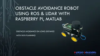
Autonomous Obstacle Avoidance Robot Using ROS, Lidar, and Raspberry Pi with Matlab Path Planning
Obstacle avoidance in robotics has evolved from basic collision avoidance to autonomous path planning with the use of Lidar and ROS. This project involves mapping the environment using Lidar scans and implementing a path planning algorithm in Matlab to navigate around obstacles. By utilizing a Raspb
0 views • 15 slides
Mapping Methodology for Establishing ESCO Relations
Learn how to set up teams, collect resources, compare classifications, and establish mapping relations for ESCO implementation projects. Get insights on using computer-assisted suggestions, updating mapping tables, and selecting mapping projects. Explore techniques for navigating classifications, br
0 views • 21 slides
Micro:bit Robot Entry Tutorial with YahBoom - Buzzer Singing Lesson
In this engaging tutorial series, you will learn how to program a micro:bit robot to sing "Happy Birthday" using a buzzer. Follow step-by-step instructions to set up your micro:bit, connect it to your computer, search for coding blocks, and combine them to create a musical robot. Powered by YahBoom,
2 views • 8 slides
Exploring Texture Mapping in Computer Graphics
Delve into the world of texture mapping as a solution to the smoothness of polygons in computer graphics. Learn how to create textured scenes using techniques such as bump mapping and environmental mapping. Discover the process of representing textures, working with curved surfaces, and mapping onto
2 views • 24 slides
Building and Programming Self-Driving Robot Car with Elegoo Robot
Join the workshop to build and program a self-driving car using the Elegoo Robot and TinkerCAD Circuits. Learn to code functions for driving forward, left, right, backwards, and stopping. Complete the bronze, silver, and gold challenges to enhance your text programming skills. Get started with the c
1 views • 11 slides
Innovative LiDAR Cave Mapper for Cavers
Develop a portable and cost-effective LiDAR cave mapper to assist freelance cavers in mapping caves efficiently. The project aims to create a device that is affordable, DIY-style, and open-source, making cave mapping more accessible and accurate. The team from FAMU-FSU College of Engineering strives
0 views • 22 slides
Learn to Move Straight in Beginner Programming Lesson
This beginner programming lesson teaches how to make a robot move forward and backward using the Move Steering block, read sensor values, adjust power for direction, and explore different challenges to enhance programming skills. With step-by-step instructions and challenges, students can practice m
0 views • 12 slides
Atlantic Seabed Mapping Workshop Summary
Workshop held in Dublin Castle on Dec 2, 2014, discussed current and future plans for seabed mapping in the Atlantic. Key topics included navigational charting, initiatives by various organizations, challenges of disjointed mapping efforts, and proposed actions to address issues. Recommendations inc
1 views • 5 slides
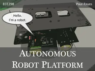
Developing an Autonomous Robot Platform for Robotics Enthusiasts
In the journey to simplify entry into robotics, the autonomous robot platform project aims to offer mobility and communication capabilities. Addressing the limitations of existing hobby and commercial robots, the goal is to create an affordable, user-friendly system that navigates autonomously, comm
0 views • 13 slides
Innovative Tank-Filling Lorry Using Self-Controlling Robot Car Technology
Ethar, Abu Sarah, Dr. Luai Malhis, and Baidaa Al Bzoor have developed a tank-filling lorry powered by a self-controlling robot car that follows predetermined paths to specific tanks and utilizes RF signals for operation. The project aims to address water distribution challenges by creating a machine
0 views • 22 slides
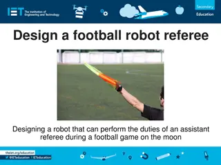
Designing a Football Robot Referee for Lunar League Games
Design a robot assistant referee to support games played on the moon by indicating when the ball is out of play and retrieving it. The robot must also be sustainable, carry logos for fundraising, and operate effectively in the unique lunar environment. Safety precautions and thoughtful design consid
0 views • 9 slides
Mind Controlled Robot Project by Adithya Kumar - Eighth Grade
Adithya Kumar, an eighth-grade student, has designed a groundbreaking Mind Controlled Robot project that allows users to control a robot using brain waves. The project utilizes a Mindwave EEG headset, Arduino Uno motherboard kit, and various materials. Adithya's detailed experimental design and proc
0 views • 11 slides
Power Mapping: A Visual Tool for Advocates to Influence Change
Power mapping is a visual tool used by advocates to identify key individuals to target in order to effect change. It involves mapping the community around an issue or campaign, identifying decision-makers, adversaries, and influential stakeholders. By following important steps and asking relevant qu
0 views • 10 slides
Understanding GraphSLAM: Mapping Urban Structures with Soft Constraints
GraphSLAM is an algorithm that extracts soft constraints from data in the form of a sparse graph to create a globally consistent map and robot path. The key idea involves resolving these constraints for accurate mapping. The exposition details assumptions, measurements, and robot poses in the GraphS
0 views • 19 slides
Innovative Autonomous Ground Robot for Orchard Management
This project showcases an Autonomous Ground Robot designed for orchard management tasks. The robot's hardware, software design, problem identification, and objectives are outlined. Key features include YOLO-based apple counting, SLAM navigation, and soil moisture detection. The system runs on Ubuntu
0 views • 19 slides
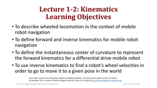
Understanding Mobile Robot Kinematics for Navigation
Exploring the kinematics of wheeled locomotion in mobile robots, this content covers forward and inverse kinematics, instantaneous center of curvature, and the use of kinematics for robot navigation. Highlighting the challenges of measuring robot position and the integration of wheel velocities for
0 views • 52 slides
GEBCO Technical Sub-Commission on Ocean Mapping (TSCOM) Overview
Technical Sub-Commission on Ocean Mapping (TSCOM) is a key component of the GEBCO program, established in 2006 to provide expertise in seafloor mapping and discuss emerging technologies. TSCOM serves as an authoritative source for bathymetric and hydrographic data and offers ongoing advice to associ
0 views • 12 slides
Virtual Network Mapping: A Graph Pattern Matching Approach
Virtual Network Mapping (VNM) involves deploying virtual network requests in data center networks in response to real-time demands. It facilitates the deployment of virtual networks on physical machines by mapping virtual nodes and links onto substrate nodes and paths, ensuring constraints are met.
0 views • 15 slides
Understanding Robot Localization Using Kalman Filters
Robot localization in a hallway is achieved through Kalman-like filters that use sensor data to estimate the robot's position based on a map of the environment. This process involves incorporating measurements, updating state estimates, and relying on Gaussian assumptions for accuracy. The robot's u
0 views • 26 slides
Shy Robot Programming Challenge: Logic-Based Autonomous Robot
The Shy Robot is an autonomous robot equipped with two IR sensors to avoid obstacles. Its behavior is determined by a logical control system - moving backward if both sensors detect an object, turning right if only the left sensor detects an object, turning left if only the right sensor detects an o
0 views • 5 slides
Learn to Make a Dancing Robot with micro:bit – YahBoom Tutorial
Dive into the world of robotics with this engaging tutorial on creating a dancing robot using micro:bit! Follow step-by-step instructions to program the robot to sing, dance, move in various directions, and synchronize light effects to music. Explore hardware setup, block coding, music scoring, and
0 views • 12 slides
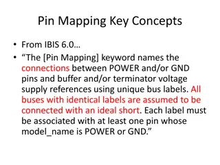
Understanding Pin Mapping and Interconnect in IBIS 6.0
Pin Mapping in IBIS 6.0 defines the connections between POWER/GND pins and buffer/terminator voltage supplies using unique bus labels. Interconnects between VDD pins and buffer supply terminals are crucial, with all pins associated with a named supply being shorted together. Draft 9 Interconnects an
0 views • 6 slides
Cutting-Edge Robotics Research in Interdisciplinary Field
Explore the cutting-edge research in robotics and artificial intelligence, focusing on topics such as real-time object recognition, robot mapping, and multi-robot cooperative pursuit. Discover how decision tree learning, data mining, and association rules play a crucial role in advancing the field o
0 views • 9 slides
Understanding Mercator Mapping: A Key Tool for Information System Management
Mercator is a web application designed for managing the mapping of an organization's information system, allowing for a comprehensive representation of its components and connections with the outside world. Mapping is crucial for controlling, protecting, and defending the information system, as well
0 views • 21 slides
Installation of Robot-Mounted Detector on DIAD Beamline
Installing a robot-mounted detector on the DIAD beamline for the 2021 MOCRAF Workshop at the ICALEPCS conference. The robot arm holds a diffraction detector for dual imaging and diffraction purposes, ensuring safety for personnel, equipment, and integration into EPICS and GDA systems. Functionality
0 views • 28 slides
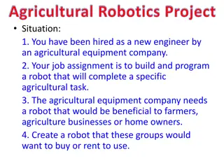
Innovative Agricultural Robotics Project for Enhanced Farming Efficiency
Engage in a stimulating agricultural robotics project to design, build, and program a robot to perform specific tasks beneficial to farmers, agriculture businesses, and homeowners. Dive into researching designs, materials, and sketching detailed plans. Craft a compelling presentation showcasing the
0 views • 5 slides
Micro:bit Robot Ultrasonic Obstacle Avoidance Tutorial
Learn how to set up and program a micro:bit robot for ultrasonic obstacle avoidance. Follow the step-by-step guide to prepare hardware, connect the micro:bit to the computer, search for programming blocks, and test the ultrasonic sensor. Children can understand the concepts and experiment with obsta
0 views • 10 slides
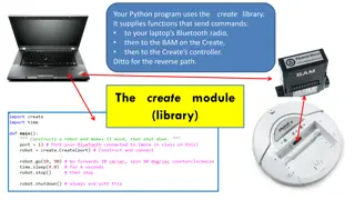
Python Create Library Overview
This Python program uses the Create library to send commands, enabling communication between your laptop's Bluetooth radio, the BAM on the Create robot, and the Create's controller. The library facilitates non-blocking commands for controlling the robot's movements and sensors, with specific instruc
0 views • 9 slides
Introduction to Robocode: A Fun and Interactive Programming Game
Robocode is a programming game where you simulate robot competitions by coding robots to battle autonomously. You program Java classes to define your robot's behavior on a simulated battlefield, learning software engineering principles in an engaging way. Explore robot anatomy, different components
0 views • 20 slides
Futuristic Patient Assistant Robot Enhancing Healthcare
This research project introduces a patient assistant robot supervised by Dr. Ahmed Mostafa and presented by a team comprising Amira Ibrahim Sayed, Asmaa Mohamed Saad, and Amna Ahmed Mohammed. The robot aims to assist individuals with infectious diseases by providing essential care and isolating them
0 views • 22 slides
Universal Collaborative Robot Platform Revolutionizing Robotics Industry
The Universal Collaborative Robot Platform is a game-changer in the robotics world, providing full autonomy, innovation, creativity, and enhanced productivity through robot collaboration. With features like universal robot communication protocols, centralized fleet management, mobile autonomy, and A
0 views • 14 slides
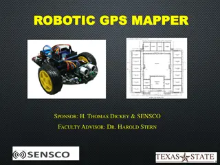
Robotic GPS Mapper Project Presentation
The Robotic GPS Mapper project aims to address the issue of water loss through leaks in city infrastructure by designing a GPS mapping robot that can locate unknown pipe system routes in real-time. The project overview includes goals such as remote communication with the robot, real-time mapping, wi
0 views • 19 slides
Enhancing Curriculum Development through Mapping for Schools
Curriculum mapping in schools involves using electronic tools to input, track, and analyze data related to curriculum, enabling stakeholders to meet standards, align content, collect real-time data on instruction, and reflect on practices for continuous improvement. Software programs like Rubicon At
1 views • 15 slides
Strategic Design and Systems Engineering in FIRST Robotics: Detroit-Mercy Kick-off Event
Explore the essentials of strategic design and systems engineering in the context of FIRST Robotics as highlighted during the Detroit-Mercy Kick-off event. Delve into the significance of strategic identification, design purpose, and systems engineering to optimize robot functionality and performance
0 views • 18 slides
Importance of Maps and GIS in Census Mapping: A Case Study from Nepal
Census mapping plays a crucial role in ensuring accurate population counts and territorial delineation. This case study from Nepal highlights the significance of Geographic Information Systems (GIS) in producing high-quality maps for census operations, data collection, analysis, and dissemination. T
0 views • 12 slides
