Analysis of Sea-level User Requirements from GCOS and CMUG
Detailed analysis of user requirements for sea-level observations, focusing on consistency with GCOS and CMUG standards. Discusses challenges in meeting accuracy, spatial resolution, and temporal stability criteria. Emphasizes the need for refinement and improvement in existing and future missions to fulfill these demanding requirements.

Download Presentation

Please find below an Image/Link to download the presentation.
The content on the website is provided AS IS for your information and personal use only. It may not be sold, licensed, or shared on other websites without obtaining consent from the author. Download presentation by click this link. If you encounter any issues during the download, it is possible that the publisher has removed the file from their server.
E N D
Presentation Transcript
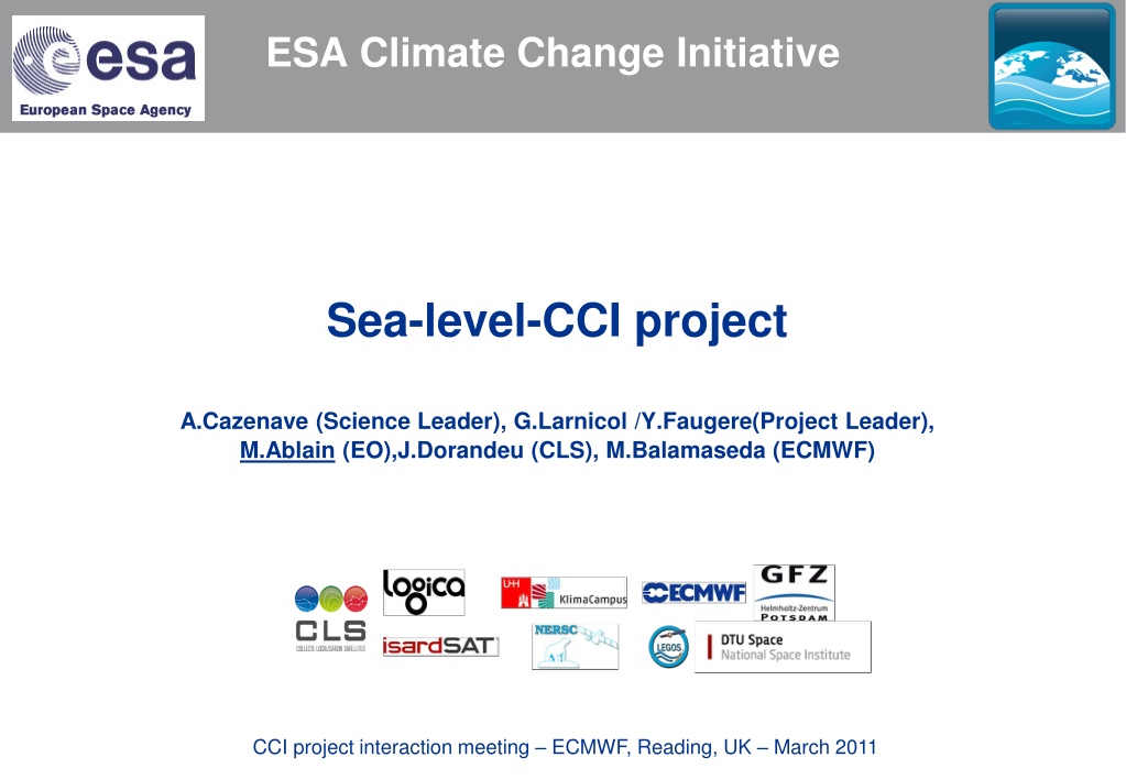
ESA-2 ESA Climate Change Initiative Sea-level-CCI project A.Cazenave (Science Leader), G.Larnicol /Y.Faugere(Project Leader), M.Ablain (EO),J.Dorandeu (CLS), M.Balamaseda (ECMWF) CCI project interaction meeting ECMWF, Reading, UK March 2011
Overview Objectives: 1) Description of user requirements (URD): consistency with GCOS and CMUG requirements 2) Description of product specifications (PSD) for FCDR and ECV 3) Description of validation strategy (PVP) : focus on uncertainties 4) Description of ECMWF data used (DARD) 5) Integrated perspective for consistency between the ECVs CCI project interaction meeting ECMWF, Reading, UK March 2011
1) Description of URD To perform the sea-level URD, requirements have been analyzed in details from: Global Climate Observing System (GCOS) World Climate Research Program (WCRP) Global Ocean Observing System (GOOS) Climate Modelling User Group (CMUG) Analysis of requirements coming from altimetry community and the climate research group have been also performed thanks to a questionnaire CCI project interaction meeting ECMWF, Reading, UK March 2011
1) Description of URD Analysis of GCOS requirements for sea-level: GCOS TARGET REQUIREMENTS described in2006 report ACCURACY 1 cm SPATIAL RESOLUTION 25 km horizontal resolution TEMPORAL RESOLUTION Daily observing cycle STABILITY 0.5 mm/decade These requirements will be extremely hard to satisfy for existing altimetry missions and for the future missions in the coming decade: => Currently, the stability is 6 mm/decade Issue of global coverage in area covered by ice is very challenging Therefore, we pointed out that the GCOS requirements have been to refined CCI project interaction meeting ECMWF, Reading, UK March 2011
1) Description of URD Analysis of GCOS requirements for sea-level: Ocean dynamic topography Requirement from GCOS Parameter name Coastal sea level change Requirements are also expressed in terms of 5 criteria: quantity, horizontal resolution, observing cycle, delay of availability, accuracy Goal 25 km 25 km Horizontal resolution Breakthrough 100 km 50 km Threshold 1000 km 250 km Goal 24 h 1 day Observing Cycle Requirements are also defined by type of applications: Coastal sea level change and Ocean dynamic topography do not really cover the needs for climate application Breakthrough 50 h 3 days 30 days Threshold 240 h Goal 1 h 0.125 day Delay of availibity Breakthrough 3 h 0.25 day Threshold 24 h 1 day Goal 1 cm 1 cm Accuracy Breakthrough 2 cm 15 cm Threshold 10 cm 5 cm Confidence CF_NAME Reasonable Firm Application Use OOPC OOPC CCI project interaction meeting ECMWF, Reading, UK March 2011
1) Description of URD Analysis of CMUG requirements for sea-level: More precise since applications areas have been defined CCI project interaction meeting ECMWF, Reading, UK March 2011
1) Description of URD We have tried to define the requirements taking into account several temporal and spatial scales in order to fulfill more accurately the requirements by application areas 2 kinds of ocean surface topography signal have been identified: Global Mean Sea level Regional Mean Sea Level For each of these categories, User requirements have been proposed. The current status of the ocean surface topography is also proposed. We also tried to follow the recommendations of the colocation meeting to identify requirements in term of stability, precision and accuracy CCI project interaction meeting ECMWF, Reading, UK March 2011
1) Description of URD A. Cazenave proposed new requirements to the last GCOS steering meeting (Geneva, 2011) in agreement with those described in the URD Accuracy 2-4 mm over an orbital cycle - Long-term drift precision : < 0.3 mm/yr - Annual time scale : <0.5 mm over 12 months Global mean sea level Stability Spatial resolution Temporal resolution Precision Stability 25-50 km weekly Regional sea level 1 cm (over a grid mesh of 50-100 km) <1mm/yr for a grid mesh of 50-100 km CCI project interaction meeting ECMWF, Reading, UK March 2011
1) Description of URD At the moment, the CCI URD and GCOS requirements are the same We are still working on them in order to propose a revisited version further in the project to formalize better the spatial and temporal scales to refine the requirements: precision, accuracy to add others applications which could also impact the climate as the mesoscale or the ocean circulation Global Mean Sea Level Regional mean sea level Spatial resolution - 25-50 km Temporal resolution 1 month 1 month Stability 0,3 mm/yr 1 mm/yr (over a grid mesh of 50 km) over 1 month 1 mm 1 cm (over a grid mesh of 50 km) Precision over 1 year 0,5 mm ? over interannual period 0,5 mm ? Accuracy - - CCI project interaction meeting ECMWF, Reading, UK March 2011
2) Description of PSD 2 products have been specified: - FCDR products: Fundamental Climate Data Records - ECV products: Essential Variable Climate FCDR product It is a mono-mission product generated from altimeter level-2. It contains: the along-track sea level height (SSH) over ocean a quality control indicator to remove spurious measurements the altimeter standards applied in the SSH calculation as the geophysical corrections, the mean sea surface, etc... information derived from multi-mission cross-calibration in order to remove the global SSH bias and to homogenize long spatial scale errors Data will be produced along the tracks of the different altimeters, with a resolution of 1Hz corresponding to a ground distance close to 6km. CCI project interaction meeting ECMWF, Reading, UK March 2011
2) Description of PSD ECV product The sea Level ECV products are composed of 3 categories: Time data series of sea level anomaly (SLA): correspond to the global and regional time data series: - Global MSL: 1-dimension vector of monthly averaged SLA - Regional MSL: 2-dimension grids of monthly SLA grids calculated after merging all the altimetric mission together. Ocean indicators: correspond to statistic information estimated over all the altimeter period from the SLA time data series. Several indicators are provided as the trend of the global and the regional MSL, the amplitude and phase of the main periodic signals (annual, semi-annual) Errors of oceanic indicators: correspond to the errors of the oceanic indicators (error on the global MSL trend for instance). CCI project interaction meeting ECMWF, Reading, UK March 2011
2) Description of PSD FCDR and ECV products are stored using the NetCDF (Network Common Data Form) using CF (Climate and Forecast) Metadata convention. 2 versions will be generated : -V0: it is the sea level products produced using the existing standards algorithms, it corresponds to the state of the art at the beginning of the project. - V1: it is the new sea level products, produced using the algorithms selected in the first phase of the project. Both versions will allow us to estimate the improvements brought by new algorithms Sea-Level CCI Product specifications meet the needs of sea-level Climate research group for regional and global MSL applications: long-term stability, time data series of 2- dimension grids, Could other products than specific CCI products be of interest for climate studies? For instance mesoscale or ocean circulation products, Absolute Dynamic Topography (ADT). With which requirements? CCI project interaction meeting ECMWF, Reading, UK March 2011
3) Description of PVP: focus on uncertainties Validation diagnoses are defined in order to : To assess the impact of the new algorithms on the round-robin procedure and finally to select the best ones to calculate the altimeter sea surface height To assess the final FCDR and ECV products generated during the project A main principle of validation phases including round-robin and final validation is to use a common set of validation diagnoses for all the algorithms or products (FCDRs and ECVS) which will be developed in the project. This strong principle allows us to estimate the impact of different algorithms with comparable statistics. This will be also a rigorous approach to characterize the sea-level altimetry errors. CCI project interaction meeting ECMWF, Reading, UK March 2011
3) Description of PVP: focus on uncertainties The validation diagnoses are of different types which allow us to check altimetry data with complementary objectives: Type Objective Altimetry level L1 & L2 L3 & L4 Global internal analyses Ensure the internal consistency of new proposed algorithms compared to standard or reference and evaluate the global improvement in system performances. Global multi-mission comparisons Estimate improvements in sea-level consistency between different altimetry missions using the new algorithms use independent data to measure the impact of new algorithms on the sea-level calculation derived from altimetry missions. L1 & L2 Global altimetry and In- situ data comparison L1 & L2 L3 & L4 CCI project interaction meeting ECMWF, Reading, UK March 2011
3) Description of PVP: focus on uncertainties Inside a validation diagnostic type, they are different diagnostics groups based on the same input data derived from altimetry measurements or from external data used: Input data Description Along-track altimetric components Values of the altimetric corrections or altimetric parameters or orbit calculation along the satellite 1 Hz ground track Along-track Sea Level Anomaly (SLA) Along theoretical track SLA Sea level anomalies along the ground track of the satellite at 1 Hz SLA along the theoretical ground track of the satellite at 1 Hz. Allows repeat-track analysis SLA grids are derived from along-track SLA combining and interpolating in time and space several altimetric missions. SSH differences between ascending and descending passes for time differences lower than 10 days Measurements from global tide gauges networks (GLOSS/Clivar, PMSL) covering all the altimetric period Data from the ARGO Global network SLA maps combined from several missions SSH Crossovers Tide gauges Temp/Salinity profiles CCI project interaction meeting ECMWF, Reading, UK March 2011
3) Description of PVP: focus on uncertainties Number Diagnostics name A01 Temporal evolution of differences between both altimetric components Map of differences between both altimetric components over all the period Periodogram derived from temporal evolution of altimetric component differences A04 Temporal evolution of SSH crossovers A05 Differences between temporal evolution of SSH crossovers A06 Map of SSH crossovers A07 Differences between maps of SSH crossovers A08 Temporal evolution of SLA A09 Differences of SLA temporal evolution A10 Map of SLA over all the period A11 Differences between maps of SLA A12 Periodogram derived from temporal SLA evolution A13 SLA differences versus coastal distances between 0 and 300 km B01 Temporal evolution of SLA for 2 missions over the same period B02 Differences between maps of SLA for 2 missions over the same period Temporal evolution of SSH differences between tide gauges and altimetry data over all the altimetry period Differences of temporal evolution of SSH differences between tide gauges and altimetry data over all the altimetry period Periodogram derived from temporal evolution of SSH differences between tide gauges and altimetry data over all the altimetry period Difference of histograms between tide gauges and altimeter SSH differences Temporal evolution of SSH differences between T/S profiles and altimetry data over all the altimetry period: global, north/south, east/west Differences of temporal evolution of SSH differences between T/S profiles and altimetry data over all the altimetry period Periodogram derived from temporal evolution SSH differences between A02 A03 The validation diagnosis is to compare the new algorithms with the reference ones. basic principle of The are the state of the art at the beginning of the project. reference algorithms C01 C02 C03 C04 C05 C06 CCI project interaction meeting ECMWF, Reading, UK March 2011 C07 T/S profiles and altimetry data over all the altimetry period
3) Description of PVP: focus on uncertainties Number Diagnostics name A01 Temporal evolution of differences between both altimetric components Map of differences between both altimetric components over all the period Periodogram derived from temporal evolution of altimetric component differences A04 Temporal evolution of SSH crossovers A05 Differences between temporal evolution of SSH crossovers A06 Map of SSH crossovers A07 Differences between maps of SSH crossovers A08 Temporal evolution of SLA A09 Differences of SLA temporal evolution A10 Map of SLA over all the period A11 Differences between maps of SLA A12 Periodogram derived from temporal SLA evolution A13 SLA differences versus coastal distances between 0 and 300 km B01 Temporal evolution of SLA for 2 missions over the same period B02 Differences between maps of SLA for 2 missions over the same period Temporal evolution of SSH differences between tide gauges and altimetry data over all the altimetry period Differences of temporal evolution of SSH differences between tide gauges and altimetry data over all the altimetry period Periodogram derived from temporal evolution of SSH differences between tide gauges and altimetry data over all the altimetry period Difference of histograms between tide gauges and altimeter SSH differences Temporal evolution of SSH differences between T/S profiles and altimetry data over all the altimetry period: global, north/south, east/west Differences of temporal evolution of SSH differences between T/S profiles and altimetry data over all the altimetry period Periodogram derived from temporal evolution SSH differences between A02 A03 The validation diagnosis is to compare the new algorithms with the reference ones. basic principle of The are the state of the art at the beginning of the project. reference algorithms C01 C02 C03 C04 C05 C06 CCI project interaction meeting ECMWF, Reading, UK March 2011 C07 T/S profiles and altimetry data over all the altimetry period
3) Description of PVP: focus on uncertainties Number Diagnostics name A01 Temporal evolution of differences between both altimetric components Map of differences between both altimetric components over all the period Periodogram derived from temporal evolution of altimetric component differences A04 Temporal evolution of SSH crossovers A05 Differences between temporal evolution of SSH crossovers A06 Map of SSH crossovers A07 Differences between maps of SSH crossovers A08 Temporal evolution of SLA A09 Differences of SLA temporal evolution A10 Map of SLA over all the period A11 Differences between maps of SLA A12 Periodogram derived from temporal SLA evolution A13 SLA differences versus coastal distances between 0 and 300 km B01 Temporal evolution of SLA for 2 missions over the same period B02 Differences between maps of SLA for 2 missions over the same period Temporal evolution of SSH differences between tide gauges and altimetry data over all the altimetry period Differences of temporal evolution of SSH differences between tide gauges and altimetry data over all the altimetry period Periodogram derived from temporal evolution of SSH differences between tide gauges and altimetry data over all the altimetry period Difference of histograms between tide gauges and altimeter SSH differences Temporal evolution of SSH differences between T/S profiles and altimetry data over all the altimetry period: global, north/south, east/west Differences of temporal evolution of SSH differences between T/S profiles and altimetry data over all the altimetry period Periodogram derived from temporal evolution SSH differences between A02 A03 The validation diagnostic is to compare the new algorithms with the reference ones. basic principle of The reference algorithms or are the state of the art at the beginning of the project. C01 C02 C03 C04 C05 C06 CCI project interaction meeting ECMWF, Reading, UK March 2011 C07 T/S profiles and altimetry data over all the altimetry period
3) Description of PVP: focus on uncertainties All these validation diagnoses lead to the uncertainties in the sea-level estimation at different temporal and spatial scales, and for each application in agreement with the URD: Global Mean Sea Level Global Mean Sea Level Errors (current status) Application (requirements) 0.6 mm/yr in a confidence interval of 90% Stability 0,3 mm/yr (Ablain et al, 2009) over 1 month 1 mm < 4 mm Precision over 1 year 0,5 mm < 2 mm over interannual period 0,5 mm < 2 mm Accuracy - - As specified in PSD, we will provide this information in the ECV products for global and regional mean sea level. CCI project interaction meeting ECMWF, Reading, UK March 2011
3) Description of PVP: focus on uncertainties Example: The local MSL trends calculated over the 1993 - 2009 period are plotted on the left map and the associated formal error on the right map This information will be provided in the sea-level-ECV CCI project interaction meeting ECMWF, Reading, UK March 2011
4) DARD: Description of ECMWF data used For the sea-level-CCI project, we need to use the ERA INTERIM Meteo fields to improve the wet and dry troposphere, and inverse barometer corrections: model Levels: 3D-Specific humidity, 3D-Temperature, Logarithm of surface pressure Surface: 2m temperature, 2m dew point, Mean Sea Level Pressure, 10m winds (U Static files: Model topography grid, Geopotential, Land sea mask We need also additional fields to improve the Sea-State bias model: Sea surface temperature, Sea-ice cover, wind stress for u and v, Mean wave direction, Mean wave period, Significant wave height Period: 01/07/1991 to 31/12/2010 For wet and dry troposphere, and inverse barometer corrections: data were delivered until 31/12/2009 as part as the Reaper Project (reprocessing of ERS missions, ESA), therefore only last year is required For additional fields: all the period is required. We need in urgence of ECMWF data CCI project interaction meeting ECMWF, Reading, UK March 2011
5)Integrated perspective for consistency between the ECVs Round Robin / Validation: validation diagnoses have been clearly formalized: validation diagnoses are available for all the CCI participants (see PVP) iteration with others ECVs is necessary to improve/homogenize our diagnoses Uncertainty Characterization: The approach to determine sea-level uncertainties is based on validation diagnoses Uncertainties will be provided in ECV products Data standards and formats: All products will be generated in NetCDF-CF Synergy with other projects has also to be developed (MyOcean, METAFOR, ) Web sites and data access guidelines: sea-level-CCI web site is on-line: http://www.esa-sealevel-cci.org/ a dedicated ftp site has been created to share all the documents, the altimetry database and the RRDP : ftp://ftp.esa-sealevel-cci.org/ CCI project interaction meeting ECMWF, Reading, UK March 2011
5)Integrated perspective for consistency between the ECVs Interactions with other ECVs: sea-level ECV dependency on other ECVs is weak Interaction with SST project could be developed in terms of validation diagnoses (PVP), and product specification (PSD) because the problematic is similar More interactions could be developed with sea-ice ECV but this project is not started Though not planned in the first phase of the CCI project, interaction with others ECVs as water vapor and sea state will be very useful for sea-level ECV CCI project interaction meeting ECMWF, Reading, UK March 2011


 Description of URD")
 Description of URD")
 Description of URD")
 Description of URD")
 Description of URD")
 Description of URD")
 Description of URD")
 Description of PSD")
 Description of PSD")
 Description of PSD")
 Description of PVP: focus on uncertainties")
 Description of PVP: focus on uncertainties")
 Description of PVP: focus on uncertainties")
 Description of PVP: focus on uncertainties")
 Description of PVP: focus on uncertainties")
 Description of PVP: focus on uncertainties")
 Description of PVP: focus on uncertainties")
 Description of PVP: focus on uncertainties")
 DARD: Description of ECMWF data used")
Integrated perspective for consistency between the ECVs")
Integrated perspective for consistency between the ECVs")