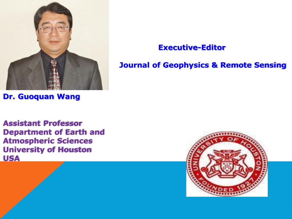
Dr. Guoquan Wang - Executive Editor, Journal of Geophysics & Remote Sensing
Dr. Guoquan Wang is an Assistant Professor at the University of Houston, USA, with expertise in coastal hazards, neotectonics, GPS seismology, and geological hazard risk analysis. His research interests focus on natural hazards studies, field monitoring, and numerical modeling in geophysics and remote sensing.
Download Presentation

Please find below an Image/Link to download the presentation.
The content on the website is provided AS IS for your information and personal use only. It may not be sold, licensed, or shared on other websites without obtaining consent from the author. Download presentation by click this link. If you encounter any issues during the download, it is possible that the publisher has removed the file from their server.
E N D
Presentation Transcript
Executive-Editor Journal of Geophysics & Remote Sensing Dr. Guoquan Wang Assistant Professor Department of Earth and Atmospheric Sciences University of Houston USA
Biography 09/2011----Present: Assistant Professor 08/2006 08/2011: Assistant Professor, Department of Geology, University of Puerto Rico at Mayaguez, PR. (Tenured on July 1, 2011) 07/2004 07/2006: Research Associate, Applied Geophysical Science Laboratories, College of Arts and Sciences, North Carolina A&T State University, NC. 01/2004 06/2004: Visiting Research Scholar, Multidisciplinary Center for Earthquake Engineering Research (MCEER), University of New York at Buffalo, NY. 06/2001 12/2003: Postdoctoral Scholar, Institute of Geophysics, Department of Geosciences, University of Munich, Germany.
Research Interest Coastal hazards (e.g., faulting, subsidence, wetland loss) in the Gulf Coast area Caribbean neotectonics GPS seismology, strong earthquake ground motion Applications of GPS and LIDAR technologies in natural hazards studies Geological hazard risk analysis and mitigation Field and structural monitoring and instrumentation Numerical modeling---Numerical 3D simulation (e.g., Parallel Super-Computer Numerical Simulation, MPI and Finite Difference Method)
GeoHazards Geohazards take an increasing toll of lives, disrupt livelihoods and cost more more money each year
Natural and Human-Induced Extreme Events GEOHAZARDS Volcanoes Earthquakes and T sunamis Landslides/Mudslides CLIMATIC HAZARDS Floods Drought Hurricanes/Cyclones INDUSTRIAL/OTHER HAZARDS Oil Spills NuclearAccidents Phuket, Thailand: Before and after the 2004 tsunami Meteor Impacts
Cost Breakdown of Disasters
Natural and Human-Induced Extreme Events Extreme events, whether natural or human-induced, can cause significant environmental change, not to mention their devastating impacts on peoples lives In 2005, there was an 18% rise in disasters that killed 91 900 people There were 360 natural disasters in 2005 compared to 305 in 2004: the number of floods increased by 57% in 2005 and droughts by about 47% The 2004 Indian Ocean tsunami accounted for 92%, and the 2005 SouthAsian earthquake, for 81% of the deaths in each respective year
Earthquakes and Tsunamis According to long-term records (since about 1900), we can expect about 18 major earthquakes (7.0 - 7.9 on the Richter scale) and one great earthquake (8.0 or above) in any given year The number of earthquakes and tsunamis resulting in fatalities has increased approximately in proportion to global populations The growth of giant urban cities near regions of known seismic hazard is a new experiment for life on the Earth T sunamis are a threat to life and property for all coastal residents
IGOS - Geohazard Most destructive known earthquakes in the World Date Location Deaths January23, 1556 China, Shansi 830,000 July 27, 1976 China, Tangshan 255,000 (official) August 9, 1138 Syria, Aleppo 230,000 May 22, 1927 China, near Xining 200,000 December 22, 856 Iran, Damghan 200,000 December 16, 1920 March 23, 893 Iran, Ardabil 150,000 September 1, 1923 October 5, 1948 USSR (Turkmenistan, Ashgabat) December 28, 1908 100,000 September, 1290 China, Chihli 100,000 November, 1667 Caucasia,Shemakha 80,000 November 18, 1727 November 1, 1755 Portugal, Lisbon 70,000 December 25, 1932 May 31, 1970 Peru 66,000 1268 Asia Minor, Silicia 60,000 January11, 1693 Italy, Sicily 60,000 May 30, 1935 Pakistan, Quetta 30,000 to 60,000 M Comments 8Estimated death toll as high as 655,000. 8.3Large fractures. China, Gansu 200,000 8.6Major fractures, landslides. Japan, Kwanto 143,000 8.3Great Tokyo fire. 110,000 7.3 Italy, Messina 70,000 to 7.5Deaths from earthquake and tsunami. Iran, Tabriz 77,000 8.7Great tsunami. 7.6 China, Gansu 70,000 7.8Great rock slide, floods. 7.5Quetta almost completely destroyed.
Earthquakes with 1,000 or more deaths from 1998 to 2001 Date Location Latitud Longitud e 70.1 E Deaths M Comments e Feb 04, 1998 Afghanista n- Tajikistan Borde r Regio n Afghanista n- Tajikistan Border Papua New Guinea, Near N. Coast Colombia 37.1 N 2,323 6.1 818 injured, 8,094 houses destroyed, 6,725 livestock killed. May 30, 1998 37.1 N 70.1 E 4,000 6.9 Many thousands injured and homeless. Jul 17, 1998 2.96 S 141.9 E 2,183 7.1 Thousands homeless and about 500 missing as a result of a tsunami with maximum wave heights estimated at 10 meters. injured, about 9,500 Jan 25, 1999 4.46 N 75.82 W 1,185 6.3 Over 700 missing and presumed killed, over 4,750 injured and about 250,000 homeless. 7.4 At least 50,000 injured, thousands homeless. Damage estimate at 3 to 6.5 billion USD. 7.6 Over 8,700 injured, over 600,000 Aug 17, 1999 Turkey 40.7 N 30.0 E 17,118 Sep 20, Taiwan 23.7 N 121.0 E 2,297
Hazards & Vulnerabilty Research Institute (2006). 2005 U.S. Hazard Losses. University of South Carolina. UN InternationalStrategy for Disaster Reduction (2006). 2005 Disasters in Numbers
SPITAK EARTHQUAKE (ARMENIA) 7.12.1988, M=6.8 http://www.hleb.net/armenia/internet/index.html
SURFACE DISPLACEMENT FOR RADAR DATA Mantle convection theory, continent drift theory, as a base of horizontal and vertical movement of the earth surface. Earthquake mechanism theories: dilatancy theory, elastic rebound theory. Strong motion after the shock.
The model of ground displacement: a - dilatancy model; b-elastic rebound theory. 1- stress, 2- cleavage stress.
Satellite and In-situ observations Satellite observations In-situ observations Ground displacement before the shock Allweather surface temperature Ion density and temperature in F-layer, 180-300 km Gas concentration Tilt, strain, GPS, water level Meteorological observations EM ground observations Gas concentration Oxygen luminescence Atmospheric temperature, pressure and humidity Aerosol Oxygen luminescence Meteorological observations Aerosol
OMICS International O Ope M Me em mb be er rs sh hip ip pen n A Acc cce es ss s OMICS International Open Access Membership enables academic and research institutions, funders and corporationsto actively encourage open access in scholarly communication and the dissemination of research published by their authors. Formore details and benefits, click on the link below: http://omicsonline.org/membership.php
