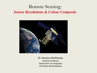
Remote Sensing Sensor Resolutions & Colour Composite
Explore the art and science of remote sensing, detailing sensor types, resolution categories, and color composite techniques. Learn about the stages involved in remote sensing, sensor variations, and band designations for satellites like Landsat 8. Discover the significance of pixel, high-resolution
7 views • 13 slides
Latest Consensus on UWB Sensing for 802.15.4ab
Co-authors from various companies present the latest agreement on ultra-wideband (UWB) sensing topics for the IEEE 802.15.4ab standard. The consensus includes definitions for sensing pulse shape, packet formats for bi/multi-static sensing, and support for specific sequences and patterns in UWB sensi
2 views • 27 slides
Spectrum Sensing for Enhanced Channel Access in Wireless Networks
This document presents a proposal for Spectrum Sensing Based Deferral (SSBD) to improve channel access in wireless networks. SSBD incorporates spectrum sensing with transmission deferral in a time-bound manner to enhance performance, reliability, and latency control. The proposed solution safeguards
4 views • 11 slides
IEEE 802.11-21/1321r1 WLAN Sensing Procedure Proposal
This document by Solomon Trainin from Qualcomm presents a proposal on aligning the SFD for the WLAN sensing procedure. It aims to resolve contradictions, optimize behavior, and introduce a structured WLAN sensing procedure. The content outlines phases, terminology, setup, measurement, and reporting
0 views • 8 slides
IEEE 802.11-21/2011r0 Sensing NDP Announcement Overview
This document presents an overview of the IEEE 802.11-21/2011r0 Sensing NDP Announcement for utilizing NDP in sensing applications. It discusses the motivation behind NDP sensing, outlines the NDP Announcement frames, and explains possible sensing frame exchange sequences. The Ranging NDP Announceme
0 views • 8 slides
IEEE 802.11-19/1769: CSI-based Wi-Fi Sensing Results & Challenges
This document from Oct. 2019 explores IEEE 802.11-19/1769 CSI-based Wi-Fi sensing, focusing on results and standardization challenges. It delves into the concept of Wi-Fi sensing, its applications in security, automation, healthcare, and more, as well as the importance of CSI parameters such as reso
0 views • 10 slides
Wi-Fi Sensing in IoT: Advantages, Use Cases, and Challenges
Wi-Fi sensing utilizes Wi-Fi devices/network to detect presence, range, angle, and velocity of passive/non-transceiver objects. This document discusses the definition, advantages, use cases like smart home applications, and challenges of Wi-Fi sensing compared to other sensing technologies. It also
6 views • 15 slides
Wireless Sensing Privacy Discussions in May 2023 Document
May 2023 document (.IEEE 802..11-23-0782-00-00bf) discusses privacy issues related to wireless sensing, including unauthorized access to sensing reports, tracking of sensing devices, and potential eavesdropping on sensing signals. It proposes solutions to protect sensitive information and addresses
4 views • 12 slides
Comparison of Trigger-based vs. Non-Trigger-based Sensing Measurement in IEEE 802.11
The document discusses the differences between Trigger-based (TB) and Non-Trigger-based (Non-TB) sensing measurement instances in IEEE 802.11 standards, focusing on who initiates the sensing measurement. TB sensing is initiated by the AP, while Non-TB sensing is initiated by a non-AP STA, enabling o
6 views • 13 slides
IEEE P802.15 WPAN Sensing Device Submission
This submission to the IEEE P802.15 Working Group focuses on the development of a sensing device for Wireless Personal Area Networks (WPANs). The document discusses the integration of Ultra-Wideband (UWB) technology for sensing applications, including presence detection and environment mapping. Key
1 views • 16 slides
Remote Sensing: Meaning, History, and Applications
Remote sensing is the acquisition of information without physical contact, widely used in various fields like geography, military, and more. Its history dates back to aerial photography and has evolved with satellite technology. The process involves elements like energy source, radiation, interactio
0 views • 9 slides
Exploring Wi-Fi Sensing: Feasibility and Standardization Gaps
Delve into the technical aspects of Wi-Fi sensing, discussing its definition, feasibility, and standardization gaps according to the IEEE 802.11 standard. The presentation highlights the ability of Wi-Fi systems to detect environmental changes and explores scientific publications related to Wi-Fi se
0 views • 27 slides
Wireless LAN Sensing Use Cases in Home Environments
The document discusses use cases for Wireless LAN (WLAN) sensing in home environments, focusing on the connection between multiple access points and home appliances for enhanced performance. It outlines scenarios such as gesture-controlled home appliance operation, user identification for personaliz
0 views • 11 slides
GIS and Remote Sensing for Overlay Analysis Training Program
This training program focuses on GIS and remote sensing techniques for overlay analysis, covering topics such as data processing, suitability mapping, sensitivity analysis, and introduction to Python. The program includes practical sessions on QGIS, lithology, land use, recharge, TWI, and more. Part
2 views • 24 slides
Lagrange Remote-Sensing Instrument Package Overview
The Lagrange Remote-Sensing Instrument Package comprises four instruments for monitoring solar activity, including the Photospheric Magnetic Field Imager (PMI) and Extreme-UltraViolet Imager (EUVI). Consortium members from six nations are involved in this initiative, aimed at enhancing space weather
0 views • 16 slides
Detection of Rhododendron in Deciduous Woodland Using Airborne Hyperspectral Remote Sensing
Airborne hyperspectral remote sensing, specifically with the NEO HySPEX VNIR sensor, has enabled the identification of invasive Rhododendron species in UK woodlands. The technology offers high spectral resolution, allowing for the targeted detection of understorey species like Rhododendron, which ca
2 views • 6 slides
Remote Sensing Methods for Identifying Degraded Forests in the Amazon
Using multisource remote sensing data, this study aims to identify and characterize forest degradation in the Amazonian landscape. Field work in Paragominas, Brazil, combined with optical and radar data analysis, helps in understanding carbon stocks and typology of degraded forests. The research foc
3 views • 7 slides
Ocean Optics Class 2013: Calibration & Validation for Remote Sensing
This class in 2013 focused on calibration and validation for ocean color remote sensing, featuring instructors like Emmanuel Boss and Mary Jane Perry. From historical insights to the key to the class's success, the curriculum provided a learning community emphasizing hands-on experience, critical an
0 views • 9 slides
Remote Sensing Coast Monitoring in Poland - Aerial Survey Insights
Explore the comprehensive process of remote sensing coast monitoring in Poland, covering data collection specifics, UAV utilization, sea level navigation requirements, ALS data accuracy, image data details, and the role of Jakub Krawczyk as the Aerial Survey Department Manager. Get insights into the
0 views • 27 slides
Applications of Remote Sensing in Environmental Studies
Dr. Sanjib Pramanik, an Assistant Professor at Durga College, delves into the fascinating realm of remote sensing for environmental studies. Remote sensing allows data collection from a distance, utilizing methods like air photos and satellite imagery. The environment comprises components such as na
0 views • 35 slides
2nd International GeoRS Conference 2023 - Geosciences and Remote Sensing Explorations
Delve into the world of geosciences and remote sensing at the upcoming 2nd International Conference - GeoRS 2023. This event, taking place on Dec 18-19, 2023, will be held both physically at NH Gent Belfort and online via the conference website. Explore cutting-edge research and methodologies presen
0 views • 8 slides
Advanced Remote Sensing Requirements and Terminology in Environmental Monitoring
Explore the latest satellite data requirements and terminology for environmental monitoring, focusing on surface soil moisture measurement, three-level climate application approach, and on-site validation reports. Gain insights into maximizing the accuracy and stability of remote sensing data for im
0 views • 6 slides
Advances in Remote Sensing for Soil Moisture Validation and Calibration
Cutting-edge methods like Cosmic-Ray Neutron Sensing (CRNS) and mobile measurements are revolutionizing soil moisture validation and calibration. From satellite-based techniques to local approaches, researchers are enhancing the accuracy and reliability of soil moisture data for various applications
1 views • 15 slides
Evaluation of Soil Moisture Estimates from Satellite-Based Products
The study evaluates soil moisture estimates from satellite-based products over two network regions. Soil moisture is crucial for the hydrological cycle, necessitating continuous monitoring due to its spatial and temporal variability. Remote sensing is utilized to gather information without physical
0 views • 5 slides
Remote Sensing Needs Assessment for Wildland Fire Research
Contributors from various institutions are collaborating to identify and improve remote sensing products to support wildland fire operations, monitoring, and research. Existing and prospective products along with their limitations are explored in phases such as pre-fire, active fire, and post-fire.
0 views • 17 slides
Remote Sensing for Blue Whale Conservation: Enhancing Maritime Policy
Using remote sensing technology to monitor blue whale habitats can help address the conservation challenges posed by ship strikes. By predicting species distributions with greater precision, regulatory agencies can implement effective measures to reduce the risks faced by blue whales. Remote sensing
0 views • 18 slides
Satellite Products for Aviation Remote Sensing Needs in High Latitudes
Addressing the specific needs of aviation remote sensing in high latitudes, this content explores the importance of satellite products, variations in equipment requirements, data expectations, and the significance of cloud products for aviation safety. Feedback from aircraft operators emphasizes the
0 views • 8 slides
Spectral and Radiometric Considerations for Government Remote Sensing Instruments
This presentation explores the important considerations in designing and calibrating government passive optical remote sensing instruments, focusing on spectral and radiometric aspects. Topics include spectral variation, design considerations, uniformity, reflectance calibration, and examples from i
0 views • 27 slides
Radiometric Calibration Methods for Remote Sensing Applications
Techniques for radiometric calibration in remote sensing include vicarious approaches utilizing invariant desert sites, in-situ methods characterizing surfaces and atmospheres, and SI-traceable measurements for intercomparisons between sensors. The repeatability of in-situ results and comparison wit
2 views • 20 slides
Remote Sensing Panel Discussion: Addressing Challenges in RFI Reporting, Regulations, and Protection of Operations
The Remote Sensing panel discussion highlights key issues such as the lack of RFI reporting to the ITU, importance of RFI reporting for regulatory enforcement, obstacles in protecting remote sensing operations, desired changes in Radio Regulations, and potential discussion points for the research an
0 views • 7 slides
Enhancing Smartphone Location Sensing Efficiency
This study delves into optimizing energy consumption in smartphone location sensing mechanisms like GPS and Network Based Triangulation. Comparisons of battery drainage rates with and without GPS provide insights. Additionally, the energy efficiency of Network Based Triangulation as a less accurate
1 views • 41 slides
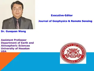
Dr. Guoquan Wang - Executive Editor, Journal of Geophysics & Remote Sensing
Dr. Guoquan Wang is an Assistant Professor at the University of Houston, USA, with expertise in coastal hazards, neotectonics, GPS seismology, and geological hazard risk analysis. His research interests focus on natural hazards studies, field monitoring, and numerical modeling in geophysics and remo
0 views • 19 slides
Geoscience and Remote Sensing Society Underrepresented Program Report
Geoscience and Remote Sensing Society's report discusses initiatives to address underrepresentation in the field, focusing on globalization, local/ host country underrepresentation, and objectives for developing a comprehensive plan for the future. The report outlines strategies, committee members,
0 views • 13 slides
Remote Sensing and GIS Applications in Photogrammetry: Understanding Scale Variations
Exploring the fundamental principles of photogrammetry in remote sensing and GIS applications, this content delves into the science of measurements from aerial photographs. It discusses the implications of scale differences on maps and aerial photographs, emphasizing the variations in scale due to t
0 views • 19 slides
Advances in Hyperspectral Remote Sensing Science for Aquatic Environments
This conference focuses on the latest developments in hyperspectral remote sensing technology for studying aquatic environments. With sessions covering topics like atmospheric correction, ocean color imagery, and water quality monitoring, experts discuss how hyperspectral data can address critical s
0 views • 8 slides
Constrained Adaptive Sensing and Benefits of Adaptivity
Constrained adaptive sensing involves estimating sparse signals with constraints, utilizing strategies like nonadaptive sensing and adaptive sensing. Benefits of adaptivity include reducing errors and improving estimation accuracy in signal processing. It explores the potential for improvement in re
0 views • 17 slides
Product Development Science Advisory Committee Meeting Overview
The Product Development Science Advisory Committee Meeting held at the National Space Science and Technology Center focused on developing experimental products for satellite missions to meet forecast needs. The Products Team objectives included integrating user forecast needs with available capabili
0 views • 6 slides
IEEE 802.11 Sensing: Applications, Feasibility, Standardization
IEEE 802.11 sensing, also known as WiFi sensing, utilizes 802.11 signals to detect changes in the environment through signal processing and machine learning. This technology offers various advantages over common sensors, such as motion detection, breathing monitoring, and tracking, without the need
1 views • 15 slides
Ocean Optics Class 2017: Calibration and Validation for Ocean Color Remote Sensing
Join the Ocean Optics Class 2017 to delve into ocean color remote sensing techniques and calibration procedures. Explore the history, evolution, and key success factors of the class. Engage with expert instructors and collaborate in a unique learning community focused on advancing ocean sciences thr
0 views • 9 slides
IEEE 802.11-22 WLAN Two-Way Sensing Use Cases
This document explores the use cases and implementation of two-way sensing in WLAN environments, focusing on scenarios where both access points (AP) and non-AP stations require sensing results for various applications such as home security, presence detection, and sleep monitoring. The proposed appr
0 views • 14 slides
