Remote Sensing Methods for Identifying Degraded Forests in the Amazon
Using multisource remote sensing data, this study aims to identify and characterize forest degradation in the Amazonian landscape. Field work in Paragominas, Brazil, combined with optical and radar data analysis, helps in understanding carbon stocks and typology of degraded forests. The research focuses on remote sensing applications in conservation biology for territorial governance and modelization.

Uploaded on Sep 09, 2024 | 3 Views
Download Presentation

Please find below an Image/Link to download the presentation.
The content on the website is provided AS IS for your information and personal use only. It may not be sold, licensed, or shared on other websites without obtaining consent from the author. Download presentation by click this link. If you encounter any issues during the download, it is possible that the publisher has removed the file from their server.
E N D
Presentation Transcript
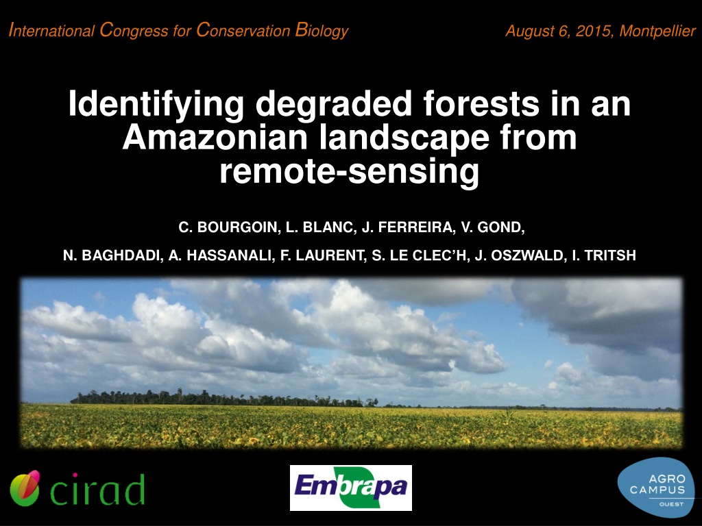
International Congress for Conservation Biology August 6, 2015, Montpellier Identifying degraded forests in an Amazonian landscape from remote-sensing C. BOURGOIN, L. BLANC, J. FERREIRA, V. GOND, N. BAGHDADI, A. HASSANALI, F. LAURENT, S. LE CLEC H, J. OSZWALD, I. TRITSH
Context & definitons- Objectives - Field work - Multisource remote sensing - Perspectives Deforested lands = 20% Brazilian Amazonian forest (INPE, FAO 2013) http://blog.cifor.org/wp-content/uploads/2012/06/5660746818_c247083bec_b1-500x332.jpg 1
Context & definitons - Objectives - Field work - Multisource remote sensing - Perspectives How to identify and characterize a range of forest degradation within this fragmented landscape ? Paragominas, Par , Brazil Combining : field work & multisource remote sensing 2
Context & definitons - Objectives - Field work - Multisource remote sensing - Perspectives Emergents 35 m 25 m Forest degradation typology F1 F1 35 m 25 m F2 F2 35 m 25 m 15 m F3 F3 25 m 15 m F4 F4 15 m 15 m 6 m 6 m F5 F5 3
Context & definitons - Objectives - Field work - Multisource remote sensing - Perspectives 250m 25m 100km AGB plots Optical data RADAR data Time series data Berenguer E., Ferreira J., Gardner T., Barlow J. A Large-Scale Field Assessment of Carbon Stocks in Human-Modified Tropical Forests. (2014) MODIS LANDSAT 8 SPOT 5 ALOS-1 SENTINEL-1 Variables importance RMSE = 2.1339 Mg/ha Predicted AGB (Mg/ha) RANDOM FOREST : AGB regression and prediction Field measured AGB (Mg/ha) AGB PREDICTION 4
Context & definitons - Objectives - Field work - Multisource remote sensing - Perspectives UNDERSTANDING Definitions Field typology Remote sensing REMOTE SENSING O TERRITORIAL GOVERNANCE MODELISATION 5
THANK YOU FOR YOUR ATTENTION ! Contact : bourgoin.clement2@gmail.com