NCI Data Collections BARPA & BARRA2 Overview
NCI Data Collections BARPA & BARRA2 serve as critical enablers of big data science and analytics in Australia, offering a vast research collection of climate, weather, earth systems, environmental, satellite, and geophysics data. These collections include around 8PB of regional climate simulations a
6 views • 22 slides
Geophysics Field Testing Workshop: Methods and Interpretation
This workshop on geophysics field testing covers a range of methods such as downhole and surface testing, spectral analysis, seismic refraction, and more. Geophysical investigations help assess subsurface properties efficiently and non-invasively, offering valuable insights for site exploration and
1 views • 16 slides
Evolution of Geomagnetic Methods in Applied Geophysics and Their Diverse Applications
Explore the rich history of geomagnetic methods from ancient Chinese lodestone use to modern magnetic surveying technologies. Learn about the principles of magnetics surveying, applications in locating metal objects, mapping near-surface features, mineral exploration, and geological bedrock mapping.
9 views • 36 slides
Advanced Ring Laser Instrument - GINGERINO: Precision Earth Rotation Measurement
The GINGERINO project utilizes a groundbreaking ring laser instrument for precise measurement of Earth's rotation variations. It offers advantages in local measurements compared to space-based methods, aiding in geophysics and fundamental physics research. Operational since May 2017, GINGERINO boast
0 views • 27 slides
Introduction to Data Analysis in Geophysics with Seismic Analysis Code - SAC Lab 2.1
Explore the world of geophysics data analysis using the SAC Lab 2.1 code. Learn about seismic analysis, Fourier transform analysis, spectral analysis, color tracing, integration, differentiation, and more. The SAC online documentation provides valuable resources for users to delve deeper into this f
0 views • 45 slides
Understanding Geophysics: Methods, Branches, and Applications
Geophysics applies physics principles to study Earth's physical processes and properties, contributing to scientific and economic advancements. The field encompasses various branches such as Solid Earth Geophysics and Exploration Geophysics, with scopes including natural hazard studies and resource
0 views • 25 slides
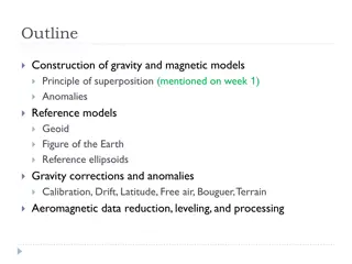
Understanding Gravity and Magnetic Models in Geophysics
Construction of gravity and magnetic models involves principles of superposition to isolate anomalies, reference ellipsoids, geoid, and various corrections like drift, latitude, free air, Bouguer, and terrain corrections. Gravity anomalies are determined by subtracting multiple factors from observed
0 views • 15 slides
Detailed Overview of Emissions Development in Louisiana
Emissions Processing System (EPS3) generates chemically speciated, gridded formats required by CAMx, with a focus on raw annual/ozone season county/parish-level emission inventory files and support data. Spatial and temporal profiles, along with cross-reference files, are essential for this work, co
1 views • 27 slides
Innovative Seismic Software and Services for Geophysics Applications
Celebrating 20 years of providing seismic software, dataloggers, and sensors, this company was founded by the original IRIS PASSCAL programming team. With expertise in micro-seismic monitoring and a focus on wide-band, low-power, and portable solutions, they offer sensors with various specifications
0 views • 5 slides
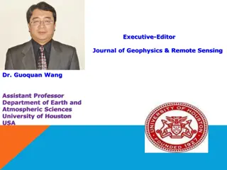
Dr. Guoquan Wang - Executive Editor, Journal of Geophysics & Remote Sensing
Dr. Guoquan Wang is an Assistant Professor at the University of Houston, USA, with expertise in coastal hazards, neotectonics, GPS seismology, and geological hazard risk analysis. His research interests focus on natural hazards studies, field monitoring, and numerical modeling in geophysics and remo
0 views • 19 slides
Introduction to Data Analysis in Geophysics Using UNIX
Learn how to use UNIX commands such as pipes and xargs in geophysics data analysis. Discover how to manipulate file lists, search for specific strings in files, and run programs on file names efficiently using xargs in a UNIX environment.
0 views • 34 slides
Introduction to MATLAB Commands for Data Analysis in Geophysics
Learn how UNIX commands work in MATLAB, differentiate between MATLAB and UNIX commands, utilize MATLAB's help function, explore topics available for help, access help on individual commands, and create constant matrices in MATLAB for data analysis in geophysics.
0 views • 28 slides
Understanding Earth's Internal Structure: A Geographical Perspective
Deep parts of Earth's interior are studied indirectly through geophysics, including seismic waves, magnetic fields, gravity, and heat. Seismic studies reveal Earth's layers - crust, mantle, and core - each with distinct properties and compositions. The lithosphere, comprising the upper mantle and cr
0 views • 12 slides
Data Analysis Techniques in Geophysics Using MATLAB
Explore data processing, analysis, and visualization techniques in geophysics through MATLAB. Learn how to generate synthetic data, calculate mean and standard deviation, select data within a certain range, and plot the results effectively. Embrace the power of MATLAB for geophysical data exploratio
0 views • 7 slides
Geophysics Field Testing Workshop: Methods and Interpretation
South Carolina DOT Training Workshop on geophysics field testing methods, data reduction, and interpretation of results by Robert C. Bachus and Glenn J. Rix. The workshop covers suspension logging, borehole geophysical logging, geotechnical testing, and geophysical service companies such as Schlumbe
0 views • 11 slides
Introduction to Data Analysis in Geophysics using MATLAB Graphics Handles
Practice interactive input, file reading, and plotting in MATLAB Graphics Handles lab. Explore ways to improve graphics in Geophysics data analysis. Learn basic histogram plot representation with properties and understand the functionalities provided in MATLAB for handling geophysical data through g
0 views • 21 slides
Texas A&M Geology & Geophysics Curriculum Revision and Development
Involving a backward redesign led by curriculum revision specialists, the Texas A&M Geology and Geophysics curriculum has been undergoing changes since 2014. The revision aims to identify the necessary skills, knowledge, and competencies for students. It includes new courses introduced in 2016-17, w
0 views • 5 slides
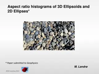
Analysis of 3D Ellipsoids and 2D Ellipses: Geophysics Study 2015
Investigate aspect ratio histograms of 3D ellipsoids and 2D ellipses with implications for representing pore crack grain structures. Explore the relationship between 2D and 3D aspect ratios, transformations between dimensions, and comparisons with simulated and actual data. The study delves into uni
0 views • 17 slides
RAS Policy Group Overview and Work Plan
The RAS Policy Group, led by Robert Massey, consists of RAS Fellows with a focus on public affairs in astronomy, space science, and geophysics. The group advises on policy matters, including megaconstellations, and collaborates with key organizations. Their 2020 work plan includes budget considerati
0 views • 4 slides
Enhancing Disaster Preparedness with Indonesia's Seismic Monitoring Network
Indonesia's Digital Seismic Network, operated by the Indonesian Agency for Meteorology, Climatology, and Geophysics (BMKG), comprises 164 stations strategically located across the country. The network provides critical seismic data for the Seismic Integration System of InaTEWS, supporting real-time
0 views • 11 slides
Understanding DC Resistivity Method in Geophysics
The DC resistivity method is widely used in geophysics for measuring earth resistivity, especially in groundwater exploration and various other studies. This method involves passing an electric current through the ground and measuring the resulting potential difference to determine the earth's resis
0 views • 15 slides
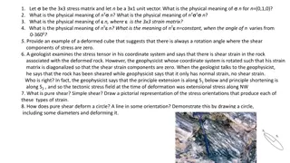
Understanding Strain and Stress: Concepts and Applications for Geologists and Geophysicists
This content delves into various aspects of stress and strain in the context of geology and geophysics, exploring the physical meanings of unit vectors, stress matrices, strain matrices, pure shear, simple shear, and their implications on deformation characteristics. It also discusses scenarios wher
0 views • 4 slides

