Understanding Mountain Building and Evolution of Continents
Mountain building, orogeny, and the formation of major mountain belts are key processes in the evolution of continents. This chapter delves into the geological mechanisms behind these phenomena, focusing on convergent boundaries, the American Cordillera, Alpine-Himalaya chain, and other significant mountain ranges like the Appalachians and the Urals. The text highlights the role of plate tectonics in mountain formation and the visual evidence of compressional forces. It also explores the features of subduction zones, volcanic arcs, and deep-ocean trenches created through convergent plate movements.

Download Presentation

Please find below an Image/Link to download the presentation.
The content on the website is provided AS IS for your information and personal use only. It may not be sold, licensed, or shared on other websites without obtaining consent from the author. Download presentation by click this link. If you encounter any issues during the download, it is possible that the publisher has removed the file from their server.
E N D
Presentation Transcript
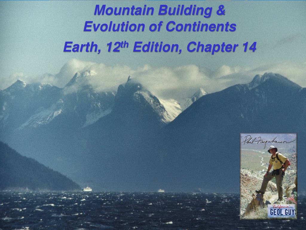
Mountain Building & Evolution of Continents Earth, 12thEdition, Chapter 14
Mountain Building Mountain building has occurred during the recent geologic past American Cordillera The Alpine Himalaya chain The mountainous terrains of the western Pacific Several other chains are Paleozoic in age The Appalachians The Urals in Russia These mountains are deeply eroded and topographically less prominent
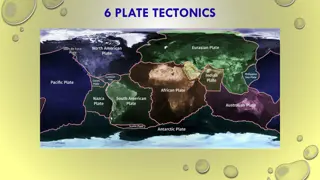
Mountain Building Orogenesis The process that collectively produces a mountain belt Mountains that display faulted and folded rocks are compressional mountains Display visual evidence of compressional forces Including metamorphism and some igneous activity Plate tectonics provides a model for orogenesis Earth's major mountains have formed along convergent plate boundaries
Convergence and Subducting Plates Major Features of Subduction Zones Volcanic arc Deep-ocean trench Forearc region Back-arc region
Convergence and Subducting Plates Volcanic Arcs The subducting slab partially melts the overlying mantle wedge Melt migrates upward through the overlying oceanic lithosphere and forms a growth called a volcanic island arc or island arc When the melt migrates through continental lithosphere, a continental volcanic arc is created
Convergence and Subducting Plates Deep Ocean Trenches Created when oceanic lithosphere bends as it descends into the mantle Trench depth is related to the age of the subducting lithosphere Old lithosphere is cold and dense Plates subduct at a steep angle, producing a deep trench Young lithosphere is warm and buoyant Plates subduct at a shallower angle and produce shallower trenches (if at all)
Convergence and Subducting Plates Forearc and Back-Arc Regions The forearc region is the area between the trench and the volcanic arc The back-arc region is located on the side of the volcanic arc opposite the trench Both regions consist of accumulated pyroclastic material and eroded sediments Tensional forces prevalent in these regions, causing stretching
Convergence and Subducting Plates Extension and Back-Arc Spreading Two plates converging, but not necessarily dominated by compressional forces When the subducting plate is cold, the plate sinks vertically as it descends along an angled path This causes the trench to roll back away from the overlying plate Consequently, the overlying plate is stretched Tension and thinning may initiate seafloor spreading, enlarging the back-arc basin
Subduction and Mountain Building Island Arc-Type Mountain Building Results from the steady subduction of oceanic lithosphere Continued growth can result in topography consisting of parallel belts of igneous and metamorphic rocks Just one phase in the development of mountain belts
Subduction and Mountain Building Andean-Type Mountain Building Subduction beneath a continent rather than oceanic lithosphere Associated with long-lasting magmatic activity and crustal thickening Exemplified by the Andes Mountains Starts with a passive continental margin Thick platform of shallow-water sedimentary rocks Eventually, the forces that drive plate tectonics change direction and a subduction zone forms Oceanic lithosphere must be dense enough to sink
Subduction and Mountain Building Andean-Type Mountain Building Building volcanic arcs As crustal rocks descend, water and volatiles are driven from the crustal rocks into the overlying mantle wedge These volatiles trigger the partial melting of ultramafic peridotite Generates mafic primary magmas which rise through the mantle wedge Magmas pool at the base on the continental crust Magmatic differentiation creates less dense magmas that rise through the crust
Subduction and Mountain Building Andean-Type Mountain Building Emplacement of batholiths Thick continental crust impedes the ascent of magma Most magma crystallizes underground as massive plutons called batholiths Eventually, uplift and erosion expose the batholiths Example: The Sierra Nevada in California Batholiths typically range from diorites to granites
Subduction and Mountain Building Andean-Type Mountain Building Development of an accretionary wedge An accretionary wedge is the accumulated sediments and scraped upper crust of the subducting plate plastered against the edge of the overriding plates Similar to soil and sediments being pushed by a bulldozer Prolonged subduction may thicken an accretionary wedge enough so that it protrudes above sea level Forearc basin The accretionary wedge acts as a barrier to sediment movement from the volcanic arc to the trench The region of relatively undeformed layers of sediment and sedimentary rock is called a forearc basin
Subduction and Mountain Building The Sierra Nevada, Coast Ranges, and Great Valley One of the best examples of features associated with an Andean-type subduction zone Features produced by the subduction of the Farallon Plate (part of the Pacific basin) under the western margin of California
Collisional Mountain Belts Cordilleran-Type Mountain Building Associated with the Pacific Ocean Highly likely that subduction zones will form island arcs which will eventually collide with a continental crust The collision and accretion of small slivers of continental crust form the mountainous regions that rim the Pacific Terranes (crustal fragments of exotic material) make up much of the western United States The nature of terranes Prior to accretion onto the continent, some terranes were microcontinents (similar to Madagascar) Other terranes were island arcs (similar to Japan)
Collision and Accretion of Small Crustal Fragments to a Continental Margin
Collision and Accretion of Small Crustal Fragments to Margin
Collisional Mountain Belts Accretion and orogenesis Small features on the ocean floor are subducted with the plate Large, buoyant features do not subduct These features are peeled off the subducting plate and accreted onto the continental crust Subduction continues on the other side of the crustal fragment The North American Cordillera Many terranes that make up the North American Cordillera were scattered through the eastern Pacific During the breakup of Pangaea, the Farallon plate began to subduct under North America Resulted in the piecemeal addition of crustal fragments to the western side of North America
Collisional Mountain Belts Alpine-Type Mountain Building: Continental Collisions Named for the Alps two continental masses collide The zone where two continents collide is called a suture Typically contains slivers of oceanic lithosphere May also include accreted terrane Most compressional mountains exhibit the deformation of a thick sequence of sedimentary rocks called a fold-and-thrust belt
Collisional Mountain Belts The Himalayas Collision began about 50 million years ago India collided with Asia following the subduction of oceanic lithosphere As Pangea fragmented, India moved rapidly northward Following the closing of the ocean basin, India docked into Eurasia Precambrian rocks of India resisted deformation while the younger crustal fragments of southeast Asia were highly deformed Followed by a period of uplift that raised the Tibetan Plateau
Continental Collision, the Formation of the Himalayas
Collisional Mountain Belts The Himalayas India is still moving northward Crust is shortening and thickening, accommodating some of this movement Much of the remaining penetration into Asia caused lateral displacement of large blocks of the Asian crust by continental escape The thick, cold slab of India has stayed essentially intact
Continental Collision, the Formation of the Himalayas
Continental Collision, the Formation of the Himalayas
Collisional Mountain Belts The Appalachians Of a similar origin to the mountains in the British Isles, Scandinavia, northwest Africa, and Greenland Formed from three main orogenic events that cumulated with the formation of Pangaea Taconic Orogeny Volcanic arc located east of North America was thrust over the continental block 450 million years ago The volcanic rocks and marine sedimentary rocks were metamorphosed and are exposed in New York
Collisional Mountain Belts The Appalachians Acadian Orogeny Continued closing of the ocean basin resulted in a micro- continent colliding with North America 350 million years ago Thrust faults, metamorphism, and granite intrusions are associated with this event Substantially added to the width of North America Alleghanian Orogeny Africa collided with North America 250 300 million years ago Material was displaced 250 km inland on North America Pangaea began rifting 180 million years ago Rift was eastward of the suture, leaving a remnant of Africa welded to North America
Fault-Block Mountains Continental rifting can produce uplift and the formation of mountains known as fault-block mountains Example: The Tetons of Wyoming
Fault-Block Mountains The Basin and Range Province One of the largest regions of fault-block mountains on Earth Located between the Sierra Nevada and the Rocky Mountains Extends N S roughly 3000 km, encompasses all of Nevada, portions of surrounding states, and a large part of New Mexico Tilting of faulted structures, called half-grabens, has produced nearly parallel mountain ranges that average 80 km in length Extension beginning 20 million years ago has stretched the crust twice its original width
Fault-Block Mountains The Basin and Range Province Two different theories of formation Following the subduction of the Farallon plate, the northwest movement of the Pacific plate produced tensional forces that have stretched the region 20 million years ago, the lower lithospheric mantle decoupled from the crust beneath the region This delamination resulted in the upwelling and lateral spreading of hot mantle rocks, producing tensional forces in the crust
Model for the Formation of the Basin and Range Province
What Causes Earth's Varied Topography? The Principle of Isostasy Less dense crust floats on top of the denser rocks of the mantle Isostasy is the concept of floating crust in gravitational balance Envision a series of different-sized floating blocks on water How is isostasy related to changes in elevation? If weight is added or removed from the crust, isostatic adjustment will take place as the crust subsides or rebounds Crustal rebound is present in Canada's Hudson Bay region following the melting of ice sheets in that region
What Causes Earth's Varied Topography? The Principle of Isostasy How high is too high? As mountains grow, gravity acts on the warm and weak rocks inside the mountains Eventually, the gravitational forces are so large that these rocks will flow laterally This ductile spreading and consequential subsidence is called gravitational collapse
What Causes Earth's Varied Topography? Mantle Convection: A Cause of Vertical Crustal Movement Uplifting whole continents Mantle plumes (superplumes) can elevate a region on continental crust Southern Africa has large-scale vertical motion Elevation is nearly 1500 m higher than would be expected for a stable craton
What Causes Earth's Varied Topography? Mantle Convection: A Cause of Vertical Crustal Movement Crustal subsidence Extensive areas of downwarping The slabs of oceanic lithosphere will detach from the trailing lithosphere A downward flow is created as the detached slab continues to sink, pulling down the crust into a basin structure Example: nearly circular basins in Michigan and Illinois