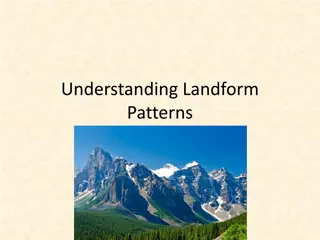
Understanding Earth's Landforms and Features

A detailed overview of Earth's landforms and features, including mountains, hills, plateaus, plains, peninsulas, archipelagos, and continents. Explore the characteristics and classifications of these natural phenomena through informative images and descriptions.

Download Presentation

Please find below an Image/Link to download the presentation.
The content on the website is provided AS IS for your information and personal use only. It may not be sold, licensed, or shared on other websites without obtaining consent from the author. Download presentation by click this link. If you encounter any issues during the download, it is possible that the publisher has removed the file from their server.
E N D
Presentation Transcript
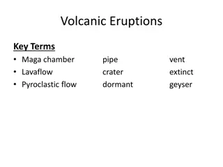
Earths Features Earth s Features
Landforms Natural features of the Earth s surface Classified by type to help people locate them
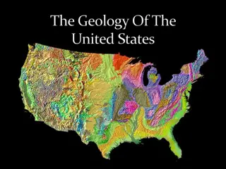
Continents 7 large landmasses 1. Asia largest 2. Australia smallest Some people consider Europe and Asia to be one continent (Eurasia) 1. divided by the Ural Mountains
Major landforms Mountains highest landform, steep slopes with a peak or summit Hills - lower than mountains, more rounded Plateaus higher than surrounding land, usually has one steep side (table top) Plains flat or gently rolling lands 1. Coastal plains have lower elevations 2. Interior plains have higher elevations Peninsula piece of land surrounded by water on 3 sides (Florida) Archipelago a group or chain of islands (Hawaii) Continental Shelf underwater extension of a continent
Mountains highest landform, steep slopes with a peak or summit
Hills lower than mountains, more rounded
Plateaus higher than surrounding land, usually has one steep side (table top)
Plains Flat or gently rolling lands Flat or gently rolling lands 1. Coastal plains have lower elevations 2. Interior plains have higher elevations
Peninsula Piece of land surrounded by water on 3 sides (Florida)
Archipelago A group or chain of islands (Hawaii) NASA satellite photograph of the Hawaiian islands of O ahu, Moloka i, L na i, Kaho olawe, and Maui (left to right)
Water Saltwater Most of the Earth s water is salty. Oceans 1. Pacific 2. Atlantic 3. Indian 4. Arctic Seas bodies of salt water smaller than oceans
Water Continued Freshwater Lake body of water surrounded by land Stream body of water flowing through land 1. Combine to form rivers 2. Rivers combine to form major waterways Groundwater freshwater that lies beneath the surface 1. main source comes from rain and melted snow 3% of world s water is fresh 2% trapped in glaciers .5% is groundwater .5% rivers and lakes
Water Continued Water cycle regular movement of water from ocean to air to ground back to ocean 1. Begins with evaporation changing of liquid water to gas
Earths Resources Earth s Resources
Managing resources Renewable resources can replace themselves 1. plants and animals Nonrenewable can t be replaced 1. iron and fossil fuels Recycle to reuse but can t replace Protecting 1. crop rotation 2. conservation
Distribution of resources Not distributed evenly Influences how countries relate to each other Scarcity has lead to trade 1. Japan imports raw material sells finished products Imports what a country brings in Exports what a country sends out
Summary Assignment: Create an Island Utilizing pages 34-35 of your textbook your task if you choose to accepted it .and you will .is to create your own island. You must include the following; Title: name your island (should be based around a theme) At least 20 landforms including the name of each. Legend with symbols/labels Latitude/Longitude Compass Rose Full Color