Enhancing Mountain Resilience through SDG Indicator 15.4.2

Fabio Parisi, a dedicated member of the Mountain Partnership Secretariat at FAO, has been actively involved in developing and updating the Mountain Green Cover Index for SDG Indicator 15.4.2. His educational background in crisis and security management, along with a passion for volunteer work in refugee shelters, reflects a well-rounded individual committed to sustainable development and environmental conservation in mountain regions.
- Mountain Resilience
- SDG Indicator
- Sustainable Development
- Crisis Management
- Environmental Conservation

Download Presentation

Please find below an Image/Link to download the presentation.
The content on the website is provided AS IS for your information and personal use only. It may not be sold, licensed, or shared on other websites without obtaining consent from the author. Download presentation by click this link. If you encounter any issues during the download, it is possible that the publisher has removed the file from their server.
E N D
Presentation Transcript
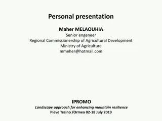
Personal presentation Fabio Parisi Mountain Partnership Secretariat fabio.parisi@fao.org IPROMO Landscape approach for enhancing mountain resilience Pieve Tesino /Ormea 02-18 July 2019
Education Master of Science in Crisis and Security Management, Leiden University, The Hague, Netherlands Focus on crisis management / security studies / human rights law 2015 - 2016 Bachelor in Crisis and Security Management, Universit degli Studi di Roma Tre, Rome, Italy Focus on international relations / international law / international economy 2011 - 2014 Employment and main activities Mountain Partnership Secretariat, FAO, Rome, Italy Work on the SDG Indicator 15.4.2: the Mountain Green Cover Index Developement and update the indigenous mountain peoples database Since 2017 2016 - 2017 Freelance Research, CLEVIS Research, Berlin, Germany Market research
Other interests (volunteer work, hobbies etc.) Volunteer work: Refugee Shelter Baobab , Rome, Italy Organization and coordination of the arrival of refugees to the shelter, assisting in travel arrangements organization of weekly events and activities for the integration of the refugees in the local community. 2015 Local committee Miriam Mafai , Rome, Italy Participation in several political campaigns at city and national level Coodination of the work carried out by the association. Organization of events for the local community 2012 - 2014 Personal Interests: Rock climbing, hiking, cooking, performance art
SDG Indicator 15.4.2: The Mountain Green Cover Index SDG 15 (Life on Land): Protect, restore and promote sustainable use of terrestrial ecosystems, sustainably manage forests, combat desertification, halt and reverse land degradation, halt biodiversity loss By 2030, ensure the conservation of mountain ecosystems, including their biodiversity, to enhance their capacity to provide benefits essential for sustainable development TARGET 15.4 2016: Mountain Green Cover Index (SDG Indicator 15.4.2) adopted as one of the official indicators for target 15.4 Developed by FAO Mountain Partnership Secretariat in cooperation with other FAO teams In 2017, the methodology is accepted internationally and a baseline is built
SDG Indicator 15.4.2: Definition, Rationale, Calculus SDG Indicator 15.4.2 Mountain Green Cover Index: measures the changes of green vegetation and land cover in mountain areas - i.e. trees, shrubs, grassland, cropland, wetland, settlements, other land (IPCC) to monitor progress on the mountain target. There is a direct correlation between the green coverage of mountain areas and their state of health, and as a consequence their capacity of fulfilling their ecosystem roles. ????? ????? ???? ????? ???????? ???? ???????? ????? ????? ????? = The index has a range from 0 to 1, where 0 indicates no green vegetation and 1 indicates that the entire area is covered by green vegetation.
SDG Indicator 15.4.2: Methodology Mountains are classified according to the UNEP-WCMC Classification (Kapos) Land Cover Classess follow the IPCC Classification Green Cover Classes = Forest Land; Cropland; Grassland-Shrubland Other = Other Land; Wetlands; Settlments Data is collected and analyzed using Collect Earth, a software application developed by FAO and Google for land cover/use assessments 120,000 sampling plots have been collected and assessed in mountain areas Global accuracy is 99% It decreases at country level
Thank for your attention!


")