ICAR KRISHI Geo-Portal: Spatial Agricultural Research Information
ICAR KRISHI Geo-Portal is a digital platform aiming to facilitate spatial agricultural data generation, compilation, visualization, and analysis. It hosts spatial databases, provides map services, and allows data sharing across platforms. The portal, developed using open-source technologies, offers features like handling various types of spatial data, district boundary overlays, and user data uploading capabilities.

Download Presentation

Please find below an Image/Link to download the presentation.
The content on the website is provided AS IS for your information and personal use only. It may not be sold, licensed, or shared on other websites without obtaining consent from the author. Download presentation by click this link. If you encounter any issues during the download, it is possible that the publisher has removed the file from their server.
E N D
Presentation Transcript
KRISHI: ICAR GEO-PORTAL Spatial Agricultural Research Information http://krishi.icar.gov.in/geoportal 4-Aug-2015, NASC, New Delhi
Background One of the Six Research Data Repositories of ICAR KRISHI Portal Aims to provide a digital platform in public domain to - to facilitate generation and compilation of data of agriculture having spatial context - to store/host spatial database generated in NARS - to provide visualization of spatial data as maps with contextual attributes - to assimilate existing spatial agricultural data from other sources - to provide tools for analysis of spatial data - to allow spatial data access and sharing to clients across platform and GIS flavours - strengthen in-house technical capabilities
Status Version 1 (beta) is online http://krishi.icar.gov.in/geoportal Some of the spatial layers finalized and made online Configured on ICAR Data Centre at IASRI Version 2 with enhanced capabilities under development http://14.139.56.74:8080/geoexplorer/ Available on development server at IARI
Technologies Used Open source technologies Total in-house development Server Side Linux (Redhat ver. 6.x) Apache http server (ver 2.4) Apcahe Tomcat server (ver 7.0.6) Programming Language: PHP (ver 5.4) Geoserver (ver 2.6) : provide WMS service Database Engine: MySql, PostGIS Client Side JavaScript OSM (Open Street Layer) Open Layers HTML, CSS, Jason CMS: Joomla
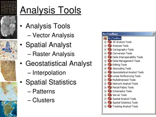
GeoPortal Features Handles all type of spatial data Vector ( point, line, polygon), Raster, Quadtree Highly configurable due to Open Source technologies Extended functionalities Compatibility across platforms Provides Web Map Services (WMS) Overlay State and district boundaries on any map Open Source Base layer till street level details Provision for users to upload their data directly to Geoportal
Geo-Portal Ver 2.0 Live on: http://14.139.56.74:8080/geoexplorer/ An updated interface Two panels: Map Window panel, Layer panel Geoportal Toolbar and Map Window Toolbar Display of Layer Properties, Metadata and Layer Styles Selection of map scale Selection of base layers: OpenStreetMaps, Bing, Google Overlay of Map Layers: Order and Transparency Enhanced Query: Map extent and Map attributes Add WMS (Web Map Service) Layers from remote Geoservers
Map Toolbar Butt on Name Description Switch to 3D Viewer Changes map view to 3D. Requires the Google Earth browser plugin. Pan the Map Window by click and drag (enabled by default). Shift, click, and drag together zooms in to a user-defined extent. Pan map Zoom by dragging a box Zoom to user-defined extent Zoom in Increases the zoom level by one Zoom out Decreases the zoom level by one Zoom to previous extent Returns to the previous map extent Zoom to next extent Returns to the next map extent (activated only after using Zoom to previous extent) Zoom to max extent Zooms to the maximum extent of all layers
Geoportal Toolbar Button Name Description About ICAR Displays information about the ICAR Geoprtal application Publish map Composes a map application based on the current Map Window and generates HTML code to embed the application into a web page. Saves the current Map Window composition and generates a URL to revisit the current configuration. Requires Login to local GeoServer. Save map Print Creates a PDF of the current Map Window composition Displays feature information (attributes) for the feature at a user-defined location in the Map Window Identify Measure Measures distance or area in the Map Window Queries the selected layer. Options are Query by current map extent and Query by attributes. Query Creates a new feature in the selected layer. Works with vector overlay layers only and requires Login to local GeoServer. Create Edits an existing feature in the selected layer. Works with vector overlay layers only and requires Login to local GeoServer. Modify Login to local GeoServer (if available) for creating and editing features and style settings Login
Way Forward Practice and sensitize Data Openness . Identify Spatial Data of your Subject Matter / Commodity Generated in your institutes, Generated in allied institutes Available in public domain Identify Tabular Data with spatial context Current Historical Digitization / reformatting of identified data Be meticulous in generating Metadata of spatial data Now on always generate data with precise Geolocation Experimental, Observational, Survey Be an active partner of team KRISHI
Thank You sehgal@iari.res.in vksehgal@gmail.com Acknowledgements DDG(NRM), ADG(SWM), DIR(IASRI), DIR(IARI), DIR(NBSS) Dr R. Prasad, Dr O. Reddy, Dr A. Dhandapani, Dr A.K. Choubey Mr R. Verma, Mr Subhash Mr Ashish Tiwari, Ms Priyanka, Ms Malti
Issues Procurement of base layer data from Survey of India Open Source vs Commercial Geoserver How many concurrent users to be served? Redundancy of Geoportal Security of Data Availability of Data to ICAR users / General users Disclaimer about boundaries, geolocation, administrative boundaries etc.
http://bhuvan5.nrsc.gov.in/bhuvan/wms http://14.139.56.74:8080/geoexplorer/