Terrestrial ECVs: Fire, Land Cover, Soil Moisture Overview
Detailed examination of Terrestrial Essential Climate Variables (ECVs) focusing on fire monitoring, land cover analysis, and soil moisture assessment. The information encompasses product summaries, error characterization methods, outreach efforts, user statistics, planned activities for phase 2, and cross-ECV activities like fire risk assessment and emissions evaluation.
- Terrestrial ECVs
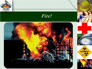
- Fire Monitoring
- Land Cover Analysis
- Soil Moisture Assessment
- Environmental Monitoring

Download Presentation

Please find below an Image/Link to download the presentation.
The content on the website is provided AS IS for your information and personal use only. It may not be sold, licensed, or shared on other websites without obtaining consent from the author. Download presentation by click this link. If you encounter any issues during the download, it is possible that the publisher has removed the file from their server.
E N D
Presentation Transcript
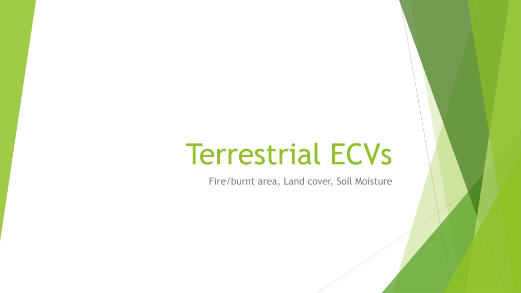
Terrestrial ECVs Fire/burnt area, Land cover, Soil Moisture
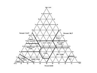
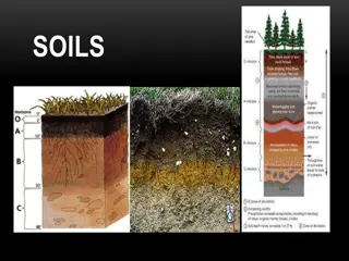
Product summaries BA: Pixel product: monthly, MERIS resolution, date of detection, 2006-2008 Grid product: 15 day, 0.5x0.5 , 2006-2008 LC: 3 epochs centred around 2000, 2005, 2010 Including land surface condition climatology: NDVI, Burnt area, snow cover Water bodies mask based on ASAR MERIS surface reflectance SM: 2 versions released, 3rd version in internal reviw (release Dec 2015) 3 products: active, passive, combined, based on 9 MW sensors 1978-2014
Error characterisation Innovative ways for QA are being explored: BA: Probabilistic description of uncertainty LC: 19 experts each dealing with ~200 points, cross-walking uncertainty SM: signal-to-noise ratio as error metric
C3S, H2020 + outreach C3S: No one really knows, but everyone is giving best effort to get prepared FP7/H2020: used in various FP7 projects and various H2020 proposals submitted for all ECVs Several national projects and initiatives International and national activities: BA: GOFC-GOLD; USGS ECV LC: GOFC-GOLD SM: GEWEX GDAP, BAMS StoCl [Dorigo et al., 2015, BAMS State of the climate in 2014]
User statistics Many users of LC (750) and SM (1700) but also large potential for BA (>300 of GFED)
Planned activities phase 2 Various product updates BA (2): longer time series (2000-2017): full MERIS record, MODIS, OLCI; fire database for Africa (landsat-8, Sentinel-2, Sentinel-1 LC: Epoch 2015, based on PROBA-V & Sentinel-3 Epoch 1992-93, based on AVHRR used for IGBP DISCover Change product back to 1982, based on AVHRR GIMMS Seasonal water bodies product Sentinel-2 over Africa SM: 3 updates Yearly extensions Integration of new sensors: SMOS, MEtOp-B, FengYun dataset
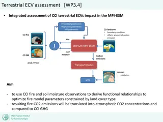
Cross-ECV activities BA: Fire risk assessment with SM and LST BA: Fire emissions: GHG,Ozone, aerosol BA: deforestation fires: LC BA : LC maps included in gridded BA layers LC: include soil moisture climatology ? LC : BA to be averaged as land surface seasonality component SM: fire risk ?
Common issues Common input datasets -> strive for consistency MERIS: BA and LC sharing most of the processing chain Sentinel 1: BA, LC, SM Sentinel 2: BA, LC Common water mask (LC) Need to establish cloud platforms that enable cooperation: