Top Drone Solutions Companies
In recent years, the world has witnessed the rapid rise of a revolutionary technology that is reshaping the way we live, work, and interact with our environment: drones. Unmanned aerial vehicles, commonly known as drones, have evolved from mere gadgets to powerful tools with vast potential across a
2 views • 5 slides
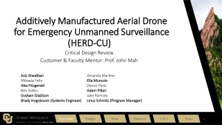
AMADEUS - Additively Manufactured Aerial Drone for Emergency Unmanned Surveillance
AMADEUS aims to provide a low-cost, high-endurance, human-portable, and rapidly deployable unmanned aerial system (UAS) for various missions in challenging environments. Designed for aerial surveillance, search and rescue operations, and more, it features functional and driving design requirements t
0 views • 178 slides
Aerial Rod, Multiple Point, Terminal Base, Electrolytic Copper Air Rod,
Nexus Metal & Alloys is a leading manufacturer, exporter and supplier of Aerial Rod, Multiple Point, Terminal Base, Electrolytic Copper Air Rod, Lightning Protection Accessories at very cheap prices for our clients from Mumbai, India.
3 views • 2 slides
TEAM SEVEN CRITICAL DESIGN REVIEW.
During the critical design review, Team Seven presented their project purpose, objectives, and key elements related to developing an energy-efficient unmanned aerial system (UAS). The project aims to improve mission endurance, reduce user workload, and enhance communications in remote areas. By focu
1 views • 80 slides
Coastal Monitoring and Lessons Learned in Southwest England
Southwest England's coastal monitoring efforts, including the South West Coastal Monitoring program and lessons learned from the destruction of Hallsands in 1917 due to lack of understanding of coastal processes. The monitoring involves data collection on beach profiles, bathymetry, wave patterns, a
4 views • 15 slides
Drone Detection Using mmWave Radar for Effective Surveillance
Utilizing mmWave radar technology for drone detection offers solutions to concerns such as surveillance, drug smuggling, hostile intent, and invasion of privacy. The compact and cost-effective mmWave radar systems enable efficient detection and classification of drones, including those with minimal
0 views • 8 slides
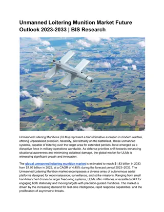
Unmanned Loitering Munition Market Future Outlook
The global unmanned loitering munition market is estimated to reach $1.83 billion in 2033 from $1.06 billion in 2022, at a CAGR of 4.45% during the forecast period 2023-2033.\nRead Report Overview: \/\/bisresearch.com\/industry-report\/unmanned-loitering-munition-market.html
1 views • 3 slides
Navy Modeling and Simulation Office Open House 2023 Overview
The UNCLASSIFIED Opening Remarks at the Navy Modeling and Simulation Office's Open House 2023 highlight the need for innovation and agility in computational technology. Emphasizing the importance of Don M&S Vision and Engineering Initiatives, the event focuses on leveraging advanced technologies lik
1 views • 8 slides
Successful Integration of Phoenix Systems for Improved Aerial Performance
Phoenix Systems, led by Michael Mann, successfully integrated the NexGen system and AMS into new airplanes, enhancing operational life and system versatility. Key updates include new motors, controllers, enhanced orthorectification, satellite communications, and cryocooler advancements. These improv
1 views • 13 slides
Drone Team Operations and Regulations Overview by Duluth Police Department
The Duluth Police Department operates a Small Unmanned Aerial System (SUAS) Drone Team regulated by FAA and Minnesota State Statute 626.19. The team follows strict FAA regulations, state statutes, and departmental policies for SUAS operations. Compliance with search warrant requirements, restricted
0 views • 23 slides
Adaptations of Flying Mammals and Fish for Aerial Life
Explore the fascinating adaptations of flying mammals like Pteropus, commonly known as flying foxes, and flying fish like Exocoetus for their arboreal and aerial lifestyles. From modified wings to unique habitats, discover how these creatures have evolved for flight and survival in their environment
2 views • 16 slides
Enhancing Earthwork Volumetric Calculations with UAV Technology
Explore the comparative study on utilizing Unmanned Aerial Vehicles (UAVs) for earthwork volumetrics in engineering applications. Discover the benefits, global interests, reasons for UAV popularity, civilian applications, and the evolution of technology in this field. Streamline volumetric calculati
1 views • 14 slides
Exploring Challenges and Opportunities in Adopting a Drone Program
Exploring the complexities involved in establishing a drone program, this content discusses public perceptions, realities, policy considerations, partnerships, board approvals, liability concerns, justifications, and the process of obtaining a Certificate of Authorization. It delves into issues such
1 views • 22 slides
Geographical Skills: Aerial Photographs, Charts, Graphs and Infographics
Aerial photographs are key tools for interpreting land surfaces, with vertical and oblique types used for different perspectives. Locating places on photographs involves dividing them into sections and understanding directions. Sketching aerial photographs requires creating a frame and dividing sect
0 views • 30 slides
RALPHIE Testing Readiness Review Overview
RALPHIE is a project aiming to enhance the endurance of small Unmanned Aerial Systems by developing an autonomous flight controller. The project involves meeting FAA requirements, creating a cost-effective solution, and implementing critical project elements. Levels of success are categorized into d
0 views • 59 slides
Unmanned Aerial System Market Analysis by 2033
The global unmanned aerial system (UAS) market is estimated to reach $72.42 billion by 2033 from $18.10 billion in 2023, growing at a CAGR of 14.87% during the forecast period 2023-2033.\n\nRead Report Overview: \/\/bisresearch.com\/industry-report\/
1 views • 4 slides
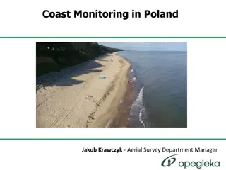
Remote Sensing Coast Monitoring in Poland - Aerial Survey Insights
Explore the comprehensive process of remote sensing coast monitoring in Poland, covering data collection specifics, UAV utilization, sea level navigation requirements, ALS data accuracy, image data details, and the role of Jakub Krawczyk as the Aerial Survey Department Manager. Get insights into the
0 views • 27 slides
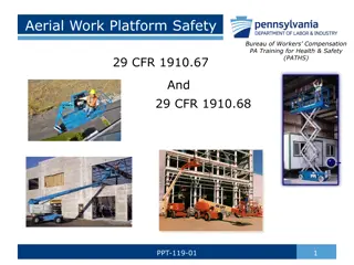
Aerial Work Platform Safety Training Guidelines
A comprehensive overview of aerial work platform safety guidelines providing insights on operator training requirements, inspection protocols, maintenance needs, and statistics on aerial lift incidents such as falls, tip-overs, and electrocutions. Emphasizes the importance of qualified personnel for
0 views • 29 slides
Overview of Aerial Lift Testing Per ANSI 92.2-2009 Standards
This presentation by Nathan Personius, a Sales Engineer at High Voltage, Inc., provides an introduction to aerial lift testing as per ANSI 92.2-2009 standards. It emphasizes the importance of referencing ANSI standards for dielectric testing of bucket trucks and aerial lifts while highlighting key p
0 views • 44 slides
Spectrum Allocations for RPAS C2 Links and ITU-R Resolution 155 Status Update
This content delves into the spectrum allocations for RPAS C2 links to facilitate safe operation in non-segregated airspace, covering the background, regulatory considerations, technical aspects, and updates from ITU-R Resolution 155. It highlights the identified frequency allocations for different
0 views • 24 slides
IPO of IdeaForge Technology Ltd.: Leading Indian UAS Market Pioneer
IdeaForge Technology Ltd. is a top player in the Indian unmanned aircraft systems market, boasting a 50% market share in 2022. With a strong product portfolio, the company aims to utilize IPO proceeds for debt repayment, working capital, product development, and general purposes. Recognized globally
0 views • 9 slides
Workshop on Drones: Joint Authorities for Rulemaking of Unmanned Systems
This workshop on drones, led by Eric Sivel, the Chairperson of JARUS, focuses on establishing technical, safety, and operational requirements for certifying and integrating UAS into airspace. JARUS comprises experts from various countries collaborating to recommend guidelines and deliverables toward
0 views • 22 slides
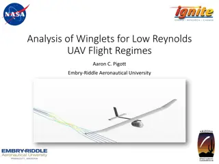
Analysis of Winglets for Low Reynolds UAV Flight Regimes
This study focuses on the analysis and optimization of winglets for low Reynolds number Unmanned Aerial Vehicles (UAVs). It covers the importance of winglets in reducing induced drag, the design considerations, meshing models, and the results obtained. The research aims to enhance the performance an
0 views • 14 slides
Exploring the Role of Drones in Agriculture
Discover the various functionalities of drones in agriculture, from aerial surveying of crops to inspection of power lines and pipelines. Learn about the different uses of drones beyond traditional applications, including search and rescue missions, acrobatic aerial footage, and wildlife counting. E
0 views • 12 slides
Overview of UAVs and UAS: Opportunities, Issues, and Policy Developments
Unmanned Aerial Vehicles (UAVs) and Unmanned Aerial Systems (UAS) offer a wide range of opportunities and applications, from military missions to commercial use. Recent policy developments in the US, including funding for research and guidelines for UAV operation, aim to promote the adoption of dron
0 views • 13 slides
Compact Aerial Photogrammetry System (CAPS) with VTOL Drone
Developing a Compact Aerial Photogrammetry System (CAPS) utilizing a fixed-wing VTOL drone equipped with cameras and GPS for generating georeferenced maps of large areas. The system combines drone versatility with advanced image analysis, enabling aerial assessments and coherent change detection. Pr
0 views • 18 slides
Application of STPA on Small Drone Operations: A Benchmarking Approach
This study focuses on the application of the System Theoretic Process Analysis (STPA) methodology to identify hazards and safety requirements for small drone operations. It addresses the lack of a uniform regulatory framework for unmanned aircraft systems, especially for light drones, and explores t
0 views • 21 slides
University of California UAS Safety Management System Overview
Explore the University of California's UAS Safety Management System, led by Brandon Stark, Director of the Unmanned Aircraft System Safety Center of Excellence. Discover the existing UAS activities within the UC system, common UAS vocabulary, services provided by the Center of Excellence on Unmanned
0 views • 52 slides
Cutting-Edge Robotics: Black-I Robotics Innovations
Black-I Robotics, led by CEO Brian Hart, is a technology-focused company specializing in unmanned ground vehicles and mobile manipulators. Their flagship product, the Landshark Robotic Arm, is a powerful electric arm designed for manipulating artillery shells and disrupting improvised explosive devi
0 views • 28 slides
Understanding Remote Identification of Unmanned Aircraft: Compliance Methods
The Final Rule on Remote Identification of Unmanned Aircraft introduces compliance methods for the model aircraft community to fly safely in national airspace. Explore the three ways to comply, including Standard Remote ID, Broadcast Modules, and FAA Recognized Identification Areas. Learn about regi
0 views • 11 slides
Learning-Based Path Planning for Aerial Multi-View Stereo Reconstruction
This project focuses on view selection and path planning to capture high-quality aerial images using drones for 3D reconstruction. The approach involves exploring scene geometry, generating trajectories, and optimizing image capture within travel constraints. Learning-based methods are preferred ove
0 views • 24 slides
Understanding 3D Information in Computer Vision
Exploring the importance of estimating 3D information in computer vision applications, such as perspective camera models, stereo vision, and the transition from 2D to 3D representations. It discusses the need for detailed 3D data for tasks like object manipulation, obstacle detection for unmanned ve
0 views • 118 slides
Comprehensive Guide to Scaffolds and Aerial Lift Safety
Explore different types of scaffolds like pole, tube and coupler, needle beam, and two-point adjustable scaffolds. Learn about aerial lifts, hazards associated with them, and safety measures to prevent injuries. Stay informed to ensure construction site safety.
0 views • 25 slides
Innovative Technologies for Challenging Environments
Developing advanced technologies to address customer challenges in tough environments, the company focuses on photonics, navigation systems, acoustics, motion systems, and sea operations. They offer specialty fibers, photonic components, inertial systems, acoustic positioning solutions, and a range
0 views • 14 slides
Underwater Light Communications in November 2017
Discusses the advantages of light communications (LC) for underwater use, such as high data rate, low latency, and cost-effectiveness. Contrasts LC with acoustic and RF methods, highlighting benefits and limitations. Explores use cases including communication between submarines, divers, oil platform
0 views • 5 slides
Remote Sensing and GIS Applications in Photogrammetry: Understanding Scale Variations
Exploring the fundamental principles of photogrammetry in remote sensing and GIS applications, this content delves into the science of measurements from aerial photographs. It discusses the implications of scale differences on maps and aerial photographs, emphasizing the variations in scale due to t
0 views • 19 slides
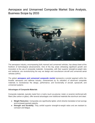
Aerospace and Unmanned Composite Market
The global aerospace and unmanned composite market represents a pivotal segment within the broader aerospace and defense industry, characterized by its utilization of advanced composite materials to revolutionize the design, performance, and function
1 views • 3 slides
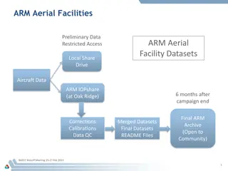
ARM Aerial Facilities Data Management Instructions
ARM provides comprehensive guidelines for managing and sharing aerial facility data, including data collection, processing, and accessibility for the scientific community. The process involves automatic collection, processing, and ingest of data to meet ARM-approved standards, with options for data
0 views • 6 slides
Sub Working Group Conclusions on Various Spectrum Interference Analyses
The draft report highlights conclusions from different sub working groups regarding spectrum interference analyses in various sectors like aeronautical telemetry, small unmanned aerial systems, air combat training systems, and precision guided munitions. It discusses feasibility challenges, separati
0 views • 7 slides
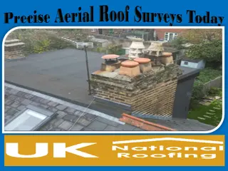
Precise Aerial Roof Surveys Today
Discover the efficiency of Aerial Roof Surveys for accurate inspections. Using advanced drone technology, we provide detailed visuals of roof conditions, saving time and ensuring safety. Perfect for identifying damages or assessing maintenance needs,
1 views • 5 slides
