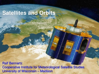
Satellites and Orbits
The realm of satellites and orbits, covering topics such as Kepler's Laws, meteorological satellite orbits, the history of satellite remote sensing, and different types of orbits including geostationary and sun-synchronous orbits. Explore the significance of inclination angles, orbital speeds, and d
3 views • 22 slides
Maximize Success S2000-013 IBM Cloud Satellite v1 Specialty Mastery
Elevate your career with success in the S2000-013 exam. Master the IBM Cloud Satellite v1 Specialty with comprehensive study materials, practice tests, and expert guidance. Prepare effectively for the IBM Cloud Satellite v1 Specialty exam and gain the skills and knowledge necessary to excel in cloud
1 views • 6 slides
Resources for Satellite Data and Imaging Enthusiasts
Explore a plethora of guides, builds, and software tools tailored for satellite data and imaging enthusiasts. Discover user groups, forums, and decoding solutions to enhance your experience in working with signals and files from GOES satellites. Vitality GOES offers a new way to access and interpret
0 views • 9 slides

Challenges and Opportunities in Satellite Connectivity Systems
Satellite connectivity systems face challenges such as handset emissions, limited bandwidth, and interference issues, but also present opportunities for innovative technologies like high-gain systems and phased array antennas. The European Union's MSS S-band spectrum allocation in 2009 is a notable
0 views • 10 slides
International Regulatory Framework for Non-Geostationary Satellite Systems
Understanding the international regulatory framework for non-geostationary satellite systems, including coordination for protection of existing services, spectrum access/use laws, satellite frequencies and services, and mechanisms for protecting geostationary satellite orbits. The regulations aim to
2 views • 17 slides

Satellite Communications Support for Enhanced Emergency Communications
Providing support for enhanced emergency communications through mobile and fly-away satellite systems. These systems offer cellular-based WiFi, satellite-based WiFi, and voice over IP phone numbers for use during communication disruptions. Satellite airtime is provided at no cost to TxDOT through th
2 views • 4 slides
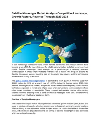
Satellite Messenger Market Analysis & Revenue Through 2023-2033
The\u00a0global satellite messenger market\u00a0is estimated to reach $2,858.7 million by 2033 from $830.9 million in 2023, at a growth rate of 13.15% during the forecast period 2023-2033.\nRead Report Overview: \/\/bisresearch.com\/industry-report\/satellite-messenger-market.html
4 views • 3 slides
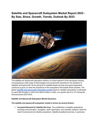
Satellite and Spacecraft Subsystem Market Size, Share, Growth, Trends, Outlook By 2033
The global satellite and spacecraft subsystem market based on satellite subsystem is estimated to reach $54.55 billion in 2033 from $29.43 billion in 2022, at a growth rate of 4.11% during the forecast period 2023-2033.\nRead Report Overview: \/\/bisresearch.com\/industry-report\/satellite-spacecraf
1 views • 3 slides
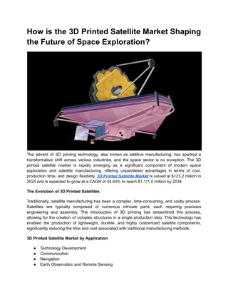
How is the 3D Printed Satellite Market Shaping the Future of Space Exploration?
3D Printed Satellite Mark is valued at $123.2 million in 2024 and is expected to grow at a CAGR of 24.60% to reach $1,111.0 million by 2034.\nRead Report Overview: \/\/bisresearch.com\/industry-report\/3d-printed-satellite-market.html
1 views • 3 slides
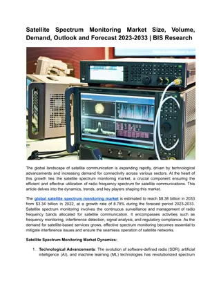
Satellite Spectrum Monitoring Market Outlook and Forecast 2023-2033
The global satellite spectrum monitoring market is estimated to reach $5.14 billion in 2031 from $2.55 billion in 2021, at a growth rate of 7.24% during the forecast period.\nRead Report Overview: \/\/bisresearch.com\/industry-report\/satellite-spectrum-monitoring-market.html
1 views • 3 slides
Understanding Global Navigation Satellite Systems (GNSS) in Geospatial Data for Public Health
Explore the key terms such as accuracy, GLONASS, GPS, precision, scale, and more in this session on GNSS technology. Understand how GNSS works, the constellation of satellites involved, and the different satellite navigation systems like GPS, GLONASS, BeiDou, and Galileo that provide autonomous geo-
6 views • 23 slides
The Drought Toolbox and Satellite Technology Overview
The Drought Toolbox is a comprehensive initiative aimed at enhancing drought preparedness and resilience through the implementation of various technical and policy tools. It covers modules such as drought monitoring, vulnerability assessment, and risk mitigation, providing stakeholders with essentia
0 views • 30 slides

Exploring Satellite Orbits and Space Missions
This content covers a variety of topics related to satellites, including geosynchronous orbit, satellite history, organisms sent to orbit, types of orbits, orbital altitudes, and current satellite usage. It delves into the history of satellite launches, types of orbits, and the functions of satellit
0 views • 20 slides
Investigating FUNcube Satellite and Space Environment
FUNcube satellite, a small satellite equipped with solar panels, batteries, and communication antennas, operates above Earth's atmosphere to collect and relay data through radio communication. By analyzing the telemetry graphs produced by the satellite, tasks include determining the time taken for o
0 views • 9 slides

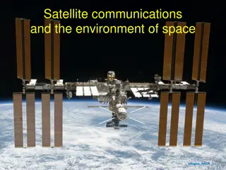
Principles of Satellite Communications in Engineering
Explore the history and fundamentals of satellite communications, including the evolution from the first artificial satellite, Sputnik, to modern active and passive satellite systems. Learn about communication via satellites as microwave repeater stations, bridging distances and optimizing frequenci
0 views • 13 slides
Systematic Comparison of Ground-Based and Satellite Measurements using TOVS and Radiosonde Data
This work discusses the systematic comparison of ground-based and satellite measurements using TIROS Operational Vertical Sounder (TOVS) and radiosonde data. The study focuses on spatial sampling, time coverage, and data resolution challenges, with comparisons at daily and station levels. Supported
0 views • 13 slides
Understanding Orbital Altitudes and Satellite Services
Explore the fascinating realm of orbital altitudes and satellite services, including the differences between Low Earth Orbit (LEO) and Geostationary Earth Orbit (GEO). Learn about the physics behind satellite trajectories and how services like Starlink and Skymuster provide unique communication solu
0 views • 35 slides
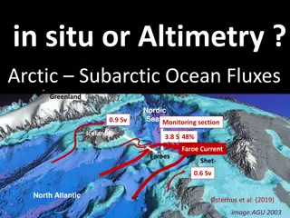
Monitoring Faroe Current Transport with Satellite Altimetry and In-situ Observations
Combining satellite altimetry and in-situ observations offers a comprehensive approach to monitoring volume, heat, and salt transports in the Faroe Current. The study focuses on the representativeness of ocean observations in the Arctic and Subarctic regions, highlighting the importance of combining
0 views • 11 slides
Development of Satellite Passive Microwave Snowfall Detection Algorithm
This study focuses on the development of a satellite passive microwave snowfall detection algorithm, highlighting the challenges in accurately determining snowfall using satellite instruments. The algorithm uses data from AMSU/MHS, ATMS, and SSMIS sensors to generate snowfall rate estimates, overcom
0 views • 20 slides
Evaluation of Soil Moisture Estimates from Satellite-Based Products
The study evaluates soil moisture estimates from satellite-based products over two network regions. Soil moisture is crucial for the hydrological cycle, necessitating continuous monitoring due to its spatial and temporal variability. Remote sensing is utilized to gather information without physical
0 views • 5 slides
Advancing Satellite Data Integration for Environmental Analysis
The Joint Center for Satellite Data Assimilation (JCSDA) operates as a multi-agency research center aimed at enhancing the use of satellite data for weather, ocean, climate, and environmental analysis. Organized under key projects like JEDI and CRTM, JCSDA focuses on algorithm development and observ
0 views • 33 slides
Overview of Satellite Communication Sub-systems in ECE 5233: Satellite Communications
This content provides insights into satellite communication sub-systems such as transponders, antenna systems, and frequency plans. It covers topics like double conversion transponders, regenerative transponders, and examples of frequency allocation in satellite transponders. The detailed block diag
0 views • 10 slides
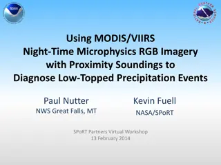
Diagnosing Low-Topped Precipitation Events Using Satellite Imagery
Utilizing MODIS/VIIRS Night-Time Microphysics RGB Imagery combined with Proximity Soundings can enhance situational awareness and aid in diagnosing low-topped precipitation events. Various satellite images and data sources are analyzed to understand why heavy rain occurred in Havre, MT, despite mini
0 views • 17 slides
Policy and Regulatory Guidelines for Satellite Services
National spectrum management involves governments controlling radio use within their jurisdiction through agencies known as administrations. The International Telecommunication Union (ITU) serves as a global forum for spectrum consultation. Policy-making bodies such as the Federal Communications Com
0 views • 41 slides
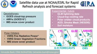
Satellite Data Use at NOAA/ESRL for Rapid Analysis and Forecast Systems
This content discusses the utilization of satellite data at NOAA/ESRL for rapid analysis and forecast systems, focusing on various data products and decision-making processes for new data inclusion. It highlights the importance of testing, reliability, resources needed, ongoing/future needs, and com
0 views • 5 slides
Satellite System Design Considerations and Applications
Satellite system design involves various technical considerations such as optimal modulation, coding schemes, and service types. Positioning satellites in orbit faces challenges like frequency and orbit selection. Satellite limitations include high initial investments and spectrum crowding. However,
0 views • 32 slides
Understanding Broadband Communication Systems and Satellite Communications
Broadband communication systems involve the use of satellites for various applications such as TV services, data services, and communication with ships and aircraft. This content delves into orbital mechanics, the gravitational forces in satellite orbits, as well as the orbital heights and velocitie
0 views • 57 slides
Understanding Satellite Communications and Its Advantages
Satellite communications play a crucial role in allowing two Earth stations to communicate through a relay satellite. This method offers various advantages such as extended coverage area, independent transmission cost, precise communication, and higher bandwidth availability. Despite its benefits, s
0 views • 20 slides
Understanding Different Types of Satellite Communication Orbits
Explore the various types of satellite communication orbits, including Geostationary Earth Orbit (GEO), Low Earth Orbit (LEO), Medium Earth Orbit (MEO), and Highly Earth Orbit (HEO). Learn about the advantages and disadvantages of each orbit in relation to satellite communication technologies.
0 views • 8 slides

Satellite Products for Aviation Remote Sensing Needs in High Latitudes
Addressing the specific needs of aviation remote sensing in high latitudes, this content explores the importance of satellite products, variations in equipment requirements, data expectations, and the significance of cloud products for aviation safety. Feedback from aircraft operators emphasizes the
0 views • 8 slides
Satellite Technology in Meteorological Forecasting
Egbert Quatre, a Forecasting Officer, utilizes satellite technology for weather forecasting. He uses EUMETSAT and Fengyun satellites to analyze cloud features, weather patterns, and extreme events. Challenges include the lack of now-casting tools and the need for more trained forecasters in Satellit
0 views • 8 slides
Expanding Educational and Career Opportunities through WANIC/Satellite Programs
WANIC/Satellite Programs provide students in Northeast King County with opportunities to enhance their educational and career prospects. These classes offer industry certifications, college credits, and practical training, helping students explore various career pathways. Students can apply for thes
0 views • 16 slides
Enhancing Satellite Network Links Performance through Cloud Attenuation Modelling
This paper discusses the impact of cloud attenuation on satellite network links in tropical regions like southwest Nigeria with high cloud cover percentages. The study focuses on improving satellite communication system design and operation by analyzing cloud effects and proposing modelling techniqu
1 views • 39 slides
Satellite Miniaturization Trends and Market Growth Analysis
The paper discusses the impact of satellite miniaturization on the space industry, showcasing new entrants in the market and the evolution of small satellite classes based on mass ranges. It highlights the transition from student projects to commercial services, emphasizing the advancements in techn
0 views • 18 slides
Satellite Data Assimilation: Enhancing Weather Forecast Accuracy
Assimilating satellite observations into Numerical Weather Prediction models improves forecast accuracy and provides valuable information for various users. Key takeaways include the benefits of incorporating more satellite data, enhancing decision support for government agencies and citizens, and t
0 views • 5 slides
Development of Standards for Satellite Servicing: Overview of CONFERS
CONFERS is an independent industry forum aiming to advance on-orbit satellite maintenance, servicing, and rendezvous operations by developing consensus technical and safety standards. It collaborates with governments, engages private sector stakeholders, and promotes transparency. Led by the Executi
0 views • 17 slides
High-Level Session on Public-Private Engagement for Sustainable Satellite Data Service
Explore the dynamic landscape of public-private collaboration in the space market at the Fifth High-Level Session of the Open Consultative Platform. Gain insights into strategies, policies, and collaboration models shared by space agencies and commercial satellite companies. Delve into key topics di
0 views • 6 slides
Report from Working Group 1: Methods
Recalling Jo Schmetz's talk on high-level priority plans from 2014-2018, the report emphasizes the need for consistency in satellite products across global users. Discussions include establishing commonality in satellite product derivation, sharing prototype algorithms, and encouraging collaboration
0 views • 19 slides
WEND-100 Implementation Guidelines Report to IRCC14 Denpasar, Bali, Indonesia + VTC (Hybrid Meeting)
IHO Resolution 1/2021 introduces the WEND-100 principles, with complementary guidelines detailing their implementation for S-1XX products. The report discusses the applicability of WEND-100 principles for S-100 based products, focusing on specific S-1XX products planned for release before S-101. It
0 views • 12 slides
In-Depth Review of Satellite Accounting Advisory Expert Group November 2018
Given the proliferation of satellite accounts, an in-depth review was conducted by the CES Bureau to determine the need for general guidance on priority areas and approaches in developing satellite accounts. The review led by Statistics Canada in collaboration with international organizations aims t
0 views • 19 slides