The Drought Toolbox and Satellite Technology Overview
The Drought Toolbox is a comprehensive initiative aimed at enhancing drought preparedness and resilience through the implementation of various technical and policy tools. It covers modules such as drought monitoring, vulnerability assessment, and risk mitigation, providing stakeholders with essential resources for designing National Drought Policy Plans. Additionally, the incorporation of Satellite Technology offers vital insights into monitoring and forecasting droughts, leveraging satellite data for soil monitoring and public awareness campaigns.
Download Presentation

Please find below an Image/Link to download the presentation.
The content on the website is provided AS IS for your information and personal use only. It may not be sold, licensed, or shared on other websites without obtaining consent from the author.If you encounter any issues during the download, it is possible that the publisher has removed the file from their server.
You are allowed to download the files provided on this website for personal or commercial use, subject to the condition that they are used lawfully. All files are the property of their respective owners.
The content on the website is provided AS IS for your information and personal use only. It may not be sold, licensed, or shared on other websites without obtaining consent from the author.
E N D
Presentation Transcript
The Drought Toolbox
The Drought Toolbox- a preliminary draft Parties at COP 13 requested the secretariat and other UNCCD institutions and bodies to implement a drought initiative in which proposes concrete action on drought preparedness systems to boost the resilience of people, communities and ecosystems against droughts. Within the framework of the drought initiative and as part of the portfolio of activities, the UNCCD is taking the lead to put together ta range of technical and policy tools that countries can deploy to reducing the impacts of drought.
Some existing toolboxes vegetation and land surface temperature from the METOP-AVHRR sensor at 1 km resolution. DMIAT. Drought Monitoring and Impact Assessment Toolbox for Vietnam to support the development of drought policy. Evaporative Demand Drought Index (EDDI). New tool developed by NOAA (USA) helping to predict U.S. droughts and global famine. Standardized Drought Analysis Toolbox (SDAT) offers a generalized framework for deriving nonparametric standardized drought indices. Drought Planning Toolbox: Developed by the USA in Nebraska drought Mitigation center. Agriculture Stress Index System (ASIS): A tool based on 10-day satellite data of Date
The drought initiative toolbox The toolbox is designed to provide drought stakeholders with easy access to tools, case studies and other resources to support the design of National Drought Policy Plan. The drought toolbox collates a large number of tools organized in 3 modules.
The 3 modules Drought monitoring and early warning Drought monitoring and early warning Drought vulnerability assessment Drought vulnerability assessment Drought risk mitigation Drought risk mitigation Date
Drought Monitoring and Early Warning tools C:\Users\cerutti\Desktop\5350-200.png Satellite technology Drought monitoring and forecasting platforms or media channels Soil monitoring probes Public awareness raising Date
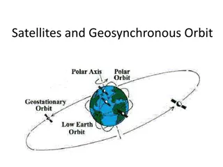
Satellite technology What: definition It consist of an artificial body placed in orbit round the earth which collects information or data by providing consistent observations at high spatial density with global coverage. (different sources) Where: geographic scale of application Global Where: feasibility It is feasible everywhere, where possible and technology, institutions (incl. space agencies) and expertise are available. It covers a wide area of earth or an entire country It is easy to install and to manage the data from the ground it is used in wide variety of applications which go beyond weather forecasting such as: radio/TV signal broadcasting, gathering intelligence in military, navigation of ships and aircrafts, global mobile communication, connecting remote areas etc. Why yes: advantages its manufacturing requires time. its design and development requires high cost It require to be monitored and controlled on regular periods to remain in the orbit Why not: disadvantages Satellite manufacturers Space agencies (Governmental and private) Private sector companies Who: actors involved Satellite technology reduces the impact of flood and drought in Uganda. RHEA https://www.rheagroup.com/fr/news/satellite-technology-reduces-impact-flood-drought-uganda Satellites measuring the greenness of Kenya from space can help insure livestock herders against droughts and mitigate the effects of climate change. https://business.esa.int/projects/dromas-fs Satellite technology to combat droughts in India. Government of India http://onlinelibrary.wiley.com/doi/10.1002/2014RG000456/full Examples: Date http://gisgeography.com/free-satellite-imagery-data-list/ How to do it:
Drought Monitoring and Forecasting platforms- media channels What: definition Drought Monitoring and forecasting platforms offers near real-time information about drought conditions at the global scale, with a 0.5 degrees spatial resolution and a monthly time resolution.(different sources) Where: geographic scale of application Both Global and Local Where: feasibility They provide timely data, indices and parameters to support stakeholders. New platforms are established where data is lacking or needs to be strengthened. Accurate measurement of current weather conditions for a particular location or surrounding Possibility to view historical data and make long-term statistical analysis, graphs or data Why yes: advantages High cost for personal to interpret data Lack of control over data quality Need to integrate data with structural measures Why not: disadvantages Research institutions Meteorological centers Monitoring centers Who: actors involved The Africa Drought and Flood monitor monitors and forecasts meteorological, agricultural and hydrological drought at various temporal and spatial scales. It also has a multi-decadal, historical reconstruction of the terrestrial water cycle against which current conditions can be compared http://stream.princeton.edu/AWCM/WEBPAGE/interface.php The U.S drought monitor provides a summary of drought conditions across the United States and Puerto Rico http://droughtmonitor.unl.edu/ The weather channel in the USA https://weather.com/climate-weather/drought Examples: Date The University of Nebraska provides data on drought to the US drought Monitoring platform. Research institutions provide data to such platforms and media channels. How to do it:
Soil monitoring probes What: definition A platform able to provide information and data on the status of soil. (different sources) Where: geographic scale of application Local Where: feasibility These systems are established in areas with a need to gather data on soil conditions. Good accuracy Ability to read multiple soil parameters Continuous measurement's at the same location Low cost Why yes: advantages Require labor and periodic service Slow response to drastic changes in soil content Why not: disadvantages Who: actors involved Private sector companies Farmers Research institutions Examples: EC-JRC provides publicly available daily soil moisture maps of Europe; daily soil moisture anomaly maps of Europe; and daily maps of the forecasted top soil moisture development in Europe. https://www.eea.europa.eu/data-and-maps/data/external/daily-soil-moisture-of-europe How to do it: https://www.youtube.com/watch?v=M_dBCOzFSAE Date
Public awareness raising What: definition Raising public awareness is creating a specific messaging campaign about a particular issue it has been shown to change knowledge and attitudes about a single topic. (different sources) Where: geographic scale of application Local Where: feasibility Wherever there is the need to educate individuals about a specific issue People become aware on the issue of drought Enhance audience preparedness to tackle the issue Audience can transmit the message to other people Why yes: advantages Difficulty to keep the massage of the campaign fresh and interesting Gain target s attention Effectiveness of the campaign is not always measurable Why not: disadvantages NGOs Local institutions Schools Who: actors involved Drought-Ready Communities. Different institutions. Examples: The project has been piloted in 3 communities in the USA: Nebraska City, NE; Decatur, IL; and Norman, OK. These communities benefited from an enhanced community awareness of water, climate, and drought issues. http://drought.unl.edu/Planning/PlanningProcesses/DroughtReadyCommunities.aspx https://bizfluent.com/make-successful-awareness-campaign-5644.html How to do it: Date
Drought Mapping and Vulnerability assessment tools C:\Users\cerutti\Desktop\address.png C:\Users\cerutti\Desktop\Register-Icon.png Mapping drought vulnerability Assessing drought damage and Vulnerability of populations Date
Mapping drought vulnerability What: definition It consists in mapping the global or regional distribution of drought risk hazard, exposure and vulnerability. (different sources) Where: geographic scale of application Local Where: feasibility Maps are normally created to show the levels of drought intensity in a certain area Areas experiencing drought are clearly depicted on the map It provides a synthesis of information coming from other sources Maps support decision making Why yes: advantages Not always up-to date Sudden droughts can happen in areas not mapped as vulnerable Why not: disadvantages Who: actors involved Governmental institutions Weather monitoring centers Mapping drought Vulnerability in East Azerbaijan Province. University of Theran Examples: Data from 16 hydrological stations have been collected to create a drought vulnerability map. Such map has been developed by following 6 precipitation parameters provided by the hydrological stations. https://carto.com/blog/thematic-map-drought-readings/ How to do it:
Assessing drought damage and Vulnerability of populations What: definition It consists in assessing the vulnerability of a society to drought which can depend on several factors such as population, technology, policy, social behavior, land use patterns, water use, economic development, and diversity of economic base and cultural composition. (different sources) Where: geographic scale of application Local Where: feasibility These systems are established in areas with no vulnerability profiles. Precise data on people who are vulnerable to drought Support decision making Why yes: advantages Costly get in touch with local populations is not always easy Why not: disadvantages NGOs International Organizations Governments Who: actors involved Examples: Wereda Disaster Risk Profiling Programme (WDRP). Ethiopian Disaster Risk Management commission 300 Weredas out of 670 have a completed vulnerability-profile. These profiles rely on data sets which include: meteorological information, demographic information, access to health facilities, and frequency of disaster occurrence. Each Wereda profile is presented in a short summarized report accessible to stakeholders through a digital library. https://reliefweb.int/sites/reliefweb.int/files/resources/cs-risk-reduction-planning-ethiopia- 150714-en.pdf How to do it: The Disaster Risk Profiles are representations of information regarding a population, place or system s exposure, sensitivity and resilience to given hazards that can be applied to DRM strategies in a district.
Drought Risk mitigation tools C:\Users\cerutti\Desktop\rain-water-harvesting.jpg Water harvesting Technology Fog Harvesting Technology Drought Tolerant Crops Sustainable Land Management Land Restoration Solar-water pumping C:\Users\cerutti\Desktop\icon_watertreatment_0.png Desalination Technology Irrigation Systems Livestock insurance Crops insurance Microcredit Sand Dams Groundwater management/ conservation Water recycling
Water Harvesting Technology What: definition Rain water harvesting is a technique of collection and storage of rain water in surface (storage tanks) or sub surface aquifer before it is lost as surface runoff. (different sources) Where: geographic scale of application Local Where: feasibility In all areas where rainwater can be harvested Easy to maintain Reduces water bills Suitable for irrigation Reduces demand on groundwater Reduces soil erosion Why yes: advantages Unpredictable rainfall Initial high cost Regular maintenance Storage limits Why not: disadvantages Government NGOs Private companies Who: actors involved Examples: A complete rainwater harvesting system in Kiribati allowed community members to have easy access to clean water and larger storage tanks permitted large amounts of water to be available during times of drought. http://www.worldbank.org/en/news/feature/2017/03/21/adapting-to-life-in-climate-change-hit-kiribati How to build it: http://rainharvesting.com.au/knowledge-center/how-to-create-a-complete-system/
Fog Harvesting Technology What: definition Fog collection refers to the collection of water from fog using large pieces of vertical canvas to make the fog- droplets flow down towards a trough below the canvas, known as a fog fence. (source: revolvy) Where: geographic scale of application Local Frequent fog occurrence High fog water content Altitude Limited distance from coastline Where: feasibility Why yes: advantages Some advantages are that the collection systems are easy to build, no energy is needed to collect or transport the water, maintenance and repair are minimal and the cost is relatively inexpensive. Why not: disadvantages Some disadvantages are community participation is needed for success, distance of the collection sites from the community, water may not meet drinking water quality and building the site could impact the landscape. Governments NGOs Local communities Farmers Who: actors involved How: how much A collection site in northern Chile that is 48 meters squared (517 feet squared) has a set-up cost of about $378.00. A site in Peru has a set-up cost of about $90 per meter squared. A 48 meter squared site in Peru would cost about $4320. Examples: New Water from fog catching in Lima. Municipality of Lima https://www.theguardian.com/global-development/2012/sep/19/peru-fog-catchers-water-supplies How to build it: https://watersustainabilityandfogwater.wordpress.com/fog-catchers-and-how-to-make-your-own/
Drought Tolerant Crops What: definition Drought tolerant crops are species which can survive for long periods of time with little amounts or no water. (different sources) Where: geographic scale of application Local Where: feasibility Drought tolerant cops are mainly planted in drought prone areas where land has become less productive and usable. Safety Higher yield Easing hunger Why yes: advantages Low awareness Inflexible consumption habits cost Why not: disadvantages Private companies Farmers NGOs Governmental organizations Who: actors involved Examples: In Busia County in Kenya, farmers managed to overcome rain failure through the use of drought tolerant crops such as: sorghum, millets and pigeon pea, cowpea and green gram. https://www.ilri.org/node/40417 How to do it: http://ucanr.edu/sites/scmg/files/183771.pdf
Sustainable Land Management What: definition Sustainable land management (SLM) refers to practices and technologies that aim to integrate the management of land, water, biodiversity, and other environmental resources to meet human needs while ensuring the long-term sustainability of ecosystem services and livelihoods. (FAO) Where: geographic scale of application Local Where: feasibility Everywhere Food security Maintenance of dams and irrigation structures Soil carbon sequestration Climate change mitigation Why yes: advantages Why not: disadvantages Not applicable Government International Organizations Farmers NGOs Who: actors involved How: how much Interviews conducted by the World Overview of Conservation Approaches and Technologies showed that 73% of farmers perceived SLM having a positive or at least neutral cost/benefit ratio in the short term, while 97% were perceived to have a positive or very positive cost/benefit ratio in the long term. Examples: In the Philippines a Comprehensive Land Use Plans (CLUPs) and Comprehensive Development Plans (CDPs) are helping to enhance the knowledge and competencies of farmers, through training modules on sustainable land management, primarily through the Farmers Field Schools. https://reliefweb.int/report/philippines/project- launch-implementation-sustainable-land-management-practices-address-land How to do it: http://www.fao.org/land-water/land/sustainable-land-management/en/
Land Rehabilitation and restoration What: definition Land restoration or rehabilitation is the process of ecological restoration of a site to a natural landscape and habitat, safe for humans, wildlife, and plant communities. (different sources) Where: geographic scale of application Local Where: feasibility In areas with degraded land Maintain biodiversity Increases soil productivity Creates jobs Food supplies are enhanced Why yes: advantages Why not: disadvantages Not applicable Some ecosystems require long time to restore Small fraction on land continue to be degraded in restored ecosystems Hard for the community to commit to land restoration Who: actors involved Examples: In Ethiopia, government is working together with regional institutions, public and private sector partners and international development programs to restore productivity to deforested and degraded landscapes, mostly through restoring forests and planting trees on agricultural land. http://www.wri.org/our-work/project/african-restoration-100 How to do it: http://goodlifepermaculture.com.au/land-regeneration-in-action/
Solar Water Pumping What: definition A solar-powered pump is a pump running on electricity generated by photovoltaic panels or the radiated thermal energy available from collected sunlight as opposed to grid electricity or diesel run water pumps. (World Bank) Where: geographic scale of application Local Where: feasibility The technology is feasible in areas with low energy infrastructures where water is present in underground aquifers . Furthermore, people are lacking water supplies where this technology is established. Low maintenance No fuel costs or spills Easy to install Simple and reliable Unattended operation System can be made to be mobile Why yes: advantages Potentially high initial costs Lower output in cloudy weather Must have good sun exposure between 9 AM and 3 PM Why not: disadvantages Solar companies Water companies Energy companies Government and NGOs Who: actors involved Examples: Gidewari (Tanzania), a Solar-Power Solution to its Water Problem. The World Bank http://www.worldbank.org/en/news/feature/2017/06/06/for-this-remote-village-of-gidewari-a-solar-power- solution-to-its-water-problem How to build it: https://www.youtube.com/watch?v=GIeLeJ6cc-A
Irrigation systems What: definition It consist of enhancing the efficient use of water through improved management and advanced irrigation technologies. (different sources) Where: geographic scale of application Local Where: feasibility Irrigation are feasible in areas where crop fail for lack of water. For proper nourishment of crops certain amount of water is required. Irrigation improves the yield of crops and makes people prosperous. Sometimes large irrigation channels can be used as a means of communication Why yes: advantages Excessive seepage and leakage of water forms marshes and ponds all along the channels It lowers the temperature and makes the locality damp due to the presence of irrigation water. Under irrigation canal system valuable residential and industrial land is lost Why not: disadvantages Irrigation companies Farmers NGOs Government Who: actors involved Examples: Northern Chu and Southern Ma Rivers Irrigation System. Asian Development Bank https://www.adb.org/projects/40239-012/main How to do it: https://www.thisoldhouse.com/how-to/how-to-install-drip-irrigation
Crop insurance What: definition Crop insurance refers to an insurance which insures farmers and crop producers against their loss of crops due to natural disasters, such as hail drought, and floods. (Source: PSC insurance brokers) Where: geographic scale of application Local Where: feasibility In areas where droughts are always associated with reduced harvest Stability in income Minimal debts Technological advancement Yield protection Why yes: advantages Payments not always correlated with the loss Preference of one kind of crop causing loss of biodiversity Why not: disadvantages Farmers Unions Consortia Insurance providers Who: actors involved Examples: Crop insurance in the Sahel. Allianz https://www.allianz.com/en/about_us/open-knowledge/topics/finance/articles/120402-the-price-of-dust- crop-insurance-in-the-sahel.html/ How to do it: http://www.fao.org/3/a-y5996e.pdf
Livestock insurance What: definition An insurance policy providing coverage for losses due to the death or injury of one's livestock. (Source: The Hartford) Where: geographic scale of application Global Where: feasibility In all areas where it is fundamental to protect livestock keepers from drought-related losses. Stability in income Minimal debts Why yes: advantages Cost Payments not always correlated with the loss Why not: disadvantages Breeders Insurance providers Who: actors involved Examples: Mongolia - Index-based Livestock Insurance http://www.worldbank.org/en/news/feature/2009/09/23/index-based-livestock-insurance-project How to do it: https://www.trustedchoice.com/farm-ranch/livestock-cattle/
Microcredit What: definition Drip irrigation is defined as any watering system that delivers a slow moving supply of water at a gradual rate directly to the soil. Drip irrigation, which is also sometimes referred to as micro-irrigation or trickle irrigation, consists of a network of pipes, tubing valves, and emitters. (FAO) Where: geographic scale of application Local Where: feasibility In areas with a need to reduce poverty and social exclusion caused by drought. It allows people to better provide for their families It gives people access to credit It provides families with an opportunity to provide an education to their children It can create jobs Its sustainable It encourages people to save Why yes: advantages Interest rates might be high It can lead to a debt trap Microcredit does not improve health and education Why not: disadvantages Microcredit providers Farmers Banks NGOs Who: actors involved Examples: Agricultural microcredit in Madagascar. Different partners http://ideas4development.org/en/madagascar-agricultural-microcredit-digital-microfinance/ How to make it: http://www.un.org/en/africa/osaa/pdf/pubs/2013microfinanceinafrica.pdf
Groundwater management and conservation What: definition Groundwater management means management of groundwater sub basins to provide for multiple long-term benefits without resulting in or aggravating conditions that cause significant economic, social, or environmental impacts, such as long-term overdraft, land subsidence, ecosystem. (Source: California water foundation) Where: geographic scale of application Local Where: feasibility In all water-stressed semi-arid areas with limited yearly rainfall supply and a lack of perennial streams. Ground water generally does not get polluted Since bore well is closed, no risk of getting contaminated. Since it is closed no danger of children or animals falling into it. Temperature of deep water remains stable. It feels cool in summer and warm in winter. Since bore are deep, chances of water remaining available in summer are more. Why yes: advantages Manage groundwater requires big effort Polluted rainwater Why not: disadvantages Local Water councils Farmers Non-governmental organization Farmers Who: actors involved Examples: Groundwater conservation. Government of Yemen & the World Bank. In Yemen, an integrated approach using a combination of water supply interventions was implemented to increase the available water supply as well as to reduce the demand of groundwater.https://www.waterscarcitysolutions.org/groundwater-conservation/ How to make it: http://re.indiaenvironmentportal.org.in/files/Indigenous%20water%20conservation%20systems.pdf
Water reuse and recycling What: definition Reclaimed or recycled water (also called wastewater reuse or water reclamation) is the process of converting wastewater into water that can be reused for other purposes. Reuse may include irrigation of gardens and agricultural fields or replenishing surface water and groundwater (i.e., groundwater recharge). (source: EU water initiative) Where: geographic scale of application Local Where: feasibility Wherever wastewater can be converted into water that can be reused for other purposes Low cost Water conservation Useful for irrigation Why yes: advantages Low public awareness Heath risk Why not: disadvantages Who: actors involved Private sector Farmers Non-governmental organization Irrigation companies Farmers Examples: Water recycling in the food sector. Unilever In south Africa, companies in order to reduce the municipal water supply are using ways to recover water. Water produced from the factories is recycled and harvested from the roofs. https://www.waterscarcitysolutions.org/water-recycling-in-the-food-sector/ How to make it: http://www.unep.or.jp/ietc/Publications/Urban/UrbanEnv-2/9.asp
Sand Dams What: definition Sand dams are a simple, low-cost and low-maintenance, replicable rainwater harvesting technology. They provide a clean, local water supply for domestic and farming use and are suited to semi-arid areas of the world. (source: wikiversity) Where: geographic scale of application Local Where: feasibility In all areas where there is a need to provide a clean, local water supply for domestic and farming. Combat desertification by recharging groundwater and creating opportunity for sustainable land management. Mitigate climate change by creating water security and the time to practice climate-smart agriculture. Reduce conflict by increasing access to water for people and livestock Support disaster resilience by creating a buffer against drought and enabling vulnerable people to improve food production. Enable the installation of shallow wells producing safe drinking water. Why yes: advantages When sand dams were relatively unknown and under-utilized, villagers used to spend hours fetching water, hence not getting enough time to grow food Predictable rain had also made it difficult for farmers to plan sowing and harvesting of crops Why not: disadvantages Local communities NGOs Who: actors involved Examples: Sand Dams in Kenya. Africa Sand Dam Foundation A sand dam is a reinforced concrete wall built across a seasonal riverbed to capture and store water beneath the sand. It holds 2-20 million liters of water depending on the size of the dam and the size of the sand particles collected. Evaporation is reduced to a minimum with the water stored beneath the sand. http://www.excellentdevelopment.com/articles/people-amp-communities/africa-sand-dam-foundation How to make it: https://www.youtube.com/watch?v=SUJfcTJIYN4
Desalination technology What: definition Desalination is a process of removing dissolved salts from seawater to produce fresh water for consumption. There are two major types of desalination technologies around the world, namely membrane desalination and thermal desalination (source: AMTA American Membrane Technology Association) Where: geographic scale of application Local Where: feasibility The technology is mainly implemented in areas near the cost with high water shortages which impacts on agriculture. In particular, desalination technology provides a sustainable source of clean water for the municipal and agricultural needs of the growing population. Why yes: advantages -Desalination plants can provide drinking water in areas where no natural supply of potable water exists. -It is not dangerous or hazardous to any living thing. -It provides people with water- meaning that many people don't get water that is clean so the desalination plants provide that. Why not: disadvantages -High Costs to Build and Operate -Environmental Impact Who: Actors involved Private water companies Government water companies How: how much The installed cost of desalination plants is approximately $1m for every 1,000 cubic meters per day of installed capacity. Therefore, a large scale desalination plant serving 300,000 people typically costs in the region of $100 million. The costs of infrastructure to distribute water must be added to this. Examples: https://www.technologyreview.com/s/534996/megascale-desalination/ How to do it: https://www.lenntech.com/desalination-installations.htm
Next steps Digitalize and transfer the drought toolbox on the Knowledge Hub to make it accessible to all stakeholders for the creation of the Drought Toolbox Navigator Incorporate the Toolbox on the Flood and Drought Portal developed by UNEP- DHI Denmark Experiences of tools which have been successfully tested can be shared in the Drought Toolbox Navigator (GM projects on drought) Date
Instructions of use for stakeholders Choose a tool according to the criteria under which it was implemented The selected tool could reduce drought risk in country X criteria Implement the tool at country level & share experiences , lessons learned Outline all actions needed to test the tool in country X Date
