Diagnosing Low-Topped Precipitation Events Using Satellite Imagery
Utilizing MODIS/VIIRS Night-Time Microphysics RGB Imagery combined with Proximity Soundings can enhance situational awareness and aid in diagnosing low-topped precipitation events. Various satellite images and data sources are analyzed to understand why heavy rain occurred in Havre, MT, despite minimal radar and satellite indications. This comprehensive approach provides insights into cloud microphysics, cloud heights, and atmospheric conditions that influence precipitation patterns.

Download Presentation

Please find below an Image/Link to download the presentation.
The content on the website is provided AS IS for your information and personal use only. It may not be sold, licensed, or shared on other websites without obtaining consent from the author.If you encounter any issues during the download, it is possible that the publisher has removed the file from their server.
You are allowed to download the files provided on this website for personal or commercial use, subject to the condition that they are used lawfully. All files are the property of their respective owners.
The content on the website is provided AS IS for your information and personal use only. It may not be sold, licensed, or shared on other websites without obtaining consent from the author.
E N D
Presentation Transcript
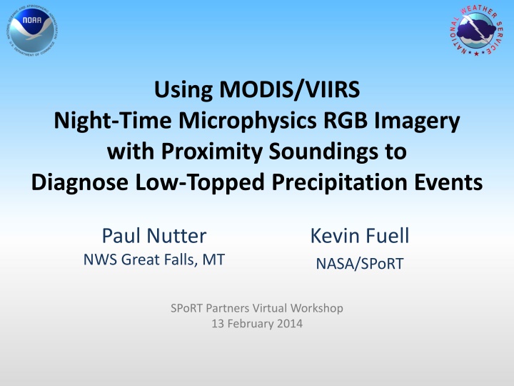
Using MODIS/VIIRS Night-Time Microphysics RGB Imagery with Proximity Soundings to Diagnose Low-Topped Precipitation Events Paul Nutter NWS Great Falls, MT Kevin Fuell NASA/SPoRT SPoRT Partners Virtual Workshop 13 February 2014
Low-Topped Precipitation Heavy rain at Havre, MT 12Z, 25-Sept-2013 (6am MDT) Still dark; sunrise occurred at 7:09 am MDT 50% forecast 12hr POP Just a few pixels on radar 0.5 base reflectivity Could Night-time Microphysics RGB imagery enhance situational awareness?
GOES 11 m IR Satellite 1215 UCT 25 Sep 2013 http://www.mmm.ucar.edu/imagearchive/ Havre L Havre is on a transition line; dry slot to west, rain showers to east.
Composite Reflectivity 12 UTC 25-Sep-2013 http://nmq.ou.edu/applications/qvs_2d_maps.html Havre Orographic showers west of Great Falls on low-level northeasterly flow. Heavy rain band near BYZ radar, moving northeast. 12-hr forecast included 50% POP at Havre.
GOES 11-3.9 m Satellite Ceiling & Visibility Obs Widespread stratus layer with areas of higher, apparently deeper clouds High Clouds KHVR, 1000 UTC: OVC 900 ft AGL KHVR, 1200 UTC: BKN 500 ft AGL OVC 900 ft AGL 1.5 mi visibility Heavy rain, fog
0.5 Base Ref with GOES 11 m IR 12 UTC 25-Sep-2013 Heavy rain report at Havre was a surprise given radar and satellite trends at this time. 12Z KHVR TAF amended to add at TEMPO group for SHRA. What more can we learn about why these low clouds produced heavy rain?
0.5 Base Ref with GOES 11 m IR with AWIPS Pop-up Skew-T Image Sampling Shows: -14 C brightness temp 15 dBZ reflectivity 93 nm from radar 11,800 ft agl 14,400 ft msl
Great Falls 12Z Sounding Most unstable parcel lifts from 867 mb, with 17 J/kg CAPE. Convective temp is 52F; parcel likely needs mechanical lift. Mid-level dry, stable layer; limits cloud height. Saturated layer from around -5 to -12C. Ice or water?
Nighttime Microphysics RGB VIIRS, 0924 UTC 25 Sept 2013 AQUA MODIS, 1010 UTC 25 Sept 2013 Delineation of high cloud, low cloud, and clear skies now obvious compared to GOES imagery. Possible delineation of fog vs. stratus, and orographic showers over northern Rocky Mountains. Note enhanced spatial resolution in VIIRS image.
RGB Pixel Saturation Fog or thick low stratus Thick stratus, mid-level tops, small water droplets Havre As above, but more small water droplets AQUA MODIS, 1010 UTC 25 Sept 2013 Red: Green: [10.8-3.9 m] Particle phase; presence of water Blue: [10.8 m] Temperature but inverted. Warmer is more blue. [12-10.8 m] Optical depth (cloud thickness)
Havre Event Summary Low-topped +RA not seen on Radar GOES imagery of limited additional value Radar Pop-up Skew-T reveals conditionally unstable layers near saturation, -5 to -12 C. MODIS/VIIRS Nt Microphysics RGB suggests super-cooled water (strong green). Development of precipitation is most efficient with mixed ice/water at these temperatures (i.e., Rogers and Yau, A Short Course in Cloud Physics)
Mixed Phase Precipitation 10:09 UTC, Oct 09 2013 Deep trough over Great Basin. Weak shortwave ridge over Montana. Upslope flow; surface high pressure strengthening. Shallow, weak rain or snow showers.
VIIRS Nt Microphysics RGB 10:02 UTC, 09 Oct 2013 Thick mid-level stratus, mostly water Thick mid-level stratus, ice Mid-level Stratus, mostly water Less red/blue shows thinner, colder clouds, but still a large contribution from small water particles (bright green) Thick, mid-level stratus, mostly water
Dual-Pol Hydrometeor Class. 10:09 UTC, Oct 09 2013 Mix of dry snow and ice crystals. Recall that melting layer algorithm relies on RUC analysis. Green in Nt Microphysics RGB initially suggests large water particles. What does sounding suggest?
12Z TFX Sounding, 09-Oct-2013 Stable, saturated layer capped by inversion just above FZL. Also saturated near 700 mb; possible source of ice crystal precipitation? Mid-level clouds possible around 560 mb. Radar shows ice/dry snow, but VIIRS Nt micro and sounding together suggest elevation dependent rain or snow. Orange line is approx height of radar beam over showers
Low-Topped RA in N. Mexico VIIRS Nt Micro, 07:53 UTC, 17 July 2013 Brian Guyer, NWS ABQ. Post to SPoRT Blog. ABQ Radar 0.5 scan is at 15 kft AGL near rain report at Farmington, so no coverage at 135 nm from radar. 00Z ABQ sounding reveals temp at this level near -10 C, becoming saturated by 12Z. Super cooled or mixed species in cloud to generate efficient rainfall? Tan/light green shading suggests cold thicker cloud / small water droplets
Summary Tan with green channel color saturation of 50% or more suggest mixed or warm rain microphysical process. Nt Micro RGB can enhance situational awareness: Improved spatial detail for cloud coverage in radar gaps, including vertical layers Use proximity soundings (Raob or Model Analyses) to identify temperature of cloud feature seen in RGB Limitations: High clouds may obscure lower level water signature Temporal coverage Nighttime use only