Avian Hazard Advisory System (AHAS) Update
The latest updates to the Avian Hazard Advisory System (AHAS) providing crucial bird hazard information for flight safety. Learn about calculating NEXRAD risk, regional mosaics, flying areas, and risk management.
2 views • 23 slides
Energy Wheel & Hazard Recognition Toolbox Talk
Hazard recognition is crucial for safety in all activities. Hazards can range from gravity and motion to mechanical and chemical risks. Failure to identify hazards can lead to incidents, making tools like the Energy Wheel key for improving recognition. The Energy Wheel enhances hazard recognition by
2 views • 10 slides
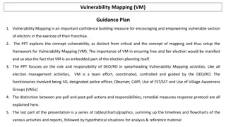
Vulnerability Mapping (VM).Guidance Plan
Vulnerability Mapping (VM) is crucial in empowering vulnerable voters by identifying and addressing potential threats to their exercise of franchise. This guide explains the concept of vulnerability mapping, its role in ensuring free and fair elections, and the responsibilities of election officials
2 views • 42 slides
REACH Pathway Mapping Toolkit
Explore the REACH Pathway Mapping Toolkit to analyze credentials in pathways, labor market outcomes, work-based learning, and holistic support to identify gaps and needs for improved guidance. Learn about different mapping examples and types to enhance educational pathways effectively.
0 views • 19 slides
Relational Database Design and Mapping Techniques
Explore the process of mapping Entity-Relationship (ER) and Enhanced Entity-Relationship (EER) models to relational databases. Learn about relational model concepts, mapping algorithms, and the goals and steps involved in the mapping process. Discover how to preserve information, maintain constraint
3 views • 42 slides
Virginia Commonwealth University Hazard Mitigation Plan Update
The Virginia Commonwealth University (VCU) Hazard Mitigation Plan (HMP) Update Public Comment Meeting #1 took place on April 5, 2022. The meeting included introductions, overview of hazard mitigation planning, work plan details, data and information needs, next steps, and action items. Various commi
0 views • 20 slides
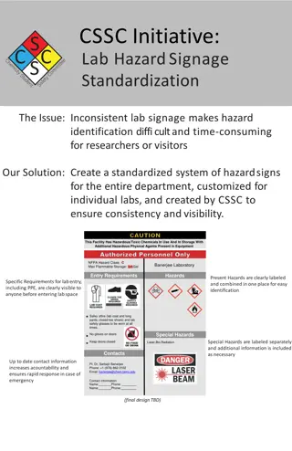
Standardized Hazard Signage for Lab Safety
Addressing the challenge of inconsistent lab signage hindering hazard identification, our solution introduces a standardized system for hazard signs within the department. By customizing signage for individual labs and ensuring consistency and visibility, researchers and visitors can easily identify
0 views • 8 slides
Hazard Curves in Dam Safety Risk Assessments
This content focuses on the role of hazard curves in dam safety risk assessments, emphasizing the level of effort required for their development and the use of HEC software. It highlights the three components of risk (hazard, performance, consequence), discusses hazardous loads and potential consequ
1 views • 58 slides
Comprehensive Risk Assessment and Hazard Mitigation Planning
This work delves into risk assessment and hazard mitigation planning supported by the National Science Foundation. It covers the importance of hazard identification, risk assessment, and mitigation planning components. Mitigation actions are outlined to reduce risks to life and property, prevent dam
3 views • 20 slides
Mapping Robot using ROS, Lidar with Raspberry Pi & MATLAB
Turtle.bot is a popular product for home service robots, utilizing SLAM and navigation technologies. It features gyro, Kinect sensors, Lidar, and a laptop for mapping. The robot localizes and navigates using ROS in Raspberry Pi connected with MATLAB. ROS (Robot Operating System) is a set of software
0 views • 17 slides
National Labor Mapping Application User Roles and Access Overview
This detailed overview outlines the implementation plan, user roles, and access benefits of the National Labor Mapping Application. Users are assigned specific roles with established access through domain usernames, enhancing security measures. Different user roles such as VISN Coordinators, Site Te
1 views • 14 slides
Mapping Methodology for Establishing ESCO Relations
Learn how to set up teams, collect resources, compare classifications, and establish mapping relations for ESCO implementation projects. Get insights on using computer-assisted suggestions, updating mapping tables, and selecting mapping projects. Explore techniques for navigating classifications, br
1 views • 21 slides
Texture Mapping in Computer Graphics
Delve into the world of texture mapping as a solution to the smoothness of polygons in computer graphics. Learn how to create textured scenes using techniques such as bump mapping and environmental mapping. Discover the process of representing textures, working with curved surfaces, and mapping onto
2 views • 24 slides
Probabilistic Tsunami Hazard Assessment Project for the NEAM Region
The project, coordinated by Istituto Nazionale di Geofisica e Vulcanologia (INGV) with various partners, aims to develop a region-wide Probabilistic Tsunami Hazard Assessment (PTHA) for the North East Atlantic and Mediterranean coastlines. It involves creating PTHA database and maps, engaging intern
0 views • 10 slides
Innovative LiDAR Cave Mapper for Cavers
Develop a portable and cost-effective LiDAR cave mapper to assist freelance cavers in mapping caves efficiently. The project aims to create a device that is affordable, DIY-style, and open-source, making cave mapping more accessible and accurate. The team from FAMU-FSU College of Engineering strives
0 views • 22 slides
Atlantic Seabed Mapping Workshop Summary
Workshop held in Dublin Castle on Dec 2, 2014, discussed current and future plans for seabed mapping in the Atlantic. Key topics included navigational charting, initiatives by various organizations, challenges of disjointed mapping efforts, and proposed actions to address issues. Recommendations inc
1 views • 5 slides
Enhancing Safety through Systematic Hazard Combinations Analysis in NPP Design Basis & PSA at NPP Paks
In this preparatory study, Tamas Siklossy, Attila Bareith, and Barnabas Toth discuss the importance of considering hazard combinations in the design basis and PSA of the Paks NPP in Hungary. The study reviews current practices, outlines technical tasks, and emphasizes the need to assess the impact o
0 views • 17 slides
Declining Competition and Industrial Disruption Study
Research conducted by James Bessen, Erich Denk, Joowon Kim, and Cesare Righi focuses on the trends in competition and industrial disruption, with a specific emphasis on the hazard of displacing top firms, impacts of investments by dominant firms, and the relationship between displacement hazard, mar
0 views • 38 slides
Seismic Site Characterization in Metropolitan Vancouver
The Greater Vancouver area faces high seismic risk due to its population density and critical infrastructure. Ground shaking during large earthquakes depends on various factors including the earthquake source, material properties, and site conditions. Efforts are being made to map seismic hazards, u
0 views • 13 slides
Virginia Commonwealth University (VCU) Hazard Mitigation Plan Update Public Forum
Virginia Commonwealth University (VCU) is updating its Hazard Mitigation Plan to address natural, human-caused, and technological threats affecting the campus. The plan aims to lessen disaster impact, assess vulnerabilities, develop mitigation strategies, and prioritize high-risk areas. VCU's rich h
1 views • 40 slides
Comprehensive Hazard Vulnerability Assessment Workshop and Tools
In this collection of images and descriptions, various aspects of Hazard Vulnerability Assessment (HVA) workshops, tools, and scoring methods are covered. Topics include risk assessment, planning policies, human factors, probability considerations, environmental and non-environmental hazard scoring,
0 views • 21 slides
Hazard Communication and the Global Harmonized System
This content discusses the changes introduced by the Global Harmonized System in Hazard Communication Standards (HCS). It highlights the impact on classifications, labels, safety data sheets, and information and training requirements. The GHS aims to enhance workplace safety by providing a standardi
0 views • 37 slides
Combining Natural Hazards with Societal Issues: Unit 1 Hazard Map Template
Delve into Unit 1 of the Hazard Map Template, identifying and locating regions susceptible to hazards by choosing top hazards in the mapping area. Create hazard maps, combine shapes, and include a key and sources for a comprehensive view of potential hazards and vulnerabilities.
0 views • 13 slides
Risk Assessment and Hazard Mitigation Overview
This document introduces risk assessment and hazard mitigation planning, supported by the National Science Foundation. It outlines the key components of risk assessment and hazard mitigation planning, emphasizing the importance of identifying and addressing the greatest risks. The process includes h
0 views • 20 slides
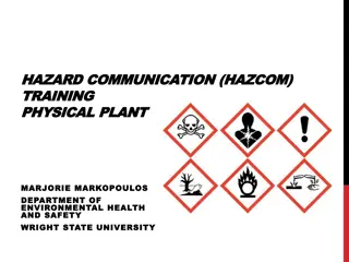
Importance of Hazard Communication Training for Workplace Safety
Hazard communication training is essential for creating a safe work environment by helping individuals recognize and manage hazardous materials effectively. Understanding the Globally Harmonized System (GHS) and following hazard communication laws can improve workplace safety, protect human health,
1 views • 36 slides
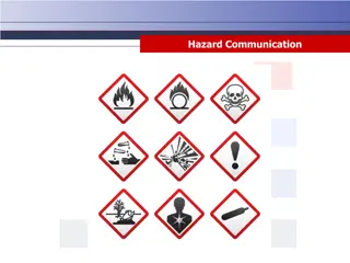
Hazard Communication Training and Safety Data Sheets Overview
This resource provides detailed information on hazard communication training, safety data sheets (SDS), GHS format elements, HMIS and NFPA labeling systems, GHS symbols, and building safety precautions. It covers essential aspects such as hazard identification, SDS requirements, chemical labeling, G
0 views • 39 slides
Engineering Seismology & Seismic Hazard Assessment Lectures Overview
This content provides detailed information on the Rose School Lectures 2013 by Sinan Akkar and D. M. Boore focusing on Engineering Seismology & Seismic Hazard Assessment. It includes course schedules, instructor details, contact information, and online software used. Topics covered range from hazard
0 views • 10 slides
Global Harmonized System of Classification and Labeling of Chemicals (GHS) Overview
The Global Harmonized System of Classification and Labeling of Chemicals (GHS) was developed to address the inconsistencies in hazard information for chemicals globally due to significant trade. The history, mandate, and provisions of GHS, along with additional domestic harmonization efforts, are di
0 views • 29 slides
Statistical Modelling of Hazard Frequency and Magnitude in External Events
Dr. Curtis Smith from Idaho National Laboratory presented a benchmark on External Events Hazard Frequency and Magnitude Statistical Modelling. The background involves the Working Group on External Hazards (WGEV) addressing the challenges in formulating and assessing external event initiating events
0 views • 11 slides
Power Mapping: A Visual Tool for Advocates to Influence Change
Power mapping is a visual tool used by advocates to identify key individuals to target in order to effect change. It involves mapping the community around an issue or campaign, identifying decision-makers, adversaries, and influential stakeholders. By following important steps and asking relevant qu
0 views • 10 slides
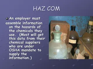
Hazard Communication in the Workplace
Employers must gather information on the hazards of chemicals they use and communicate this information to workers through training, labeling, and access to Safety Data Sheets (SDSs) as per OSHA Hazard Communication Standard (1910.1200). Hazard Communication Program (HCP) training covers chemical ex
0 views • 20 slides
GEBCO Technical Sub-Commission on Ocean Mapping (TSCOM) Overview
Technical Sub-Commission on Ocean Mapping (TSCOM) is a key component of the GEBCO program, established in 2006 to provide expertise in seafloor mapping and discuss emerging technologies. TSCOM serves as an authoritative source for bathymetric and hydrographic data and offers ongoing advice to associ
0 views • 12 slides
Virtual Network Mapping: A Graph Pattern Matching Approach
Virtual Network Mapping (VNM) involves deploying virtual network requests in data center networks in response to real-time demands. It facilitates the deployment of virtual networks on physical machines by mapping virtual nodes and links onto substrate nodes and paths, ensuring constraints are met.
0 views • 15 slides
Pin Mapping and Interconnect in IBIS 6.0
Pin Mapping in IBIS 6.0 defines the connections between POWER/GND pins and buffer/terminator voltage supplies using unique bus labels. Interconnects between VDD pins and buffer supply terminals are crucial, with all pins associated with a named supply being shorted together. Draft 9 Interconnects an
0 views • 6 slides
Mercator Mapping: A Key Tool for Information System Management
Mercator is a web application designed for managing the mapping of an organization's information system, allowing for a comprehensive representation of its components and connections with the outside world. Mapping is crucial for controlling, protecting, and defending the information system, as well
0 views • 21 slides
Survival Analysis: Hazard Function and Cox Regression
Survival analysis examines hazards, such as the risk of events occurring over time. The Hazard Function and Cox Regression are essential concepts in this field. The Hazard Function assesses the risk of an event in a short time interval, while Cox Regression, named after Sir David Cox, estimates the
0 views • 20 slides
Enhancing Curriculum Development through Mapping for Schools
Curriculum mapping in schools involves using electronic tools to input, track, and analyze data related to curriculum, enabling stakeholders to meet standards, align content, collect real-time data on instruction, and reflect on practices for continuous improvement. Software programs like Rubicon At
1 views • 15 slides
Importance of Maps and GIS in Census Mapping: A Case Study from Nepal
Census mapping plays a crucial role in ensuring accurate population counts and territorial delineation. This case study from Nepal highlights the significance of Geographic Information Systems (GIS) in producing high-quality maps for census operations, data collection, analysis, and dissemination. T
0 views • 12 slides
Mitigating California Wildfires: Hazard Mitigation Grant Program Overview
The Hazard Mitigation Grant Program (HMGP) aims to reduce loss of life and property from future disasters by implementing long-term risk reduction strategies. The program focuses on creating or updating Local Hazard Mitigation Plans, prioritizing post-wildfire mitigation activities, including soil s
0 views • 18 slides
Tuberculosis, MRSA, Hazard Communication - Workplace Safety Guidelines
Workplace safety guidelines focusing on tuberculosis, MRSA, hazard communication, PPE with respirators, and emergency action/pandemic planning. The content covers inspection procedures for TB cases, respiratory protection enforcement, MRSA and MDRO transmission risks in nursing facilities, and hazar
0 views • 24 slides
