Rescue Drone: Increasing Autonomy and Implementing Computer Vision
Focuses on developing a rescue drone with increased autonomy and implementing computer vision for advanced object detection. The team, consisting of Cody Campbell (Hardware Engineer), Alexandra Borgesen (Computer Engineer), Halil Yonter (Team Leader), Shawn Cho (Software Engineer), Peter Burchell (M
78 views • 44 slides
Top Drone Solutions Companies
In recent years, the world has witnessed the rapid rise of a revolutionary technology that is reshaping the way we live, work, and interact with our environment: drones. Unmanned aerial vehicles, commonly known as drones, have evolved from mere gadgets to powerful tools with vast potential across a
2 views • 5 slides
Revolutionizing Agriculture with Drone Technology in India
Exploring the current and future landscape of drone technology in India, specifically its impact on agriculture. From the use of drones for spraying pesticides to the government's initiative of providing drones to women's self-help groups, the potential benefits for farmers are immense. Experts beli
1 views • 82 slides
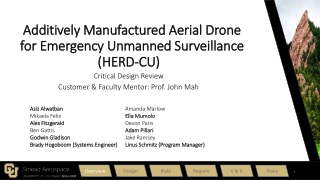
AMADEUS - Additively Manufactured Aerial Drone for Emergency Unmanned Surveillance
AMADEUS aims to provide a low-cost, high-endurance, human-portable, and rapidly deployable unmanned aerial system (UAS) for various missions in challenging environments. Designed for aerial surveillance, search and rescue operations, and more, it features functional and driving design requirements t
0 views • 178 slides
Risk Management Plan for Drone Operations
This document outlines a comprehensive risk management plan for drone operations, covering areas such as operational zones, probability assessment, severity definitions, and specific risks like rotor damage in flight. Detailed maps and mitigation strategies are provided to ensure safe and effective
2 views • 12 slides
IEEE Aerospace Electronic Systems DSTEI Project Update
DSTEI project focusing on Distributed Sensing Technology and Education Initiatives aims to support commercial growth, increase AESS membership, and enhance technical capabilities in aerospace technology. Project teams in South America and India are working on innovative drone and UAV applications. T
1 views • 7 slides
Exploring Drone Usage in Tacoma: Regulations, Legislation, and Applications
Discussing the front end of the drone issue in Tacoma, covering prohibited locations, legislative developments, FAA operational requirements, and the use of drones as first responders. The content delves into privacy concerns, operational restrictions, and the various applications of drones in law e
5 views • 12 slides
Virtual Home Staging Canada
Fraser Valley Virtual is a professional photography and video production company based in Abbotsford, British Columbia. We specialise in 3D Renderings and video editing, and drone photography and videography.\r\nwww.fraservalleyvirtual.com
6 views • 8 slides
Drone Detection Using mmWave Radar for Effective Surveillance
Utilizing mmWave radar technology for drone detection offers solutions to concerns such as surveillance, drug smuggling, hostile intent, and invasion of privacy. The compact and cost-effective mmWave radar systems enable efficient detection and classification of drones, including those with minimal
0 views • 8 slides
Drone Team Operations and Regulations Overview by Duluth Police Department
The Duluth Police Department operates a Small Unmanned Aerial System (SUAS) Drone Team regulated by FAA and Minnesota State Statute 626.19. The team follows strict FAA regulations, state statutes, and departmental policies for SUAS operations. Compliance with search warrant requirements, restricted
0 views • 23 slides
Flying Tips for 3DR Solo Drone with Sidepilot App
Learn how to fly the 3DR Solo drone using the Sidepilot app efficiently. Get guidance on installing props, powering on the device, connecting it via Sidepilot, and understanding flight controls. Follow the step-by-step instructions to ensure a smooth drone flying experience.
0 views • 15 slides
Drone Major Group: Update Briefing for DIAG
Independent advisory service providing insights on drone and counter-drone technology across various environments. Offers a global network of suppliers, industry support, and a mission-driven Drone Delivery Group. Recommends collaboration with the DIAG for sharing expertise and forming wider industr
2 views • 5 slides
Exploring Challenges and Opportunities in Adopting a Drone Program
Exploring the complexities involved in establishing a drone program, this content discusses public perceptions, realities, policy considerations, partnerships, board approvals, liability concerns, justifications, and the process of obtaining a Certificate of Authorization. It delves into issues such
1 views • 22 slides
Understanding Feature Engineering in Machine Learning
Feature engineering involves transforming raw data into meaningful features to improve the performance of machine learning models. This process includes selecting, iterating, and improving features, converting context to input for learning algorithms, and balancing the complexity of features, concep
0 views • 28 slides
Challenges and Trends in Restaurant Technology
Guests still lag in widely using restaurant technology, as revealed by surveys from the Food Marketing Institute and AlixPartners. Despite the importance placed on technological features like digital ordering, many restaurants are yet to implement them fully. Generation Z's spending habits and prefe
1 views • 9 slides
Comparing Different Consumer Multirotor and Fixed Wing UAS Models
Explore the differences between multirotor and fixed wing UAS models, their flying capabilities, and key features of popular consumer drones like DJI Phantom 4, Parrot AR Drone 2.0, Birds Eye View Firefly 6, Parrot Bebop 2, 3D Robotics IRIS+, and Hobbico Hubsan X4 Pro.
0 views • 21 slides
Innovative DIY Quadcopter Project with Autonomous Features
Explore the Drone Project by Krish Kabra & Stefan Orosco, detailing the creation of a DIY Quadcopter Drone with Arduino-based control, radio-frequency, PID stabilization, collision avoidance, and voice control. Discover its applications in search and rescue, agriculture, entertainment, and defense,
0 views • 27 slides
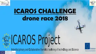
ICAROS Challenge Drone Race 2018: Exciting High School Competition
The ICAROS Challenge Drone Race 2018 took place at High School St. Exupery in Blagnac, France, featuring five high schools competing in a thrilling drone racing event. Each school created unique obstacles for the race, and students operated toy drones through a challenging circuit. The competition r
0 views • 9 slides
Drone Pilot Health and Safety Guidelines
Understanding the importance of maintaining good health and following safety protocols is essential for drone pilots. This includes being in good general health, taking breaks for eating and drinking, being cautious with medicines, and avoiding alcohol and recreational drugs. Neglecting these factor
0 views • 16 slides
IoT/IoL Technology for Drone-based Guard Tour Solution
Proposed IoT/IoL connectivity technology for checkpoints reporting in a Drone-based Guard Tour System. The system aims to operate on various application services like ITS, ADAS, and IoT/IoL for efficient road condition monitoring. It can also be utilized for LEDIT, Digital Signage, and connected inf
0 views • 5 slides
Revolutionizing Drone Operations with Windhover Ecosystem
Windhover Ecosystem, developed through NASA SBIR Phase I and II, offers a robust and open-source software solution for drone operations. The ecosystem includes integrated flight and ground control software, providing scriptable flight control, rapid prototyping, and full autonomy capabilities. Lever
0 views • 23 slides
Drone Product Comparison and Market Analysis
A detailed analysis of various drone products including Phantom 3 Professional, Solo Smart Drone, and X8+, highlighting features such as cost, weight, flight time, battery capacity, payload, and more. The predicted market value trends and key considerations like durability, affordability, and lightw
0 views • 18 slides
Acquisition, Tracking, and Pointing (ATP) for NG-OWC System in Drone Networks
The research discusses the implementation of Acquisition, Tracking, and Pointing (ATP) in Next-Generation Optical Wireless Communication (NG-OWC) systems for drone networks. It covers the background of drone networks, ATP overview, schemes, tracking mechanism, current developments, challenges, and c
0 views • 16 slides
CRM, Safety, Maintenance, and Review Guide for Drone Pilots
This guide covers Crew Resource Management (CRM), Safety precautions, Drone Maintenance tips, and a Review checklist for drone pilots. Learn about effective CRM practices, safety guidelines for flying drones, essential maintenance checks, and the I'M SAFE checklist to ensure safe and responsible dro
1 views • 15 slides
The Future of Freight: Drones Revolutionizing Cargo Transport
Drones are set to transform the future of freight with innovative technologies like Natilus' Nemo Drone and Singular Aircraft's FLYOX I.4. These amphibious drones have the capability to carry significant payloads over long distances, offering solutions for challenging terrains and remote locations.
0 views • 15 slides
Tracking and Mapping with the Parrot A.R. Drone Project Presentation
Alex Triaca, under the supervision of James Connan, presents a project on tracking and mapping using the Parrot A.R. Drone. The project covers literature review, pitch and roll control, yaw control, implementation using C++ SDK, glyph detection, and aerial cartography techniques.
0 views • 8 slides
Functional Requirements for Drone Networks with OCC
Explore the functional requirements for drone networks based on Next Generation OCC, offering secure communication, RF interference immunity, low latency, and high bandwidth. The system overview of a multi-drone system is discussed, showcasing how drones communicate, collaborate, and perform various
0 views • 11 slides
Overview of UAVs and UAS: Opportunities, Issues, and Policy Developments
Unmanned Aerial Vehicles (UAVs) and Unmanned Aerial Systems (UAS) offer a wide range of opportunities and applications, from military missions to commercial use. Recent policy developments in the US, including funding for research and guidelines for UAV operation, aim to promote the adoption of dron
0 views • 13 slides
Exploring the DJI Phantom 4 Pro V2.0 Drone Features and Resources
Dive into the details of the DJI Phantom 4 Pro V2.0 drone, including its advanced features like the OcuSync 2.0 transmission system and FOC sinusoidal driver ESCs. Discover where to find specifications, compare with other models, watch videos, download resources, and explore the user manual for a co
0 views • 4 slides
Unlocking Opportunities in the Commercial Drone Industry
DroneLife, established in 2013, offers comprehensive digital marketing solutions catering to the commercial drone sector. With a focus on branding, lead generation, and sponsored content, DroneLife's reach extends globally to industry leaders and enthusiasts alike. Through avenues like podcasts and
0 views • 17 slides
Compact Aerial Photogrammetry System (CAPS) with VTOL Drone
Developing a Compact Aerial Photogrammetry System (CAPS) utilizing a fixed-wing VTOL drone equipped with cameras and GPS for generating georeferenced maps of large areas. The system combines drone versatility with advanced image analysis, enabling aerial assessments and coherent change detection. Pr
0 views • 18 slides
Enhancing Drone Safety Measures with Parachute Functionality
This project focuses on ensuring safety measures during critical scenarios by activating the parachute function embedded within the drone's software. By replicating and simulating this action in a virtual environment, the effectiveness and reliability of the drone's emergency protocols are enhanced.
1 views • 8 slides
Drone Collision Avoidance Simulator for Autonomous Maneuvering
Our project focuses on developing a drone collision avoidance simulator using NEAT and Deep Reinforcement Learning techniques. We aim to create a model that can maneuver obstacles in a 2D environment, enhancing performance and survivability. Previous attempts utilizing non-machine learning solutions
0 views • 28 slides
Innovative Solutions for Drone Operation Risk Assessment
Working groups within IAG focus on key aspects such as UTM integration, public perception, and tackling challenges associated with OSC risk assessments. Participants from various organizations collaborate to develop interactive tools and strategies to ensure the reliability and sustainability of dro
0 views • 11 slides
Application of STPA on Small Drone Operations: A Benchmarking Approach
This study focuses on the application of the System Theoretic Process Analysis (STPA) methodology to identify hazards and safety requirements for small drone operations. It addresses the lack of a uniform regulatory framework for unmanned aircraft systems, especially for light drones, and explores t
0 views • 21 slides
Essential Rules and Tips for Creating Quality Maps
Understanding what a map is, the rules of mapping, key features that should be included on maps (BOLTS), and essential tips for creating tasteful and easy-to-read maps. Guidelines include labeling in pencil first, horizontal labeling for human features, following natural directions for physical feat
0 views • 14 slides
UAS Funding Recommendations for Successful Integration
The future success of the drone industry relies heavily on government and private sector funding. The DACSC TG3 provides recommendations for near-term funding to support drone integration into the National Airspace System (NAS). Guiding principles prioritize a combination of funding sources and emph
0 views • 20 slides
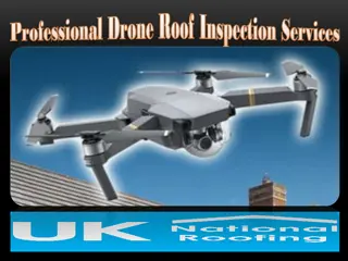
Professional Drone Roof Inspection Services
Discover cutting-edge drone roof inspections with UK National Roofing. Our advanced drone technology offers a safe, accurate, and cost-effective way to inspect roofs, providing high-resolution images and videos that reveal even the smallest issues. P
1 views • 5 slides
utility drones’
Furthermore, more favorable regulations, rising demand for BVLOS drones, and the emergence of drone-as-a-service are estimated to provide considerable potential opportunities for players operating in this market. However, privacy concerns about drone
0 views • 4 slides
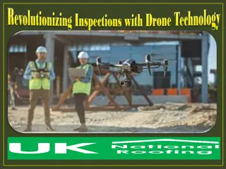
Revolutionizing Inspections with Drone Technology
Explore the future of roof assessments with advanced Drone Inspection Technology from UK National Roofing. Our drones deliver high-resolution imagery and accurate data, making inspections safer, faster, and more affordable. Avoid the hassle of scaffo
1 views • 5 slides

