Top Drone Solutions Companies
In recent years, the world has witnessed the rapid rise of a revolutionary technology that is reshaping the way we live, work, and interact with our environment: drones. Unmanned aerial vehicles, commonly known as drones, have evolved from mere gadgets to powerful tools with vast potential across a
2 views • 5 slides

The Amazing Banyan Tree of India: A Natural Wonder
Discover the extraordinary banyan tree, also known as the great banyan tree of India. Learn about its unique life cycle, aerial prop roots, and significance as the National tree of India. Explore the fascinating attributes of this majestic fig tree, from its epiphyte stage to the growth of strangler
2 views • 23 slides
AMADEUS - Additively Manufactured Aerial Drone for Emergency Unmanned Surveillance
AMADEUS aims to provide a low-cost, high-endurance, human-portable, and rapidly deployable unmanned aerial system (UAS) for various missions in challenging environments. Designed for aerial surveillance, search and rescue operations, and more, it features functional and driving design requirements t
0 views • 178 slides

Aerial Rod, Multiple Point, Terminal Base, Electrolytic Copper Air Rod,
Nexus Metal & Alloys is a leading manufacturer, exporter and supplier of Aerial Rod, Multiple Point, Terminal Base, Electrolytic Copper Air Rod, Lightning Protection Accessories at very cheap prices for our clients from Mumbai, India.
3 views • 2 slides

TEAM SEVEN CRITICAL DESIGN REVIEW.
During the critical design review, Team Seven presented their project purpose, objectives, and key elements related to developing an energy-efficient unmanned aerial system (UAS). The project aims to improve mission endurance, reduce user workload, and enhance communications in remote areas. By focu
1 views • 80 slides

Coastal Monitoring and Lessons Learned in Southwest England
Southwest England's coastal monitoring efforts, including the South West Coastal Monitoring program and lessons learned from the destruction of Hallsands in 1917 due to lack of understanding of coastal processes. The monitoring involves data collection on beach profiles, bathymetry, wave patterns, a
4 views • 15 slides

The Battle of Vimy Ridge in the First World War
The Battle of Vimy Ridge in 1917 was a significant event where all 4 Canadian Divisions joined forces, marking a historic victory and symbolizing the birth of Canada. The battle was a breakthrough for Britain and France, as Vimy Ridge was a crucial German stronghold that had resisted previous attack
9 views • 22 slides

Capture Your Special Moments with ZS Productions
ZS Productions offers award-winning wedding videography and photography services across the UK. Based in Bradford, West Yorkshire, their experienced team uses top-notch 4K cameras and advanced media production techniques to deliver stunning visuals. Specializing in weddings, they also cover a range
6 views • 5 slides
Successful Integration of Phoenix Systems for Improved Aerial Performance
Phoenix Systems, led by Michael Mann, successfully integrated the NexGen system and AMS into new airplanes, enhancing operational life and system versatility. Key updates include new motors, controllers, enhanced orthorectification, satellite communications, and cryocooler advancements. These improv
1 views • 13 slides
Battle of the Philippine Sea: World War II Aircraft Carriers Showdown
Explore the pivotal Battle of the Philippine Sea in 1944, featuring a fierce confrontation between the Imperial Japanese Navy and the United States Navy. Witness the strategic maneuvers of Vice Admiral Jisaburo Ozawa and Admiral Ray Spruance as their fleets clashed with numerous aircraft carriers, b
0 views • 22 slides
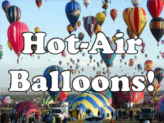
The Fascinating History of Hot Air Balloons and Their Adventurous Journeys
Hot air balloons were first used in Paris, France in 1783 by the Montgolfier brothers. They tested with animals before taking human passengers. These balloons are made of light but strong fabric with a basket carrying a heater. The heating of air inside the balloon allows it to ascend. The journey o
0 views • 23 slides

Drone Team Operations and Regulations Overview by Duluth Police Department
The Duluth Police Department operates a Small Unmanned Aerial System (SUAS) Drone Team regulated by FAA and Minnesota State Statute 626.19. The team follows strict FAA regulations, state statutes, and departmental policies for SUAS operations. Compliance with search warrant requirements, restricted
0 views • 23 slides

Understanding the Importance of Seed Banks in Ecosystems
Seed banks, categorized into soil and aerial types, serve as essential reservoirs for viable seeds and propagules. Soil seed banks are natural storage areas for seeds within ecosystems and play a crucial role in plant regeneration. They can persist for varying durations, influencing plant diversity
1 views • 16 slides
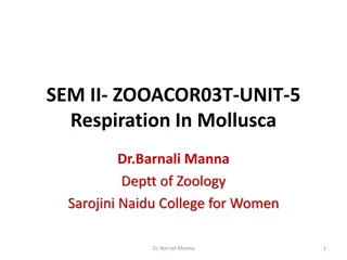
Respiration in Mollusca: Adaptations to Different Habitats
Mollusca exhibit various modes of respiration depending on their habitat - aquatic, terrestrial, or amphibious. Different respiratory organs are modified accordingly, such as ctenidia or gills for aquatic species, pulmonary sac for aerial species, and mantle or integument for those lacking specific
0 views • 17 slides

Adaptations of Flying Mammals and Fish for Aerial Life
Explore the fascinating adaptations of flying mammals like Pteropus, commonly known as flying foxes, and flying fish like Exocoetus for their arboreal and aerial lifestyles. From modified wings to unique habitats, discover how these creatures have evolved for flight and survival in their environment
2 views • 16 slides

Understanding Coastal Processes and Erosion
Coasts are dynamic environments shaped by a variety of processes such as erosion and transportation. Waves influence the size and energy of waves, while erosion is caused by processes like corrasion and solution. Coastal transportation involves suspension, solution, and saltation. The impact of mari
6 views • 18 slides

Understanding Transpiration in Plants: Importance and Mechanisms
Transpiration is the process in which plants lose water vapor through their aerial parts, playing a crucial role in their overall functioning. This loss of water occurs mainly through stomata, lenticels, and the cuticle of leaves and stems. Different types of transpiration like stomatal, lenticular,
0 views • 19 slides
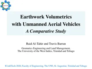
Enhancing Earthwork Volumetric Calculations with UAV Technology
Explore the comparative study on utilizing Unmanned Aerial Vehicles (UAVs) for earthwork volumetrics in engineering applications. Discover the benefits, global interests, reasons for UAV popularity, civilian applications, and the evolution of technology in this field. Streamline volumetric calculati
1 views • 14 slides

Understanding Remote Sensing: Meaning, History, and Applications
Remote sensing is the acquisition of information without physical contact, widely used in various fields like geography, military, and more. Its history dates back to aerial photography and has evolved with satellite technology. The process involves elements like energy source, radiation, interactio
0 views • 9 slides

Characteristics of the Genera Psilotum and Tmesipteris
The class represented by Psilotum and Tmesipteris features rootless sporophytes with subterranean rhizomes and aerial shoots, dichotomous branching, rhizoids for nutrient absorption, scale-like or leaf-like appendages, protostelic or siphonostelic stele, eusporangiate sporangial development, homospo
0 views • 9 slides

Exploring Kamloops: Landforms, Climate, Vegetation, and Environmental Issues
Discover the diverse landscape of Kamloops with its mountains, lakes, and unique vegetation. Learn about the hot summers and cold winters, ideal for activities like golfing and snowshoeing. However, forest fires pose a significant environmental issue, impacting animals, humans, and habitats. Explore
0 views • 9 slides

Understanding Plant Anatomy and Characteristics
Explore the diverse aspects of plant life cycles, habitats, vegetative organs, stems, aerial stem modifications, leaves, phyllotaxy patterns, and leaf durations. Gain insights into the classification of roots, different types of plant habitats, and the arrangement of leaves on stems. Discover the va
2 views • 9 slides
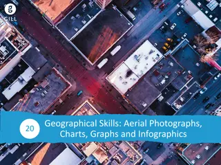
Geographical Skills: Aerial Photographs, Charts, Graphs and Infographics
Aerial photographs are key tools for interpreting land surfaces, with vertical and oblique types used for different perspectives. Locating places on photographs involves dividing them into sections and understanding directions. Sketching aerial photographs requires creating a frame and dividing sect
0 views • 30 slides

RALPHIE Testing Readiness Review Overview
RALPHIE is a project aiming to enhance the endurance of small Unmanned Aerial Systems by developing an autonomous flight controller. The project involves meeting FAA requirements, creating a cost-effective solution, and implementing critical project elements. Levels of success are categorized into d
0 views • 59 slides

Unmanned Aerial System Market Analysis by 2033
The global unmanned aerial system (UAS) market is estimated to reach $72.42 billion by 2033 from $18.10 billion in 2023, growing at a CAGR of 14.87% during the forecast period 2023-2033.\n\nRead Report Overview: \/\/bisresearch.com\/industry-report\/
1 views • 4 slides

Wildlife Safety and Hazard Awareness in the Field
Explore the importance of safety in wildlife professions, highlighting the risks, common accidents, and preventive measures. Understand the dangers associated with field activities such as aerial surveys, driving, and watercraft operation. Learn from past incidents to prioritize safety as a professi
0 views • 17 slides
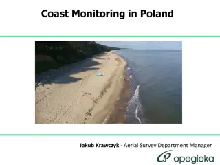
Remote Sensing Coast Monitoring in Poland - Aerial Survey Insights
Explore the comprehensive process of remote sensing coast monitoring in Poland, covering data collection specifics, UAV utilization, sea level navigation requirements, ALS data accuracy, image data details, and the role of Jakub Krawczyk as the Aerial Survey Department Manager. Get insights into the
0 views • 27 slides

Understanding GIS Data Collection and Sources
Exploring various data sources for GIS projects, this information discusses the importance of data collection, different types of data (primary, secondary, administrative records), formats (digital, hardcopy), and the value of spatial data. Emphasizing the significance of in-house data and major GIS
0 views • 35 slides

Exploring the Rich History and Natural Beauty of Milicz Ponds and Barycz River
Discover the fascinating history behind the creation of the Milicz Ponds, the largest artificial pond collection in the world, dating back to the 12th century when monks excavated the ponds. Explore the traditional carp production practices maintained for over 800 years by skilled fishermen. Delve i
0 views • 35 slides

Unique Modes of Transport Around the World
Explore some of the most unusual means of transportation globally, including a prototype bus in China that passes over cars, an Amfibus in the Netherlands running on land and water, an inverted aerial train in Wuppertal, Germany, the futuristic Shanghai Maglev train in China, and the traditional Mon
0 views • 12 slides
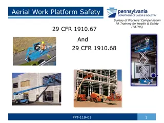
Aerial Work Platform Safety Training Guidelines
A comprehensive overview of aerial work platform safety guidelines providing insights on operator training requirements, inspection protocols, maintenance needs, and statistics on aerial lift incidents such as falls, tip-overs, and electrocutions. Emphasizes the importance of qualified personnel for
0 views • 29 slides
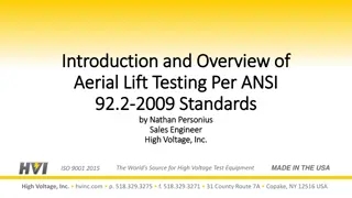
Overview of Aerial Lift Testing Per ANSI 92.2-2009 Standards
This presentation by Nathan Personius, a Sales Engineer at High Voltage, Inc., provides an introduction to aerial lift testing as per ANSI 92.2-2009 standards. It emphasizes the importance of referencing ANSI standards for dielectric testing of bucket trucks and aerial lifts while highlighting key p
0 views • 44 slides
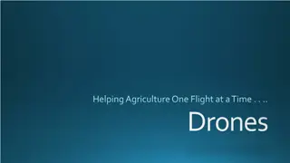
Exploring the Role of Drones in Agriculture
Discover the various functionalities of drones in agriculture, from aerial surveying of crops to inspection of power lines and pipelines. Learn about the different uses of drones beyond traditional applications, including search and rescue missions, acrobatic aerial footage, and wildlife counting. E
0 views • 12 slides
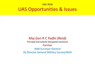
Overview of UAVs and UAS: Opportunities, Issues, and Policy Developments
Unmanned Aerial Vehicles (UAVs) and Unmanned Aerial Systems (UAS) offer a wide range of opportunities and applications, from military missions to commercial use. Recent policy developments in the US, including funding for research and guidelines for UAV operation, aim to promote the adoption of dron
0 views • 13 slides

Compact Aerial Photogrammetry System (CAPS) with VTOL Drone
Developing a Compact Aerial Photogrammetry System (CAPS) utilizing a fixed-wing VTOL drone equipped with cameras and GPS for generating georeferenced maps of large areas. The system combines drone versatility with advanced image analysis, enabling aerial assessments and coherent change detection. Pr
0 views • 18 slides

Learning-Based Path Planning for Aerial Multi-View Stereo Reconstruction
This project focuses on view selection and path planning to capture high-quality aerial images using drones for 3D reconstruction. The approach involves exploring scene geometry, generating trajectories, and optimizing image capture within travel constraints. Learning-based methods are preferred ove
0 views • 24 slides

Comprehensive Guide to Scaffolds and Aerial Lift Safety
Explore different types of scaffolds like pole, tube and coupler, needle beam, and two-point adjustable scaffolds. Learn about aerial lifts, hazards associated with them, and safety measures to prevent injuries. Stay informed to ensure construction site safety.
0 views • 25 slides
Remote Sensing and GIS Applications in Photogrammetry: Understanding Scale Variations
Exploring the fundamental principles of photogrammetry in remote sensing and GIS applications, this content delves into the science of measurements from aerial photographs. It discusses the implications of scale differences on maps and aerial photographs, emphasizing the variations in scale due to t
0 views • 19 slides
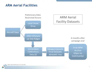
ARM Aerial Facilities Data Management Instructions
ARM provides comprehensive guidelines for managing and sharing aerial facility data, including data collection, processing, and accessibility for the scientific community. The process involves automatic collection, processing, and ingest of data to meet ARM-approved standards, with options for data
0 views • 6 slides
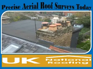
Precise Aerial Roof Surveys Today
Discover the efficiency of Aerial Roof Surveys for accurate inspections. Using advanced drone technology, we provide detailed visuals of roof conditions, saving time and ensuring safety. Perfect for identifying damages or assessing maintenance needs,
1 views • 5 slides