Understanding SLAM Techniques for Robot Localization and Mapping
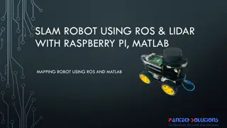
SLAM (Simultaneous Localization and Mapping) is a concept crucial for robots to construct and update maps while tracking their own locations. It is likened to a chicken and egg problem, where building a map and localizing the robot occur concurrently. Hardware, landmarks, and steps involved in SLAM play essential roles in this process. Landmarks serve as recognizable features for localization, with key characteristics defining a good landmark. Various challenges and considerations, such as data association and state estimation, need to be addressed during the SLAM process.
Download Presentation

Please find below an Image/Link to download the presentation.
The content on the website is provided AS IS for your information and personal use only. It may not be sold, licensed, or shared on other websites without obtaining consent from the author. Download presentation by click this link. If you encounter any issues during the download, it is possible that the publisher has removed the file from their server.
E N D
Presentation Transcript
SLAM Techniques 1 -Venkata satya jayanth Vuddagiri
What is SLAM 2 Stands for simultaneous localization and mapping. Its more of a concept than an algorithm. It consists of different type of steps and these steps can be implemented by a number of different algorithms.
What is SLAM 3 SLAM is two fold as the name suggests, it needs to construct or update map of an environment while simultaneously keeping track of the object location. SLAM is initially compared to a chicken and egg problem.
Chicken and Egg problem 4 It is the problem of building a map while at the same time localizing the robot within that map In practice, these two problems cannot be solved independently of each other Before a robot can answer the question of what the environment looks like given a set of observations, it needs to know from which locations these observations have been made.
Chicken and Egg problem 5 At the same time, it is hard to estimate the current position of a vehicle without a map. Hence the comparisons with chicken and egg problem. A good map is needed for localization while an accurate pose estimate is needed to build a map.
Steps in SLAM 6 Landmark Extraction. Data association. State estimation. State update. Landmark update.
Hardware: 7 Mobile robot to test the algorithms and programs Range measurement devices: Laser scanner Cant be used in underwater and foggy environments Sonar not exactly accurate Vision needs a constant light source
Landmarks 8 Landmarks are features which can easily be re- observed and distinguished from the environment. These are used by the robot to find out where it is (to localize itself).
Characteristics of a good landmark: 9 Landmarks should be easily re-observable. Individual landmarks should be distinguishable from each other. Landmarks should be plentiful in the environment. Landmarks should be stationary.
Landmark Extraction 10 Once the types of landmarks are decided by the user, we need to successfully extract them from the robot s sensory inputs The algorithms that are used in landmark extraction are spikes and RANSAC
Spikes 11 Spike landmark extraction is a simple algorithm concerned with landmark extraction from laser or sonar scan range data. In scanning systems where scans yield multiple values within a certain angle of scanning, this algorithm tries to find extreme differences in the values read by the scanners
Spikes 12 This happens when the distance measured at one angle is different to the distance measured at the next angle. Which in turn indicates that there is a geometric change between the angles, which can be interpreted as a landmark.
Spikes 13 It relies a lot of environment changing between two beams. This means that the algorithm will fail in smooth environments.
RANSAC (Random Sampling Consensus): 14 This method can be used to extract lines from a laser scan that can in turn be used as landmarks. RANSAC finds these line landmarks by randomly taking a sample of the laser readings and then using a least squares approximation to find the best fit line that runs through these readings.
RANSAC (Random Sampling Consensus): 15
Data Association 16 The problem of data association is that of matching observed landmarks from different (laser) scans with each other. Problems in Data Association You might not re-observe landmarks every time. You might observe something as being a landmark but fail to ever see it again. You might wrongly associate a landmark to a previously seen landmark.
Algorithm Nearest Neighbor Approach 17 When you get a new laser scan use landmark extraction to extract all visible landmarks. Associate each extracted landmark to the closest landmark we have seen more than N times in the database. Pass each of these pairs of associations (extracted landmark, landmark in database) through a validation gate.
Algorithm Nearest Neighbor Approach 18 If the pair passes the validation gate it must be the same landmark we have re-observed so increment the number of times we have seen it in the database. If the pair fails the validation gate add this landmark as a new landmark in the database and set the number of times we have seen it to 1.
Basic principle of SLAM 19 Stars represent landmarks, initially position is estimated by sensors
Basic principle of SLAM 20 The robot moves and it now thinks it is here, distance given by odometry alone
Basic principle of SLAM 21 Robot measures distance now using sensors and landmarks
Basic principle of SLAM 22 Robot starts relying more on sensors than odometry. The dotted triangle represents where it thinks it is while the solid triangle shows where exactly the robot is.
Extended Kalman Filter (EKF): 23 The Extended Kalman Filter is used to estimate the state (position) of the robot from odometry data and landmark observations. The EKF is usually described in terms of state estimation alone.
Overview of the process in EKF 24 1. Update the current state estimate using the odometry data. 2. Update the estimated state from re-observing landmarks. 3. Add new landmarks to the current state.
Overview of SLAM using EKF 25 SLAM cannot be based on odometry alone Correction of robot s position is achieved by observing the robots position EKF is responsible for updating the robots position and also keeps track of the estimate of the uncertainty in the robots position and also the uncertainty in these landmarks it has seen in the environment
Applications of SLAM 26 Autonomous vehicles UAV s Autonomous Underwater vehicles Planetary rovers Domestic robots like Roomba Self driving cars
Limitations 27 Multiple objects (confusing landmarks) Moving objects (vehicles or pedestrians) Underwater environments Complexity Computational power
References 28 1. FastSLAM: A Factored Solution to the Simultaneous Localization and Mapping Problem - Michael Montemerlo and Sebastian Thrun, Daphne Koller and Ben Wegbreit 2. Simultaneous Localisation and Mapping (SLAM): Part I The Essential Algorithms - Hugh Durrant-Whyte 3. Simultaneous Localization and Mappin part 2 - Hugh Durrant-Whyte, Tim Bailey 4. Real-Time Simultaneous Localisation and Mapping with a Single Camera - Andrew J. Davison 5. Optimization of the Simultaneous Localization and Map-Building Algorithm for Real-Time Implementation - Jos E. Guivant and Eduardo Mario Nebot
29 THANK YOU !


