Updates on GOES-R Aerosol Optical Depth Validation Activities
Generated proxy data algorithm enhancements for post-launch validation activities were discussed at the GOES-R AWG 2nd Validation Workshop in January 2014. The use of MODIS reflectances as a proxy for ABI to retrieve Aerosol Optical Depth (AOD) was emphasized, along with the importance of AERONET ground truth data for evaluating satellite retrievals. Available proxy datasets, field campaign data from Cape Cod, MA, and other validation methods were also presented.

Download Presentation

Please find below an Image/Link to download the presentation.
The content on the website is provided AS IS for your information and personal use only. It may not be sold, licensed, or shared on other websites without obtaining consent from the author. Download presentation by click this link. If you encounter any issues during the download, it is possible that the publisher has removed the file from their server.
E N D
Presentation Transcript
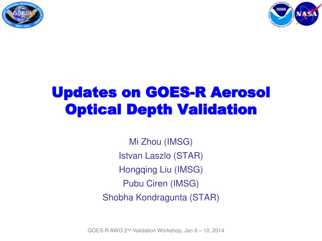
Updates on GOES Updates on GOES- -R Aerosol Optical Depth Validation Optical Depth Validation R Aerosol Mi Zhou (IMSG) Istvan Laszlo (STAR) Hongqing Liu (IMSG) Pubu Ciren (IMSG) Shobha Kondragunta (STAR) GOES-R AWG 2nd Validation Workshop, Jan 9 10, 2014
OUTLINE OUTLINE Generated Proxy Data Algorithm Enhancements Validation Activities Post-launch Plan Summary GOES-R AWG 2nd Validation Workshop, Jan 9 10, 2014 2
Proxy MODIS Reflectance Proxy MODIS Reflectance MODIS reflectances are used as proxy for ABI to retrieve AOD Many MODIS and ABI channels are similar Provide a wide range of realistic atmospheric and surface conditions. Currently routine and deep-dive validation use clear-sky reflectance from MOD04 aerosol product Obtained from MODIS collection 5 aerosol product at 10km resolution; Avoid ABI vs. MODIS cloud screening differences; ABI vs. MODIS/Aqua AOD Since 1st Workshop evaluation has been extended from years 2000 2009 to years 2000 2012. Newly generated L1b reflectance at ABI channel resolution MODIS L1b reflectance are processed to ABI channel resolution (2 km); Provide the opportunity to test cloud screening for ABI aerosol algorithm. GOES-R AWG 2nd Validation Workshop, Jan 9 10, 2014 3
AERONET Ground Truth AERONET Ground Truth The ground-based AERONET remote sensing network provides a comprehensive dataset of aerosol properties for evaluating satellite retrievals. AERONET Stations Level 1.5 data: automatically cloud- cleared; time lag of one or two days; potential for near-real time routine validation. 09/2007 Level 2.0 data: quality assured and widely used; but the time lag can be several months or longer; included for deep-dive validation. GOES-R AWG 2nd Validation Workshop, Jan 9 10, 2014 4
Available Proxy Dataset Available Proxy Dataset AERONET-ABI(MODIS )match-up data: AERONET data are temporally averaged within 1-hour window around MODIS overpass ABI data AOD retrievals are spatially averaged in a 50x50 km box centered at AERONET station. Collected and co-located AERONET level 2.0 and MOD04 clear-sky reflectance at 10-km resolution for years 2000-2012; AERONET level 1.5 and MOD04 clear-sky reflectance at 10-km resolution for years 2010- Nov 2013; AERONET level 2.0 and MODIS L1b reflectance at ABI channel resolution (2 km) for year 2009. ABI aerosol algorithm is run using proxy MODIS reflectances and ABI AODs are validated with AERONET. GOES-R AWG 2nd Validation Workshop, Jan 9 10, 2014 5
Field Campaign Data AOD at 550nm, July 30, 2012 0.12 Field measurements at Cape Cod, MA (for deep dive) Measured AOD550 0.10 Location: 42.03 N, 70.05 W, near the ocean Part of the Two-Column Aerosol Project (TCAP) (ARM field campaign) 0.08 Surface albedo and AOD measurements (partially supported by GOES-R Proving Ground to Joseph Michalsky and Kathy Lantz, NOAA/ESRL) 0.06 10 15 20 UTC (hour) Instruments: MFRSR and MFR (sampled every 20 seconds simultaneously) Albedo at 496nm, July 30, 2012 0.05 Deployment period: 28 June to 6 September, 2012 Measured Albedo 0.04 Wavelengths: 413, 496, 671, 869, 937, 1623 nm 0.03 Estimated uncertainty: is 0.01 in AOD, 2% in albedo 0.02 0.01 10 15 20 GOES-R AWG 2nd Validation Workshop, Jan 9 10, 2014 6 UTC (hour)
Validation with Extended Dataset Validation with Extended Dataset Using AERONET-MODIS dataset for years 2002-2012 Over Land Over Water AOD range Accuracy Precision # of points Range AOD Accuracy Precision # of points <0.04 0.06 (0.06) 0.13 (0.13) 24,421 Low <0.4 0.02 (0.02) 0.06 (0.15) 38,436 High >0.4 -0.05 (0.10) 0.18 (0.23) 3,221 0.04 - 0.8 0.03 (0.04) 0.13 (0.25) 157,067 ABI AODs meet requirements. > 0.8 -0.06 (0.12) 0.32 (0.35) 4218 7 GOES-R AWG 2nd Validation Workshop, Jan 9 10, 2014
Algorithm Enhancement Algorithm Enhancement Internal Cloud Check (1) Internal Cloud Check (1) One Month Framework Run Validation for Aug. 2006 Land Water Range AOD Accuracy Precision # of points AOD Accuracy Precision # of points Low <0.04 0.14 (0.06) 0.21 (0.13) 100 Medium 0.04 - 0.8 0.08 (0.04) 0.16 (0.25) 748 <0.4 0.08 (0.02) 0.10(0.15) 49 High > 0.8 0.12 (0.12) 0.20(0.35) 6 >0.4 0.06 (0.10) 0.04 (0.23) 3 MODIS Aqua L1b reflectances at 1km resolution are used as proxy; ABI cloud mask, clear pixel from the 4-level cloud mask, is used for cloud screening; Numbers in red are F&PS requirements; Framework run overestimates AOD and does not meet accuracy requirements for low and medium ranges over land, and for low range over ocean. CAVEAT: Sample size is limited from one-month data! Statistics are not robust. GOES-R AWG 2nd Validation Workshop, Jan 9 10, 2014 8
Algorithm Enhancement Algorithm Enhancement Internal Cloud Check (2) Internal Cloud Check (2) Case Study Case Study While framework run with MODIS L1b reflectance does not meet all accuracy requirements, off-line run using MOD04 clear-sky reflectance for the same time period can meet the requirement. Aqua granule MYD20062181840 was selected with co-location with AERONET at station CCNY. Co-located AERONET Site Site Longitude -73.949 Latitude 40.821 CCNY ABI-framework uses ABI cloud mask. AERONET ABI-framework 0.266 ABI-offline 0.325 ABI offline run uses the internal cloud checks. AOD 0.641 Case study suggested that the ABI cloud mask may not be sufficient for ABI aerosol retrieval. GOES-R AWG 2nd Validation Workshop, Jan 9 10, 2014 9
Algorithm Enhancement Algorithm Enhancement Internal Cloud Check (3) Internal Cloud Check (3) Internal Cloud Check LAND Apply reflectance threshold and spatial variability tests; Channel 0.47 um reflectance test (> 0.4) Channel 1.38 um reflectance test (> 0.025) Channel 0.47 um reflectance spatial variability test for standard deviation of 3x3 array (> 0.0025) Channel 1.38 um reflectance spatial variability test for standard deviation of 3x3 array (> 0.003) OCEAN Channel 0.64 um reflectance spatial variability test for standard deviation of 3x3 array (> 0.003) Use available ABI channel and ABI cloud mask. Dust call back 0.47/0.66 ratio (< 0.75) Results for August 2006 Channel 0.47 um reflectance test (> 0.4) IR cirrus tests if any of 3 specific ABI Cloud Mask tests indicates cloudy , then cloudy : PFMFT, CIRH2O, RFMFT Updated One Month Framework Run for Aqua, Aug. 2006 Channel 1.38 um reflectance test (> 0.025) Land Water Range AOD Accuracy Precision # of points AOD Accuracy Precision # of points Low <0.04 0.04 (0.06) 0.13 (0.13) 93 Medium 0.04 - 0.8 -0.002 (0.04) 0.13 (0.25) 696 <0.4 0.01 (0.02) 0.04 (0.15) 45 High -0.06 (0.12) GOES-R AWG 2nd Validation Workshop, Jan 9 10, 2014 ABI AOD meets requirements when internal cloud test is used. > 0.8 0.15 (0.35) 6 >0.4 0.07 (0.10) 0.06 (0.23) 3 10
Validating AOD with Ground Validating AOD with Ground Measurements at Cape Cod Measurements at Cape Cod Over Land Over Water Bias: 0.01 Std: 0.03 Bias: 0.04 Std: 0.06 15 match-ups were found over land and 22 over water after spatially (50 x 50 - km box) and temporally (1-hour window) co-locating with MODIS. MODIS L1b proxy reflectance was generated at ABI channel resolution, and ABI AOD algorithm was run to produce 2km product. A better agreement is observed over water than over land. GOES-R AWG 2nd Validation Workshop, Jan 9 10, 2014 11
Validating Land Surface Validating Land Surface Albedo Ground Measurements at Cape Cod Ground Measurements at Cape Cod Albedo with with The land surface relationship assumption between SWIR and VIS reflectance remains challenging for aerosol retrieval over land, and the current ABI aerosol algorithm uses a linear relationship. Bias: -0.010 Std: 0.006 ABI albedo at channel 470nm is chosen to compare with Cape Cod measurement at 496nm as there is no exact channel match. The albedo at 496nm is expected to be larger than that at 470nm, which could partially explain the underestimation of albedo by ABI . The land surface relationship between SWIR and VIS reflectance could be improved as a function of NDVI potential algorithm enhancement. Vegetation GOES-R AWG 2nd Validation Workshop, Jan 9 10, 2014 (Lillesand and Kiefer, 1994) 12
Is AERONET level 1.5 good Is AERONET level 1.5 good enough for AOD validation? enough for AOD validation? Validating ABI AOD for year 2010 level 2.0 Over land, statistics are comparable for low and medium AOD ranges, which account for 98% land retrievals. Land Ocean Range # of points # of points AOD Accuracy Precision AOD Accuracy Precision <0.0 4 0.04 - 0.8 0.06 0.14 4,552 Low <0.4 0.02 0.06 5,842 Over ocean, the statistics are generally comparable. 0.03 0.14 22,372 Medium -0.05 0.32 658 >0.4 -0.04 0.16 399 High > 0.8 This suggests the feasibility to set up a near-real time routine validation of ABI aerosols using AERONET L1.5 data. level 1.5 Land Ocean Range # of points # of points AOD Accuracy Precision AOD Accuracy Precision At high AOD range over land, the difference is noticeabe, which will need to be further validated when AERONET L2.0 data become available in deep-dive validation. <0.0 4 0.04 - 0.8 0.05 0.14 4,942 Low <0.4 0.01 0.07 6,616 0.02 0.14 25,827 Medium -0.23 0.70 819 >0.4 -0.06 0.19 453 High > 0.8 GOES-R AWG 2nd Validation Workshop, Jan 9 10, 2014 13
Routine Validation Tool Routine Validation Tool Example of frequency scatter-plot AERONET level 1.5 instead of level 2.0 is used for near-real time validation. Example frequency scatter-plot for September, 2013 over land is shown. Users can specify validation period. regression line Users can choose from functions: statistics, frequency scatter-plot and time series. The Statistics pull-down menu generates the scatter-plot and the metrics to characterize the AOD product accuracy and precision. GOES-R AWG 2nd Validation Workshop, Jan 9 10, 2014 14
Deep Deep Dive Validation Tool Dive Validation Tool Same functions as in routine validation: statistics generation, scatter-plot/frequency scatter- plot and time series; typical aerosol type AERONET station Add function for dependence analysis on parameter of interest: input, diagnostic, and intermediate. Example: Cross validation between ABI, MODIS and AERONET level 2.0; GOES-R AWG 2nd Validation Workshop, Jan 9 10, 2014 15
Dependence Analysis over Land Dependence Analysis over Land AOD retrieval error Solar zenith angle Satellite zenith angle Scattering angle Relative Azimuth Angle AOD retrieval error Month Fine-mode fraction Retrieved AOD Retrieved surface albedo ABI AOD retrievals run with co-located AERONET-MODIS dataset for years 2000-2012. ABI and MODIS ADOs generally have similar pattern. AOD error vs. retrieved AOD shows similar pattern for AOD range of 0 1.5; and ABI shows a smaller error for AOD > 1.5. Note that MODIS does not report AOD < -0.05. 16
Dependence Analysis over Ocean Dependence Analysis over Ocean AOD retrieval error Solar zenith angle Satellite zenith angle Scattering angle Relative Azimuth Angle AOD retrieval error Month Retrieved AOD Ocean surface wind speed Fine-mode fraction ABI AOD retrievals run with co-located AERONET-MODIS dataset for years 2000-2012. ABI and MODIS AODs generally have similar pattern. Accuracy decreases when wind speed goes out of the LUT range. 17
Derive Threshold for Routine Derive Threshold for Routine Daily Monitoring Daily Monitoring Over Land Over Ocean Mean + Mean + Mean Mean Mean - Mean - Routine daily monitoring/validation requires threshold values of statistics, so that out-of-bound retrievals trigger deep-dive validation. Using co-located AERONET-MODIS dataset for years 2000-2012, ABI retrievals were collected for each day of year from day 1 day 366 to calculate the mean value and . Mean is suggested as daily monitoring threshold. GOES-R AWG 2nd Validation Workshop, Jan 9 10, 2014 18
Validation with ABI Channel Validation with ABI Channel Resolution Proxy Reflectance Resolution Proxy Reflectance Proxy MODIS L1b reflectance at ABI channel resolution is generated, at the co-locations with AERONET level 2.0, for year 2009. ABI aerosol algorithm is run to produce 2km AOD product. Aerosol internal cloud tests are applied, where individual cloud test was implemented at pixel level; 2 km 2 km is masked as cloudy if any of the pixels is identified as cloudy by individual tests. Data filtering strategy is the same as in MODIS aerosol algorithm. Land Water Range AOD Accuracy Precision # of points AOD Accuracy Precision # of points Low <0.04 -0.02 (0.06) 0.08 (0.13) 116 Medium 0.04 - 0.8 -0.004(0.04) 0.16 (0.25) 1074 <0.4 0.01 (0.02) 0.15(0.15) 468 High > 0.8 -0.28 (0.12) 0.34(0.35) 60 >0.4 -0.30 (0.10) 0.33 (0.23) 8 ABI AODs meet the requirement everywhere except high AOD range with limited data points. GOES-R AWG 2nd Validation Workshop, Jan 9 10, 2014 19
Connections to other Programs Provided ABI MODIS Proxy AOD for field campaigns: NOAA SENEX 2013 campaign (Southeast Nexus) Studying the Interactions Between Natural and Anthropogenic Emissions at the Nexus of Climate Change and Air Quality Provided aerosol data retrieved for June-early July 2013 from MODIS reflectances using the ABI algorithm SEAC4RS Studies of Emissions and Atmospheric Composition, Clouds and Climate Coupling by Regional Surveys Provided aerosol data retrieved for mid July-August 2013 from MODIS reflectances using the ABI algorithm Data were provided to Bradley Pierce (STAR) GOES-R AWG 2nd Validation Workshop, Jan 9 10, 2014 20
Potential Algorithm Enhancements (1) Implement internal cloud tests has been tested for one month (Aug 2006); candidate for transition to ops, but need more evaluation Develop NDVI-dependent spectral surface reflectance relationships software tool to derive these relationships has been developed for NPP/JPSS tool should be applied to an extensive set (12 months) of actual (good quality) ABI reflectances GOES-R AWG 2nd Validation Workshop, Jan 9 10, 2014 21
Potential Algorithm Enhancements (2) Replace current ABI AOD algorithm for over-land retrieval with one developed under JPSS Risk Reduction Project (JPSS PGRR) unified code with a single core to handle either ABI or VIIRS inputs combines current IDPS and ABI over-land algorithms tries IDPS retrieval first, switches to ABI when IDPS fails not yet tested; would need to run ABI, and ABI+IDPS on VIIRS data for an extended period of time, and compare it to IDPS GOES-R AWG 2nd Validation Workshop, Jan 9 10, 2014 22
Post Post- -launch Validation (1) launch Validation (1) Post-launch Test (checkout) period (L+6 months) Validation tool is applied to one month of data from the end of the period ABI aerosol products are compared with like VIIRS and AERONET products Expected to reveal any major issues, but not a full evaluation Post-launch product validation (PLT+12 months) Algorithm update tasks: Re-generate LUT and ancillary coefficients using actual sensor response functions Re-derive SWIR VIS land surface reflectance relationship Comparison with existing ground networks (AERONET) Inter-comparison with other satellite-based aerosol data (VIIRS) Global, regional, seasonal statistics Update reference statistics used in routine monitoring/evaluation GOES-R AWG 2nd Validation Workshop, Jan 9 10, 2014 23
Post Post- -launch Validation (2) launch Validation (2) Post-launch product validation (PLT+12 months) (contd.) Use field campaign data when available No specific campaigns have been indentified at this time, but field data including aerosol, surface albedo and gas amount are preferred Challenges: No continuous, permanent reference data are available over open ocean; evaluation must rely on island/coastal sites For evaluation, spatial averaging of ABI AOD and temporal averaging of AERONET AOD are needed, thus strict validation of instantaneous 2-km ABI AOD product is not possible. GOES-R AWG 2nd Validation Workshop, Jan 9 10, 2014 24
Summary Summary Available proxy data 10-km data now covers years 2000 2012 New proxy data using L1b MODIS reflectance processed at ABI product resolution Validation activities Routine validation uses co-located AERONET level 1.5 and MODIS data for near-real time validation Deep-dive validation uses the extended co-located AERONET level 2.0 and MODIS data Presented validation results with new proxy data at ABI channel resolution Algorithm enhancements internal cloud masking has been developed and is a candidate for transition to ops NDVI-dependent SWIR-VIS land-surface reflectance relationship needs development JPSS PGRR algorithm already has the above two enhancements in some form, but needs more extensive testing; surface reflectance relationship must be re-derived using ABI data Post-launch validation will apply tools developed in the pre-launch phase GOES-R AWG 2nd Validation Workshop, Jan 9 10, 2014 25