Overview of Sea Ice Characterization and Validation Process
Sea ice characterization and validation process for cryosphere products involve three stages of validation maturity. It includes evaluating algorithm performance, analyzing required inputs, conducting quality flag analysis, and documenting error budget. The team members consist of experts from various organizations contributing to the development of sea ice data products. The data products include sea ice concentration, ice surface temperature, snow cover, and more. Validation stages range from using a limited set of samples to a large set representing global conditions across four seasons. The ultimate goal is to meet performance attributes identified in JPSS Level 1 requirements.

Download Presentation

Please find below an Image/Link to download the presentation.
The content on the website is provided AS IS for your information and personal use only. It may not be sold, licensed, or shared on other websites without obtaining consent from the author. Download presentation by click this link. If you encounter any issues during the download, it is possible that the publisher has removed the file from their server.
E N D
Presentation Transcript
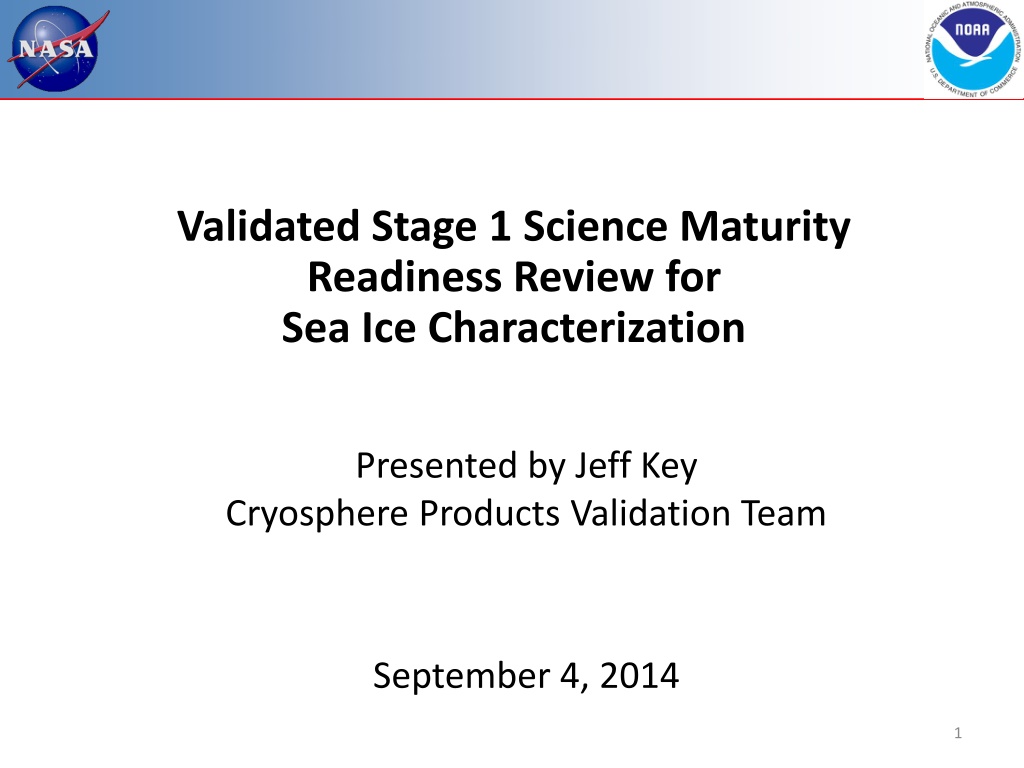
Validated Stage 1 Science Maturity Readiness Review for Sea Ice Characterization Presented by Jeff Key Cryosphere Products Validation Team September 4, 2014 1
Outline Algorithm Cal/Val Team Members Product Requirements Evaluation of algorithm performance to specification requirements Evaluation of the effect of required algorithm inputs Quality flag analysis/validation Error Budget Documentation Identification of Processing Environment Users & User Feedback Conclusion Path Forward 2
Cryosphere Team Membership EDR Name Organization Lead Jeff Key NESDIS/STAR Co-Lead Pablo Clemente-Col n NESDIS/STAR and NIC Wisconsin: Ice Yinghui Liu CIMSS/U. Wisconsin Ice Xuanji Wang CIMSS/U. Wisconsin Ice Maryland: Rich Dworak CIMSS/U. Wisconsin Snow Peter Romanov CREST/CCNY Snow Igor Appel IMSG Colorado: Ice Mark Tschudi U. Colorado Ice Dan Baldwin U. Colorado Other: All Paul Meade DPE 3
Overview of Data Products 1. Sea ice characterization - Provisional Currently this is an age category: no ice, new/young ice, other ice 2. Sea Ice concentration IP Fractional coverage of ice in each pixel 3. Ice surface temperature (IST) Val 1 Radiating temperature of the surface (ice with or without snow) 4. Snow cover 4a. Binary snow cover Val 1 4b. Fractional snow cover Provisional RGB Image shows dense smoke (high absorption) in northwest, north central and central coastal portions of image. Notes: Information on ice and snow cover is needed by other EDRs. AMSR2 on GCOM-W1 will be used to generate other snow and ice products: Ice Characterization, Snow Cover, Snow Depth, and Snow Water Equivalent (SWE). 4
SNPP Validation Stages Maturity Definition Validated Stage 1: Using a limited set of samples, the algorithm output is shown to meet the threshold performance attributes identified in the JPSS Level 1 Requirements Supplement with the exception of the S-NPP Performance Exclusions Validated Stage 2: Using a moderate set of samples, the algorithm output is shown to meet the threshold performance attributes identified in the JPSS Level 1 Requirements Supplement with the exception of the S-NPP Performance Exclusions Validated Stage 3: Using a large set of samples representing global conditions over four seasons, the algorithm output is shown to meet the threshold performance attributes identified in the JPSS Level 1 Requirements Supplement with the exception of the S-NPP Performance Exclusions 5
Sea Ice Characterization EDR L1RD Requirements Sea Ice Characterization Requirements from L1RD version 2.9 EDR Attribute Threshold Objective a. Vertical Coverage Ice Surface Ice Surface b. Horizontal Cell Size 1. Clear 2. All weather Note that because the percentage of N/Y ice is, on the annual average, very small, the 70% probability of correct typing of both types together could be met by simply labeling all ice pixels as Other Ice ! 1.0 km No capability 0.5 km 1 km c. Mapping Uncertainty, 3 sigma 1. Clear 2. Cloudy 5 km No capability 0.5 km 1 km d. Measure Range 1. Ice Age Ice free, Nilas, Gray White Grey, White, First Year Medium, First Year Thick, Second Year, Multiyear, Smooth and Deformed Ice Ice Free, New Young, all other ice 2. Ice Concentration 0/10 to 10/10 0/10 to 10/10 RGB Image shows dense smoke (high absorption) in northwest, north central and central coastal portions of image. 2. Ice Concentration f. Refresh e. Measurement Uncertainty 1. Probability of Correct Typing (Ice Age) 70% Note 1 90% 5% At least 90% coverage of the global every 24 hours (monthly average) 6 hrs g. Geographic coverage All Ice-covered regions of the global ocean All Ice-covered regions of the global ocean Notes: 1. VIIRS produces a sea ice concentration IP in clear sky conditions, which is provided as an input to the ice surface temperature calculation 6 6
Evaluation of algorithm performance to specification requirements (3-5 slides) Findings/Issues from Provisional Review: VIIRS Sea Ice Characterization EDR has met the provisional maturity stage based on the definitions and the evidence shown Some issues have been uncovered during validation and solutions are being evaluated. (Specific issues are too numerous to list here but are in the additional slides.) Improvements since Provisional A number of improvements have been made to the VIIRS Cloud Mask (by the Cloud Team) and to snow/ice gridding, which have resulted in improvements to SIC. However, no changes have been made to the SIC algorithm. In- depth testing and analysis has not resulted in any solutions. Cal/Val Activities for evaluating algorithm performance: See the following slides 7
Summary of VIIRS Sea Ice Characterization EDR The VIIRS Sea Characterization EDR (Ice Age) consists of ice classifications for Ice Free, New/Young and Other Ice at VIIRS moderate spatial resolution (750m @ nadir), for both day and night, over oceans poleward of 36 N and 50 S latitude. New or Young ice is discriminated from thicker ice (Other Ice) by a threshold ice thickness of 30 cm. Discrimination of New/Young ice from thicker ice is achieved by two algorithms: 1. Energy (heat) balance based retrieval for night and high solar zenith angles 2. Reflectance/ice thickness retrieval using modeled Sea Ice Reflectance LUT for daytime Heritage: No operational visible/IR heritage. AVHRR research heritage (Comiso and Massom 1994, Yu and Rothrock 1996 and Wang et al. 2010) 8
Summary of VIIRS Sea Characterization EDR (Ice Age) Algorithm Overview Reflectance Threshold Branch (Day Region Algorithm) Input ice tie point reflectance (I1, I2), VCM IP, AOT IP Input granulated NCEP gridded precipitable water, total ozone fields Obtain snow depth for each ice thickness bin obtained from climatology modeled snow depth/ice thickness LUT Retrieve ice thickness from sea ice reflectance LUT using ice tie point reflectances, modeled snow depth, AOT, precip. water and solar and satellite view geometry Classify by comparing retrieved ice thickness to 30 cm ice thickness threshold Energy Balance Branch (Terminator and Night Region Algorithm) Input Ice Temperature Tie Point IP Input granulated NCEP gridded surface fields (sfc.P, sfc air temp, specific hum. etc ) Compute snow depth for 30cm ice thickness threshold from heat/energy balance Classify by comparing computed and climatology LUT snow accumulation for a 30 cm ice thickness threshold The Snow-Depth-Ice Thickness Climatology LUT contains: predicted snow accumulation depths for modeled ice thickness threshold growth times based on monthly climatology surface air temperatures and precipitation rates 9
Performance Evaluation of the VIIRS Sea Ice Characterization EDR (Ice Age) Algorithm Detailed analysis of 20 Arctic scenes including four seasons: July 2012, March May 2013, December 2013, and April 2014 Golden granule: March 17, 2013 Examined performance of daytime, nighttime and terminator (transition) areas Comparisons to other products: VIIRS SDR reflectance NOAA IMS ice extent CU ice age One-dimensional Thermodynamic Ice Model (OTIM) Airborne ice thickness IceBridge ice thickness Airborne EM & Lidar 10
Assessment of the Sea Ice Characterization EDR Summary: There are times when performance is good, and other times (too many) when performance is not good. Overall, it does not appear to be meeting the accuracy requirements. This is a complex algorithm where improvements would be required in a number of components. March 17, 2013 20:52 UTC scene (above) shows a broad region of Other Ice (green) misclassified as New Young ice (blue) in the terminator region where the algorithm transitioned from the reflective algorithm (left half) to the thermal heat balance branch (right half) 11
Case Study: December 2013 VIIRS Ice Surface Temperature composite on Dec 19, 2013. Note warmer temperatures in the Greenland Sea, extending north. We would expect thinner ice here (it s December, so no melting), hence New/Young ice should be most prevalent in this region.
SIC EDR OTIM The VIIRS Sea Ice Characterization EDR nighttime algorithm composite (left) and the OTIM* algorithm (right). Note that OTIM calculates sea ice thickness here the thickness is binned into either New/Young (NY) ice for ice <= 30 cm, or Other Ice for thickness > 30 cm, to match the classification for Ice Age. Both the VIIRS and OTIM algorithms identify the thin ice near Greenland, but overall VIIRS appears to over-estimate NY ice, while OTIM appears to underestimate it. *OTIM (One-dimensional Thermodynamic Ice Model) was developed for GOES-R ABI and will run in NDE on VIIRS data.
Now we zoom into the Laptev / East Siberian Seas for a single overpass. Region 1: VIIRS ice age nighttime algorithm appears to overestimate N/Y ice; OTIM classification appears to be more accurate Region 2: VIIRS algorithm misclassifies cold pixels as N/Y ice, OTIM does not Region 3: OTIM estimates much less N/Y ice than the VIIRS algorithm Region 4: VIIRS algorithm misclassifies N/Y ice, OTIM appears to be more accurate
Ice Thickness and Age IDPS and NDE (OTIM) Comparison Sea ice age categories from VIIRS sea ice age classification (left) and OTIM ice thickness converted to the same categories (right) on May 4, 2013 over the Arctic.
Ice Thickness and Age IDPS and NDE (OTIM) Comparison Statistics for figure on previous slide:
Validation with IceBridge For some NASA IceBridge Arctic flights, sea ice thickness was estimated from lidar (ice freeboard) and radar (snow depth) (NSIDC: Kurtz et al., 2012, updated 2014) IceBridge thickness compared to correct typing of SIC EDR New/Young Ice (<30cm) and Other Ice (>30cm) April 4, 2014 (shown at left): 2307 total pixels 19% N/Y pixels correct 2% N/Y incorrect 18% Other correct 60% Other incorrect March 17, 2014: 13535 total pixels <1% N/Y correct 1% N/Y incorrect 96% Other correct 4% Other incorrect
Validation with IceBridge All ice is Other ice in this case SIC EDR, daytime algorithm Classification accuracy for 1155 pixels = 76% IceBridge Ice Thickness [Kurtz et al, 2012] 18
Validation with EM & Lidar Dan Baldwin/CU, Mark Tschudi/CU 19
Validation with EM & Lidar Thickness (cm) courtesy of C. Haas: Airborne EM & Lidar - All ice for VIIRS SIC EDR is other ice (> 30 cm) - 1004 airborne data points: 99% > 30 cm (in agreement with VIIRS SIC EDR) 20
Other issues: Orbit-to-Orbit Classification Variability Note: This is with the daytime algorithm. The problem has been observed on multiple days. 21
Evaluation of the effect of required algorithm inputs Required Algorithm Inputs Ice Reflectance/Temperature IP, Ice Quality Flags IP, AOT IP Granulated ancillary surface wind speed, surface air pressure, surface air temperature and surface air specific humidity Modeled Snow Depth/Sea Ice Climatology LUT, modeled sea ice reflectance LUT, sea ice spectral albedo and broadband albedo LUTs, atmospheric transmittance LUT Ancillary Data 22
Impact of Errors in Inputs Discontinuities detected along lat/lon boundaries spaced 0.5 deg. Some misclassification evident due to VCM IP cloud leakage and cloud shadows 72.5 N 73.0 N 163.0 W Large region misclassified where ice tie point reflectance values drop below ~ 0.53 Several discontinuities that align along 0.5 steps of latitude and longitude are evident as shown along the black dashed lines. The reflectance based day algorithm has dependencies on the coarse resolution NCEP ancillary fields for precipitable water and total column ozone. In addition the algorithm also has a dependency on the climatological snow depth/ice thickness LUT (modeled using 2.5 deg. surface air and precipitation rate climatology data) . The 0.5 deg are strongly suggestive of sensitivity to the NCEP precipitable water field. (Data from June 8, 2012)
Daytime Ice Age Dependency Reflectance LUT Examination of the Modeled Sea Ice TOA Reflectance LUT: I2 ice tie point reflectance for 19:23 UTC orbit for high value of sensor zenith is below that of the corresponding modeled Sea Ice Reflectance LUT. I2 ice tie point reflectance for 22:43 UTC orbit for low value of sensor zenith is above that of the corresponding modeled Sea Ice Reflectance LUT. Snow depth = 3 cm Water Vapor = 0.4 cm Total Ozone = 0.2 atm-cm I2 Ice Tie Point Reflectance 22:43 UTC scene I2 Ice Tie Point Reflectance 19:23 UTC scene Dan Baldwin U. Colorado VIIRS I1 (640 nm) and I2 (865 nm) band reflectances extracted from the Modeled Sea Ice Reflectance LUT are shown as function of satellite view zenith angle for two solar zenith angle and relative azimuth bins that bound the scene conditions. The fact that the I2 band modeled reflectances are greater than that of the I1 band reflectances is unexpected since the spectral albedo of snow decreases with increasing wavelength beyond about 0.5 m. 24
Evaluation of Cloud and Ice Quality Flags ALLCLD ALLQUAL #1 63252 45136 42708 (94.6%) ALLCLD GOOD #2 27889 32458 31867 (98.2%) CNFCLR ALLQUAL #3 40190 33368 32485 (97.4%) CNFCLR GOOD #4 27889 32458 31867 (98.2%) SIC EDR is compared to MODIS over sea ice during the melt period, when only other ice is expected. MODIS Ice Pix VIIRS Ice Pix VIIRS New/Young Ice Pix VIIRS Other Ice Pix Ice Agree Beaufort Sea, July 23, 2012 2428 (5.4%) 30695 (48.5%) 591 (1.8%) 27608 (99.0%) 59067 883 (2.6%) 27902 (69.4%) 62080 591 (1.8%) 27608 (99.0%) 59067 NOTE BOTTOM ROW ALLCLD=No Cloud Cover Quality Flag Filter ALLQUAL=No Ice Quality Flag Filter CNFCLR=Only Pixels with Confidently Clear Cloud Cover Flag GOOD=Only pixels with Good Ice Quality Flag MODIS Ice Free Pix VIIRS Ice Free Pix Ice Free Agree 83064 109187 61632 80778 61632 74192 (89.3%) 15599 58511 (99.1%) N/A 61479 (99.0%) N/A 58511 (99.1%) N/A MODIS ICE VIIRS Cloud MODIS Ice VIIRS Free Ice Type Classification Accuracy* 16958 281 12288 281 5.4% 1.8% 2.6% 1.8% * note: all pixels with good ice quality are confidently clear, so columns 2 & 4 are identical.
Error Budget Attribute Analyzed L1RD Threshold Analysis/Validation Result Error Summary SIC uncertainty (probability of correct typing) 70% Comparison with MODIS ice extent: 2-5% correct typing Beaufort Sea Melt season depressed reflectance due to melt affects daytime algorithm SIC uncertainty (probability of correct typing) 70% Comparison with Airborne Lidar & EM: 99% correct Beaufort Sea Spring - Almost all ice was measured thicker than 30cm and classified as other SIC uncertainty (probability of correct typing) 70% Comparison with IceBridge derived thickness: 4/14/14: 37% correct 3/17/14: 97% correct Beaufort Sea: April 4 had 20% ice <30cm, March 17 had almost no ice < 30 cm SUMMARY: SIC probability of correct typing 70% 2 99%, with case study results uniformly distributed in this range (1) Validation data are limited. (2) Lowest accuracies occur during melt. 26
Evaluation Summary The Sea Ice Characterization EDR does meet the requirement for some sample, but does not meet the requirement overall. Misclassification of ice age was observed to occur for the following categories of conditions: Day regions: Bias towards misclassification of Other Ice as NY in regions with 1) large values of climatological snow depth, 2) high satellite view zenith angle and regions with 3) low reflectance due to melting ice and 4) cloud shadows Night regions Reversals of ice age classification Terminator regions Frequent, broad misclassification of Other Ice as NY and reversals of classification Ice classification discontinuities are most evident and frequent where the algorithm transitions from the day reflectance based algorithm to the night energy balance based algorithm 27
Potential Solutions for Known Issues Issue Description Proposed Solution Day Region Ice Age Misclassifications Daytime algorithm shows a bias towards N/Y ice for higher scattering angles Update Modeled TOA Sea Ice Reflectance LUT to eliminate bias (reconstruct LUT based on CASIO/DISORT Snow/Ice BRDFs and coupled sea/ice/atmosphere RTM) Night Region Ice Age Classification Reversals Nighttime algorithm shows numerous classification reversals Investigate tie point calculation in area of misclassification; investigate energy balance Terminator Region Ice Age Misclassifications Frequent misclassification of ice for broad regions, major discontinuities where algorithm transitions from day reflectance based to night energy balance algorithm, frequent reversal of ice classification Update night algorithm to use a local sliding IST window; investigate energy balance and solar flux term Climatology Modeled Snow Accumulation/Ice Thickness LUT Snow depth thresholds based on the monthly, climatology based snow/depth ice thickness LUT are problematic Investigate use of ancillary precipitation to derive snow depth and compute an ice thickness based on that snow depth. Dependence on the problematic SnowDepth/IceThickness Climatology LUT can then be eliminated. False ice is frequently observed near cloud edges False ice is frequently observed near cloud edges due to undetected clouds Implement additional quality checks for extended cloud adjacency and partly cloudy conditions within the ice tie point search window in the Sea Ice Concentration IP 28
Known Issues and Potential Solutions, cont. Issue Description Proposed Solution Ice Age Misclassification due to low opacity clouds Ice misclassifications occur due to low opacity clouds or ice fog, particularly during nighttime Continued improvement of VCM to facilitate cloud vs. ice detection Ice Age Misclassification due to melting ice Lower reflectance of melting sea ice appears to cause the SIC EDR to indicate New/Young Ice, although this type of ice cannot be present this time of year. Define and utilize melt season period where New/Young ice cannot exist. Could do this by date/latitude or possibly with IST or NCEP air temp input. During this time, ALL ice would be classified as other ice. Ice Age Misclassification due Cloud Shadows Lower reflectance of cloud shadow regions cause SIC EDR to indicate New/Young even though surrounding ice is Other Ice Continued improvement of VCM to extend cloud shadow algorithm and flagging. Add logic to Ice Age algorithm to check VCM cloud shadow flag cloud and set quality flag to indicate degraded Ice Age retrieval quality While there are potential solutions to the issues that have been identified, there is no guarantee of the outcome should they be implemented. Furthermore, the loss of NGAS support has severely limited our ability to perform the necessary work. 29
Documentation Status of documentation: Current or updated ATBD: Up to date Current or updated OAD: Up to date README file for CLASS: Up to date 30
Identification of Processing Environment IDPS or NDE build (version) number and effective date: Validation results were from July 2012 through April 2014. Mx6.6 (Feb 28, 2012) through 8.3 (March 18, 2014). Most validation results based on the EDR from builds 6.7 and 8.0. Effective date: N/A; the product is not recommended for Validated Stage 1 maturity Algorithm version: 1.O.000.001 - 1.O.000.003 LUTS: VIIRS-SNOWDEPTH-THICKNESS-LUT: 1-D-NPP-1 (12/02/2009) VIIRS-ATMOS-BROAD-TRANSMIT-LUT: 1-D-NPP-1 (11/10/2001) (This is the Broadband Albedo LUT) ICE-REFLECTANCE-LUT: 1-D-NPP-1 (12/02/2009) Description of environment used to achieve val stage 1 The SIC EDR was obtained from CLASS. Build dates are listed above. 31
User Feedback From 2014 STAR JPSS Annual Meeting. Main users NIC, National/Naval Ice Center Naval Research Laboratory and NAVO NWS, including the Alaska Ice Desk and NCEP/EMC Summary from the NIC: The VIIRS Ice Age Product will be used by NIC on a limited basis to map ice extent, but has no utility for ice age identification. Needs algorithm improvement to be apply Ice Age product in operational ice charting or NWP assimilation. (Same sentiment from the NWS Alaska Ice Desk) EMC: No plans to use this product. Other comments: Continuity: VIIRS, AMSR2, and ATMS products provide continuity with products from heritage imagers such as AVHRR, MODIS, and OLS for some products. What more can we get? Freshwater ice concentration and thickness. 32
Conclusion The Sea Ice Characterization EDR does meet the threshold attributes for a limited set of samples, but does not meet the requirements overall, particularly if the 70% probability of correct typing applies to each ice class. Solutions are elusive. One alternate algorithm has been investigated. Therefore, the Team defers to the AERB regarding the product maturity level. Regardless of the maturity level, the Team recommends that the NDE ice thickness product ultimately replace the SIC EDR as its operational ice characterization (age or thickness) product.
Plans, Milestones Suomi NPP JPSS J1 Validated Stage n (various) maturity reviews Continued validation of all products Improve or recommend replacement of Sea Ice Characterization algorithm Recommendations on snow/ice gridding JPSS Risk Reduction Projects: Run GOES-R algorithms on VIIRS products Minor algorithm improvements FY15 Hold algorithm preliminary design reviews Define validation plan Algorithm maintenance and minor improvements FY16 Hold algorithm critical design reviews Begin transitioning to JPSS Redefine products if needed Generate LUTs for J1 VIIRS sensor Long-term validation of VIIRS snow and ice products FY17 Long-term validation of VIIRS snow and ice products J1 launch Beta maturity status FY18
Caveats for Operational VIIRS Sea Ice Characterization EDR - from Provisional Review Known problems and proposed technical solutions In general, significant discontinuities in ice classification between New Young and Other Ice have been observed in the granule level mapped composite data. Proposed solution: Investigate and mitigate sensitivity of retrievals to NCEP ancillary data inputs. Mitigation strategies include use of parameterizations or climatology Ice classification discontinuities are very evident near the terminator region where the algorithm transitions from the day reflectance based algorithm to the night energy balance based algorithm Proposed solution: Nighttime algorithm could be revised to utilize a local sliding IST window. For example, if the IST for the pixel is greater than the mean plus a threshold of the IST in the moving window, then it would be re-classified as new/young ice. ) Proposed solution: Investigate whether there is a problem with the solar energy flux term used by the heat balance for solar zenith angles between 80 and 90 and correct the implementation if necessary. The snow depth thresholds based on the snow accumulation depth/ice thickness climatology LUT are problematic Proposed solution: LUT generation logic requires modification to correct climatologically unrealistic values of snow accumulation depth identified the current LUT Proposed solution: Investigate use of ancillary precipitation to derive snow depth and compute an ice thickness based on that snow depth. Dependence on the problematic SnowDepth/IceThickness Climatology LUT can then be eliminated. 36
Caveats for Operational VIIRS Sea Ice Characterization EDR (additional issues) - from Provisional Review False ice is frequently observed near cloud edges Proposed solution: Implement additional quality checks for extended cloud adjacency and partly cloudy conditions within the ice tie point search window in the Sea Ice Concentration IP and pass quality flag to Sea Ice Characterization EDR Ice misclassifications occur due to low opacity clouds or ice fog, particularly during nighttime Proposed solution: Assistance from VCM to improve cloud vs. ice detection Thin ice in small leads are evident in SDR imagery are sometimes not detected and are classified as thicker Other ice Proposed solution: Investigate using VIIRS SDR reflectance and Surface Temperature IP value at each pixel for retrievals instead of the ice tie point Proposed solution: Add an ice temperature threshold hold test to the day reflectance algorithm as a consistency check for the day, reflectance based retrievals Lower reflectance of melting sea ice appears to cause the SIC EDR to indicate New/Young Ice, although this type of ice cannot be present this time of year. Proposed solutions: Define and utilize melt season period where New/Young ice cannot exist. Could do this by date/latitude or possibly with IST or NCEP air temp input. During this time, ALL ice would be classified as other ice Investigate reflectance and temperature thresholds used in the algorithm Investigate and mitigate sensitivity of retrievals to NCEP ancillary data inputs Change the category New/Young Ice to Thin Ice . Thin ice can occur, through melt, in the warm season.
Backup: JPSS-1 Product Maturity Definition JPSS/GOES-R Data Product Validation Maturity Stages COMMON DEFINITIONS (Nominal Mission) 1. Beta o o Product is minimally validated, and may still contain significant identified and unidentified errors. Information/data from validation efforts can be used to make initial qualitative or very limited quantitative assessments regarding product fitness-for-purpose. Documentation of product performance and identified product performance anomalies, including recommended remediation strategies, exists. o 2. Provisional o Product performance has been demonstrated through analysis of a large, but still limited (i.e., not necessarily globally or seasonally representative) number of independent measurements obtained from selected locations, time periods, or field campaign efforts. o Product analyses are sufficient for qualitative, and limited quantitative, determination of product fitness-for-purpose. o Documentation of product performance, testing involving product fixes, identified product performance anomalies, including recommended remediation strategies, exists. o Product is recommended for operational use (user decision) and in scientific publications. 3. Validated o Product performance has been demonstrated over a large and wide range of representative conditions (i.e., global, seasonal). o Comprehensive documentation of product performance exists that includes all known product anomalies and their recommended remediation strategies for a full range of retrieval conditions and severity level. o Product analyses are sufficient for full qualitative and quantitative determination of product fitness-for-purpose. o Product is ready for operational use based on documented validation findings and user feedback. o Product validation, quality assurance, and algorithm stewardship continue through the lifetime of the instrument. 38 May 2014, GOES-R, JPSS, and STAR Science Teams