NASA MODIS and VIIRS Land Surface Temperature and Emissivity Products Overview
Explore NASA's MODIS and VIIRS continuity products for monitoring land surface temperature and emissivity. Learn about MODIS/VIIRS LST&E updates, new VIIRS products, and the MODIS-VIIRS continuity effort. Dive into error dependencies, algorithms, band emissivity, and uncertainty estimates provid
0 views • 43 slides
NPP VIIRS Pre-Launch Performance and SDR Validation Overview
This presentation covers the pre-launch performance evaluation and SDR validation of the NPP VIIRS instrument, highlighting comparisons with MODIS Aqua, spectral and spatial characteristics, radiometric and polarization sensitivities, as well as calibration and validation strategies. It discusses th
0 views • 32 slides
VIIRS Land Surface Temperature (LST) Calibration Approach and Data Analysis
The VIIRS Land Surface Temperature (LST) Provisional Status project, led by Dr. Yunyue Yu, focuses on improving the LST EDR through algorithm coefficient updates and calibrations. The calibration process involves regression steps and comparisons with reference datasets like MODIS Aqua LST. Various c
0 views • 29 slides
Diagnosing Low-Topped Precipitation Events Using Satellite Imagery
Utilizing MODIS/VIIRS Night-Time Microphysics RGB Imagery combined with Proximity Soundings can enhance situational awareness and aid in diagnosing low-topped precipitation events. Various satellite images and data sources are analyzed to understand why heavy rain occurred in Havre, MT, despite mini
0 views • 17 slides
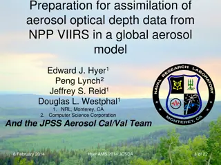
Assimilation of NPP VIIRS Aerosol Optical Depth Data in Global Model
Preparation and assimilation of aerosol optical depth data from NPP VIIRS into a global aerosol model, including product descriptions, data requirements, processed observations, and conclusions on VIIRS aerosol products. Details on AOT, APSP, SM classification, and environmental data records are cov
0 views • 19 slides
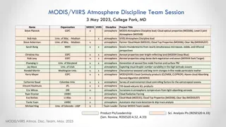
MODIS/VIIRS Atmosphere Discipline Team Session - May 2023, College Park, MD
The MODIS/VIIRS Atmosphere Discipline Team hosted a session in May 2023 at College Park, MD, focusing on various aspects of atmospheric science. The session included presentations on aerosols, clouds, data access, continuity products, and new science products. Speakers discussed topics such as ambie
0 views • 4 slides
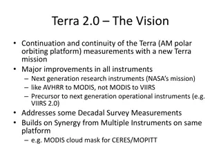
Terra 2.0: Advancements in Earth Observation Instruments and Platforms
Terra 2.0 envisions a new mission continuation focusing on major improvements in research instruments like MODIS 2.0 and VIIRS, with enhanced capabilities for measuring various Earth parameters. The platform enhancements include smaller, lighter designs and multiple platforms for better coverage. Di
0 views • 6 slides
MODIS and VIIRS Product Status Overview - May 2023
The MODIS and VIIRS Product Status for May 2023 discusses the current processing status of MODIS and VIIRS data, reprocessing plans, algorithm changes, geolocation updates, and upcoming activities of the science team meetings. Key points include the forward processing status, C7 reprocessing plan, V
0 views • 6 slides
Resources for Finding and Using MODIS Products
This presentation delves into valuable resources for accessing and utilizing MODIS products, presented during the MODIS Atmosphere Team Webinar Series #12. It includes reference sites, images, data archives, and visualization tools, along with guidance on how to effectively leverage these resources.
0 views • 8 slides
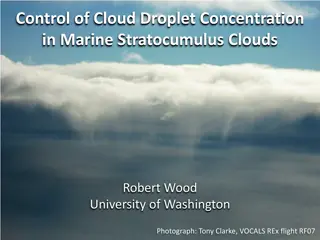
Understanding Cloud Droplet Concentration in Marine Stratocumulus Clouds
Analysis of cloud droplet concentration's impact on aerosol indirect effects and cloud morphology transitions in marine stratocumulus clouds. Observations on drizzle-CCN coupling, MODIS estimation of cloud droplet concentration, and prevalence of drizzle in low clouds. Insights on CCN budget in the
0 views • 30 slides
Update on Terra Spacecraft Operations and MODIS Instrument Status
Presentation on the current operations status of the EOS Terra spacecraft and the MODIS instrument. Details include recent maneuvers, configuration changes, and recovery efforts following abnormal events. Focus on maintaining operational stability and functionality during the spacecraft's long histo
0 views • 24 slides
Updates on GOES-R Aerosol Optical Depth Validation Activities
Generated proxy data algorithm enhancements for post-launch validation activities were discussed at the GOES-R AWG 2nd Validation Workshop in January 2014. The use of MODIS reflectances as a proxy for ABI to retrieve Aerosol Optical Depth (AOD) was emphasized, along with the importance of AERONET gr
0 views • 25 slides
Atmospheric Correction Techniques for Satellite Image Enhancement
Atmospheric correction is essential for improving the quality of Remote Sensing images captured by satellites. This process involves correcting for the effects of atmospheric gases such as scattering and absorption on the measured Top-of-Atmosphere (TOA) reflectance. Techniques like molecular correc
0 views • 8 slides
