Study on the Effectiveness of Coastal Bunds in Selangor State
The State Government of Selangor aims to evaluate the coastal bunds' efficiency in protecting against sea level rise. With a focus on the 492.1 km coastline, the study will assess bund integrity, formulate a management plan for coastal flooding, and cover a wide scope of work.

Download Presentation

Please find below an Image/Link to download the presentation.
The content on the website is provided AS IS for your information and personal use only. It may not be sold, licensed, or shared on other websites without obtaining consent from the author. Download presentation by click this link. If you encounter any issues during the download, it is possible that the publisher has removed the file from their server.
E N D
Presentation Transcript
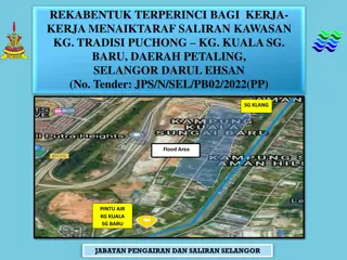
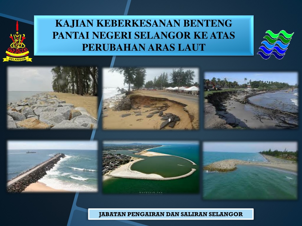
KAJIAN KEBERKESANAN BENTENG PANTAI NEGERI SELANGOR KE ATAS PERUBAHAN ARAS LAUT JABATAN PENGAIRAN DAN SALIRAN SELANGOR
INTRODUCTION The State Government of Selangor (the Government) through its implementing agency, Jabatan Pengairan dan Saliran Selangor (JPS), intends to appoint a qualified engineering consulting firm, the Consultant registered with the Board of Engineers Malaysia and with the Ministry of Finance, Malaysia to execute a study for the preparation of KAJIAN KEBERKESANAN BENTENG PANTAI NEGERI SELANGOR KE ATAS PERUBAHAN ARAS LAUT. The period of this study is about 12 months
BACKGROUND The coast of the State of Selangor is covered with coastline (or other shoreline), 492.1 kilometers (km) by National Coastal Erosion Study (NCES 2015) with bordered by five (5) districts, including Sabak Bernam, Kuala Selangor, Klang, Kuala Langat and Sepang.
BACKGROUND Almost the entire coastline of Selangor is protected with bunds to serves as protection from waves and overflow of seawater during high tide and as a control of coastal erosion along the Straits of Malacca. Along the west coast of Peninsular Malaysia, most of the agricultural land is seriously threatened. Coastal bunds, which serve to keep and protect seawater out of the agricultural lands, have been broken by the force of the waves. To resolve the problems within the area, Jabatan Pengairan dan Saliran Selangor (JPS) requires the study proposed by consultant for preparation of the impact of sea level rise up to 2050 on the effectiveness of existing coastal bunds study at Selangor state.
OBJECTIVE To assess the integrity of the existing coastal bund along the identified shoreline in the state of Selangor in providing protection from wave is overtopping and seawater intrusion into the leeward side of the land due to various environmental forces including at various tidal levels and the effect of sea level rise. To formulate a comprehensive and integrated master plan for the management coastal flooding phenomenon along the identified shoreline in the state of Selangor including conceptual design, cost estimates and implementation plan.
SCOPE OF WORK The length of the study area shall be the shoreline area from Sabak Bernam (Border Selangor/ Perak) to Sepang (Border Selangor/ Negeri Sembilan) including Islands is approximately 492.1 km. Coordinate starting from 3.844444 N, 100.824444 E and end at 20.587381 N, 101.711247 E . The extent of the shoreline area to be considered in this study shall in general be 0.5 km landward and 0.5 km seawards of the shoreline The scope of work covers various components with activities ranging from data collection, identification of issues, planning and preparation of master plan and reports. The scope of works shall include but not be confined to the following (Detail refer to TOR) : i) Data Information and Collection ii) Site Investigation, Inspection and Measurement ii) Analysis of Existing Conditions iii) Identification of Issues and Problems iv) Development of Integrated and Comprehensive Coastal Flooding Management Plan
SEKIAN, TERIMA KASIH BAHAGIAN PENGURUSAN PANTAI JPS SELANGOR