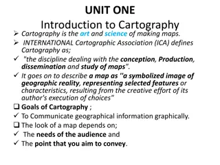
Understanding Cartography: The Art and Science of Mapmaking
Cartography, or mapmaking, entails the study and practice of creating maps by combining scientific and artistic elements. Cartographers play a vital role in researching, designing, and manipulating data to produce various types of maps, such as political, physical, and topographic maps. Understanding fundamental map characteristics like scale, projections, and symbolization is crucial in achieving cartographic proficiency. Various types of maps, including political, physical, climatic, and economic maps, serve diverse purposes in representing geographical areas.

Download Presentation

Please find below an Image/Link to download the presentation.
The content on the website is provided AS IS for your information and personal use only. It may not be sold, licensed, or shared on other websites without obtaining consent from the author. Download presentation by click this link. If you encounter any issues during the download, it is possible that the publisher has removed the file from their server.
E N D
Presentation Transcript
cartography I m.Sc Geography date : 02/11/2020 time : 1.30 to 2.30 Topic : cartography introduction Dr.K.Indhira m.sc.,ph.d., guest Lecturer department of geography government college for women (a) kumbakonam
Cartography Definition Cartography Cartography or mapmaking is the study and practice of making maps. Map making involves the application of both scientific and artistic elements, combining graphic talents and specialised knowledge of compilation and design principles with available techniques for product generation.
Mapmaking, mapping. Cartography, the art and science of graphically representing a geographical area, usually on a flat surface such as a map or chart. It may involve the superimposition of political, cultural, or other non geographical divisions onto the representation of a geographical area.
characteristics of cartography The achievement of cartographic understanding has, as a prerequisite, the understanding of the basic characteristics of maps. Scale, map projections, generalization, and symbolization are common to every map and are considered as basic characteristics of maps.
Function of cartography are concerned with all aspects of map-making (scientific, Cartographers technological and artistic). They are responsible for: researching, collecting, storing, retrieving, evaluating and manipulating data. designing maps.
Some of the most common types are political, physical, topographic, climate, economic, and thematic maps.
Different Types of Maps Political Map. A political map shows the state and national boundaries of a place. ... Physical Map. A physical map is one which shows the physical features of a place or country, like rivers, mountains, forests and lakes. ... Topographic Map. ... Climatic Map. ... Economic or Resource Map. ... Road Map. ... Scale of a Map. ... Symbols.
Map projections: The foundation of the map is the plane on which it rests (whether paper or screen), but projections are required to flatten the surface of the earth. All projections distort this surface, but the cartographer can be strategic about how and where distortion occurs.Generalization: All maps must be drawn at a smaller scale than reality, requiring that the information included on a map be a very small sample of the wealth of information about a place. Generalization is the process of adjusting the level of detail in geographic information to be appropriate for the scale and purpose of a map, through procedures such as selection, simplification, and classification. Symbology: Any map visually represents the location and properties of geographic phenomena using map symbols, graphical depictions composed of several visual variables, such as size, shape, color, and pattern. Composition: As all of the symbols are brought together, their interactions have major effects on map reading, such as grouping and Visual hierarchy. Typography or Labeling: Text serves a number of purposes on the map, especially aiding the recognition of features, but labels must be designed and positioned well to be effective. Layout: The map image must be placed on the page (whether paper, web, or other media), along with related elements, such as the title, legend, additional maps, text, images, and so on. Each of these elements have their own design considerations, as does their integration, which largely follows the principles of Graphic design. Map type-specific design: Different kinds of maps, especially thematic maps, have their own design needs and best practices.