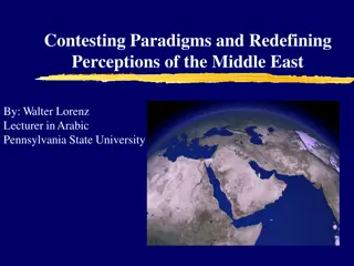
Geography of the Middle East: Features and Countries to Locate on Maps

Discover key physical and political features of the Middle East (Southwest Asia) as you learn to locate landmarks, rivers, seas, and countries on detailed maps. Explore the significance of the Euphrates River, Jordan River, Persian Gulf, and more while gaining insights into the region's geography.

Download Presentation

Please find below an Image/Link to download the presentation.
The content on the website is provided AS IS for your information and personal use only. It may not be sold, licensed, or shared on other websites without obtaining consent from the author. Download presentation by click this link. If you encounter any issues during the download, it is possible that the publisher has removed the file from their server.
E N D
Presentation Transcript
SS7G5 Geography of the Middle East Get out your notes and maps!
NOTES: SS7G5a, b SS7G5 The student will locate selected features in Southwestern Asia (Middle East). a. Locate on a world and regional political- physical map: Euphrates River, Jordan River, Tigris River, Suez Canal, Persian Gulf, Strait of Hormuz, Arabian Sea, Red Sea, Mediterranean Sea, and Gaza Strip. b. Locate on a world and regional political- physical map the nations of Afghanistan, Iran, Iraq, Israel, Saudi Arabia, and Turkey.
KEY WORDS Political map shows government boundaries Physical map shows land features
KEY Words Canal manmade waterway Strait a narrow body of water that joins two larger bodies of water
Countries to label on map 1 Iraq Iran Afghanistan Saudi Arabia Turkey Israel
Turkey Afghanistan Iraq Iran Israel Saudi Arabia
PHYSICAL FEATURES-to label on map 2 Euphrates River Jordan River Tigris River Suez Canal Persian Gulf Strait of Hormuz Arabian Sea Red Sea Gaza Strip
1. Euphrates River 2. Tigris River 3. Mediterranean Sea 4. Jordan River 5. Suez Canal 6. Red Sea 7. Persian Gulf 8. Straight of Hormuz 9. Arabian Sea 1 3 2 5 4- 7 8 6 9
Euphrates River 1700 miles/2700 kilometers long Begins in Turkey Empties into the Persian Gulf 94% of water originates in Turkish highlands The Murat Korasuyu and several other Turkish rivers join the Euphrates in central Turkey
Euphrates River cont.. The Khabur joins the Euphrates in eastern Syria The Euphrates and Tigris run parallel to each other The land between the Euphrates and the Tigris is known as Mesopotamia, which means "between the rivers" in Greek
Tigris River A boundary of Mesopotamia, or the "land between the rivers" (Tigris and Euphrates) The Tigris was the eastern of the two rivers and flowed from a source deep in the Armenian mountains all the way to the Persian Gulf, about 1,200 miles. Both rivers were essential to Mesopotamian civilizations, giving them water and a vehicle for their trade and defense.
Jordan River Key water source for Israel, Jordan, Syria, and Lebanon; water remains a central issue to the Middle East conflict. Israel and Jordan have signed treaties on Jordan River-related matters. For Israel, the water of the Jordan River is an absolute necessity for drinking water and for irrigation.
Suez Canal The Suez canal is actually the first canal directly linking the Mediterranean sea to the Red sea. Opened for international navigation on 17 November 1869. Egypt nationalized its canal on 26 July 1956 The canal was closed five times, the last time was for 8 years (1967-1975) and was reopened in 1975
Persian Gulf An extension of the Indian Ocean located between Iran and the Arabian Peninsula. 615 mi (990 km) long and rarely exceeds a depth of 300 ft (90 m). ESSENTIAL trade route between the Middle East and South Asia. Connected with the Gulf of Oman and the Arabian Sea through the Strait of Hormuz.
Persian Gulf It contains the island kingdom of Bahrain and is bordered by Iran, the United Arab Emirates, Oman, Saudi Arabia, Qatar, Kuwait, and Iraq. Good fishing grounds, extensive coral reefs, and abundant pearl oysters in danger due to pollution and industrialization.
Strait of Hormuz The narrow Strait of Hormuz is considered one of the most, if not the most strategic strait of water on the planet. Passes much of the oil from Bahrain, Iran, Iraq, Kuwait, Qatar, Saudi Arabia and the United Arab Emirates. Bordered by Iran, Oman's Musandam Peninsula and the United Arab Emirates, this stretch of water is of obvious military significance, and subsequently, the U.S. Navy and others patrol its waters.
Strait of Hormuz According to historians, (and Wikipedia) the name "Hormuz" is derived from a variation of the Persian God named Hormoz, or from the Persian word Hurmogh - meaning date palm tree.
Arabian Sea An extension of the Indian Ocean, positioned between India, Oman, Pakistan and Yemen, and Cape Guardafui in far northeastern Somalia. The sea connects with the Persian Gulf through the Gulf of Oman and the Strait of Hormuz. In the southwest, the Gulf of Aden connects it with the Red Sea.
Red Sea An extension (or inlet) of the Indian Ocean, located between Africa and Asia. This salty sea is just over 190 miles (300 km) across at its widest point, and about 1,200 miles (1,900 km) in length.
Gaza Strip The Gaza Strip is part of the proposed country of Palestine.

")