Understanding Different Types of Maps and Their Uses
SK RAI
SSGJ
We
have
learnt
in
the
previous
chapter
about
the
advantages
of
a
globe.
However,
globe
has
limitations
as
well.
A
globe
can
be
useful
when
we
want
to
study
the
earth
as
a
whole.
But,
when
we
want
to
study
only
the
part
of
earth,
as
about
our
country,
states,
districts,
towns
&
villages,
it
is
of
little
help.
In
such
situation
we
use
maps
.
A
m
a
p
i
s
a
r
e
p
r
e
s
e
n
t
a
t
i
o
n
o
r
a
d
r
a
w
i
n
g
o
f
t
h
e
e
a
r
t
h
’
s
s
u
r
f
a
c
e
a
c
c
o
r
d
i
n
g
t
o
a
s
c
a
l
e
.
B
u
t
i
t
’
s
i
m
p
o
s
s
i
b
l
e
t
o
f
l
a
t
t
e
n
a
r
o
u
n
d
s
h
a
p
e
c
o
m
p
l
e
t
e
l
y
.
W
e
f
i
n
d
t
h
a
t
m
a
p
s
a
r
e
u
s
e
f
u
l
t
o
u
s
f
o
r
v
a
r
i
o
u
s
p
u
r
p
o
s
e
s
.
O
n
e
m
a
p
s
h
o
w
s
a
s
m
a
l
l
a
r
e
a
a
n
d
a
f
e
w
f
a
c
t
s
.
A
n
o
t
h
e
r
m
a
p
m
a
y
c
o
n
t
a
i
n
a
s
m
a
n
y
f
a
c
t
s
a
s
a
b
i
g
b
o
o
k
.
W
h
e
n
m
a
n
y
m
a
p
s
a
r
e
p
u
t
t
o
g
e
t
h
e
r
w
e
g
e
t
a
n
A
t
l
a
s
b
o
o
k
.
A
t
l
a
s
e
s
a
r
e
o
f
d
i
f
f
e
r
e
n
t
s
i
z
e
s
,
m
e
a
s
u
r
e
m
e
n
t
s
d
r
a
w
n
o
n
d
i
f
f
e
r
e
n
t
s
c
a
l
e
s
.
M
a
p
s
p
r
o
v
i
d
e
m
o
r
e
i
n
f
o
r
m
a
t
i
o
n
t
h
a
n
t
h
e
g
l
o
b
e
.
T
h
e
y
a
r
e
o
f
d
i
f
f
e
r
e
n
t
t
y
p
e
s
.
S
o
m
e
o
f
t
h
e
m
a
r
e
d
e
s
c
r
i
b
e
d
b
e
l
o
w
:
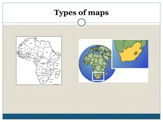
Physical
Map
Maps
showing
natural
features
of
the
earth
such
as
Mountain,
Plateaus,
Plains,
Oceans,
Rivers
etc.
are
called
PHYSICAL
or
RELIEF
MAP.
POLITICAL
Map
Maps
showing
cities,
towns
&
villages
&
different
countries
&
states
of
the
world
with
there
boundaries
are
called
POLITICAL
MAP.
Thematic
Map
Some
map
focus
on
specific
information;
such
as
road
map,
rainfall
maps,
maps
showing
distribution
of
forest,
industries
etc. are
known as
THEMATIC
MAP.
S
K
E
T
C
H
A
S
K
E
T
C
H
i
s
a
d
r
a
w
i
n
g
m
a
i
n
l
y
b
a
s
e
d
o
n
m
e
m
o
r
y
a
n
d
s
p
o
t
o
b
s
e
r
v
a
t
i
o
n
a
n
d
n
o
t
t
o
s
c
a
l
e
.
S
o
m
e
t
i
m
e
s
a
r
o
u
g
h
d
r
a
w
i
n
g
i
s
r
e
q
u
i
r
e
d
o
f
a
n
a
r
e
a
t
o
t
e
l
l
w
h
e
r
e
a
p
a
r
t
i
c
u
l
a
r
p
l
a
c
e
i
s
l
o
c
a
t
e
d
w
i
t
h
r
e
s
p
e
c
t
t
o
o
t
h
e
r
s
p
l
a
c
e
s
.
S
u
p
p
o
s
e
s
,
y
o
u
w
a
n
t
g
o
t
o
y
o
u
r
f
r
i
e
n
d
’
s
h
o
u
s
e
,
b
u
t
y
o
u
d
o
n
’
t
k
n
o
w
t
h
e
w
a
y
.
Y
o
u
r
f
r
i
e
n
d
w
i
l
l
m
a
k
e
a
r
o
u
g
h
d
r
a
w
i
n
g
t
o
s
h
o
w
t
h
e
w
a
y
t
o
h
i
s
/
h
e
r
h
o
u
s
e
.
S
u
c
h
a
r
o
u
g
h
d
r
a
w
i
n
g
i
s
d
r
a
w
i
n
g
i
s
d
r
a
w
n
w
i
t
h
o
u
t
t
h
e
s
c
a
l
e
,
&
i
s
c
a
l
l
e
d
a
S
K
E
T
C
H
M
A
P
.
p
l
a
n
A
P
L
A
N
i
s
a
d
r
a
w
i
n
g
o
f
a
s
m
a
l
l
a
r
e
a
o
n
a
l
a
r
g
e
s
c
a
l
e
.
A
l
a
r
g
e
s
c
a
l
e
m
a
p
g
i
v
e
s
l
o
t
s
o
f
i
n
f
o
r
m
a
t
i
o
n
,
b
u
t
t
h
e
y
a
r
e
c
e
r
t
a
i
n
t
h
i
n
g
s
w
h
i
c
h
w
e
m
a
y
s
o
m
e
t
i
m
e
s
w
a
n
t
t
o
k
n
o
w
s
o
m
e
t
i
m
e
.
F
o
r
e
x
a
m
p
l
e
t
h
e
l
e
n
g
t
h
&
b
r
e
a
d
t
h
o
f
a
r
o
o
m
,
w
h
i
c
h
c
a
n
’
t
b
e
s
h
o
w
n
i
n
t
h
e
m
a
p
.
A
t
t
h
a
t
t
i
m
e
,
w
e
c
a
n
r
e
f
e
r
d
r
a
w
i
n
g
s
d
r
a
w
n
t
o
s
c
a
l
e
i
s
c
a
l
l
e
d
a
P
L
A
N
.
Distance
There
are
THREE
types
of
COMPONENTS
OF
MAPS
.
They
Are:
-
DIRECTION
SYMBOL
Exit
Maps are
drawing
which
reduce
the
entire
world or
a
part
of
it
to
fit
on
a
sheet
of
paper.
Or
we
can
say
maps
are drawn
to
reduced scale.
But
this
reduction
is
done
very
carefully
so
that
the
distance
between
the
places
is real.
It
can only
be
possible
when
a
small
distance
on
paper represents
a large
distance
on
ground.
Therefore,
a
scale
is
chosen
for
this
purpose.
Scale
is
the
ratio
between
the
actual
distance
on
the
ground and
the
distance shown
on
the
map.
For
example,
the
distance
between
your
school
and
your
home
is
10
Km.
If
you show
this
10
Km.
distance
by
2
Cm
on
a map,
it
means
1
Cm
is
5
Km
on
the
ground.
The
scale
your
drawing
will be,
1
Cm.
is
equal
to
5
Km.
Thus,
scale
is
very
important
in
any
map.
If
you
know
the
scale,
you
will
be
able
to
calculate
the
distance
between
any
two
place
on
a
map.
When
Large
areas
like
continent
or countries
are
to be
shown
on
a
paper,
then
we
use small
scale.
For
example
5
Cm.
on
the
map
shows
500
Km.
of
the
ground.
It
is
called
a
SMALL SCALE
MAP.
When
a
small
area
like
village
or
town
is
to
be
shown
on
paper,
then
a
use
a large
scale, i.e.
5
Cm
on
the
map shows
500
Meter
Only
on
the
ground.
It
is
called
LARGE
SCALE
MAP.
Large
Scale
Maps
give us
more
information
than
Small
Scale
Map.
Distance
Back
DIRECTION
Most
maps
content
an
arrow
mark
with
the
letter
‘N’
at
the
upper
right hand
corner.
This
arrow
shows
the
North
Direction.
It
is
called
the
North
Line.
When
you
know
the
North,
you
can
find
out
other
directions,
for
example
East,
West
and
South.
There
are
major
directions,
North,
South,
East
and West.
They
are
called
CARDINAL
POINTS.
directions
are
North-East
(NE),
South-East
(SE),
Other
four
intermediate
N
ort
h
-
W
est
(
N
W)
a
nd
South-West
(SW).
We
can
locate
any
place
more accurately
with
the
help
of
these
Intermediate
Directions.
We
can
find
out the
direction
of
a
place
with
the
help
of
Compass.
It
is
an
instrument
used
to
find
out
Main
Directions.
Its
magnetic
needle
always
point
towards
North
and South
Directions.
Back
SY
M
BOL
It
is
the
third
important
component
of
a
map.
It
is
not
possible to
draw
on
a
map
the
actual
shape
and
size
of
different
features
such
as
buildings,
roads, bridges, trees,
railway
lines or
a
well.
So,
they
are
shown
by
certain
letters,
shades,
colours, pictures and lines .
These
symbols
give
a
lot of
information
in
a
limited
space.
With
the
use
of
these
symbols,
maps
can
be
drawn
easily
and
are
simple
to
read.
Even
if
you
don’t
know
the
language
of
an
area
and therefore
cannot
ask
someone
for
directions
,
you
can
collect
information
from
maps
with the
help
of
these
symbols.
Maps
have
a
universal
language
that
can
be
understood by
all. There
is
an
international
agreement
regarding
the
use
of
these
symbols.
These
are
called
CONVENTIONAL
SYMBOLS.
Various
colours
are
used
for
this
purpose.
For
example,
generally
blue
is
used
for
showing
water
bodies,
brown
for
mountain,
yellow
for
plateau and
green
is
used
for
plains.
Click
Here
for
some
Symbols
Back
Back
Learn about the advantages and limitations of using a globe versus maps for studying the earth, as well as the various types of maps like Physical, Political, Thematic, Sketch, and Plan maps. Each type serves a specific purpose, from showing natural features to detailed information on cities, towns, and villages. Discover how maps provide more detailed information than globes and are essential tools for different geographical studies.

Download Presentation

Please find below an Image/Link to download the presentation.
The content on the website is provided AS IS for your information and personal use only. It may not be sold, licensed, or shared on other websites without obtaining consent from the author. Download presentation by click this link. If you encounter any issues during the download, it is possible that the publisher has removed the file from their server.
E N D
Presentation Transcript
SK RAI SSGJ
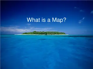
We have learnt in the previous chapter about advantages of a globe. limitations as well. A globe can be useful when we want to study the earth as a whole. But, when we want to study only the part of earth, as about our country, states, districts, towns & villages, it is of little help. In such situation we use maps. the However, globe has A map is a representation or a drawing of the earth s surface according to a scale. But it s impossible to flatten a round shape completely. We find that maps are useful to us for various purposes. One map shows a small area and a few facts. Another map may contain as many facts as a big book. When many maps are put together we get an Atlas book. Atlases are of different sizes, measurements drawn on different scales. Maps provide more information than the globe. They are of different types. Some of them are described below:
PhysicalMap Maps showing natural features of the earth such as Mountain, Plains, Oceans, Rivers etc. are called PHYSICAL or RELIEFMAP. Plateaus, POLITICALMap Maps showing cities, towns & villages & different countries & states of the world with there boundaries POLITICALMAP. are called ThematicMap Some map focus on specific information; such as road map, rainfall maps, maps showing distribution of forest, industries etc. are known asTHEMATIC MAP.
S K E T C H A SKETCH is a drawing mainly based on memory and spot observation and not to scale. Sometimes a rough drawing is required of an area to tell where a particular place is located with respect places. Supposes, you want go to your friend s house, but you don t know the way. Your friend will make a rough drawing to show the way to his/her house. Such a rough drawing is drawing is drawn without the scale, & is called a SKETCH MAP. to others
p la n A PLAN is a drawing of a small area on a large scale. A large scale map gives lots of information, but certain things which we may sometimes want sometime. For example the length & breadth of a room, which can t be shown in the map. At that time, we can refer drawings scale is called a PLAN. they are to know drawn to
There areTHREE types of COMPONENTS OF MAPS. They Are:- Distance DIRECTION S Y M B O L
Distance Maps are drawing which reduce the entire world or a part of it to fit on a sheet of paper. Or we can say maps are drawn to reduced scale. But this reduction is done very carefully so that the distance between the places is real. It can only be possible when a small distance on paper represents a large distance on ground. Therefore, a scale is chosen for this purpose. Scale is the ratio between the actual distance on the ground and the distance shown on the map. For example, the distance between your school and your home is 10Km. If you show this 10Km. distance by 2 Cm on a map, it means 1Cm is 5 Km on the ground. The scale your drawing will be, 1Cm. is equal to 5 Km. Thus, scale is very important in any map. If you know the scale, you will be able to calculate the distance between anytwo place onamap. When Large areas like continent or countries are to be shown on a paper, then we use small scale. For example 5 Cm. on the map shows 500 Km. of the ground. Itiscalled aSMALLSCALE MAP. When a small area like village or town is to be shown on paper, then a use a large scale, i.e. 5 Cm on the map shows 500Meter Only on the ground. It iscalled LARGESCALE MAP. Large Scale Maps give us more information than Small Scale Map. Back
DIRECTION Most maps content an arrow mark with the letter N at the upper right hand corner. This arrow shows the North Direction. It is called the North Line. When you know the North, you can find out other directions, for example East, West and South. There are major directions, North, South, East and West. They are called CARDINAL POINTS. directions are North-East (NE), South-East (SE), South-West (SW). We can locateany place more accurately with the help of these Intermediate Directions. Other four intermediate North-West (NW) and We can find out the direction of a place with the help of Compass. It is an instrument used to find out Main Directions. Its magnetic needle always point towards North and South Directions. Back
S Y M B O L It is the third important component of a map. It is not possible to draw on a map the actual shape and size of different features such as buildings, roads, bridges, trees, railway lines or a well. So, they are shown by certain letters, shades, colours, pictures and lines . These symbols give a lot of information in a limited space. With the use of these symbols, maps can be drawn easily and are simple to read. Even if you don t know the language of an area and therefore cannot ask someone for directions , you can collect information from maps with the help of these symbols. Maps have a universal language that can be understood by all. There is an international agreement regarding the use of these symbols. These are called CONVENTIONAL SYMBOLS. Various colours are used for this purpose. For example, generally blue is used for showing water bodies, brown for mountain, yellow for plateau and green isused for plains. Click Here for someSymbols Back