Understanding Factors Influencing Temperature Variations in US Cities
Solar zenith angle, location, specific heat, and axial tilt are key factors influencing temperature variations in US cities. Proximity to water bodies, altitude, and latitude also play significant roles. This lab explores why coastal cities experience different temperature patterns compared to inland cities and how seasonal variations affect solar radiation levels. Participants will analyze mean temperatures for various US locations, considering factors such as thermal inertia and climate classifications.

Uploaded on Sep 26, 2024 | 0 Views
Download Presentation

Please find below an Image/Link to download the presentation.
The content on the website is provided AS IS for your information and personal use only. It may not be sold, licensed, or shared on other websites without obtaining consent from the author. Download presentation by click this link. If you encounter any issues during the download, it is possible that the publisher has removed the file from their server.
E N D
Presentation Transcript
Week 5: Lab 10 -Temperature TA: Hannah M Daley Modified from Lindsey Rodio (TA) 1
Solar Zenith Angle (SZA) Low SZA = sun is higher in the sky Warmer temperatures High SZA = sun is setting/rising Cooler temperatures In unit of degrees 2
US Climate Main factor of temperature: location! Factors that decide a city s temperature Proximity to a body of water Altitude Latitudinal location Thermal inertia = moderation of temperature between a location and its surroundings Dependent on absorptivity, moisture, specific heat, etc 3
US Climate The US has a wide range of climate type Example: K ppen Climate Classifications What makes the east coast so different than the west coast? Aside from the fact that were not on fire Think about climate is going to be different for different US cities for this lab! 4
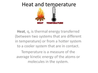
The specific heat strikes back! Specific heat = heat capacity per unit mass (how much energy it takes to raise a 1 kg substance 1 K) Water specific heat: 4185.5 J kg-1K-1 What does this have to do with this lab you may ask? Why are coastal cities cooler in the summer and warmer in the winter? 5
Axial Tilt Leads to seasonal variations in the amount of solar energy reaching the surface During the winter, the SZA is high (sun is lower in the sky) We receive much less solar radiation than we would in the summer Just the opposite occurs in the summer 6
Washington, D.C. Climate For this lab, you will be plotting mean temperatures for several US locations If you were not born in the US, pick a US city to complete #2 For your preferred city, you cannot pick your home town! 7
Other important info Lines of equal latitude runs east-west Lines of equal longitude runs north- south May need to convert to degrees minutes seconds Elevation map of US Red = higher elevations Green/blue = lower elevations 8

")


![Importance of Rock v. MWB [2018] UKSC 24 as Explained by Lord Sumption](/thumb/193348/importance-of-rock-v-mwb-2018-uksc-24-as-explained-by-lord-sumption.jpg)