Understanding Map Projections: Types and Techniques
Explore the world of map projections with a focus on classification based on construction methods and developable surfaces. Learn about perspective, non-perspective, and conventional projections, as well as cylindrical, conical, and zenithal projections. Delve into how different surfaces interact with globe mapping and the unique characteristics of each projection type.

Download Presentation

Please find below an Image/Link to download the presentation.
The content on the website is provided AS IS for your information and personal use only. It may not be sold, licensed, or shared on other websites without obtaining consent from the author. Download presentation by click this link. If you encounter any issues during the download, it is possible that the publisher has removed the file from their server.
E N D
Presentation Transcript
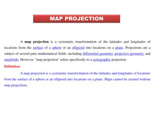
Map Projection Map Projection Prepared by Prof. M.R
CLASSIFICATION OF MAP PROJECTIONS Drawing Techniques: On the basis of method of construction, projections are generally classified into perspective, non-perspective and conventional or mathematical. Perspective projections can be drawn taking the help of a source of light by projecting the image of a network of parallels and meridians of a globe on developable surface. Non perspective projections are developed without the help of a source of light or casting shadow on surfaces, which can be flattened. Mathematical or conventional projections are those, which are derived by mathematical computation, and formulae and have little relations with the projected image.
CLASSIFICATION OF MAP PROJECTIONS Developable Surface: A developable surface is one, which can be flattened, and on which, a network of latitude and longitude can be projected. A non-developable surface is one, which cannot be flattened without shrinking, breaking or creasing. A globe or spherical surface has the property of non-developable surface whereas a cylinder, a cone and a plane have the property of developable surface. On the basis of nature of developable surface, the projections are classified as cylindrical, conical and zenithal projections.
Conical projection Conical projection A Conical projection is drawn by wrapping a cone round the globe and the shadow of graticule network is projected on it. When the cone is cut open, a projection is obtained on a flat sheet.
Cylindrical projection Cylindrical projections are made through the use of cylindrical developable surface. A paper-made cylinder covers the globe, and the parallels and meridians are projected on it. When the cylinder is cut open, it provides a cylindrical projection on the plane sheet.
Zenithal projection Zenithal projection is directly obtained on a plane surface when plane touches the globe at a point and the graticule is projected on it. Generally, the plane is so placed on the globe that it touches the globe at one of the poles. These projections are further subdivided into normal, oblique or polar as per the position of the plane touching the globe.
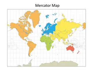
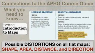
CLASSIFICATION OF MAP PROJECTIONS Global Properties: As mentioned above, the correctness of area, shape, direction and distances are the four major global properties to be preserved in a map. on the basis of global properties, projections are classified into equal area, orthomorphic, azimuthal and equi-distant projections. Equal Area Projection is also called homolographic projection. It is that projection in which areas of various parts of the earth are represented correctly. .
CLASSIFICATION OF MAP PROJECTIONS Orthomorphic or True-Shape projection is one in which shapes of various areas are portrayed correctly. The shape is generally maintained at the cost of the correctness of area. Azimuthal or True-Bearing projection is one on which the direction of all points from the centre is correctly represented. Equi-distant or True Scale projection is that where the distance or scale is correctly maintained. However, there is no such projection, which maintains the scale correctly throughout. It can be maintained correctly only along some selected parallels and meridians as per the requirement
CLASSIFICATION OF MAP PROJECTIONS Source of Light: On the basis of location of source of light, projections may be classified as gnomonic, stereographic and orthographic. Gnomonic projection is obtained by putting the light at the centre of the globe. Stereographic projection is drawn when the source of light is placed at the periphery of the globe at a point diametrically opposite to the point at which the plane surface touches the globe. Orthographic projection is drawn when the source of light is placed at infinity from the globe, opposite to the point at which the plane surface touches the globe.