Vulnerability Mapping (VM).Guidance Plan
Vulnerability Mapping (VM) is crucial in empowering vulnerable voters by identifying and addressing potential threats to their exercise of franchise. This guide explains the concept of vulnerability mapping, its role in ensuring free and fair elections, and the responsibilities of election officials
2 views • 42 slides
REACH Pathway Mapping Toolkit
Explore the REACH Pathway Mapping Toolkit to analyze credentials in pathways, labor market outcomes, work-based learning, and holistic support to identify gaps and needs for improved guidance. Learn about different mapping examples and types to enhance educational pathways effectively.
0 views • 19 slides
Relational Database Design and Mapping Techniques
Explore the process of mapping Entity-Relationship (ER) and Enhanced Entity-Relationship (EER) models to relational databases. Learn about relational model concepts, mapping algorithms, and the goals and steps involved in the mapping process. Discover how to preserve information, maintain constraint
3 views • 42 slides
Spatial Distortion Correction in EPI Sequences: Field Mapping Examples
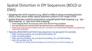
Spatial distortion artifacts in EPI sequences (BOLD or DWI) due to slow sampling rates in the phase encoding direction can be corrected using B0/spatial field mapping techniques. This correction requires obtaining field maps under the same B0 shimming conditions and with identical FoV and adjustment
2 views • 4 slides
Creating a Curriculum Map for Competency-Based Education
This presentation aims to guide faculty and staff in competency-based curriculum mapping at the program level. It covers the definition of curriculum mapping, a recommended framework, steps for identifying program competencies, developing a matrix, and mapping courses to competencies. Utilize this r
0 views • 11 slides
Community Relationship Mapping Tool for Organizational Assessment
Designed to support organizations in assessing relationships with various constituencies and networks, the Community Relationship Mapping Tool increases awareness of social groups influencing decisions in a community. Regular use enhances self-reflection on an organization's position in the system,
1 views • 12 slides

Evolution of Data Processing Systems in Geographic Information Science
Data processing systems in Geographic Information Science have evolved from manual, analogue methods to advanced software and hardware components. The incorporation of Geographic Information Systems (GIS) has revolutionized the handling and analysis of geo-referenced data, making tasks like data cap
3 views • 20 slides

Geographic Objects in GIS
Geographic objects play a crucial role in GIS by being easily distinguished and named based on parameters like location, shape, size, and orientation. These objects are studied collectively to understand their interactions and relationships, aiding in tasks such as navigation systems and route optim
5 views • 13 slides

Geographic Information System in Sud Nouvelle Calédonie
The province of Sud Nouvelle Calédonie utilizes an open-source-based Geographic Information System (GIS) to serve its territorial administration, with a focus on applications such as land administration, environment, agriculture, and urban planning. The system is supported by a team of engineers, g
0 views • 15 slides
Spatial Referencing Systems for Mapping
Spatial reference systems play a crucial role in defining geographic parameters and coordinate systems for mapping. They consist of components like orientation, latitude, longitude, and elevation, which help in representing spatial properties on maps. Reference surfaces such as the Geoid and ellipso
5 views • 13 slides
Enhancing Performance with Business Process Mapping
Explore the significance of business process mapping in optimizing performance through detailed insights into process mapping, types of business process maps, common pitfalls, and strategies for leveraging this tool for transformation and process enhancement. Uncover the essentials of documenting, a
0 views • 24 slides
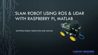
Mapping Robot using ROS, Lidar with Raspberry Pi & MATLAB
Turtle.bot is a popular product for home service robots, utilizing SLAM and navigation technologies. It features gyro, Kinect sensors, Lidar, and a laptop for mapping. The robot localizes and navigates using ROS in Raspberry Pi connected with MATLAB. ROS (Robot Operating System) is a set of software
0 views • 17 slides
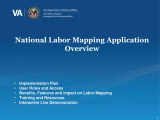
National Labor Mapping Application User Roles and Access Overview
This detailed overview outlines the implementation plan, user roles, and access benefits of the National Labor Mapping Application. Users are assigned specific roles with established access through domain usernames, enhancing security measures. Different user roles such as VISN Coordinators, Site Te
1 views • 14 slides
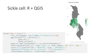
Geographic Data Visualization in R and QGIS for Malawi Health Analysis
Utilizing R and QGIS, this project focuses on visualizing sickle cell and HIV percentages by district in Malawi, mapping health facility locations, creating Voronoi polygons, and displaying malaria cumulative incidence data. Various geographic data visualization techniques are applied to provide ins
0 views • 8 slides

Exporting Relational Data to RDF: Strategies and Considerations
Explore the process of mapping relational data to RDF, including the choice of RDF vocabulary, defining mapping techniques, and exporting strategies. Learn about RDB systems that support RDF, direct mapping approaches, and the use of hybrid storage solutions. Discover how to bridge SPARQL and SQL fo
4 views • 13 slides
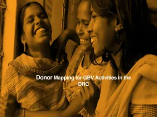
Donor Mapping for GBV Activities in the DRC
This report delves into the magnitude and severity of gender-based violence (GBV) in the Democratic Republic of the Congo (DRC) in recent years. It highlights the methodology used in data collection, key results, and leveraging findings for advocacy. The report also outlines the objectives of the ma
1 views • 19 slides

Mapping Methodology for Establishing ESCO Relations
Learn how to set up teams, collect resources, compare classifications, and establish mapping relations for ESCO implementation projects. Get insights on using computer-assisted suggestions, updating mapping tables, and selecting mapping projects. Explore techniques for navigating classifications, br
1 views • 21 slides
Water Point Mapping Survey in Sierra Leone
The Water Point Mapping survey in Sierra Leone reveals that while there has been progress in mapping and improving water points, there are still challenges in ensuring sustainability and functionality. Issues such as seasonal water points, inadequate attention to service payments, and the need for e
0 views • 15 slides
Texture Mapping in Computer Graphics
Delve into the world of texture mapping as a solution to the smoothness of polygons in computer graphics. Learn how to create textured scenes using techniques such as bump mapping and environmental mapping. Discover the process of representing textures, working with curved surfaces, and mapping onto
2 views • 24 slides

Unlock Your Full Potential with our Revolutionary Skills Mapping Tool
Enhance your career with Skills Mapping by Thirst! Identify your strengths, pinpoint areas for growth and reach your goals efficiently. Our innovative tool provides personalised insights to help you thrive in your professional journey. Start mapping
2 views • 8 slides
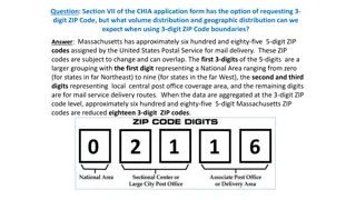
Geographic Distribution Using 3-Digit ZIP Codes
Massachusetts has approximately 685 5-digit ZIP codes assigned by the USPS, which can be aggregated into 18 3-digit ZIP codes for geographic analysis. The distribution of Emergency Department visit volumes varies across these 3-digit ZIP code boundaries, reflecting different regional characteristics
1 views • 4 slides
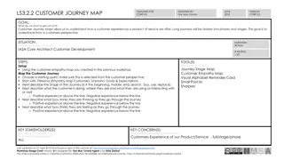
Customer Journey Mapping Workshop Guide for Understanding Customer Experiences
This guide outlines a structured approach for conducting a Customer Journey Mapping workshop to understand how customers interact with products or services. It provides detailed steps, tools, key stakeholders, and goals for mapping the customer journey effectively. The workshop aims to gain insights
0 views • 5 slides

Effective Mapping Strategies for Aligning Student Learning Outcomes (SLOs) with Program Learning Outcomes (PLOs)
Explore effective strategies for aligning Student Learning Outcomes (SLOs) with Program Learning Outcomes (PLOs) to enhance PLO assessment. Understand the connection between PLOs and SLOs as key elements in the education mapping process. Discover top-down and bottom-up approaches to strategically ma
1 views • 13 slides
GAC Working Group on Geographic Names Protection in New gTLD Expansion
The GAC Working Group is focused on improving protections for geographic names in future gTLD expansions. They aim to develop practical options and rules to reduce uncertainties for governments, communities, and applicants using geographic or community names. The group seeks to engage local communit
3 views • 27 slides

Innovative LiDAR Cave Mapper for Cavers
Develop a portable and cost-effective LiDAR cave mapper to assist freelance cavers in mapping caves efficiently. The project aims to create a device that is affordable, DIY-style, and open-source, making cave mapping more accessible and accurate. The team from FAMU-FSU College of Engineering strives
0 views • 22 slides
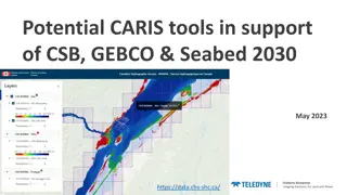
Enhancing Geospatial Imaging Solutions with CARIS Tools for Seabed Mapping
CARIS offers a suite of tools including CARIS Cloud and BDB Server, facilitating the seamless upload, processing, and transfer of bathymetric data to support initiatives like Seabed 2030 and GEBCO. The integration of CARIS tools enables stakeholders to manage, disseminate, and access hydrospatial da
0 views • 5 slides
Atlantic Seabed Mapping Workshop Summary
Workshop held in Dublin Castle on Dec 2, 2014, discussed current and future plans for seabed mapping in the Atlantic. Key topics included navigational charting, initiatives by various organizations, challenges of disjointed mapping efforts, and proposed actions to address issues. Recommendations inc
1 views • 5 slides

Frequency Finder 6 Mapping Workshops Overview
Explore the Frequency Finder 6 Mapping, Export, and Special Functions workshops held in Egypt and Thailand in October 2016. The workshops cover topics such as mapping station coverage, exporting data to different formats, accessing historical frequency assignment records, and ensuring data integrity
0 views • 7 slides
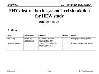
System-Level Simulation for HEW Study in IEEE 802.11-14/0043r2
This document discusses abstraction in system-level simulation for High-Efficiency Wireless (HEW) study, focusing on effective Signal-to-Noise Ratio (SNR) mapping, parameter fitting, selection of mapping functions, and simulation conditions/assumptions for IEEE 802.11. The study explores various met
0 views • 25 slides

Overview of the U.S. Federal Statistical System and Census Geography
The U.S. Federal Statistical System comprises 13 principal statistical agencies responsible for collecting and analyzing data across various sectors. The system includes agencies like the Bureau of Economic Analysis, Bureau of Labor Statistics, and U.S. Census Bureau. Geographic identifiers (GEOIDs
0 views • 94 slides
Introduction to Technology Mapping Using Linear Delay Model
Explore the process of technology mapping on a Directed Acyclic Graph (DAG) using a linear delay model. Learn about transforming circuits into subject graphs, utilizing sample cell libraries, and implementing circuits to meet user requirements. The challenges of technology mapping, circuit recovery,
0 views • 23 slides
Power Mapping: A Visual Tool for Advocates to Influence Change
Power mapping is a visual tool used by advocates to identify key individuals to target in order to effect change. It involves mapping the community around an issue or campaign, identifying decision-makers, adversaries, and influential stakeholders. By following important steps and asking relevant qu
0 views • 10 slides

Fusion of Stereo Vision for Enhanced Disparity Mapping
The fusion of stereo vision presented by Hualong Huang aims to improve disparity mapping by combining different up-sampling methods. The goal is to enhance the quality of disparity maps through the integration of active and passive sensors, resulting in both high-resolution and low-resolution maps.
0 views • 5 slides
GEBCO Technical Sub-Commission on Ocean Mapping (TSCOM) Overview
Technical Sub-Commission on Ocean Mapping (TSCOM) is a key component of the GEBCO program, established in 2006 to provide expertise in seafloor mapping and discuss emerging technologies. TSCOM serves as an authoritative source for bathymetric and hydrographic data and offers ongoing advice to associ
0 views • 12 slides
Virtual Network Mapping: A Graph Pattern Matching Approach
Virtual Network Mapping (VNM) involves deploying virtual network requests in data center networks in response to real-time demands. It facilitates the deployment of virtual networks on physical machines by mapping virtual nodes and links onto substrate nodes and paths, ensuring constraints are met.
0 views • 15 slides
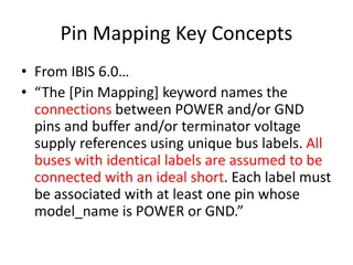
Pin Mapping and Interconnect in IBIS 6.0
Pin Mapping in IBIS 6.0 defines the connections between POWER/GND pins and buffer/terminator voltage supplies using unique bus labels. Interconnects between VDD pins and buffer supply terminals are crucial, with all pins associated with a named supply being shorted together. Draft 9 Interconnects an
0 views • 6 slides
Mercator Mapping: A Key Tool for Information System Management
Mercator is a web application designed for managing the mapping of an organization's information system, allowing for a comprehensive representation of its components and connections with the outside world. Mapping is crucial for controlling, protecting, and defending the information system, as well
0 views • 21 slides

Near Real-Time Flood Inundation Mapping Using Sentinel-1 Data During Hurricane Florence
A study by Shen, Xinyi and colleagues from the University of Connecticut has developed the RAdar Produced Inundation Diary (RAPID) algorithm for near real-time flood inundation mapping using Synthetic Aperture Radar (SAR) data from Sentinel-1 during Hurricane Florence. The analysis revealed large in
0 views • 8 slides
Enhancing Curriculum Development through Mapping for Schools
Curriculum mapping in schools involves using electronic tools to input, track, and analyze data related to curriculum, enabling stakeholders to meet standards, align content, collect real-time data on instruction, and reflect on practices for continuous improvement. Software programs like Rubicon At
1 views • 15 slides
Importance of Maps and GIS in Census Mapping: A Case Study from Nepal
Census mapping plays a crucial role in ensuring accurate population counts and territorial delineation. This case study from Nepal highlights the significance of Geographic Information Systems (GIS) in producing high-quality maps for census operations, data collection, analysis, and dissemination. T
0 views • 12 slides