Understanding the MIDS Calculator for Stormwater Management

The MIDS Calculator is an Excel-based tool that helps quantify stormwater runoff volume reduction and pollutant removal for Best Management Practices (BMPs). It can assist in selecting and sizing BMPs to meet regulatory or water quality objectives. Despite some limitations, it is widely used and offers ease of use and capacity for treatment trains. Learn about its features, application, and opening procedures for effective stormwater management.

Uploaded on Sep 17, 2024 | 0 Views
Download Presentation

Please find below an Image/Link to download the presentation.
The content on the website is provided AS IS for your information and personal use only. It may not be sold, licensed, or shared on other websites without obtaining consent from the author. Download presentation by click this link. If you encounter any issues during the download, it is possible that the publisher has removed the file from their server.
E N D
Presentation Transcript
Intro MIDS Calculator Use Intro MIDS Calculator Use What is the calculator? When can/should it be used? Basics Opening the calculator Creating/saving files Creating a site Implementing best management practices at a site Checking results Meeting goals Getting help How does the calculator work?
What is the MIDS calculator What is the MIDS calculator An Excel spreadsheet that quantifies reductions in stormwater runoff volume for a given BMP or group of BMPs quantifies reductions in phosphorus (P) and TSS in stormwater runoff for a given BMP or group of BMPs can be used to select and size best BMP(s) for a particular situation Has a Graphical User Interface (GUI)
Performance goal a regulatory or water quality objective Targets for volume and/or pollutant reductions CSW permit has a goal of 1 inch retention of impervious surfaces for new development: captures about 90% of annual precipitation MIDS goal is 1.1 inches: mimics native vegetation and soils TMDLs might have goals for TSS or P reduction to meet surface water quality standards Called a retention requirement in the MIDS calculator
When can/should it be used Created as a site calculator focused on volume control Widely used as a water quality tool, for which it has limitations Defaults for emc Can t modify curve numbers directly Simulating larger areas/systems is challenging Can t modify removal efficiencies Can t modify runoff water quality characteristics (e.g. dissolved P ratios) Despite these limitations, it has many advantages Easy to use Treatment trains Can be used for sizing
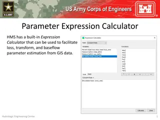
To open the MIDS calculator, double click on the MIDS icon on your desktop Click on file and create a new file or open an existing MIDS calculator file
Kickoff example Kickoff example Create a new file Site information tab: no to CSW permit, zip=55155, 3 acres impervious, 2 acres turf on B soil Schematic tab Bioretention no underdrain, 1 acre impervious , 3000 ft2 areas, 1.35 feet depth, B soil, 48 hour drawdown Bioretention with underdrain, 2 acre turf B soil, 1 acre impervious, underdrain not raised, not lined, 3000 ft2 for each area, overflow depth=1.5 feet, 2 foot media depth, 0.11 FC-WPt, 0.25 MP-FC, no tree, Mix A, no to P test, no amendment, B soil (0.45 in/hr), 48 hr drawdown, route to bioretention with no underdrain Infiltration basin, 1 acre impervious, 4000 ft2 areas, 1.8 foot overflow depth, B soils, 48 hour drawdown Results tab: Is the performance goal met? If not, how can it be met?
How does it work? Calculate the amount of stormwater runoff, P, and TSS entering the BMP Different BMPs have removal efficiencies based on research and monitoring Calculator does a mass balance on volume, P, and TSS coming in, being removed, and returning as runoff
Overflow volume 0% TSS, Particulate P (PP), and Dissolved P (DP) reduction Infiltration BMPs 100% TSS, PP, DP reduction Filtered volume 60% TSS. Particulate P (PP), and Dissolved P (DP) Calculated based on media Filtration BMPs w/ some infiltration 100% TSS, PP, DP reduction Settled solids Sedimentation BMPs No infiltration 90% TSS and associated pollutants, No removal of dissolved pollutants Settled solids
Bioretention Basin Green Roof Infiltration Basin The BMPs The BMPs Permeable Pavement Swale Side Slope Wet Swale Swale Main Channel Swale With Underdrain
Impervious Disconnect Tree trench with underdrain Harvest and Reuse Stormwater Pond Underground Infiltration Sand Filter Stormwater Pond w/ Filter Bench Other Wetland Other Bioretention Basin with underdrain Tree trench
Problem 1 10 acre site 5 acres impervious 5 acres pervious turf (B soils) B soils (0.3 in/hr) Zip = 55155 Goals Infiltrate first 1.1 inches off impervious surfaces Capture 80 percent of Total P
Features, warnings, restrictions, help Zip code rainfall data Question about CSW permit affects BMPs available Default values for retention requirement, P and TSS concentrations Must have impervious acres Summary information toolbar Warnings involve a change of a default condition (e.g. changing the P concentration) Restrictions prevent you from entering data (examples - drawdown requirement, green roof and permeable pavement areas, bioretention depth Help button or links within each BMP go to Stormwater Manual
Restrictions Restrictions 48 hour drawdown requirement Green roof: count as impervious surface, at least of impermeable surface must be green roof, can only route another roof to a green roof Bioretention: 1.5 foot depth max Permeable pavement: Count permeable pavement as impervious, max 5:1 impervious:pervious ratio Swale side slope: can only route to a swale; cannot route to a swale side slope Disconnection: cannot be used to meet the CSW permit, cannot route another BMP to disconnection; cannot route more impervious or pervious than is in watershed tab for this BMP Wet swale, sand filter, constructed pond, constructed wetland: no volume reduction
Problem 2 and/or 3 1. Same as previous problem except C soil 2. Site is downtown Minneapolis, 9 acres impervious and 1 acres pervious, B soil (0.45 in/hr) Contact: Mike Trojan, mike.trojan@state.mn.us; 651-757-2790