The Surface Weather Map
Surface weather maps, symbols, and their meanings. Discover how to interpret weather features and map lines for weather predictions. Learn the efficient plotting of data on maps.
1 views • 11 slides
Surface Tension and Wettability in Nature
Discover the fascinating world of surface tension and wettability through engaging experiments and observations, from water cohesion on a penny to the microscopic structures on lotus leaves. Delve into the role of cohesion and adhesion, surface wettability factors, and everyday applications of these
2 views • 17 slides
Surfaces and Interfacial Energy in Chemistry
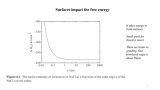
Surfaces play a crucial role in free energy and dissolution processes, impacting surface tension and interfacial energy. Learn about the adsorption of molecules, surface excess properties, and the contributions of surface area and curvature to surface energy. Dive into concepts such as Laplace's equ
6 views • 71 slides
Map Projections: Types and Applications
Map projection is a systematic transformation of latitudes and longitudes from a curved surface to a flat plane. There are various classifications based on construction methods, tangent surface position, view point of light, and qualities like equal area and equi-distance. Zenithal Polar Equidistanc
0 views • 9 slides
Canopy and Surface Methods in HEC-HMS
Explore the various canopy and surface methods utilized in HEC-HMS for managing water resources. Learn about canopy interception, evapotranspiration, common parameter values, and factors affecting losses. Delve into available methods, canopy storage values, and surface depression storage. Enhance yo
0 views • 12 slides
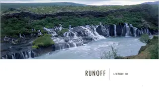
Runoff in Surface Water Systems
Runoff, the flow of precipitation and other contributions in surface streams, plays a crucial role in watershed systems. It encompasses various sources such as surface runoff, interflow, and base flow. Surface runoff, which travels over the ground surface to channels, is influenced by factors like s
1 views • 27 slides
Ocean Currents and Effects
Ocean currents play a crucial role in the movement of water across the Earth's surface. Wind-driven surface currents, influenced by the Coriolis effect, move water horizontally and impact climate patterns worldwide. Major currents extend deep below the surface and can move rapidly, while rip current
0 views • 14 slides
Surface Area in Mathematics
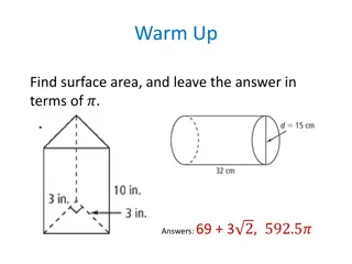
Delve into the concept of surface area as an essential mathematical topic, understanding its significance in everyday life and its application in various 3D shapes. Learn how to calculate surface area for different space figures like prisms and pyramids through step-by-step methods. Engage with esse
6 views • 21 slides
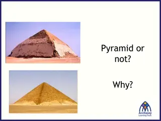
Pyramid Geometry for Surface Area Calculations
Delve into the concept of surface area calculations for pyramids, ranging from identifying fake pyramids to determining the surface area of iconic structures like the Great Pyramid. Learn about the essential information needed, such as base length and slant height, to derive accurate measurements. D
0 views • 32 slides
WaferMap Configuration Guide for Graph Builder
This guide provides detailed instructions on setting up WaferMap in Graph Builder, preparing map files, distributing and installing map files, creating wafer maps by cube/sub-chunk/chunk, using map shapes as background, and accessing a custom map creator tool.
0 views • 6 slides
Empowering Veterans Through the MAP Initiative
The Military Articulation Platform (MAP) aims to give veterans the credit they deserve by articulating college courses with ACE credit recommendations. This initiative allows veterans to receive up to one year of credit, enabling them to achieve their educational goals and access high-wage jobs. Thr
5 views • 35 slides
Surface Tension in Physical Pharmacy Lab
Surface tension is a crucial concept in physical pharmacy lab dealing with gas-solid or gas-liquid interfaces. It refers to the force per unit length required to balance the inward pull on the surface. Interfacial tension, cohesive forces, and adhesive forces play significant roles in determining su
0 views • 16 slides
Essential Guide to Map Reading and Navigation Techniques
Discover the fundamentals of map reading and navigation developed by Dave Bere. Explore various types of maps used within SES, learn how to use different maps effectively, and understand the importance of map care and folding. From understanding marginal information to mastering compasses and bearin
0 views • 53 slides
Near-Surface Sea Temperature Development in NCEP GFS/CFS
This informative piece delves into the evolution of Near-Surface Sea Temperature (NSST) within the NCEP GFS/CFS, discussing its significance in Numerical Weather Prediction (NWP) systems, the utilization of sea surface temperature (SST), and the T-profile near the sea surface. It covers the role of
0 views • 28 slides
Atmosphere-Ocean Coupling in Madden-Julian Oscillation
Atmosphere-ocean coupled processes in the Madden-Julian Oscillation (MJO) play a crucial role in intraseasonal oscillations. This paper review by Shao Yun-Chuan explores how the ocean's Sea Surface Temperature (SST) influences surface fluxes, MJO convection, and energy balance dynamics. It delves in
0 views • 17 slides
Environmental Geology and Surface Processes
Geology in relation to the environment involves studying Earth's geological processes, both surface and deep, and their impacts on nature and human activities. Environmental geology focuses on the interaction between humans and the Earth's near-surface environment, addressing hazards like erosion, f
0 views • 71 slides
Proposal for Dynamic Multi-AP Coordination in IEEE 802.11-23
This proposal focuses on enhancing the reliability of multi-AP coordination in IEEE 802.11-23 through the formation and management of MAP (Multi-AP) groups. It discusses the limitations of the current setup and suggests a dynamic approach where multiple APs can form MAP groups flexibly. The document
0 views • 11 slides
Surface Ozone Seasonal Cycle Reversal Study in Northeastern United States Lower Manhattan
Study on the reversal of the surface ozone seasonal cycle over Northeastern United States Lower Manhattan, analyzing the impact of NOx and VOC emissions on Surface O3 levels. Research shows a 26% decrease in regional NOx emissions leading to changes in the seasonal cycle of surface ozone concentrati
0 views • 24 slides
Surface Tension in Physical Pharmacy Lab
Surface tension is a critical aspect in physical pharmacy lab experiments, involving the study of forces at gas-solid or gas-liquid interfaces. It is the force per unit length required to counterbalance the net inward pull on a surface. The concept extends to interfacial tension, cohesive and adhesi
0 views • 21 slides
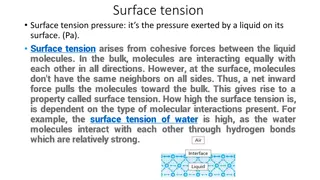
Surface Tension: Properties, Measurement Methods, and Calculations
Surface tension is the pressure exerted by a liquid on its surface due to cohesive forces among molecules. The measurement methods include the liquid rise in a capillary tube technique, drop weight method, and bubble pressure method. The surface tension coefficient can be calculated using the equati
0 views • 12 slides
Basic Map Skills and Terms
Explore the essential map skills and terms such as map key/legend, compass rose, scale, latitude, longitude, Equator, Prime Meridian, hemispheres, and more to enhance your map reading and interpretation skills effectively.
0 views • 7 slides
Map Concepts: An Overview
Exploring essential map-related terms and concepts such as map projection, hemisphere, latitude, longitude, scale, equator, prime meridian, map symbol, and globe. Enhance your understanding of how maps represent Earth's surface and the key elements involved in cartography.
0 views • 14 slides
Coordinate Systems, Map Projections, and GIS Applications
Explore the intricacies of Geographic Coordinate Systems, Projected Coordinate Systems, and different types of map projections as part of the Remote Sensing and GIS Application course taught by Lecturer Ruba Yousif Hussain in the third year. Dive into the properties of map projections like conforman
0 views • 13 slides
Unveiling the Art and Science of Cartography
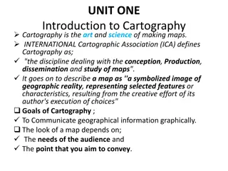
Cartography is the intricate discipline of creating maps that visually communicate geographical information. A map serves as a symbolized image of reality, representing selected features on Earth's surface. This summary delves into the goals of cartography, the essential components of a well-designe
0 views • 65 slides
Messy Situational Map Template with Suggestions for Use
This SA template provides a messy situational map template along with suggestions for use. The initial map should be done by hand on a large piece of paper to allow for quick adjustments and capturing thoughts. The template includes an abstract map and a customizable version for creating more readab
0 views • 4 slides
Various Strategy Maps and Their Components
This content discusses different types of strategy maps including the Balanced Scorecard, Classic Kaplan/Norton Strategy Map, Generic Example Strategy Map, and Basic Strategy Map Background. Each map highlights different perspectives such as financial, customer, internal, and learning & growth, alon
0 views • 22 slides
Surface Chemistry and Adsorption Phenomena
Surface chemistry is a crucial branch of chemistry that focuses on the chemical processes occurring at interfaces between different surfaces like solid-liquid, solid-gas, and liquid-gas. This field plays a significant role in various industries, including electronics. Adsorption, absorption, and sor
0 views • 15 slides
Surface Chemistry and Adsorption Phenomenon
Surface chemistry explores the interactions that occur at surfaces and interfaces, with adsorption being a key phenomenon. Adsorption involves the concentration of molecules on a surface, with adsorbents and adsorbates playing crucial roles. Desorption, the opposite process, removes adsorbed substan
1 views • 21 slides
Establishment of GCOS Surface Reference Network (GSRN) Pilot Phase
The establishment of the GCOS Surface Reference Network (GSRN) Pilot Phase aims to improve the accuracy, stability, and comparability of surface observations for Essential Climate Variables (ECVs). The GSRN will serve as the reference network for surface observations, providing data traceability and
0 views • 7 slides
Changes in Viscose Fabric Surface Morphology Due to Sunlight Exposure
This study explores the impact of sunlight exposure on the surface morphology of viscose fabrics. Direct exposure to sunlight for 120 days during summer showed significant changes in fiber surface depressions. The observed damage in mechanical properties correlated with alterations in surface morpho
0 views • 11 slides
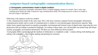
The Evolution of Cartographic Communication Theory in the Digital Age
Cartographic communication theory in digital mapping involves two models: the static map communication model and the interactive map communication model. The static map model follows traditional map-making methods adapted to digital tools, while the interactive map model leverages user feedback to r
0 views • 8 slides
Mathematical Insights into Surface Plasmon Polaritons
This mathematical explanation delves into the intricacies of surface plasmon polaritons, covering Maxwell's equations, wavenumbers, bulk and surface plasmon-polariton formulations, medium considerations, excitation conditions, losses, and matching examples with air, gold, and sapphire prisms. Detail
0 views • 13 slides
Sets, Maps, and Map Methods
Explore the concepts of sets, maps, and map methods in programming, focusing on efficient operations like adding, removing, and searching for values. Sets allow unique values with no duplicates, while maps hold key-value pairs like a dictionary. Map methods provide functions for manipulating mapping
0 views • 5 slides
Satellite Applications in Estimating Earth's Surface Energy Budget
Satellites play a crucial role in estimating the Surface Energy Budget (SEB) by providing data on various components such as Surface Radiation Budget and Surface Turbulent Fluxes. The SEB includes factors like net radiation flux, sensible and latent heat fluxes, and subsurface heat transfer. Satelli
0 views • 38 slides
Introduction to Spark in The Hadoop Stack
Introduction to Spark, a high-performance in-memory data analysis system layered on top of Hadoop to overcome the limitations of the Map-Reduce paradigm. It discusses the importance of Spark in addressing the expressive limitations of Hadoop's Map-Reduce, enabling algorithms that are not easily expr
0 views • 16 slides
Geometry Concepts for Surface Area Calculations
Explore various geometric shapes such as pyramids and cones to calculate surface area. Learn the differences between prisms and pyramids, understand the importance of altitude and slant height in pyramids, and differentiate between lateral and surface areas. Practice finding lateral and surface area
0 views • 16 slides
Surface-to-Surface Radiation Verification and Boundary Detection in COMSOL
Explore the verification of surface-to-surface radiation setups in COMSOL, detecting incorrect radiation configurations with nonradiating boundaries. Learn how to identify and resolve nonradiating boundaries, ensuring accurate and effective radiation simulations. Discover the importance of selecting
0 views • 10 slides
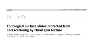
Surface Analysis of STM Bi0.92Sb0.08(111) with Spectroscopic Techniques
Explore the surface properties of STM Bi0.92Sb0.08(111) using advanced spectroscopic methods such as dI/dV mapping, QPI patterns, JDOS, SSP, Spin Selection Probability, ARPES, FT-STS, charge inhomogeneity, scattering of surface states, and spatial fluctuations of momentum. The images provide a detai
0 views • 10 slides
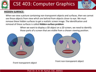
Hidden Surface Removal in Computer Graphics
In computer graphics, the hidden-surface problem refers to identifying and removing surfaces that are not visible in a given view to create a realistic screen image. Different methods like Depth Buffer (Z-Buffer) and Scan-Line are used to address this issue by determining the closest visible surface
0 views • 14 slides
Surface Temperatures and Albedo in Planetary Systems
Surface temperatures and albedo play significant roles in understanding planetary characteristics. Albedo, the fraction of sunlight reflected from a planet's surface, varies among planets. By considering factors like albedo, distance from the Sun, and energy flux, we can estimate surface temperature
0 views • 10 slides

