Re-examining Cryosphere Applications and Requirements in WMO - SAT Meeting Summary
The System Assessment Team (SAT) meeting on 10th July 2023 revolved around re-evaluating cryosphere applications and requirements within WMO. Jeff Key from NOAA/NESDIS/STAR chaired the meeting, focusing on updating and expanding observational requirements for the cryosphere. The cryosphere, encompas
5 views • 26 slides
NOAA HRD User Group
Kelvin Brentzel provides updates on NOAA HRD User Group activities, including post-launch updates for NOAA-21 HRD and pre-launch updates for J3 HRD. The DRL team collaborates closely with JPSS teams and commercial partners to enhance HRD signal performance and data processing capabilities. Detailed
0 views • 4 slides
Privacy Act Notice and GRB Status Update for October 2023 Meeting
This content includes important privacy and recording notices for a meeting, including consent for audio and other information recording, as well as the Privacy Act statement for NOAA. It also provides details on the purpose and routine uses of recorded information. Additionally, it contains updates
0 views • 11 slides
Guide to Ordering and Downloading VIIRS L2 Data Files from NOAA CLASS
Learn how to order and download VIIRS L2 data files from NOAA CLASS. Register with CLASS, search for datasets, select geographic areas and date/time periods, choose VIIRS products, and place your order using step-by-step instructions provided in the guide.
0 views • 14 slides
Future Needs for NOAA Unified Forecast System Observation
The NOAA Unified Forecast System (UFS) is a comprehensive Earth system model designed for regional to global predictive time scales, covering various domains such as ocean, land, cryosphere, atmosphere, and more. The system involves research and operational components like data assimilation, forecas
2 views • 11 slides
Insights on State of the Southern Ocean Observing System (SOOS) Portal Data Management
Delve into the recent discussions and updates from the Southern Ocean Observing System (SOOS) Portal Data Management Sub-Committee Meeting attended by Scott Ritz, Valerie Dixon, and Michael Morahan. Explore the challenges related to metadata documents, portal usage, and GCMD keyword status as highli
0 views • 13 slides
Seasonal Flood Monitoring and Forecast in East Africa and Yemen (March 2023)
Enhanced flood monitoring and forecast assumptions for East Africa and Yemen for the season of March 2023, including specific details on flooding conditions in South Sudan, streamflow forecasts for the Blue Nile, Victoria Nile, Rwanda, Burundi, and Yemen. The analysis also predicts seasonal flooding
1 views • 6 slides
Understanding Federal Consistency in Coastal Zone Management
This presentation serves as an introduction to Federal Consistency in the context of Coastal Zone Management, emphasizing the importance of compliance with enforceable policies outlined in the Coastal Zone Management Act. It highlights the role of the Division of Coastal Resources Management (DCRM)
1 views • 13 slides
FIREX-AQ Data Management Plan and Reporting Guidelines
This data management plan outlines the repositories, submission schedule, format requirements, and reporting guidelines for the FIREX-AQ airborne field study conducted by Gao Chen (NASA Langley Research Center) and Ken Aikin (NOAA Earth System Research Laboratory). It covers access control, data typ
6 views • 13 slides
Medicaid Waivers and Services in Kentucky
Seven Counties Developmental Services Division in Kentucky provides a range of services including alcohol and drug addictions, mental health, developmental services, and more. The Division offers case management, behavior analysis, therapy services, supported employment, crisis services, grant-based
1 views • 25 slides
Comprehensive Guide to OER Writing for NOAA Corps Officers
Explore a detailed guide on writing Officer Evaluation Reports (OERs) for NOAA Corps officers. Discover key resources, objectives, responsibilities, and tips for ensuring successful OER submissions. Learn about the importance of effective OER statements and how to navigate the evaluation process wit
0 views • 21 slides
Overview of NOAA SAT Team and Its Scope
The NOAA SAT team is a technical group with expertise in various fields like remote sensing, data assimilation, and impact assessment. They provide performance assessment and expert feedback to NESDIS, assisting decision-makers in making informed decisions. The team does not advocate for specific se
0 views • 9 slides
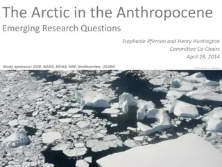
The Arctic in the Anthropocene: Emerging Research Questions
The study sponsored by organizations like DOE, NASA, NOAA, NSF, Smithsonian, and USARC delves into the significant implications of Arctic changes on ecosystems, climate, and humanity. The report emphasizes the urgent need for continued research in the Arctic to understand and address the rapid clima
1 views • 23 slides
Comprehensive Training and Education Resources for Metadata Standards
Explore a wealth of training resources including workshops, guidance documents, ISO workbooks, and online lessons related to metadata standards. Access tools, best practices, and guidance for transitioning to international metadata standards like ISO. Learn from presentations, modules, and other tra
0 views • 9 slides
Maritime Research on Tide and Current Apps for Sailing Enthusiasts
Conducted a study analyzing the usage of tide and current apps among sailing enthusiasts, revealing challenges like connectivity issues and data privacy concerns. Identified four user profiles and provided insights on NOAA websites for tide predictions. Explored user experiences with on-the-water sm
0 views • 20 slides
NOAA's Center for Operational Oceanographic Products and Services Overview
The NOAA's Center for Operational Oceanographic Products and Services (CO-OPS) provides accurate, reliable, and timely oceanographic data to support safe navigation, ecosystem stewardship, coastal hazards preparedness, and climate change understanding. With a mission to ensure access to essential co
0 views • 37 slides
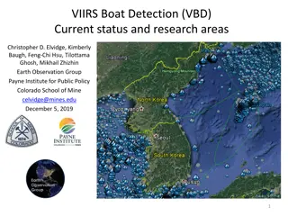
VIIRS Boat Detection (VBD) Research Overview
The Visible Infrared Imaging Radiometer Suite (VIIRS) program, a joint effort between NASA and NOAA, focuses on weather prediction and boat detection using low light imaging data collected at night. The VIIRS system provides global coverage with sensitive instruments and efficient data flow processe
1 views • 13 slides
Flood Warning Program of Urban Drainage & Flood Control District
Since 1979, the Federal/Regional/Local Early Warning Partnership of the Urban Drainage & Flood Control District has been providing the greater Denver/Boulder metropolitan area with early flood threat notifications, primarily for flash floods. Working in collaboration with NOAA's National Weather Ser
2 views • 23 slides
Tri-Agency Communications Plan for 2016 Rapid Response Project
A comprehensive document outlining the communication plan for the 2016 El Nino Rapid Response project involving NOAA, NASA, and USAF teams. It includes key contacts, roles, and responsibilities within the agencies to ensure effective coordination during the project. The plan aims to facilitate smoot
0 views • 14 slides
GOES-R ABI Aerosol Detection Product Validation Summary
The GOES-R ABI Aerosol Detection Product (ADP) Validation was conducted by Shobha Kondragunta and Pubu Ciren at the NOAA/NESDIS/STAR workshop in January 2014. The validation process involved testing and validating the ADP product using proxy data at various resolutions for detecting smoke, dust, and
1 views • 21 slides
Strategies for Enhancing PORTS System Effectiveness and Resilience
Proposed by the HSRP Strategic Effectiveness Sub-Committee, this focuses on improving the PORTS system, addressing water level changes, enhancing NOAA's products and services, and strengthening outreach and branding. Key issues identified include inconsistent funding for PORTS systems, inadequate co
0 views • 10 slides
Ask CPC Assignments in NOAA Corps: How to Manage Assignments Effectively
Learn about the assignment process in NOAA Corps, including key roles, responsibilities, and goals such as meeting service needs, developing officers, and providing planning horizons. Understand the involvement of various personnel in the multi-echelon process and how individual officers can take pr
1 views • 16 slides
Exelis Engineering Support for CrIS Post-Launch Operations
Exelis played a key role in providing support for the CrIS satellite instrument post-launch operations. The support included activities such as early orbit instrument checkout, calibration table uploads, and developing new algorithms for better data processing. Exelis also assisted in updating Engin
0 views • 56 slides
S-102 Hydrographic Project Team Milestones and Focus Areas
The S-102 project team, led by David W. Brazier from the US Navy and Janice Eisenberg from NOAA, has been focusing on finalizing the portrayal, gridding methodology, grid resolution, and other guidance for the S-102 dataset. They are working towards submitting the finalized version for variable-reso
0 views • 17 slides
Exploring Applications of Remote Sensing in Environmental Studies
Dr. Sanjib Pramanik, an Assistant Professor at Durga College, delves into the fascinating realm of remote sensing for environmental studies. Remote sensing allows data collection from a distance, utilizing methods like air photos and satellite imagery. The environment comprises components such as na
0 views • 35 slides
NOAA SAR High-Resolution Coastal Winds Overview
NOAA's Operational SAR Sea Surface Wind Products provide detailed information on wind patterns derived from SAR images. The system aims to implement high-resolution wind production, capable of deriving winds from various SAR satellites. The operational goals include compatibility with international
0 views • 28 slides
Developments in Establishing Quantitative Objectives for Salmon and Steelhead in the Columbia Basin
The Columbia Basin Partnership Task Force, led by NOAA, has been working on setting shared, quantitative objectives for salmon and steelhead in the Columbia Basin. The process involves creating prototype work teams to test and develop these objectives, with a focus on areas like the Snake River Basi
0 views • 47 slides
Arctic Research Expedition 2024: Mission to Explore Pacific Arctic Ecosystems
Researchers are embarking on a crucial expedition in August 2024 to study the environmental changes in the Pacific Arctic. Led by scientists from NOAA and UAF, the team aims to assess biodiversity, ecosystem status, and ongoing changes in the northern Bering and Chukchi Seas. The expedition will inv
1 views • 8 slides
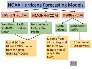
NOAA Hurricane Forecasting Models Overview
The NOAA hurricane forecasting models include HWRF, POM, HYCOM, HMON, covering regions like the Pacific, Indian Ocean, North Atlantic, and Gulf of Mexico. These models utilize a combination of climatology data, feature models, and real-time RTOFS inputs for initialization and forecasting. Various co
0 views • 14 slides
Advancements in NOAA's Next-Generation NWP System
Explore the innovative Data Assimilation techniques and the Unified Forecast System for high-resolution regional modeling at NOAA. The suite aims to simplify operational Earth modeling, combining local and global domains, with an emphasis on observation processing, data assimilation, and verificatio
0 views • 16 slides
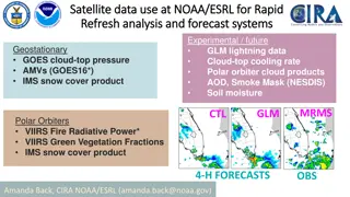
Satellite Data Use at NOAA/ESRL for Rapid Analysis and Forecast Systems
This content discusses the utilization of satellite data at NOAA/ESRL for rapid analysis and forecast systems, focusing on various data products and decision-making processes for new data inclusion. It highlights the importance of testing, reliability, resources needed, ongoing/future needs, and com
0 views • 5 slides
Advances in Global Data Assimilation at NOAA/NCEP: Radiance Data and Future Developments
Explore the utilization of radiance data in global data assimilation at NOAA/NCEP, focusing on the integration of various satellite instruments like AMSU-A, ATMS, MHS, and more. Recent and upcoming enhancements to the global data assimilation system are discussed, with an emphasis on changes to the
0 views • 5 slides
Solving IT Security Problems with iRODS at NOAA's National Climatic Data Center
The NOAA DFC Interoperability initiative aims to deposit climate data records securely by utilizing iRODS data grids. The integration of iRODS systems between OOI and NCDC simplifies data ingestion, provided security requirements are met. The setup includes iRODS Secure Ingest in the DMZ landing zon
0 views • 6 slides
Ground Support to Space Weather Missions Overview
This discussion covers ground support for space weather missions, focusing on existing RTSW and Beacon networks such as ACE and DSCOVR. The Real-Time Solar Wind Network, established in 1998, facilitates real-time solar wind data transmission, with partners including NOAA, DLR, and KSWC. The network'
0 views • 15 slides
Overview of Dentistry in England and Scotland
Dentistry in England and Scotland encompasses various services including NHS primary care dental services, hospital dental services, public dental services, dental public health services, and private dentistry. The NHS dentistry structure differs between England and Scotland, with data collection me
0 views • 9 slides
Understanding NOAA's HYSPLIT Model for Predicting Volcanic Ash Dispersion
NOAA's HYSPLIT model is crucial for predicting the transport and dispersion of volcanic ash. By utilizing satellite data, this model aids in issuing advisories for aviation safety. Applications of the model extend to various atmospheric tracer studies. Inverse modeling techniques are employed to est
0 views • 14 slides
Improving Sub-Seasonal to Seasonal Prediction at NOAA
NOAA's efforts in improving sub-seasonal to seasonal predictions aim to enhance emergency management planning, health outcomes, national infrastructure decisions, and national security posture. Specific initiatives include the California Drought Service Assessment, operational product development, E
0 views • 13 slides
Advancements in Global Data Assimilation at NOAA/NCEP
Utilizing a range of radiance data sources, NOAA/NCEP has implemented significant upgrades to its Global Data Assimilation System. Recent and upcoming changes focus on improving model levels, introducing new observation errors, and expanding all-sky assimilation capabilities. The future direction in
0 views • 5 slides
Understanding NOAA's User Needs Identification Strategies
NOAA employs various user needs identification strategies, including user interviews, diary studies, persona building, task analysis, journey mapping, and more. By observing users, their environment, and asking the right questions, NOAA can uncover real needs effectively.
0 views • 13 slides
Leadership Training Opportunities for NOAA Personnel
Explore various training programs available for NOAA personnel, including Basic Officer Training Course (BOTC), Leadership Development, and Operational Leadership Training. Discover the importance of leadership skills, military protocol, and NOAA Corps heritage in equipping officers for their roles.
0 views • 16 slides
