Tower Hamlets Annual Resident Survey 2023 Results Overview
The Tower Hamlets Annual Resident Survey 2023 provides insights into residents' feedback and opinions on various aspects. Conducted by MEL Research, the survey aims to capture a representative sample of residents in Tower Hamlets, highlighting statistical significance and methodology details. The su
1 views • 32 slides
Instructions for Completing GLAAS Country Survey 2024
In Module 4 of GLAAS information, you will find guidance on filling out the country survey for GLAAS 2024. Topics covered include an overview of the survey package, instructions for completing the survey either as a PDF or online (eGLAAS), general tips for successful completion, advice on governance
4 views • 42 slides
Cadastral Systems in Land Management
Cadastral systems play a crucial role in land management by handling land registration, property taxation, and land tenure. These systems involve private conveyancing, registration of deeds, cadastral surveying, and mapping to maintain records efficiently. They provide information on parcel index ma
1 views • 16 slides
Evolution of Land Law Systems in Trinidad and Tobago
Trinidad and Tobago's land law systems consist of the Common Law System and the Registered Land System. The Common Law system governs unregistered land where title passes upon execution and delivery of the deed. In contrast, the Registered Land System confers ownership upon registration and offers c
0 views • 28 slides
Land, Soil, and Water Resources
Natural resources such as land, soil, and water are crucial for human activities. Land comprises the lithosphere and is utilized for various purposes based on land use patterns. The study of land use patterns is essential for economic planning, as the availability of land is limited, leading to conf
5 views • 25 slides
Principles of Agricultural Land Distribution by State Government
The article discusses the distribution of agricultural land at the disposal of the state government in line with the policy objectives outlined in the WBLR Act. It covers the types of agricultural lands available, principles of land distribution, and restrictions on land transfers. Priority is given
1 views • 14 slides
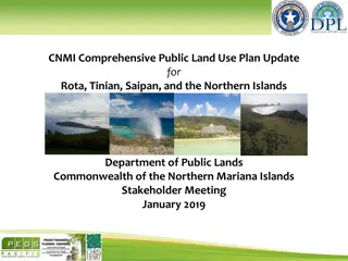
CNMI Public Land Use Plan Update Stakeholder Meeting 2019
The CNMI Comprehensive Public Land Use Plan Update details the key drivers for land selection, recommendations for future land uses on each island, and includes discussions on the project team, schedule of key milestone dates, and the purpose and scope of the plan outreach and participation. The sta
4 views • 29 slides
Namibia's Ancestral Land Rights: Historical Injustice and Restitution
Explore the historical context of land ownership in Namibia, focusing on ancestral land rights, colonization processes, and the impact on indigenous populations. Learn about the notion of ancestral land, who should be considered indigenous, and the colonial modes of land acquisition. Uncover the str
1 views • 33 slides
Challenges and Solutions in Urban Land Delivery and Pricing in Namibia
The Urban Land and Housing Sector in Namibia faces significant challenges such as a backlog in land delivery, high input costs, weak urban planning, and limited institutional capacity. These issues lead to slow supply rates and affordability problems for end users. Addressing these challenges requir
1 views • 20 slides
Land Acquisition Processes and Means of Opposing
Federal laws in Malaysia allow for land acquisition for public purposes or economic development. The process involves notification to the public, entry and survey marking of land, and award by the Land Administrator. Only persons defined as "interested" under the Land Acquisition Act can raise objec
3 views • 40 slides
Challenges in Land Allocation and Administration by Traditional Authorities and Communal Land Boards
The Communal Land Reform Act of 2002 introduced Communal Land Boards to assist Traditional Authorities in land administration. However, challenges such as misconceptions of powers, limited technical capacity, inadequate resources, and unclear procedures have hindered smooth registration and resoluti
0 views • 15 slides
Update Reports: Baroka Ba Nkwana, Bakoni-Ba-Mmamaro CPA, and Enquiry from Mr. C. Mathebe Presentation to the Portfolio Committee on Agriculture, Land Reform, and Rural Development
This report provides updates to the Portfolio Committee on Agriculture, Land Reform, and Rural Development regarding Mr. Collen Mathebe's matter, Bakoni-Ba-Mmamaro CPA, and Baroka Ba Nkwana Land Claim. Mr. Mathebe's issue cannot be resolved through the Land Title Adjustment Act, and alternative opti
0 views • 38 slides
Land Governance in Malawi: Challenges and Progress
Malawi's land governance system has evolved significantly since the colonial era, with a framework that includes institutional and legal aspects. The country has faced challenges in managing land disputes, valuation, taxation, and public land use. The institutional setup involves the central governm
0 views • 23 slides
Land Governance Framework in Botswana: A Country Scoping Study
Botswana, a landlocked middle-income country in Southern Africa, faces challenges such as high population growth, unemployment, poverty, and a less skilled workforce. This study examines the land governance framework in Botswana, focusing on key challenges in land administration, dispute resolution,
0 views • 15 slides
Implications of Land Reform in Namibia: Social and Economic Insight
Land reform in Namibia is crucial for inclusive growth and shared prosperity, with access to land being a key factor. Productive land usage can lead to wealth creation and social development. The importance of agriculture in the economy is highlighted, along with the need for skilled farmers and a s
0 views • 7 slides
Enhancing Land Degradation Neutrality Targets in Lebanon's National Action Programme
Integrating LDN targets into Lebanon's National Action Programme, led by Dr. Chadi Mohanna, aims to align the NAP with the UNCCD's 10-Year Strategy, set national targets for Land Degradation Neutrality, and implement measures to combat land degradation aggravated by climate change. The project focus
0 views • 23 slides
Overview of Non-Point Survey Training and Updates
This content provides detailed information and resources related to the Non-Point Survey Training Program, including modules, topics covered, process flow for completing the survey, reasons for conducting the survey, and changes made in the survey since the 2014 inventory. It also addresses common i
1 views • 13 slides
Land Management and Funds Allocation in New Plymouth District Council: Overview
This presentation provides an overview of the New Plymouth District Council Local Purposes (Waitara Lands) Bill, detailing the key provisions related to land sales, fund allocation, and the establishment of a Waitara Community Board and a Waitara Hap Land Fund. The bill outlines the distribution of
1 views • 12 slides
Safety Survey Readiness for Joint Commission Meeting
A call to action for Joint Commission safety survey readiness with a focus on identifying and mitigating patient and provider safety risks. Highlights include known risks from the 2021 survey findings, Vizient mock survey findings, and the purpose of the upcoming survey to ensure patient and provide
0 views • 18 slides
Overview of the Mizoram Land Revenue Act, 2013
The Mizoram Land Revenue Act, 2013 replaced several previous regulations and came into effect on June 1, 2013. It establishes authorities for land management, outlines control and powers over land, and provides guidelines for land allotment for specific purposes. The Act designates the Government of
0 views • 18 slides
Update on Northeast Land Transfers: Presentation to Roundtable Members
Ministry of Indigenous Relations and Reconciliation provided an update on land transfers in Northeastern British Columbia, focusing on Treaty Land Entitlement, stakeholder engagement, and communication methods. The presentation highlighted the historical land debt, final settlement agreements, and t
0 views • 8 slides
New York Statewide Center for Independent Living 2021 Consumer Satisfaction Survey Methodology
The New York Statewide Center for Independent Living conducts an annual Consumer Satisfaction Survey to gather feedback from consumers served by the center. The survey can be conducted online via Survey Monkey or through direct mail. Detailed instructions are provided on the NYSILC website for condu
0 views • 8 slides
Land Reform in the Context of Devolution in Kenya
Kenya, with a land area of 582,646 sq. Km, has undergone land reform in the context of devolution since gaining independence in 1963. The country's adoption of the Constitution in 2010 led to the establishment of a system with 1 national government and 47 devolved governments. Kajiado County, inhabi
0 views • 33 slides
Impact of Land Development on Stream Ecosystem Health in Mill Brook Preserve, NY, USA
The study focuses on the effects of land development on stream ecosystem health in the Mill Brook Preserve in New Paltz, NY. It discusses the degradation of water quality due to surrounding land development and the importance of macroinvertebrates as indicators of ecosystem health. The review of lit
0 views • 23 slides
Turkish Statistical Institute Tobacco Health Survey Overview
The Turkish Statistical Institute conducted a comprehensive survey on tobacco use in health interviews in May 2016. The survey process included questionnaire development, historical background, and implementation in households. Data analysis, translation tasks, and collaborating with public institut
0 views • 19 slides
CDL Land New Zealand Ltd Urban Development Proposal
CDL Land New Zealand Ltd, a land-based investment and development company, seeks to protect the Urban Expansion Area (UEA) from inappropriate subdivision. They aim to aggregate land for a master-planned community, requesting discretion for subdivisions around existing dwellings and future urban deve
0 views • 7 slides
Importance of Land Records in Preventing Land Disputes
Land records play a crucial role in documenting ownership, facilitating land-related transactions, and preventing costly litigation. They serve as a lifeline for effective governance and provide legal status to landowners, ensuring clarity and transparency in land ownership. Without proper land reco
0 views • 15 slides
Impacts of REDD+ and Bioenergy on Food Security and Land Grabbing
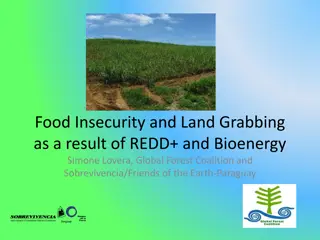
The drivers of forest loss, including demand for wood and land, conflict over land tenure, urbanization, industrialization, corruption, and climate change, are explored in relation to food insecurity and land grabbing caused by initiatives like REDD+ and bioenergy. Increasing competition for land be
0 views • 14 slides
Impact of Land Policies in Georgia: Headright System, Land Lotteries, and Yazoo Land Fraud
Georgia pursued various land policies post-Revolutionary War to allocate land obtained from Native Americans. The headright system granted land to soldiers and white men, aiming to boost population and state power. Land lotteries distributed land through random draws. The Yazoo land fraud scandal ta
0 views • 20 slides
Functioning of Institutional Allotment Land Branch - DUSIB
The Institutional Allotment Land Branch manages the allocation of DUSIB land to government departments in Delhi. The Board has the authority to allocate Nazul Lands belonging to DUSIB, with the LG of Delhi being the Competent Authority. Allotments are done based on Circle Rates for lease, with the D
0 views • 8 slides
Land and Agrarian Reforms in Rwanda: Organic Farming Perspective
Land reform policies in Rwanda have been crucial for optimal land resource utilization, conflict resolution, and equity promotion. Since 2004, there have been significant changes focusing on systematic land registration, asset transaction facilitation, and efficiency through specialization. Organic
0 views • 23 slides
Expert Report on Valuation and Land Acquisition for Metropolis Airport
Colin David Smith, FRICS, an experienced professional in property valuation and land acquisition, has prepared an expert report for Metropolis Airport. The report involves the acquisition of land for a new runway and airport expansion. The land in question, part of a larger holding owned by Logipol
0 views • 17 slides
5 Steps Questionnaire on Mapping Land Degradation and Sustainable Land Management
Preparation for mapping land degradation and sustainable land management involves steps such as preparing the base map, identifying contributing specialists, assessing land use systems, understanding land degradation types, and providing expert recommendations. The process includes analyzing area tr
0 views • 32 slides
California Public Libraries Survey 2020-2021 Overview
The California Public Libraries Survey for 2020-2021 provides an in-depth look at the state of libraries in California. This webinar covers the survey process, data elements, resources, and the importance of the survey in understanding and meeting community needs. Learn about the National Public Lib
2 views • 25 slides
Ashumet Park Common Land Project Overview
The Ashumet Park Common Land Project aims to transform Lot 8 into a multi-use community area in Ashumet Valley. The project includes three phases: Land Survey, Land Clearing, and Grass Installation. Phase 1 involved conducting a land survey, while Phase 2 focused on land clearing by removing trees a
0 views • 7 slides
Maryland Special Education Parent Involvement Survey FAQ
The Maryland Special Education Parent Involvement Survey aims to assess parental engagement with schools in supporting special education students. Parents/guardians of children aged 3 to 21 receiving special education services are required to complete the survey either online or on paper. Feedback f
2 views • 9 slides
Native Land Stewardship: Path to Climate Equity
Stephanie Leon-Rodriguez presents a proposal focused on promoting land back initiatives, including federal support programs like the Land Buy-Back Program for Tribal Nations and conservation easements. State support through initiatives like the Mass Conservation Land Tax Credit Program is also highl
0 views • 13 slides
Ptolemaic Land Surveys: Insights from Edfu Survey and Related Operations
Explore the intricacies of Ptolemaic land surveys, with a focus on the Edfu land survey conducted by Katelijn Vandorpe. Delve into main survey operations such as cadastral surveys and crop reports, discuss nome surveys at village levels, and analyze topographical land surveys highlighting personal d
0 views • 16 slides
Mori Land Court History
The history of the Mori Land Court, known as Te Kooti Whenua, explores the establishment, purpose, and impact of the court on land tenure in Aotearoa (New Zealand). It delves into the conversion of Mori customary land titles, the mana whenua concept, and the process of proving land rights. The court
0 views • 29 slides
Land development
Land development is a crucial process that involves the utilization and management of land resources for various purposes. This includes urban and rural land development, land management, and understanding the basic characteristics of land such as relative fixity of supply, heterogeneity, and the ab
0 views • 79 slides

