CNMI Public Land Use Plan Update Stakeholder Meeting 2019
The CNMI Comprehensive Public Land Use Plan Update details the key drivers for land selection, recommendations for future land uses on each island, and includes discussions on the project team, schedule of key milestone dates, and the purpose and scope of the plan outreach and participation. The stakeholder meeting held in January 2019 highlighted the progress and collaboration involved in shaping the future land use policies in the Northern Mariana Islands.
Download Presentation

Please find below an Image/Link to download the presentation.
The content on the website is provided AS IS for your information and personal use only. It may not be sold, licensed, or shared on other websites without obtaining consent from the author.If you encounter any issues during the download, it is possible that the publisher has removed the file from their server.
You are allowed to download the files provided on this website for personal or commercial use, subject to the condition that they are used lawfully. All files are the property of their respective owners.
The content on the website is provided AS IS for your information and personal use only. It may not be sold, licensed, or shared on other websites without obtaining consent from the author.
E N D
Presentation Transcript
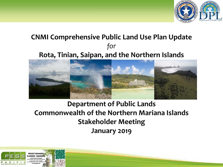
CNMI Comprehensive Public Land Use Plan Update for Rota, Tinian, Saipan, and the Northern Islands Department of Public Lands Commonwealth of the Northern Mariana Islands Stakeholder Meeting January 2019
Meeting Agenda Welcome and introductions Plan Update Key Drivers for Land Selection Recommendations for future land uses on each island with maps Q & A Meeting End 2
Welcome & Introductions Marianne Concepcion-Teregeyo, Secretary of DPL A. Kodep Ogumoro-Uludong, Director of Office of Planning and Development PDAC, CNMI Government, and other distinguished guests 3
Project Team SSFM CNMI (PEGS) Roy Reyes, PE, Project Manager Denn Manglona, CQM, Assistant Project Manager Chris Hart & Partners, Inc. Jordan Hart, Land Planner Brett Davis, Land Planner David Sereda, Landscape Architect, GIS Team Robert Bridges, Landscape Architect, GIS Team Raymond Cabebe, GIS Team John M. Knox & Associates, Inc. John M. Knox, Economic Analyst Myounghee Noh & Associates, LLC Myounghee Noh - Principal Investigator Jessica Walsh, Environmental Planner/Project Manager, B.S. 4
Schedule of Comprehensive Land Use Key Milestone Dates: September 18 - 21, 2017: First Public Information Meetings September 18, 2017 through December 31, 2017: Data Collections Phase I January 1, 2018 through February 28, 2018: Data Collections Phase II January 31, 2018: Completion of Socioeconomic Study February 21, 2018: Publication of Preliminary Draft March 1, 2018 through April 30, 2018: Data Collection Phase III Receipt of Preliminary Draft Comments April 22through April 29, 2018: Trip to the Northern Islands Agency meetings for discussion on Prelim Draft Comments May 1, 2018: Data Collections Phase IV May 1 to 11, 2018: Second Public Information Meeting & Comment Collection June 15, 2018: Conclusion of Agency and Public Comment for this DPL Comprehensive Land Use Plan Update. June 15, 2018 through January 15, 2019 finalize the Draft Plan and update all GIS maps with most current DPL data January 2019: Delivery of Final Draft Report to DPL January 2019: Stakeholder meeting 5
Purpose and Scope of Comprehensive Land Use Plan Outreach & Participation: Community involvement completed to date: Community Meetings, Newspaper Notices, Surveys (appx. 164 submitted), Radio Spots, DPL Facebook Page, DPL Website, outreach booths Coordinate use and development of public lands with plans, programs and requirements of other Commonwealth agencies: Written correspondence, with follow up meetings 6
Project Key Drivers Establishing Reserve Lands & Determining the Suitably of Usable Land using Constraints: Public or Private Land Vacant or occupied Hazardous Materials Flood or Tsunami Zone Suitable Slope Free of Known Natural Resources Free of Known Habitat Free of Known Historic or Cultural Resources Proximity to Infrastructure Accessibility On Saipan, fit with surrounding zoning On Tinian, Rota & Northern Islands, fit with surrounding uses Allocation of Reasonable Uses for Identified Remaining Suitable Lands, WITHIN THIS PLAN S TIME HORIZON: Siting of Necessary Government Services & Facilities Siting of Homesteads Siting of Proposed Lease for Economic Development Appropriate for Land Exchange 7
Purpose and Scope of Comprehensive Land Use Plan Reserve Lands: Important, habitat, resources as well as lands impractical or infeasible to use within this project horizon Governmental Use: Lands required to provide governmental facilities and services necessary to the CNMI Homesteads: Identify lands suitable for Village & Agricultural Homestead Use, on all islands Private Development on Public Lands: Reserve lands that should be made available to private developers for generation of revenue Land Exchange: Lands that should be made available for exchange in order to improve the manageability and value of public land holdings, or other public purposes such as the acquisition of rights of way, parks, shoreline access, wetland, scenic resources, important habitat, historic or cultural sites 8
Purpose and Scope of Comprehensive Land Use Plan Lands unsuitable for development, not required for current use, or to be held in reserve or for further consideration by the Commonwealth during later iterations of this plan 9
Northern Islands Overview Siting of Necessary Government Services & Facilities Siting of Homesteads The recommendation for each of the Northern Islands is for DPL to conduct feasibility study for safe boat or canoe access 10
MAPS 11
MAPS 12
MAPS 13
MAPS 14
Rota Overview Siting of Necessary Government Services & Facilities Siting of Homesteads Siting of Proposed Lease for Economic Development Appropriate for Land Exchange Agricultural Land Renewable Energy 15
MAPS 16
Tinian Overview Siting of Necessary Government Services & Facilities and Roadways Siting of Homesteads Agricultural Land Siting of Proposed Lease for Economic Development Appropriate for Land Exchange Free Trade Zone Aguiguan 17
MAPS 18
MAPS 19
Saipan Overview Siting of Necessary Government Services & Facilities Siting of Homesteads Siting of Proposed Lease for Economic Development Appropriate for Land Exchange Agricultural Land Renewable Energy Recreation Managaha 20
MAPS 21
MAPS 22
MAPS 23
MAPS 24
MAPS 25
MAPS 26
Proposed Homestead Allocation in this Plan Hectares of Land Proposed for Homestead Use Island Village Homestead Agricultural Homestead NOTES: Serious discussion of sustainability and possible transition to smaller lots by lease or multi-family options are recommended. Saipan Program no longer sustainable on Saipan 27 Approximately 51 hectares suitable for AG use should be operated through lease Tinian 313 314 Rota 387 242 Anatahan Not in current plan horizon 108 (38 primary, 70 secondary) Alamagan Not in current plan horizon 139 (58 primary, 81 secondary) Pagan Not in current plan horizon 273 (40 primary, 233 secondary) Agrihan Not in current plan horizon 212 (81 primary, 131 secondary) 27
Village Homestead Options for Saipan Available (Suitable) Land 27 Hectares Roads/Parks/Drainage 20% Lot Size No. of Lots 700 sq. m. 38 650 sq. m. 41 600 sq. m. 45 550 sq. m. 49 500 sq. m. 54 450 sq. m. 60 400 sq. m. 67 350 sq. m. 77 28
Thank you 29
