
Coastal Monitoring and Lessons Learned in Southwest England
Southwest England's coastal monitoring efforts, including the South West Coastal Monitoring program and lessons learned from the destruction of Hallsands in 1917 due to lack of understanding of coastal processes. The monitoring involves data collection on beach profiles, bathymetry, wave patterns, a
4 views • 15 slides

Coastal Path Promotion Poster Design for Wales
Design promotional posters for the Coastal Path in Wales to encourage visitors to explore the 870-mile long coastal walking path accessible to walkers, cyclists, families, limited mobility individuals, and horse riders. Discuss the essence of marketing, its impact, target audience, and advantages an
4 views • 28 slides
Understanding Relational Database Design and Mapping Techniques
Explore the process of mapping Entity-Relationship (ER) and Enhanced Entity-Relationship (EER) models to relational databases. Learn about relational model concepts, mapping algorithms, and the goals and steps involved in the mapping process. Discover how to preserve information, maintain constraint
3 views • 42 slides

Integrated Coastal Zone Management & Exclusive Economic Zone (EEZ) - Sustainable Coastal Management
The coastal zone is a vital area where land and sea interact, presenting dynamic challenges and opportunities. Integrated Coastal Zone Management (ICZM) is a science-based approach to managing coastal areas, aiming for sustainability by balancing environmental, economic, and human activities. ICZM,
0 views • 10 slides
Understanding Coastal Processes and Erosion
Coasts are dynamic environments shaped by a variety of processes such as erosion and transportation. Waves influence the size and energy of waves, while erosion is caused by processes like corrasion and solution. Coastal transportation involves suspension, solution, and saltation. The impact of mari
6 views • 18 slides
Understanding Federal Consistency in Coastal Zone Management
This presentation serves as an introduction to Federal Consistency in the context of Coastal Zone Management, emphasizing the importance of compliance with enforceable policies outlined in the Coastal Zone Management Act. It highlights the role of the Division of Coastal Resources Management (DCRM)
1 views • 13 slides
Modernizing Indian Fishing Vessel Registration & Licensing System for Coastal Security
A government initiative, the Registration and Licensing of Fishing Craft (ReALCRAFT) project aims to enhance coastal security by registering Indian fishing vessels under a national database. The system issues Registration Certificates and Fishing License Certificates online, ensuring unique identifi
0 views • 31 slides
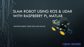
Mapping Robot using ROS, Lidar with Raspberry Pi & MATLAB
Turtle.bot is a popular product for home service robots, utilizing SLAM and navigation technologies. It features gyro, Kinect sensors, Lidar, and a laptop for mapping. The robot localizes and navigates using ROS in Raspberry Pi connected with MATLAB. ROS (Robot Operating System) is a set of software
0 views • 17 slides
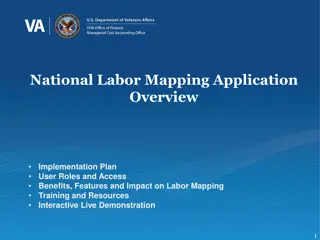
National Labor Mapping Application User Roles and Access Overview
This detailed overview outlines the implementation plan, user roles, and access benefits of the National Labor Mapping Application. Users are assigned specific roles with established access through domain usernames, enhancing security measures. Different user roles such as VISN Coordinators, Site Te
0 views • 14 slides
4th SPC Regional Technical Meeting on Coastal Fisheries and Aquaculture - Provisional Agenda
The 4th SPC Regional Technical Meeting on Coastal Fisheries and Aquaculture is set to take place on 12-15 October 2021 in a virtual format. The agenda includes sessions on integrating e-data systems into coastal fisheries, enhancing capacity for fisheries management, and community-based fisheries di
0 views • 9 slides

Mapping Methodology for Establishing ESCO Relations
Learn how to set up teams, collect resources, compare classifications, and establish mapping relations for ESCO implementation projects. Get insights on using computer-assisted suggestions, updating mapping tables, and selecting mapping projects. Explore techniques for navigating classifications, br
1 views • 21 slides
National Cyclone Risk Mitigation Project Phase I Summary
The National Cyclone Risk Mitigation Project (NCRMP) aims to reduce cyclone risk and vulnerability in coastal areas by developing an Early Warning Dissemination System, constructing cyclone risk mitigation infrastructure, and building capacity in coastal communities. Phase I in Andhra Pradesh and Od
0 views • 31 slides

Exploring Texture Mapping in Computer Graphics
Delve into the world of texture mapping as a solution to the smoothness of polygons in computer graphics. Learn how to create textured scenes using techniques such as bump mapping and environmental mapping. Discover the process of representing textures, working with curved surfaces, and mapping onto
2 views • 24 slides
Understanding Coastal Landforms: Formation and Characteristics
Coastal landforms are features shaped by erosion and sedimentation processes along coastlines. These landforms, including headlands, cliffs, bays, spits, salt marshes, and beaches, are predominantly influenced by factors such as wave action, longshore currents, tides, and climatic elements like wind
0 views • 35 slides
Coastal Conservation Strategies for Climate Resilience
Develop conceptual models for coastal conservation goals, targets, and management strategies in the context of climate change. Templates provided for reducing coastal flooding using natural areas, addressing non-climate and climate stressors, and implementing effective management strategies to enhan
3 views • 6 slides
Scientific Web Apps for Barrow Community Development Project
In this project, new web mapping applications are being developed for the Barrow community to aid decision-making on topics like climate change, coastal erosion, and sustainable development. Funded by the federal Coastal Impact Assessment Program, the initiative aims to expand environmental decision
10 views • 38 slides
Louisiana Coastal Flooding Litigation Overview
The content discusses various aspects related to the Katrina Canal breaches consolidated litigation in Louisiana, focusing on the legal implications, failures in flood control measures, geology of coastal Louisiana, coastal elevations, and the impact of canal breaches on flooding in the region. It a
1 views • 30 slides

Innovative LiDAR Cave Mapper for Cavers
Develop a portable and cost-effective LiDAR cave mapper to assist freelance cavers in mapping caves efficiently. The project aims to create a device that is affordable, DIY-style, and open-source, making cave mapping more accessible and accurate. The team from FAMU-FSU College of Engineering strives
0 views • 22 slides
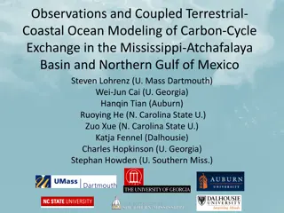
Coupled Terrestrial-Coastal Modeling of Carbon Exchange in the Gulf of Mexico
Explore the interactions between terrestrial and coastal systems in the Mississippi-Atchafalaya Basin and Northern Gulf of Mexico through coupled terrestrial-coastal ocean modeling. The study focuses on carbon dynamics, uncertainties in coastal carbon budgets, and the NASA IDS project's approach. Fu
3 views • 26 slides
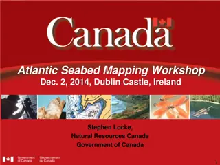
Atlantic Seabed Mapping Workshop Summary
Workshop held in Dublin Castle on Dec 2, 2014, discussed current and future plans for seabed mapping in the Atlantic. Key topics included navigational charting, initiatives by various organizations, challenges of disjointed mapping efforts, and proposed actions to address issues. Recommendations inc
1 views • 5 slides
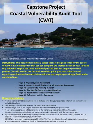
Coastal Vulnerability Audit Tool (CVAT) for Curacao, Netherlands Antilles
This document outlines the stages of the Coastal Vulnerability Audit Tool (CVAT) for assessing the physical system and human system & engineering infrastructure of Curacao, Netherlands Antilles. It covers key aspects such as coastal setting, climatic and tectonic settings, topographic profile, coast
0 views • 10 slides
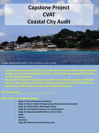
Coastal Vulnerability Assessment of Curacao, Netherlands Antilles
Conduct a comprehensive Coastal Vulnerability Audit of Curacao, Netherlands Antilles, using the Coastal Vulnerability Audit Tool (CVAT) to assess physical, human, and engineering infrastructure systems, as well as vulnerability, planning, and resiliency action plans. Consider factors such as climati
0 views • 10 slides
NOAA SAR High-Resolution Coastal Winds Overview
NOAA's Operational SAR Sea Surface Wind Products provide detailed information on wind patterns derived from SAR images. The system aims to implement high-resolution wind production, capable of deriving winds from various SAR satellites. The operational goals include compatibility with international
0 views • 28 slides
Coastal Climate Change Impacts and Adaptation Strategies Overview
This overview delves into the impacts of climate change on coastal areas, including shoreline changes, coastal hazards, and coastal geomorphic systems. It highlights the physical forcing mechanisms, such as sea level rise and increased storm activity, affecting these regions. The assessment emphasiz
0 views • 14 slides

Integrated Terrestrial-Coastal Ocean Framework for Carbon Management
An advanced framework integrating terrestrial and coastal ocean observations and modeling is developed to support carbon management decisions. The study focuses on assessing the impacts of land use, human activities, and climate scenarios on the carbon cycle, particularly dissolved inorganic carbon
0 views • 5 slides
Coastal Fisheries and Aquaculture Priorities in Tokelau
This document discusses the technical issues and priorities for coastal fisheries and aquaculture in Tokelau, a group of low-lying coral atolls heavily dependent on coastal resources. It highlights the need for assessing fisheries resources, supporting sustainability, and exploring aquaculture poten
0 views • 6 slides
Understanding Coastal Erosion and Climate Change Impact in Tunisia
Coastal erosion and climate change pose significant threats to Tunisia's coastal areas, affecting ecosystems, economy, and human livelihoods. Climate change exacerbates erosion through rising sea levels, extreme weather events, and human activities. Understanding these phenomena is crucial for susta
0 views • 18 slides
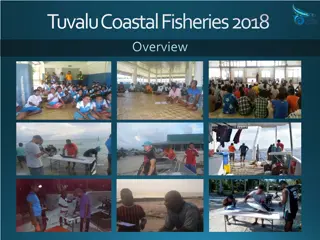
Tuvalu Coastal Fisheries 2018 Overview and Current Activities
Tuvalu Coastal Fisheries Department aims to maximize social and economic returns by sustainably managing marine resources. Their priorities include supporting livelihoods through inshore fisheries and generating revenue from oceanic fisheries. The Coastal Division focuses on outer island and Funafut
0 views • 8 slides
Understanding Coastal Processes: Erosion, Deposition, and Human Impact
Coastal processes involve a complex interplay of erosion, deposition, and human activities that impact the dynamic equilibrium of coastlines. Energy from tides, waves, wind, and currents shape the land-water interface, while human use of coasts introduces conflicts leading to unstable systems. Sedim
0 views • 44 slides
Power Mapping: A Visual Tool for Advocates to Influence Change
Power mapping is a visual tool used by advocates to identify key individuals to target in order to effect change. It involves mapping the community around an issue or campaign, identifying decision-makers, adversaries, and influential stakeholders. By following important steps and asking relevant qu
0 views • 10 slides
GEBCO Technical Sub-Commission on Ocean Mapping (TSCOM) Overview
Technical Sub-Commission on Ocean Mapping (TSCOM) is a key component of the GEBCO program, established in 2006 to provide expertise in seafloor mapping and discuss emerging technologies. TSCOM serves as an authoritative source for bathymetric and hydrographic data and offers ongoing advice to associ
0 views • 12 slides

Virtual Network Mapping: A Graph Pattern Matching Approach
Virtual Network Mapping (VNM) involves deploying virtual network requests in data center networks in response to real-time demands. It facilitates the deployment of virtual networks on physical machines by mapping virtual nodes and links onto substrate nodes and paths, ensuring constraints are met.
0 views • 15 slides
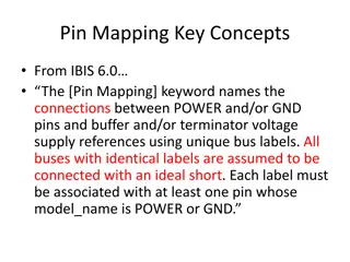
Understanding Pin Mapping and Interconnect in IBIS 6.0
Pin Mapping in IBIS 6.0 defines the connections between POWER/GND pins and buffer/terminator voltage supplies using unique bus labels. Interconnects between VDD pins and buffer supply terminals are crucial, with all pins associated with a named supply being shorted together. Draft 9 Interconnects an
0 views • 6 slides
Understanding Mercator Mapping: A Key Tool for Information System Management
Mercator is a web application designed for managing the mapping of an organization's information system, allowing for a comprehensive representation of its components and connections with the outside world. Mapping is crucial for controlling, protecting, and defending the information system, as well
0 views • 21 slides
Near Real-Time Flood Inundation Mapping Using Sentinel-1 Data During Hurricane Florence
A study by Shen, Xinyi and colleagues from the University of Connecticut has developed the RAdar Produced Inundation Diary (RAPID) algorithm for near real-time flood inundation mapping using Synthetic Aperture Radar (SAR) data from Sentinel-1 during Hurricane Florence. The analysis revealed large in
0 views • 8 slides
Coastal Management and Insurance Industry in New Zealand
Coastal areas in New Zealand face risks from flooding, storm surges, and sea-level rise, making insurance crucial for managing property losses. Insurers respond to coastal risks by adjusting premiums, excesses, and coverage. Long-term coastal planning involves managing risks through strategic buildi
0 views • 6 slides
Enhancing Curriculum Development through Mapping for Schools
Curriculum mapping in schools involves using electronic tools to input, track, and analyze data related to curriculum, enabling stakeholders to meet standards, align content, collect real-time data on instruction, and reflect on practices for continuous improvement. Software programs like Rubicon At
1 views • 15 slides
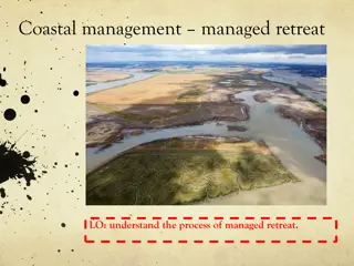
Understanding Managed Retreat in Coastal Management: Wallasea Island Case Study
Wallasea Island in Essex, England employed managed retreat as a coastal management strategy, removing the sea wall to allow natural coastal processes. This decision, despite impacting local agriculture, led to the creation of salt marshes, serving as a cost-effective and environmentally beneficial s
0 views • 7 slides
Importance of Maps and GIS in Census Mapping: A Case Study from Nepal
Census mapping plays a crucial role in ensuring accurate population counts and territorial delineation. This case study from Nepal highlights the significance of Geographic Information Systems (GIS) in producing high-quality maps for census operations, data collection, analysis, and dissemination. T
0 views • 12 slides
Facing Higher Sea Levels and Coastal Flooding in New York City: Impacts and Resilience Strategies
The research highlights the increasing threat of higher sea levels and coastal flooding in New York City, exemplified by Hurricane Sandy. It discusses observed sea level rise trends, top coastal storm floods, and climate change projections. Initiatives like the New York City Panel on Climate Change
0 views • 22 slides